
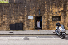
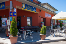
If you are starting your camino in Oviedo be sure to leave enough time to visit the Cathedral, which is the origin of the camino itself. It is also the place to pick up your credential (pilgrim passport) which will cost you 2.5€ but will include a visit to the Camara Santa, the oldest part of the Cathedral which was originally built to secure relics.
The greater Oviedo area is home to more pre-Romanesque architecture than any other place in Asturias; including the Iglesia de San Julián de los Prados, Santa María del Naranco and San Miguel de Lillo. These last two are not in the city center, but instead require a small detour when leaving Oviedo on the way to Santiago.
On the other end of the spectrum is the ultra-modern Palacio de Congresos by Calatrava, and in between the oldest and the newest are dozens of churches and civic buildings of note. The Monasteries of San Vicente and San Pelayo are the most noteworthy.
When Oviedo was founded in 761 it was all but deserted apart from two monks; Fromestano and his uncle Máximo. These two dedicated their church to San Vicente, and 20 years later it would grow to become a monastery. In that monastery was born the future King Alfonso II, during whose reign would be discovered the remains of Santiago. It was he that first made the pilgrimage to Santiago, and in so doing the mountainous path between Oviedo and Santiago became known as the Camino Primitivo.
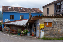
The road out of Oviedo is notoriously confusing. To make matters worse, there are too many shells on the ground to be helpful, especially in the center. They mark several of the caminos into, and out of, Oviedo. There is no distinction between the two directions.
This is how it is done:
1. With the main facade of the Cathedral to your back, walk to the opposite end of the plaza and take the exit on the right. This is the Calle San Francisco.
2. San Francisco ends when it meets Calle de Uría (350m from Cathedral). Turn right and follow Calle de Uría. For the first 250m, the Parque de San Francisco will be on your left. Stay on this road, regardless of arrows or shells. It is about 700m long and ends at the train station.
3. At the train station, turn left along the Calle de la Independencia. Stay on the right-hand side of the road. You will pass 7 cubist looking apartment buildings before the sidewalk turns sharply back to the right. Follow the turn and cross the road towards another cluster of 4 similar buildings with a plaza in front. From here it is safe to follow the arrows.
4. At the end of the plaza is a roundabout. Cross to the left (clockwise) twice and turn left along the Calle de la Argañosa. When it turns to the left (700m) you should turn towards the right, looking out for the pedestrian bridge which crosses the train tracks.
5. The arrows from here zigzag you through new development which ends quickly. By the time you get to an urban looking track and have left Oviedo behind, you will have covered about 3.6km.
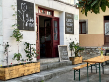
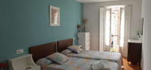
Accommodation in Oviedo y el inicio del Camino Primitivo.
| Albergue de El Salvador de Oviedo 8€ 14 |
|


The first hamlet after leaving the suburbs of Oviedo. This area is popular with day hikers from Oviedo so don't accidentally follow the person in front of you as they may have a much different destination.
The camino goes straight through the hamlet along the road but leaves it in favor of a track on the right. This track crosses the countryside into Lampajúa.


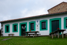
There is a small chapel here, the Capilla de Carmen, where you can get a stamp.
Follow the track in front of the chapel as it veers to the right and away from the road. There are a fountain and picnic area a short distance ahead.


Follow the road through Lloriana. It will merge with the larger AS-232 in La Bolguina.

Beyond La Bolguina the camino keeps to the road, passing through Fabaria, and only leaves it just before the río Nora. It does so in favor of crossing the river via the Puente de Gallegos and quickly returns to the road as it passes through Gallegos.
The Bridge of Gallegos belongs to the town of Gallegos (just up the road). It originally dated from the 13th century but was destroyed in 1934 during the run up to the start of the Civil War; this was a common fate for many other bridges along the way, a deliberate effort meant to slow the enemy.
If you chose to stay on the road, remember that drivers expect you to be on the trail.
After crossing the bridge, continue along the road. It will take you uphill and straight through town. The arrows at the end of town turn right into the forested countryside. This is officially the camino, but on very wet days it is very muddy and it is just as easy to stay on the road into Escamplero.

Two bars, one at the start of town and another (El Tendejón) closer to the albergue. The latter bar keeps the keys to the albergue. They are closed on Wednesdays and the key is then available at the shop on the road closer to the albergue. The albergue here is located in the old school building; its 14th century predecessor is now a private home.
Exit town via the road (turn left from the albergue). Before Valsera, the camino will leave the road for 400m.
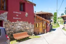
Accommodation in Escamplero.
| Albergue del Escamplero 7€ 16 |
|

Capilla de Fatima.
The camino rejoins the road in the small hamlet of Valsera, be on the lookout for a marker on your left where you will once again leave the road and follow a track through the countryside. You will once again meet a road shortly before arriving in Premoño.


There is a small picnic area on the way into town.
At the end of town, the camino turns to the right near a large horreo (the square plan structure on stilts) and onto a country track. Cyclists should leave town by staying on the road, down the hill, and to the right at the first junction (PALADIN 1km). It is the same distance and well marked but avoids some unfriendly (for bikes) terrain. Both options descend to the río Nalón.
Paládin offers a bench and shaded rest area, as well as a fountain, the ‘fuente lavadero la sierra’, which is 20m away behind a house. To get to the fountain turn right at the first road, and then right again at the entrance to the first house, then head straight back.
Between Paladin and Peñaflor you will be walking with the río Nalón and the train tracks on your left-hand side. You will pass through the roadside villages of Puerma and Laracha. Peñaflor is on the opposite side of the river when you get to the first bridge. Once you have passed the church on the opposite side of the river, the camino immediately leaves the road to the right to follow signs in the direction of the FEVE railway station.

If you are accustomed to using road signs to know where you are, then Peñaflor might confuse you. It is signed twice, once before the bridge and again afterward. For the sake of distance measurements, this guide uses the latter as it is closer the actual town. However! If you are looking for the bar, it is the one that is before the bridge.
The camino leaves the main roads and crosses underneath the railway in Peñaflor, and will cross back over them at the outskirts of Grado.


With close to 10,000 inhabitants the city of Grado is the first opportunity to stock up on supplies since leaving the capital. There is a tourist information office in the park at the start of town and several grocery stores throughout the town. If you would like to stop and look around (or shop) cut through the park towards the more pedestrian streets to your left. Along this route you will pass near the Capilla de los Dolores and the Iglesia Parroquial de San Pedro.
Beware guidebooks which erroneously place the Villapañada albergue in Grado, when it is in fact 3.5 km outside of town.
Los Indianos. In the late 19th century, during a period of great poverty, a great many Gallegos, Asturianos, Cantabrians, and Basques emigrated to Central and South America; their proximity to the sea enabled them to travel more readily. A great many left but only a few struck it rich, and when they returned they turned their fortunes to the task of building large manor homes, and to securing titles. Many of the houses still remain and those in Asturias are the finest examples. They are sometimes colonial in style, and always eclectic with palm trees as a tribute to their tropical lives in the Americas. These Indianos as they were called (the Americas were referred to as the Indios) also repaid their fortune by financing public works projects, and throughout Asturias the benefactors were responsible for bringing to their birth villages a level or modernization rarely seen elsewhere in Spain.
There is a traditional market held every Wednesday and Sunday.
Leave Grado along the main road (N-634). You will pass the 18th century Fuente de Arriba, from which the people of Grado drew their water before the installation of running water, on your right. Shortly beyond a cruceiro (stone cross) on your left the camino turns left and begins climbing, first on a concrete road and then on a gravel path.
The camino emerges onto the road, turns right, and passes over a newly constructed roadway. It then passes through the hamlets of Cascayal and El Valle (a place with no buildings whatsoever, but which does have a dumpster). At the next road junction is the turn to San Juan de Villapañada.
Accommodation in Grado.

San Juan de Villapañada and the albergue are about 700m up the road and off the camino. If you spend the night there, retrace your steps to rejoin the camino.
On the way up to El Friesnu you will pass through La Pelona.

In the 13th century the Order of St John operated a hospital for the poor and for pilgrims here. These days the hospitality is provided by Domingo in the modest albergue.
Retrace your steps to get back to the camino as it ascends to El Friesnu.
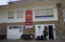
Accommodation in San Juan de Villapañada.
| Albergue de San Juan de Villapañada 7.50€ 22 |
|

Warning! There remain several yellow arrows directing you uphill from the church in El Fresno. These are from a detour which existed during the construction of the nearby A63. The camino has returned to it's original route which goes downhill from here.
Where the camino meets the road before El Fresno, a new information board indicates your options. Descend to the left, following the old access road left behind from the construction of the adjacent highway.

At the far end of Samarciellu, where the road meets a roundabout, the camino turns left onto a trail to Reaz, and beyond it Doriga.
Accommodation in Samarciellu.
| Casita Mandala Donativo€ 4 |
|

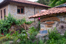
At first sight, there appears to be little of note in the very tiny town of Doriga. The church and bar stand across from one another. However just down the road a few meters to the east (turn right at the church) is the enormous and amazing Palacio de Doriga. Its earliest construction, the tower, dates back to the 14th century. Although it is private property, you can still walk right up to the gate and admire the garden and manor from a respectable distance.
Shortly beyond Doriga, the camino passes under the highway and on the other side it meets up with the alternate route that went through Cabruñana. Be mindful not to walk the wrong way back up to Cabruñana. The camino turns left sharply onto a narrow trail and descends to the quarry/village of Las Casas del Puente.

With the recent completion of road works in the area, Cabruñana has once again found itself NOT on the camino proper. It is still possible to go there, and the albergue is still open.
Keep on the road beyond the albergue for 2.3km. At that point the camino leaves the N-634 for a side road in the direction of Moratín.
Accommodation in Cabruñana [fuera del camino].
| Albergue de Cabruñana 5€ 18 |
|

The large plantations to your left as you walk through Las Casas are often mistaken for vineyards. In fact grapes grow poorly in this climate and these are kiwi.
After crossing the bridge into Cornellana there is a sign indicating a trail to your left. This option takes you directly to the albergue without first passing through town. It is the same distance.
There is a large traffic interchange at the end of Las Casas, in the hamlet of La Rodriga. The camino keeps to the left and towards the river. In the summer months there may be a bar open in the park alongside the river.

La Rodriga is the small cluster of buildings located at the roundabout before Cornellana.

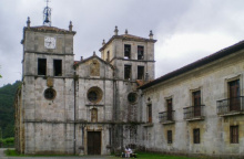
Cornellana sits at the confluence of the río Narcea and the río Nonaya, which made for a suitably strategic place to build a monastery. Dedicated to San Salvador it remains the centerpiece of the town and is where the municipal albergue is housed.
A monastery has stood here for nearly 1,000 years. Operated in the earlier centuries as a Cluniac order. At that time it was one of the most important monasteries in Asturias and a key stopping point for pilgrims along the Camino Primitivo. It remains an active monastery, though of a much smaller and more Benedictine nature.
San Juan is celebrated on the 24th of June, and Nuestra Señora on the 15th of August.
The camino leaves town from the road behind the monastery. Arrows are weakly painted here. Simply follow the road to the left of the monastery, and turn right at the first junction to follow the property line behind the monastery and uphill.
Accommodation in Cornellana.
| Albergue de Cornellana 8€ 36 |
|


600m after Sobrerriba, at a point where the houses crowd the road, the camino turns right onto a mountain track. The track uphill curves to the left and around the mount before descending near a sand pit and the town of Llamas.

Picnic area and “Fuente de Santiago”.
Beyond the town you will pass under a roadway. Shortly beyond that you will leave the road and continue by trail, passing over the Puente de Casazorrina.
Just past the fuente the camino leaves the road for a riverside trail on your left.
Gas station on main road.
Between Casazorrina and Mallecín the camino follows a trail, which crosses under the autopista (highway).
San Pedro is celebrated on the 28th of June.
Almost everything there is to see or do in Salas is centered around the Colegiata de Santa María la Mayor, a 16th century church whose patrons also built the nearby Palacio de Valdés Salas. The tower of the Palacio is now a museum for pre-Romanesque pieces.
Salas is the setting for the dramatic capture in the year 1586 of Bartholomeus Cassanu, an Italian pilgrim and habitual thief. Having successfully stolen from a Church in Zarautz (on the Camino del Norte) he tried to repeat the effort in Salas. Unfortunately for him he was caught with the loot in hand and sent before the judge. No leniency was granted to Bartholomeus. He was first hanged, then quartered, and finally displayed along the camino.
The Romería del Viso is held on the 15th of August.
To exit town, carry on under the archway and up the road. There is a fair amount of climbing ahead of you. The climb meets the road at El Llanón, which is easy to miss as its infrastructure counts for little more than an abandoned factory along the road.
Accommodation in Salas.
| Albergue de Salas 5€ 16 |
|
| Albergue El Tulipán de Salas 13€ 31 |
|
| Albergue Valle del Nonaya 14*€ 20 Booking.com |
|

The upward climb out of Salas meets the road at El Llanón, which is easy to miss as its infrastructure counts for little more than an abandoned rest stop along the road.
Not long ago this junction posed problems, but the way is now clear. Turn right here and follow the road. You will cross under a pair of large elevated roadways, take a wide turn in the road, and then pass back under the same roadways. Shortly afterwards the camino abandons the road and turns up to the left.

Bodenaya does not account for much more than the albergue. It is, however, a nice albergue and you are welcome to stop there for a break.
Accommodation in Bodenaya.
| Albergue de peregrinos de Bodenaya Donativo€ 21 |
|
You will pass through La Espina by a secondary street which runs parallel to the main road. If you need any of the services in town, head to the main road which is to your left.
This is the last place to buy anything until Tineo.
At the far end of La Espina keep on straight, do not follow the curve of the N-634.

Sadly, El Pedregal no longer offers any services to passing pilgrims. The church in town, that of Justo y Pastor, dates from the 16th century. When the camino turns right to leave the road it passes two important camino landmarks. The first is El Humilladero, a stone cross that was installed in the early 18th century to mark the camino. The large estate with a rectangular tower that sits on the site behind the cross is the 16th century Casa de la Torre o del Hospital, which served as a pilgrim hospital.
Approximately 3.5km beyond Pedregal, the camino nears but does not enter the village of Santa Eulalia de Tineo. Turn sharply right when the camino meets the road at this point.
To reach the municipal albergue in Tineo: from the Capilla de San Roque at the park before town, follow the road and turn left at the first fork (towards the pool). Follow this to the first intersection and turn to the left sharply and downhill. The municipal albergue is the second building.


Tineo was built on the side of a steep valley and everywhere you go feels like a climb, but don’t let that deter you from getting out of the albergue (particularly the municipal) for a bit of exploring. The church is dedicated to San Pedro and adjacent to it is the Museo de Arte Sacro (Museum of Sacred Art).
Buy supplies. Between Tineo and Campiello there are no services apart from a fountain at the edge of Tineo.
Tineo can trace its growth back to the early 13th century when King Alfonso IX mandated that all pilgrims pass through this place. It was at this time the largest pilgrim hospital on this route was built, the Mater Christi. The hospital is no longer, but remnants of its chapel and exterior walls remain.
San Pedro, patron of the city, is celebrated on the 29th of June. A longer fiesta is held from the 12th to the 18th of August in celebration of San Roque.
The camino descends to the center of Tineo as far as the church. From there it turns right and begins the uphill climb out of town on the Calle la Fuente; the fuente is the fountain at the edge of town near a small picnic area.
Accommodation in Tineo.
| Albergue Mater Christi de Tineo 8€ 24 |
|
| Albergue Palacio de Merás 16€ 54 |


After descending from the alto you emerge onto the main road (AS-350) in Piedratecha which no longer has a bar. Turn right and follow the road. About 600m the camino bears to the left along a trail.
Halfway down the hill to Vilaluz there is an option detour to the ruins of the Monasterio de Obona.

From Villaluz the camino rejoins the road and passes through the small hamlet of Berrugoso and the abandoned aldea of Las Tiendas. It continues along the road into Campiello.

There are two bars in Campiello. Casa Ricardo on the left is a grocery, bar, restaurant, and albergue; the owners have been at it for three generations. Across the street Casa Herminia, proprietors of the other albergue, the other restaurant, and now the Hotel Rural. In the case of the latter, take the dire advice of the owner with a grain of salt; she is likely to warn you of the horrors of the albergue in Borres. It is not great but you will survive.
If you plan on continuing to Borres, stock up on food in Campiello.
Keep on the road through and out of town.
Accommodation in Campiello.
| Albergue Casa Herminia 13€ 18 |
|
| Albergue Casa Ricardo 13€ 30 |
|

At the end of El Fresno the camino turns left onto a smaller road, and then leaves that road 300m later to follow a track through the countryside and into Borres.
The camino returns to the road in Borres, and immediately crosses it to climb up and out of town on the other side.
Accommodation in Borres (albergue).
| Albergue Santa María de Borres 7€ 19 |
|


This is the last bar, and source of water, for quite a distance for anybody following the route through hospitales.
The bar is no longer open, plan accordingly for the two options ahead.
Cross the road in front of the bar and turn right (uphill) on the first road. Where it ends, turn left and soon you will rejoin the camino that arrives from the first split.

Accommodation in Porciles.
| Casa de Acogida Tradicional Fontenonaya Donativo€ 19 |
|

At the Alto the Chavadoira the camino leaves the road on a track to your left. From there it descends to Pola through Ferroy.

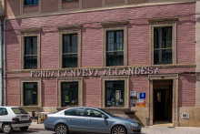
Located on the bank of the río Nisón, Pola de Allende has never been a town that was easy to get to; in fact the three hospitals for pilgrims were built high up on the mountain pass precisely because it was easier to go up than down. The Hotel and Restaurant ‘La Nueva Allandesa’ routinely receives praise from pilgrims for the kind service and healthy portions of Asturian home cooked meals.
The camino leaves Pola along the road and passes the village of El Mazo.
Accommodation in Pola de Allande.

Turn left off the road towards the village of El Mazo.
Note that Peñasieta, AND the albergue, are not on the camino. Signs point the way and see the albergue notes on how to get a hold of the keys at the bar on the road.
From Peñasieta, the climb begins. The preferred, and more beautiful, route is along the trail so if you spent the night in Peñasieta avoid the temptation of following the road (even though it will get you there). The elevation gain is about 600 meters up to the Alto de Palo, with a few particularly steep sections along the way.
Accommodation in Peñasieta.
| Albergue de Peñaseita 5€ 12 |
|

Welcome to the top. Be mindful of the way down, which is poorly signed.
The best way is to keep the road, and the guard rail, to your left while following the curve in the road. It soon joins a track and descends into Montefurado.

Montefurado is largely abandoned, apart from a few still occupied houses. One of them has a tap you can use for drinking water but ask first as a courtesy. There is also a small chapel dedicated to Santiago.
Pass through town and follow the trail to your left. You will have to step over a small wall. When the trail rejoins the road (AS-14) a few km onward, you can either stay on the track or follow along the road to Lago.


Just beyond town the camino again leaves the road in favor of a trail to your right. It will rejoin the road and then leave it again for a smaller side road to your left towards Berducedo.
The diminutive Berducedo is a common end of stage stopping point and is roughly halfway between Pola de Allande and Grandas de Salime.
The camino follows the road uphill for a quick ascent of about 80m and then descends another 100m into La Mesa.

The new albergue in La Mesa also has a bar and restaurant, a welcome addition to this convenient stopping point.
Pay close attention to the arrows when leaving town, there are 4 roads not including the one you walked into town on. The camino follows the road steeply uphill all the way to Buspol.

The Capilla de Santa Marina de Buspol is the only thing of note in Buspol. The weather here is frequently shrouded in a rainy mist which obscures views of the embalse (reservoir) below.
At the sharp curve in the road in Buspol, the camino finally leaves the road in favor of a mountain track.
NOTE: It is almost entirely downhill to the dam of the reservoir, a descent of over 750m and often very steep. Furthermore, the trail crisscrosses several other mountain tracks, look carefully for the arrows and avoid the temptation to shortcut the switchbacks.

Bar and Restaurant 1km from the dam on the way back up.
The hydroelectric dam here was built in the early 1950. The abandoned concrete structures on the north side of the dam are leftovers from its construction, which required that most of the materials (primarily the concrete) be produced on site.
What goes down must go up, in this case it is about 300m back up to Grandas de Salime. It is mostly, but not entirely, along the road. Along the way is a scenic overlook (about 2km from the dam). Shortly after the most severe turn in the road (a 180 degree bend) the camino turns left to follow a trail uphill.


Grandas de Salime is the largest town since Salas and offers enough bars and shopping to occupy your afternoon. The Iglesia de San Salvador stands at the center of town. There are several old manor homes scattered through the town, most of them dating from the 18th century. The gem of the town is the highly recommended Museo Etnográfico de Grandas de Salime, which has more objects in its collection than you could possibly lay your eyes on.
Nuestra Señora del Carmen is celebrated on the 2nd and 3rd of July. San Salvador is celebrated during the first weekend in August.
The camino leaves town along Calle Carmen and passes the Capilla de Carmen before joining the AS-28 highway for several parts; leaving and rejoining between towns on its way up to the alto that marks the border between Asturias and Galicia. There is one more albergue on the Asturian side of the border, in Castro. The first hamlet you come to, that of La Farrapa, has no services for pilgrims.

Two bars in town, one in the town (Casa Federico, which is also a small shop) and one at the far end of town on the main road.
Just past the bar located on the main road the camino turns right to follow a quieter path. Between Cereijeira and Castro is the small Capilla de la Esperanza de Malneira.


The ruins of a prehistoric settlement, the Castro de Chao Samartín, are visible to the west (right) of Castro when leaving town. There is a museum (adjacent to the camino) which offers guided visits to the bronze age settlement.
Accommodation in Castro.
| Albergue Residencia Juvenil de Castro 12€ 16 |

|


Peñafuente sits at the top of a long gentle climb along the AS-28.
The camino crosses through town to the right and follows a track above the road, and eventually intersects it. Cross the road and continue UP the track, NOT down towards Bustelo.