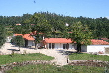
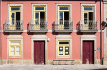
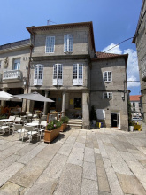
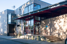
Porto is half the size of Lisbon, and twice as wonderful. It sits perched on the hillside on the north bank of the Rio Douro and has a historic center that would take two days minimum for only a casual stroll. If you plan on having a rest day, this is the town to do it in. If you had not planned on a rest day but had a long walk into Porto keep in mind that they way out of town is an arduous one too.
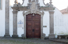
In Porto the buildings to see are the Igreja do São Pedro dos Clerigos and it's adjoining tower (5€, but the view from the top is unparalleled and 360°; don't bring your backpack with you as the 200 steps to the top are a tight enough squeeze as it is), the Igreja do Carmo (unassuming from the outside but spectacular inside), and of course the Sé do Porto (the Cathedral of Porto is one of the oldest surviving building in the city).
If you entered town along the upper bridge crossing you will have missed the Cais da Ribeira, the riverside boardwalk popular with tourists and locals alike. Somewhat overpriced but the atmosphere makes up for it.
Before you set off be certain to pick up a pilgrim’s credencial if you have not already done so. It can be found at the Sé Cathedral. This accordion-fold booklet is your passport to the camino and will become your most cherished souvenir of the trip. It is a required document in most pilgrim-specific accommodation, earns you pilgrim prices in many museums, and will serve as proof of your journey when presented to the Pilgrim Office in Santiago if you are planning on getting your Compostela Certificate.
As large towns go, Porto is no different when it comes to finding the camino. In fact, it is complicated somewhat by the fact that there are three different caminos between here and Santiago, be aware that you may see signs indicating the ‘Coastal Route’ or the ‘Braga Route,’ or the ‘Central Route’; amongst others.
Porto has a nice nickname among Portuguese historians, who call it The Unvanquished City for having resisted the unlawful siege by King Miguel I. He wasn’t too keen on implementing the liberal constitution that was drafted after a local rebellion but after 18 months of attacking the city he abdicated the throne and the constitution was restored. It was a victory for the Enlightenment and those who sought to distance themselves from the traditional Roman Catholic values.
Between Porto and the border with Spain, the camino splits into three distinct routes. They are known as the Central Way, the Coastal & Litoral Ways, and the Braga Way. Additionally, there are several paths that connect each of these options, creating a network of trails that can sometimes seem confusing. The best plan is to pick one of the options and simply follow it to its natural end.
Leaving a large city is often a challenging combination of searching for arrows, heavy traffic, and durable city pavements. As an alternative, it is possible to take the Porto Metro to the city limits or beyond.
THE CENTRAL WAY
The Central Way is currently the most popular and well-developed option. As the name implies, the route continues due north from Porto up the center of Portugal. It crosses into Spain at Valença/Tui and continues from there through Redondela to Santiago.
THE COASTAL and LITORAL WAYS
The Coastal Way is gaining in popularity as the infrastructure and signage improve. It is sometimes referred to as the Senda Litoral, although this name is technically reserved for the sections of the route that strictly follow the coast. As the primary motivation for choosing the route is the proximity to seaside views, the route set out in this book is a combination of these two routes and the blue line indicated on the map should be interpreted as such. It leaves Porto along the Litoral Route, rather than sharing the first day of walking with the Central Way before turning westward. Where options exist they are indicated on the inset maps. The route passes through Vigo and rejoins the Central Way in Redondela.
THE BRAGA WAY
Some would consider this the original way, as it passes through the city of Braga where many of the Church's earliest decisions regarding Santiago were made, and where the first Bishop ordained by Santiago (Saint Peter of Braga/Rates) officiated. It was once the capital of Galicia and remains an influential city and massive tourist attraction. These days the infrastructure along the route has not kept pace with the needs of pilgrims and it is seldom traveled. Tours to Braga can be arranged in Barcelos (on the Central Way) if you wish to visit the city. This route is not included in this guide.
THE VARIANTE ESPIRITUAL
The Variante Espiritual is a popular alternative route north of Pontevedra. It is a two day walk which ends in a 29km boat ride to the town of Pontecesures.
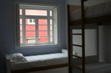
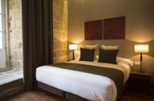
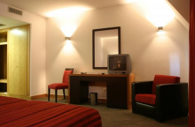
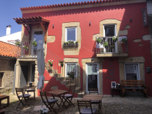
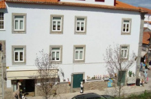
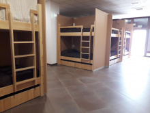
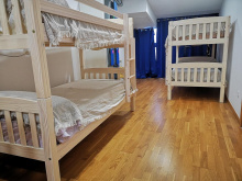
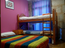
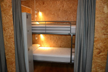
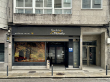
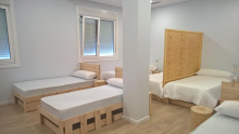
Accommodation in Porto
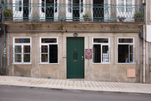
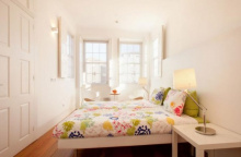
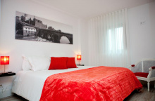
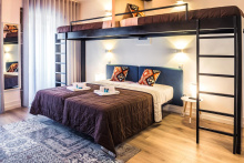
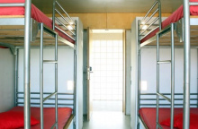
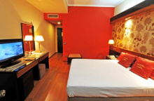
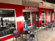
| Albergue de peregrinos Porto 16€ 52 |
|
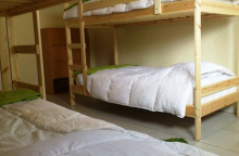
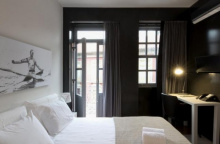
| Spot Hostel 20+€ 42 Booking.com |
|
| The Poets Inn 10 Booking.com |
|
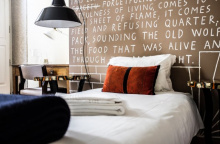
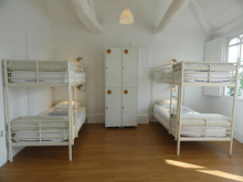
| Gallery Hostel 22*€ 40 Booking.com |
|
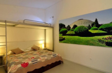
| Porto Lounge Hostel 17*€ 26 Booking.com |
|
| Albergue de Peregrinos da Senhora da Hora 12€ 20 |

|
| AHBV Porto Donativo€ 2 |


The sprawl from the center of Porto runs all the way to Gião, where a revision to the camino takes you mercifully off of the road and to Vairão where a more tranquil walk resumes. That is a stretch of 25km, more than enough walking given the terrain. It is not uncommon for pilgrims to bypass much of this sprawl by taking the metro to the suburb of Araújo.
The easiest starting point for leaving the city is the Cathedral. With your back to its main door (facing west) pass the tower, keeping it on your right and follow the ramp downhill. Jog left then right around the building that is at the bottom of the ramp and then look to your left for a set of stairs that take you down to the plaza in front of the Church of São Lourenço (until the 1750’s a Jesuit Church, and thereafter it was purchased by the Order of Saint Augustine, who brought with them from Lisbon the nickname ‘brothers of the site of cricket’, at which time the church became known simply as Grilos).
With your back to this São Lourenço, take the left most street (Rua de Santa Ana) to the intersection with Rua da Bainharia and turn left. Mere meters later, turn right. You will cross the Rua Mouzinho de Silveira, keep on straight here and turn right at the next street, the Rua das Flores (recognizable for a small square and the church at the far end). Beyond that church (the Igreja da Misericórdia) turn left against road traffic on the first street, the Rua do Ferraz. It is uphill and straight to Rua da Vitória, turn right when you get there. You will now be walking with traffic. At the next junction, turn left against traffic onto the Rua dos Caldeireiros.
At the top turn right into the square. There is a park opposite you, and you will walk through a small section on the right side. If you doubt the direction, remember that you are going to pass over the tram lines. You can follow those tram lines as they pass the statue of Ramalho Ortigão and around the University building on your right. They lead to the square and fountain of Leitao. Keep in the same direction, straight through this square (there will be two conjoined churches on your left).
Straight ahead is the Plaza de Carlos Alberto, a triangle shaped square. Exit to the left onto Rua de Cedofeita. You have now arrived at a pedestrianized shopping zone of Cedofeita.
The Metro of Porto Line C (Linha da Maia) affords an option to walking the most durable part of the camino leaving Porto.
The split between the Central and Coastal (not litoral) routes occurs at the Chapel of the Ramada Alta, a small church roughly 1.5km from where the pedestrian zone ended. Walk around the church, keeping it on your left, and follow the road behind the church. At the fork, turn right. Street signs indicate that you have left Largo Ramada Alta and are now on Rua de Nove de Julio.
The road ends at apartments, which you pass under. Cross the road and cross under the apartments opposite as well. Where you emerge from the second set of apartments, turn left.
This road (still the Nove de Julio) merges with another. Keep going straight. Eventually, you will pass under the highway. From here there is nothing to do but keep on going straight. You will eventually pass under another highway, where the camino splits into two distinct options.


The Metro of Porto Line C (Linha da Maia) stops here twice, first at the Araújo station and then again at the Custió station which is the closest to the camino.

Entering Moreira, turn right at the cemetery.
The camino will take a right-left-right a short distance on, and the arrows are painted low on the curb. Whether you follow them, or you miss them, you will arrive at the main road. Turn right there. A Pingo Doce and a Lidl tell you that you are on the correct road.
From here it is a straight road to the Zona Industrial of Maia. Turn left when you get there.
Accommodation in Moreira
| AirPorto Hostel 17*€ 6 Booking.com |

|


The Metro of Porto Line C (Linha da Maia) has a stop called Zona Industrial but it is not along the camino.
Barranha marks a change in scenery. Although you are still walking on paved or cobbled paths, the congestion and noise of Porto are now behind you.

Because you are arriving via the back roads, the town of Vilar do Pinheiro isn’t marked so obviously. The town itself is a left-hand turn from here and the camino is straight on. Small shop next to the bar.
If you wish to spend the night here, turn left. Otherwise, keep on straight through the intersection, passing a few bars on the way out of town.

Small kids park and a pretty but unused square. Plenty of shade for a rest. The church is up the road to your right when entering the town; the camino passes straight through.


At Gião - Joudina the camino has followed alongside the narrow N306 for about 2km.
The road narrows ahead, and the going was sufficiently dangerous for the camino to be rerouted to the east along a much quieter road. The distance added is 1km, but the route is pretty enough and peaceful enough to feel shorter than along the road.
There are also plenty of bars along the way, and the albergue of Vairão is best reached via the detour as well.
Turn right and head towards Igreja.


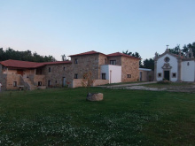
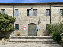
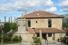
The cultural gem of this detour is the Monastery of Vairão (with an albergue).
Shortly before arriving at the Monastery the camino turns left sharply. Follow that road 500m, and turn right onto a trail through the forest.
Where the forest ends turn right, and at the next big road (N318), turn left again into Vilarinho.
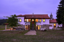
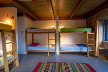
Accommodation in Vairão
| Albergue de Peregrinos do Mosteiro de Vairão 10€ 60 |

|


A pleasant and shaded square and your choice of three albergues.
The camino follows the road out of town in the direction of Fontaínhas and keeps to the left at the fork, leaving the busy road just before a curve. It passes through a small hamlet and then crosses back over the road. Old arrows indicate that the camino continues along the road, but this way should only be followed if the bridge at Ponte do Ave is not passable.
The camino goes straight across the road to a set of stairs that take you down to the river.
Accommodation in Vilarinho
| Casa da Laura 15€ 12 |

|
| Casa Família Vidal 15€ 7 |

|


The bridge and a small village of Ave, no services.
Turn right at the first fork after the bridge. Cross through town and back uphill to the N306, which has wound its way back from where you crossed it last.
Turn right on the N306, and then left on the first road. It is well marked with many arrows and a Camino de Santiago information board. If you happen to stay on the N306, you will find more arrows. It is dangerous and noisy, and you are advised to turn back.
The camino is clearly marked but anything but straight. Check the direction at every intersection and you will arrive in São Mamede without trouble.

The camino leaves the road to pass through this small village and returns to it once past.
It continues along the road and under the A7. Here it changes to a gravel and stone path before crossing the Ponte do Arcos.
From the bridge, it is a short climb into the village of São Miguel de Arcos.

At the beginning of town the camino is unclear and confused by the presence of new arrows taking you along the road. The way to Rates is better along the old path described below.
Likewise, keep an eye out for arrows which take you to Esposende on the Coastal Way, they are near the railway-line-turned-pedestrian-path which you cross over near the entrance to São Pedro de Rates.
At the start of town, you will find a small intersection with a tree set in a triangular retaining wall. Turn left here and follow the curvature of the road to the first fork and turn right. The path takes you through farmland and forest and directly into Rates. An alternate route, which is newer, follows the road.
Accommodation in São Miguel de Arcos
| Quinta de São Miguel de Arcos Booking.com |
|

Directly at the entrance to town sits the most Romanesque church in all of Portugal, the Igreja Românica de Rates. It, and a bell tower, are all that remain of the Benedictine monastery that stood here. Adjacent to the church is the church museum.
At the start of town the camino splits. Keep to your right, following the arrows along The Central Way. The other variation will take you west to join The Coastal Way.
São Pedro de Rates’ designation as an important stop along the Portuguese way to Santiago is attributed to the legendary namesake of the town, Saint Peter of Rates. He is also known as Saint Peter of Braga as he was the first bishop of Braga, ordained as such by Santiago himself. The two were contemporaries, and both met the same headless fate. The similarities don’t end there as both were rediscovered, by means of a light in the sky, a full 800 years later. A church was built to house his remains, which became the subject of pilgrimage as well.
The fountain here was used by Peter and as a result it (allegedly) has the miraculous properties of curing sterility in anyone who drinks from it.
Saint Peter of Rates is celebrated on his feast day, the 26th of April.
Accommodation in São Pedro de Rates
| Albergue de Peregrinos São Pedro de Rates Donativo€ 60 |
| Casa Rural Casa Mattos |
| Casa Anabela | 
|


The sign indicating the entrance of Pedra Furada would have you believe that the town is much smaller that it is. Pass through the narrow streets and at the main road turn left into the rest of town. After turning left, keep on the road.
Accommodation in Pedra Furada
| Albergue O Palhuço Donativo€ 24 |

|
| Casa da Maria | 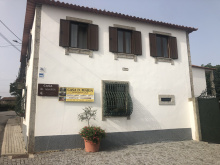
|


At the start of Góios, a small detour takes you off to the left to bypass a blind curve in the road.
Soon the scenery changes slightly, to more businesses and traffic, even a gas station. The camino stays on the road through this stretch to the end of town. Beyond the edge of town, it turns left off of the road. Between here and Barcelinhos and Barcelos there are services, but the towns are quite small. The most obviously named ones are included here, but there are many more in between them.


Turn left at the church in Carvalhal.


After passing the small chapel in the center of the intersection of Santa Cruz, the camino nears the cities of Barcelinhos and Barcelos and the tangle of roads that encircle them.
You will pass straight across a roundabout onto a road adjacent to a car dealership. The road looks like a dead-end but in fact narrows and turns right towards a tunnel underneath the highway. When it emerges, it climbs and winds slightly back up the N205, and turns right. The way into Barcelinhos is straight ahead.

Barcelinhos sits across the river from Barcelos, and by proximity to both it has grown to be a city of its own.
Leave town across the bridge over the Río Cávado. At the end of the bridge, turn left (against traffic) and follow the curve in the road up to the church and the ‘palace’.
Accommodation in Barcelinhos
| Albergue – Residência “Senhor do Galo” 10€ 20 |

|
| Amigos da Montanha 8€ 16 |

|
| Diora Hostel 15€ 20 |

|
| Top'Otel Booking.com |
|

The ruins at the entrance to town are from the palace of a former Duke, and although there were several attempts to rebuild it subsequent to the earthquake of 1755 the only thing we are left with today is the open air Museo Arqueológico, which is more like an open park than a formal museum.
The camino through town hits all of the major highlights, including the Igreja Matriz opposite the museum, the Capela da San Francisco, the Torre do Cimo da Vila (which offers the best view of the city as well as a small handicrafts exhibition), the Igreja do Senhor Bom Jesus da Cruz (constructed at the location where a large earthen cross mysteriously appeared, but 200 years after its 1504 sighting), and the Confraria de Nossa Senhora do Terço with its spectacular wooden ceiling and wall to wall azulejos tiling.
You may notice an abundance of large colorful galos (roosters) around town. A miracle not unlike that of the hanged innocent is set in Barcelos but lacks the element of St. James as savior as the tales told in Santo Domingo and Toulouse do. In any event, the rooster sprang back to life, proof of innocence and ever since the symbol of Barcelos (and often Portugal) in the process.
The Feast of the Cross is held on May 3rd at the Igreja do Bom Jesus.
Market every Thursday in the feria space opposite the Igreja.
A fresh set of arrows and signs direct the way through town, past the Igreja Senhor da Cruz and the large market square opposite it (open on Thursdays).
Accommodation in Barcelos
| Albergue Cidade de Barcelos Donativo€ 20 |

|
| AHBV Barcelos Donativo€ 4 |


The Council of Vila Boa has installed a set of highly visible yellow signs that guide you through town.
After rounding the church, keep on the road to the first side street and turn right. At the next fork (identifiable for the wash basin and cruceiro) keep to your left. One more right-hand turn and you are heading straight for the railway.
At the tracks, the arrows turn left, but that is a not strictly necessary detour to an underpass. You are in the countryside now until Lijó. Turn left at the first fork and into town.
Accommodation in Vila Boa
| Alojamento Flora | 
|

The camino passes a convenient bakery on your left as it crosses through town. Pass the front of the chapel and keep to your left, passing another chapel and park not far after.
At this point you begin the steady uphill climb to Portela de Tamel, passing along the way intermittent strings of housing.


Arrows at the end of town, opposite the ‘Restaurante 2000,’ direct you up the stairs and to your right to pass the church and albergue.
They eventually bring you back to the road, which you must follow for about 400m. Follow the road signs for Quintiães to the left, and shortly thereafter leave the road along a gravel track on your right.
Accommodation in Portela de Tamel
| Casa da Recoleta 5€ 42 |
|

The track will bring you to the modern church in Aborim. The church is nothing spectacular, but the enormous eucalyptus tree in the open lot just beyond is.
Public restroom next to the church. If you are after the ATM, coffee, or the shop, you have to keep RIGHT at the left arrow after crossing the tracks, otherwise see below.
Cross the railway on your right and keep an eye open for the arrows that will take you left shortly after that.
The camino turns to track and passes through the countryside, across a stone bridge and eventually to a paved road that leads into Quintiães.
Accommodation in Aborim
| Casa de Santiago 25€ |

|

Café / bakery at the very start of town.
At the far end of Quintiães keep an eye out for the arrows that indicate a sharp right-hand turn off the road. It is often blocked by the trucks and traffic parked around the farmer store.
From there it is back to the countryside, passing the Ponte das Tabuas on the way to Balugães.

Small sandy beach suitable for soaking your feet or taking a dip.

The camino crosses through the hillside town along the least straight path possible.
At the far end of town, where there is a small fountain set in a wall, the camino indicates a left turn. Go that way to visit the Romanesque church, or turn right and save yourself the not-strictly-necessary climb and detour.
The camino follows along the paved road until the road turns right to return to the national road; at which point the camino keeps on straight and into the forest. The forest track emerges to a small cluster of homes where you turn right and cross the national road.
Follow the narrow road to Lugar do Corgo and beyond.
Accommodation in Balugães
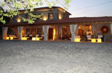


The only accommodation in town, Casa da Fernanda, is highly recommended as a pilgrim friendly experience.
Keep on along the narrow road climbing up to Vitorino.
Accommodation in Lugar do Corgo
| Casa da Fernanda 20*€ 12 |

|

Turn left at the church, and then keep on straight through the next roundabout to follow the camino uphill.
The way to Portela is more uphill.
Accommodation in Vitorino dos Piães
| Casa Sagres 20*€ |

|
| Casa Rural O Estábulo de Valinhas Booking.com |
|

From Portela, the camino rejoins the national road for a short stretch. Be on the lookout for a turn to your left that takes you into the valley and through a string of hamlets. The Quinta da Portela listed below is in the first of them.
You will eventually pass the Quinta do Sobreiro on your left.

The village proper is just a short distance from the camino, with no need to retrace your steps if you choose to spend the night there.
Accommodation in Facha
| Casa Rural Casa das Torres Booking.com |

|

The camino joins the road not far past the Quinta do Sobreiro and only for a short while. It is along that stretch that you will find the bar & bakery.
When it leaves the road, it does so by turning to the left at a sign which indicates the way to the Rio Lima and the Polidesportivo.
Before long you are along a continuous stretch of homes, and the distinction of where one town ends and another begins is a bit vague. Just keep on straight mostly, the only turns are indicated by arrows adjacent to small shrines.
Accommodation in Sobreiro
| Albergue O Caminheiro 20*€ 8 |
|
| Quinta do Sobreiro Booking.com |

|


Just beyond Pedrosa, the camino turns left to follow a small river. This small river leads to a big river, the Rio Lima.
You will follow it straight into town, passing under a bridge, past several churches, and along the shaded Avenida 5 de Outubro.

Ponte de Lima is a charming town with a small market center. The 30 arched bridge over the Rio Lima leads to the albergue and Santiago, but before you cross it be sure to have a walk around the town. The not to be missed bits are the Largo de Camões (the main plaza near the head of the bridge), the Iglesia Matriz, and remnants of the old defensive walls the Torre de San Paulo and the Torre Cadela. There are several other churches and chapels around town, and all of them pay tribute in some way to the pilgrimage to Santiago. For a quiet and beautiful place to rest, cross the river to the Parque do Arnado.
Once over the bridge, you find a museum of toys and the albergue.
Ponte de Lima has played host to a very large festival known as ‘As Feiras Novas’ every second weekend in September since 1826. It is a massive party, and if you have not made a reservation long in advance, you may find yourself without a home for the night.
The bridge of the Rio Lima gives the town its name and has been around for quite some time. The oldest 7 arches are Roman and from the 1st Century, the most recent are Medieval and were finished in 1370. Your feet will not be able to tell the difference.
As Ferias Novas, the town festival, is celebrated without pause on the second weekend in September, a three-day feast.
Cross the bridge, passing the museum of toys and the albergue and turn right on the first street. The camino joins a small country lane, passes under the highway, and into Arcozelo.
Accommodation in Ponte de Lima
| Albergue de Peregrinos Ponte de Lima 5€ 60 |
|
| Pousada de Juventude Ponte de Lima 16+*€ 50 Booking.com |
|
| Arc My Otel Booking.com |
|


Casa Veiga advertises breakfast from 6am, just past the church and 100m on your left.
The camino makes a series of well-signed turns before arriving at the Ponte do Geira. Cross and keep to your left. You will pass under the highway once, over the river on a new bridge, and then back under the highway twice, all before arriving in Arco.


The camino parallels the road (minor) for a short stretch here, and only turns left when it gets to the colorful Capilla de Codeçal. Immediately opposite the Capilla is a handy and friendly bar. It is a steady uphill climb from here, past Labruja (2.3km) and Bandeira (600m more) and to the Alto da Portela.

Accommodation in Labruja
| Albergue O Conforto 20*€ 8 |
|
| Albergue Casa da Valada 20€ |
|
| B&B Quinta Labruja Booking.com |
|
The alto is at 400m elevation, a healthy climb from Ponte de Lima (5m).
It is steadily downhill from here along parts of the old Roman road. You will pass through the small town of Agualonga (no services) shortly before São Roque.
All of the accommodation options in town can arrange for dinner from Restaurante Constantino, same owner but different location from Pension listed below.
The camino leaves the road for the forest and passes the Romanesque church of Rubiães and the albergue.
Accommodation in São Roque
| Repouso do Peregrino 20 |

|
| Albergue Constantino Booking.com |
|

From the municipal albergue, descend to the road and follow it downhill and on the left-hand side. You will pass Ninho – The Pilgrim Nest and then dogleg left.
Another Roman bridge is not far ahead. Beyond the bridge the camino returns to the road and crossed directly over it, keeping the bar on your right. It will rejoin and depart the road twice more before arriving in Pecene.
Accommodation in Rubiães
| Albergue de Peregrinos Rubiães 10€ 34 |

|
| Ninho – The Pilgrim Nest 15-20*€ 17 |

|
| Casa de São Sebastião 14€ 18 |

|

Originally of Roman origin, the bridge you see now is closer to being a 13th century construction.

The church is a bit off track; it dates from the 13th century and holds a roman milario, the original mile marker.
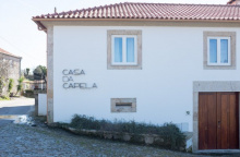
Straight through town, passing between the Capela and the Casa de Capela.
Accommodation in Pecene
| Casa da Capela Booking.com |
|

A Romería, or local pilgrimage, is held at the Santuario here on the 11th of July.
The arrows in town are not the best. To get through head to the church and turn left after passing it... after taking a rest in the bosky park in front. The camino keeps to the forest trails through Gontumil to Fontoura.

The camino rejoins a paved road before Fontoura, and then a larger one as it passes through town. On the far end of town, it turns off this road to the left and towards Paços.
Accommodation in Fontoura
| Casa da Quinta do Cruzeiro Booking.com |
|

Accommodation in Paços
| Albergue Quinta Estrada Romana 20*€ 15 Booking.com |
|
Accommodation in Ponte da Pedreira
| Quinta do Caminho Booking.com |
|
By the time you reach Tuído, the city sprawl of nearby Valença become apparent and pervasive. There are a few quiet stretches, but it is mostly well developed until a few kilometers beyond Tui.
The camino crosses the busy N13 here, following the Rua da Viega past several Churrasqueiras, and turning left at the small chapel. Follow the signs to Arão.


Turn right past the Casa do Diogo (on your left, rooms available) and through Arão. There is not much to the town.
Soon you will pass over the railway, and into the city limits of Valença. Turn right to follow the road (it is in a poor state for cars but suitable for pilgrims), turning right at the first roundabout and left at the junction shortly after. You are now walking due north towards Spain and directly into Valença.

Valença can be divided into two distinct parts, the part within the walls of the citadel and the part beyond the walls. Unlike most cities with such a defensive structure, Valença is not a city with a fort as much as it is a city within a fort. High up on the hill is a bustling village-town that bears no resemblance to the modernity below.
In fact, there are two forts side by side. They inherit a style from those along the French border that were designed by Vauban (whose prowess for building fortresses was exceeded only by his determination to break into them).
As you walk into Valença along the Avenida de Miguel Dantas, you will approach a large roundabout with a fountain in the middle. From here you have several options:
1. Carry on straight all the way to Spain.
2. Carry on straight but turn left up the ramp to the Citadel shortly after, exiting the citadel towards Spain on the other side.
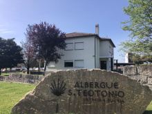
3. Turn left towards the Albergue São Teótonio, along the Avenida dos Bombeiros. The albergue is close to another entrance to the citadel.
4. Go in search of other accommodation elsewhere in the city, mindful that some are up inside the citadel.
Option number three is recommended, allowing you to enter the citadel from its southernmost door.
The most important monuments within the walls are: The Capilla da Misericórdia, with its polychromatic retablo, the Iglesia de Santa Maria dos Anjos, the Iglesia da Colegiada o de Santo Estevāo, a 1st century Roman Milario, the statue of Sāo Teotónio, Portugal’s first Saint, the Capilla do Bom Jesus, and the Capilla do Senhor do Encontro.
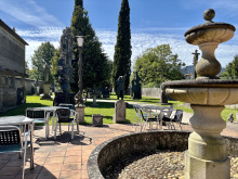
Apart from the monuments, there are numerous places along the perimeter where you can enjoy the view of the river and the shade of a tree.
Change the time on your watch/phone/sundial/wind-up alarm clock. Spain is one hour ahead, so assuming you wake up at the same hour as the day before you will find things to be darker than usual.
When leaving Valença do so by following the signs through the citadel, or along the Avenida de Espanha, crossing the Tui International Bridge (often called the Valença International Bridge, but almost never the Tui Valença International Bridge). The rather quaint building nestled into the bridge on the opposite end is the original checkpoint that has long been out of use.
TIP: Cross the bridge using the walkway that is on your right, not the more naturally accessible one on the left. You will have much better views of Tui this way.
Accommodation in Valença
| Albergue São Teotónio 10€ 49 |
|
| Hostel Bulwark 22€ 20 |
|
| Albergue e AL O Brasão Valença 20€ Booking.com |

|
| Valença Guesthouse |


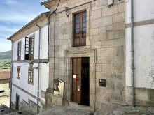
Tui is a town that deserves at least an afternoon worth of exploration and relaxation, and if you are starting your pilgrimage here try to budget in the time. If you are worried about having too much time in Tui on the day of your arrival (when starting here) remember that you can always walk across the bridge to Portugal for a wander through the citadel.
The town is centered around the Cathedral (11-13th centuries ) which is perched on top of the hill overlooking Portugal.
The route through town takes you past the most significant monuments, namely the Catedral de Santa María, the old Pilgrims Hospital, the Convento de Las Clarisas and the Monasterio de Santo Domingo. The Convento de San Francisco and the Iglesia de San Telmo are not directly on the route but are close enough.
You are advised to get your credential stamped at least twice a day between here and Santiago.
The stretch of camino ahead of you is undergoing changes for the better and keep the camino on a more tranquil and safe path, but there are sections that have become slightly longer, and the directions are not fully set in stone.
This area is one of Galicia’s largest industrial centers, most of the industry centered around O Porriño. In years past this meant a grueling romp through town, just the way that the businesses (read bars) like it. Competing arrows and confusion may ensue; despite the best efforts of local activists.
As usual, a healthy dose of common sense and the use of your best judgment is in order.
In periods of high rain the stretch of road between here and O Porriño is often flooded. In these cases, the camino is temporarily re-routed. When it is, the signs are clear but not frequent and at times it will feel like you just keep walking on the road forever. Stick to the road; the signs will appear when they are needed most.
On a hilltop and adjacent to one of Galicia’s most important rivers, the Río Miño, it is no wonder that Tui has been a strategic location since prehistoric times. For the Romans, it was an important post along their gold road that connected Braga (once the capital of Galicia) with Lugo. When the young Visigoth King Wittiza left the family stronghold in Toledo in 700, it was to Tui that he relocated.
San Telmo is celebrated on the first Sunday of Easter.
The camino leaves town just as quickly as it entered it, crosses the N551, and turns right onto the Camino Virgen del Camino at kilometer marker 111.499; a numbers whose significant digits inspires false confidence.
The Louro Valley lies ahead, and the massive granite mining industry situated along it lends a distinctly different feel to the way homes are built compared to only a few kilometers away in Portugal. It is not uncommon to find large slabs of rough granite used to build fences around even the most modest of family plots.
Accommodation in Tui
| Albergue de Peregrinos Tui 10€ 36 |
|
| Villa San Clemente 15-20€ 26 Booking.com |
|
| Jacob's Hostel Tui 14-16€ 19 Booking.com |
|
| Albergue Ideas Peregrinas 15-16€ 13 Booking.com |
|
| Albergue Buen Camino Tui 15€ 20 Booking.com |
|
| Albergue Convento del Camino 15-17€ 42 Booking.com |
|
| Albergue Pallanes 15€ 20 Booking.com |
|
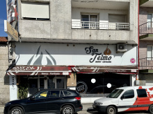
| Albergue-Hostal San Telmo 12€ |
|
| Hotel A Torre do Xudeu ★★ Booking.com |
|
| Hotel Colón Tuy ★★★ Booking.com |

|
| Hotel Alfonso I ★★★ Booking.com |
|
| Parador de Tui ★★★★ Booking.com |

|


The Capilla here is dedicated to the Virgen del Camino, but also has an image of the Virgen de la Leche (yes, milk), the protector of children.
From the church here turn left onto the road and cross the large highway. You will soon begin walking alongside this road, on a pedestrian section that is paved and separated from automotive traffic.
Less than 2km from the church you will pass under the highway and very soon after that the camino leaves the road up a dirt track to your right. It is here, at kilometer marker 109.278 that the camino may detour due to high water. Otherwise, it is back over the highway and onto a dirt track into Ribadelouro.

Pay close attention to the following directions. For several years, and even at the time of publication, the route ahead has been the subject of much trouble.
Shortly before arriving here you will have crossed a very old stone bridge. You may not have noticed its age for the modern wood decking, but it is known by the locals as the ‘bridge of fever.’ It earned that rather onerous nickname when Saint Elmo (Telmo) fell ill and died here during his pilgrimage in 1251. There are two historical characters that bear the name Saint Telmo, and both are considered patrons of sailors. However only one of them (not this one) has been canonized a Saint.

Keep your eyes wide open when passing through Orbenlle. This town is nothing of note but is a very confusing place for pilgrims to find themselves.
The route splits here and depending on who you ask the answer of where to go will differ. The deciding point is at the end of town at a fork in the road. Don’t fret. There are only two ways to go:
LEFT, towards Centeáns and O Porriño along a longer but much more tranquil path. Distances indicated in this guide are for this route. It has been created by the pilgrim association in Galicia as a peaceful alternative to the out of control industrial zone into O Porriño and is often referred to as the riverside walk.
NOTE: After turning left to head into the forest and towards the river, there is another junction where you again have to turn left. There are arrows and the yellow "x" all over the place (designed to steer you back to the industrial zone) but have faith that you will get to the river soon.
The stretch through the forest ends at the highway, where you enter Centeáns.
RIGHT, directly to O Porriño but through an almost 5km stretch of an industrial zone.
The best advice is to turn left; bearing in mind that some arrows and even the locals will tell you to turn right.
Accommodation in Orbenlle
| Casa Alternativo 30**€ 9 |

|


The walk into O Porriño can be done along the main road, or along the river, and again there are lots of conflicting arrows and warnings painted everywhere. The split occurs immediately after passing under the highway, and the new alternative river route requires an immediate left turn. The distance into town is the same.
O Porriño is the heart of Galicia’s industrialized sector and has been so for centuries, the area is rich with granite.
O Porriño’s most beloved son is the famed architect Antonio Palacios. He was fond of using the local granite as a building material, the best example of which is the Palacio Municipal in the town center. The family name Palacios appears on several buildings and monuments around town.
The camino leaves town along the N550. On the north end of town, you will cross a roundabout, keeping to your right. Soon the road passes under the highway, and the trail leaves the road immediately after. After going under the highway, look to your right for a tunnel that passes under the off-ramp. It will take you to Ameirolongo.
Accommodation in O Porriño
| Albergue de Peregrinos O Porriño 10€ 52 |
|
| Alojamiento Camino Portugués 15€ 46 Booking.com |
|
| Albergue Senda Sur 15-17€ 54 Booking.com |
|
| Albergue Camino Santiago Porriño 15€ 28 Booking.com |
|
| Albergue Rincón del Peregrino 15€ 20 Booking.com |
|
| Albergue Casucho da Peregrina 23€ 30* Booking.com |
|
| Pensión Maracaibo | |
| Pensión Puente |
| Hostal Louro |
| Hotel Azul | |
| Hotel Parque |

There are no services in town, apart from the modest fountain on your left near the basketball court.
After passing the large boulder on your right, arrows may indicate keeping on straight or turning left. Both will eventually take you across the N550 (exercise extreme caution) and into the hills. Turning left immediately after the boulder will require less walking along the busy road.
There is a bar/kiosko next to the Albergue in Veigadaña, but that is the extent of the services offered.
The hamlets run together along this stretch along the Louro Valley, which itself is the source for O Porriño’s growth.
If you have the option of staying in Veigadaña or staying in Mos for the night, the latter is recommended for its charm.
Accommodation in Veigadaña
| Albergue de Peregrinos Santa Ana de Veigadaña 13€ 16 |
|


Mos is one of the understated gems along this stretch of the camino. I don’t want to over sell the place, but as pilgrim outposts go it has everything you need for an overnight stay: A beautiful church, an albergue, a selection of bars, and the beautiful Pazo de Mos (wifi). It has little else, and that is nice.
Leave town by continuing uphill past the albergue.
Accommodation in Mos
| Albergue Santa Baia de Mos 10€ 35 |
|

Santiaguiño das Antas marks the top of the ascent. The town and the hillside derive their name from the chapel in the park on the left. The nearest bar is 100m to your left, off the camino but visible from it.
The camino goes straight across the road and begins the descent into Redondela, passing through Villar and Saxamonde.
Keep an eye open for the Roman milestone after crossing the road.

On the approach to Redondela, you will walk along the N550 for a stretch of about 600m. Do your best to cross to the right-hand side as soon as the opportunity presents itself; the official turn is along a curve in the road which is problematic.
Accommodation in Saxamonde
| Albergue O Corisco 16€ 16 |
|

Getting into town and out again is straightforward. There is an alternative route that is signed, which takes you through town closer to the river.
As a city, Redondela has its charms. It sits well inland of the Vigo estuary and is bisected by two massive train bridges.
When leaving town, the camino crosses the N550 at a bottleneck on the north side of town that is heavy with traffic at all hours. Cross the N550 as soon as you get to it, and almost immediately veer left gently onto a side road.
The arrows from here leave a bit to be desired. They are present, but have been spray painted with a not quite right yellow and at times, they don’t feel legit. Follow them all the same, and as you near Cesantes the stone markers return.
Accommodation in Redondela
| Albergue de Peregrinos (Casa da Torre) 10€ 42 |
|
| A Casa da Herba de Redondela 16€ 24 Booking.com |
|
| Albergue Rosa d'Abreu 20€ 6 Booking.com |
|
| Albergue Alfonso XII 15€ 12 Booking.com |
|
| Albergue A Conserveira 14€ 38 Booking.com |
|
| Albergue Santiago de Vilavella 17€ 46 Booking.com |
|
| Albergue A Rotonda 17€ 9 Booking.com |
|
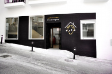
| Albergue Avoa Regina 15€ 32 Booking.com |
|
| Albergue A Dársena do Francés 20*€ 29 Booking.com |
|
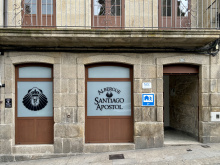
| Albergue Santiago Apóstol 12€ 30 Booking.com |
|
| Pilgrim Rooms |
| A Marisma Hostal 14€ 38 Booking.com |
|
| Apartamentos O Descansiño |
