

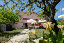
The Feast day of Saint James is celebrated with a full week of music and dance, with a fireworks display in the Plaza Obradoiro on the evening of the 24th of July. The best views can be had from Obradoiro, or from Alameda park.
The start of the camino to Finisterre is poorly marked, and the fading yellow arrows are hard to find. Fortunately, the way is easy to describe and is very brief; you will be in the forest in less than 1km.
Facing the Parador (with the Cathedral to your right) exit the square along the road to your left. It goes downhill along the Rúa da Hortas (named for the gardens which are behind the homes that line this road). The cobbled road ends at an intersection, and here there are several crosswalks, you want the one that takes you over the larger of the roads. The camino follows along the Rúa da Poza de Bar, you can recognize this street for the popular Café Tertulia (perfect for breakfast). It continues straight down this road to a small park at the end, and here the first official marker of the way can be found.
It directs you through the park and towards your right, and eventually downhill to cross the river at Ponte Sarela.
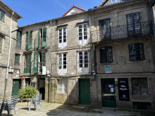
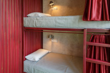
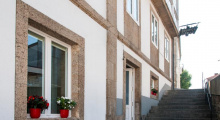
Accommodation in Santiago de Compostela to F & M
| Albergue O Fogar de Teodomiro 15€ 20 Booking.com |
|
| Albergue SCQ 18-22€ 24 Booking.com |
|
| Albergue SIXTOS no Caminho 20€ 40 Booking.com |
|
| KM. 0 18-30€ 51 Booking.com |
|
| Blanco Albergue 15-20€ 20 Booking.com |
|
| Albergue La Credencial 18-22€ 36 Booking.com |
|
| Albergue Monterrey 14-30€ 36 Booking.com |
|
| Albergue La Estación 17-19€ 30 Booking.com |
|
| Albergue Porta Real 15-25€ 22 Booking.com |
|
| Albergue Meiga Backpackers 16-30€ 30 Booking.com |
|
| Albergue Seminario Menor en Santiago de Compostela 17€ 199 Booking.com |
|
| Albergue Mundoalbergue 19€ 30 |
|
| Albergue Santo Santiago 14-18€ 40 Booking.com |
|
| Albergue-Hotel LoopINN 22€ 84 Booking.com |
|
| Albergue The Last Stamp 19-25€ 62 Booking.com |
|
| Albergue Azabache 16-25€ 22 Booking.com |
|
| Albergue La Estrella de Santiago 13-25€ 24 |
|
| Albergue Linares 16€ 14 Booking.com |
|
| Albergue Fin del Camino 14€ 110 |
|


 ⭑⭑⭑⭑⭑")
The remains of an old watermill sit aside the Río Sarela on the outskirts of Santiago.

Look back towards Santiago for a pleasant view of the Cathedral.
The camino turns left where it meets the mountain road and follows it for 100m before turning to the right.

The forest meets the road again in Moas, and when it does turn right to follow newly installed arrows.

Heavy traffic here.
Pay attention here. Although the route is well marked, it is still quite common for pilgrims to keep on following the road. If that happens to you, there is no need to retrace your steps. Keep on going to the next road (recognizable for the large stone wall) and turn right, followed by the next left and just like that you are back on the camino.
Turn right at the bus stop / Hórreo.

When you arrive at the main road of Quintáns, the camino turns left and then immediately right again... watch out for the arrows.
There is a bar where the camino emerges into town. The albergue is about half way through town and a bit (400-500m) off the camino.
The Road: The camino crisscrosses the main road and follows safer side streets. Keep an eye out for yellow arrows near a small bus stop that takes you to the right. If you miss it and walk too far, stay on the road and keep an eye out for a yellow arrow that will take you left. If you miss that one, just stay on the road, and the camino will rejoin is very soon.
The camino crisscrosses the main road and follows safer side streets. Keep an eye out for yellow arrows near a small bus stop that takes you to the right. If you miss it and walk too far, stay on the road and keep an eye out for a yellow arrow that will take you left. If you miss that one, just stay on the road, and the camino will rejoin it very soon.

Pharmacy on your right. Check out the vines above the bar patio, they are a combination of grapes and kiwi.
The road from Ventosa to Aguapesada is straight and along the road. Beyond Aguapesada, it follows a quiet track and road up and into the forest. The climb here is fairly steep. The towns between here and Ponte Maceira are of little note, and there is only one bar directly along this stretch. You will pass Carballo along the way to Trasmonte.


Keep on the road through Trasmonte.

There is a bar in O Reino, which technically is a bit off of the camino to your left. Useful if the bar in Trasmonte was closed or if you prefer taking the path less traveled.
Keep on the road through O Reino, and again in 500m through the village of Burgueiros.
The highlight of Ponte Maceira is the bridge over the río Tambre and the rio itself. In Summer it fills with locals and pilgrims alike, both taking advantage of the cold water to keep cool. If you would rather just dip your feet in there are ample places to do so.
The Road: Cross over the bridge and follow the road out of town. As is common in these parts, the camino will continue to parallel the main road, often crossing and then crossing back, it feels un-necessary but it keeps you away from the traffic. Negreira is the next city of note, and has all of the services you could need.
Note: If you intend to stay in the Logrosa albergue, watch out for signs before entering Negreira. They will take you to the left.
The one bar/restaurant in town is closed every Wednesday.
The heavily disputed legend of the translatio tells us that it was here that the disciples of Santiago, fleeing their Roman captors, were aided by divine intervention. Upon crossing the bridge the center span gave away, stranding the Romans on the other side. This legend, which some will tell you actually took place upstream or downstream from Ponte Maceira, is none-the-less recounted on the Negreira coat-of-arms.
Cross over the bridge and follow the road out of town. As is common in these parts, the camino will continue to parallel the main road, crossing and then crossing back through the village of Barca. It feels un-necessary but it keeps you away from the traffic. Negreira is the next city of note and has all of the services you could need.
NOTE: If you intend to stay in the Logrosa Albergue, watch out for signs before entering Negreira. They will take you to the left.


The Xunta albergue is on the far end of town, be sure to pick up supplies if you are not keen on walking back. All services are available in town.
“Because I am not inscribed from Noya but from Negreira, where I was born. And from Negreira, which is up the river Tambre, they take you for the army.” - a soldier to his corporal, excerpt from ‘For Whom the Bell Tolls’ by Ernest Hemingway.
Hemingway lived for a short time in Santiago de Compostela and the impression that Galicia made upon him is hard to overstate. He made reference to it in many of his novels, here with the birthplace of an unamed character and later by naming the protagonist of Old Man and the Sea after the city he called home in 1929.
The camino leaves Negreira near the municipal albergue on the West side of town. If you stayed in that albergue, go back towards town a short distance and follow the signs to the church. If you are an early morning (in the dark) walker, do yourself a favor and scout the route the night before. It passes into the dark forest fairly quickly and does not emerge until just before Zas.
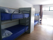
Accommodation in Negreira
| Albergue de Negreira 8€ 8 |
|
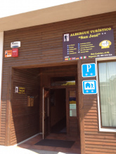
| Albergue Turístico San José 14€ 50 |
|
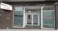
| Albergue Cotón 14€ 40 Booking.com |
|
| Albergue El Carmen 15€ 30 |
|
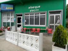
| Albergue Alecrin 15€ 40 |
|
| Albergue Bergando 20€ 60 Booking.com |
|
| Hostal La Mezquita | 
|


There may or may not be a bar open in Zas, it is also a shop for basic necessities but does not do much to advertise. It is on your left and there are stacks of empty bottles to give it away.
The Road: You enter Zas along the road, but leave it at the bar mentioned above. The town is small and you will very quickly find that the camino follows a nice country trail all the way to O Rapote.
You enter Zas along the road, but leave it at the bar mentioned above. The town is small, and you will very quickly find that the camino follows a nice country trail all the way to O Rapote.

Small farming village with a picnic table and fountain at the entrance.
 on the Camino de Santiago")
An albergue and town bar are up a flight of steps on your left as you get to the village.
Accommodation in A Peña and Piaxe
| Albergue Alto da Pena 17€ 24 Booking.com |
|
| Albergue Rectoral San Mamede da Pena 15€ 24 Booking.com |
|

The Road: Much of the camino between here and Vilaserío is along the road. Only at the very end do you turn left into the forest. A short distance on and you will have arrived in Vilaserío. Turn right to the bar, the albergues, and the camino.

Be sure to turn right if you got here along the camino through the woods. If you missed that part and stayed on the road, turn left and head into town a very short distance to the bar.
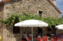
The bar here is open every day and provides excellent service to pilgrims. There is WiFi there and nice, clean, bathrooms. Recommended.
The municipal albergue is outside of town on the main road.
The camino leaves town along the road. If you stopped at the bar, take the steps down and behind it and turn right then left on the road. You will follow that road all the way to Cornado.
Accommodation in Vilaserío
| Municipal Albergue ?? |

|
| Albergue O Rueiro 12€ 30 |

|
| Albergue Casa Vella 14€ 15 |

|

There is a fountain in Cornado
The camino leaves the road in Cornado and stays off of it nearly the whole way to Maroñas.


The bar and albergue are one and the same. To get there turn left at the 'rollo'. Otherwise continue to the right past a small picnic area.
You will walk along the road here for a short but potentially dangerous stretch. Pay close attention to traffic when crossing.
Accommodation in Santa Mariña
| Albergue Casa Pepa 12€ 40 |
|

Just a few buildings along the roadside, but with a pair of bars.
The camino leaves the road quickly and follows along smaller country lanes all the way to Ponte Olveiroa. It is a particularly scenic stretch which passes first through the villages of Bo Xesus and A Gueima.
Note: There will come a junction near Porteliñas which is confusing and poorly marked. Some arrows keep you on the road, another set indicates a left turn along a gravel road. Both will get you where you want to go, but the road is half the distance.
Accommodation in Lamelas
| Albergue Santa Mariña 15€ 34 |
|


If you are interested in the alternate route via A Picota, turn left at the KM 45,146 marker in Vilar do Castro.
The local pool is free for pilgrims. There is now signage to take you along this optional detour, and it rejoins the official camino in Ponte Olveira.
Accommodation in A Picota
In 2018 a bar and an albergue opened their doors to pilgrims, allowing pilgrims to divide the route into four days of walking no more than 26km a day with a short last day..
The camino passes quickly through the twin hamlets of As Porteliñas and As Abeleiroas on the way to the church and hamlet of Corzón.
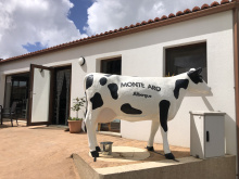
Accommodation in Lago
| Albergue Monte Aro 15€ 28 Booking.com |
|


In 2018 a bar and an albergue opened their doors to pilgrims.

The bar, restaurant, and albergue are all part of the same operation. On your right after crossing the bridge. It is worth mentioning that it is under new ownership since 2014.
Again along the road all the way to Olveiroa.
Accommodation in Ponte Olveira
| Albergue Ponte Olveira 17€ 20 |
Hundreds of Horreos and two bar/restaurants. Of the two, As Pias is the recommended choice.
The camino cuts a straight line through town but NOTE: at the edge of town the camino turns left BEFORE ever getting to the road. This is an easy turn to miss.
It is mostly uphill from here all the way to Hospital and beyond, leveling out only a bit when you get to The Great Divide.
Accommodation in Olveiroa
| Albergue de Santiago de Olveiroa 10€ 34 |
|
| Albergue Hórreo 15€ 51 |
|
| Albergue Casa Manola 12€ 16 |
|
| Albergue Santa Lucía 12€ 16 Booking.com |
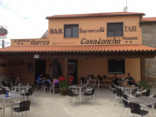
| Pensión Casa Loncho | 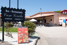
|
| Pensión As Pías | 
|

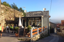
Accommodation in Logoso
| O Logoso 15€ 38 Booking.com |
|
Note: If you are continuing to Finisterre then the bar here is the last place to stock up on food and water for some distance. There is a fountain between here and Cee but very little else.
If you are continuing to Finisterre then the bar here is the last place to stock up on water or grab a sandwich. There is a fountain between here and Cee but very little else.
Accommodation in Hospital
| Albergue O Casteliño 14€ 18 |

|

Shortly after the roadside bar beyond Hospital, in the middle of a large roundabout, is a double mojón indicating the choice between Finsterre and Muxía.
From the roundabout with the twin markers, take the paved road to the left and alongside the massive factory. The camino follows the road for 300m before leaving it to join a trail on your right.
IF you are headed to Finisterra from this point, all the way to the first building in Cee, the camino remains well isolated from the road and any form of development beyond the two chapels mentioned below.
