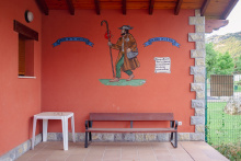
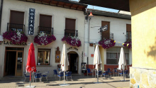
La Robla has a good restaurant, Mesón La Bogadera, stores and cafés. The pilgrim’s albergue is excellent, and there is a pensión in town.
Day 14 bis — La Robla to La Magdalena (16 km)
I went from La Robla to Pandorado when I walked the first time, but a stop in La Magdalena makes for a perfect shorter day. Either 16 from La Robla, or 24 from Candanedo. I‘ve discussed lodging in Magdalena on the mountain alternative thread, so unless anyone has found something new, I think we have that covered.
The first thing you see leaving La Robla is a big mine. You will pass through several little villages, clearly struggling as the mining industry has totally collapsed. The first time I was in La Robla, there were huge banners flying from the Ayuntamiento — Save Coal Mining!!! Even then I think the writing was clearly on the wall, but they were still fighting. Ender was a mining engineer, and I think part of what energizes him is the thought that these caminos might bring back some semblance of prosperity if enough people walk them.
When I walked this part in 2014, I noted repeatedly that the villages had three types of houses — those that were abandoned and in ruins; those that were totally renovated and beautiful but locked up tight; and those that were habitable, sometimes just barely, but with real people living there. There is something sad about a town where the summer visitors live much better than the people who are there all year.
This is not a particularly remarkable stage, but I do remember a long chat with a woman who stopped on the highway to see if I was ok and to find out what I was doing. Her husband was a retired coal miner and they were sadly watching the whole area collapse. Her children live in León capital and they have been begging them to move there, but she says — NUNCA! I wonder if she is still there 7 years later.
Some more mountains coming up, so having a few flat days is not a bad thing!
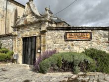
Accommodation in La Robla (Olvidado).
| Albergue de La Robla 8€ 16 |
|
Day 16. La Magdalena to Pandorado (20 km)
(For anyone who notices that the last stage I posted was numbered 14bis, this stage gets the number 16 because the mountain alternative through Vegacervera took three days from Boñar to La Magdalena, while the “bis” route took only two).
For those who want longer stages, the most obvious stop would be Vegarienza, which is about 28 km from La Magdalena, and which has a wonderful albergue above the medical office, and a very nice road-side restaurant. But I’ll stick with Pandorado as the end point.
This is another one of those idyllic off-road stages, not much in the way of dramatic scenery but very pleasant. Pine forests and oak forests. Some of the camino goes along the Transhumancia, the official “livestock path” for farmers to take their flocks down to Extremadura during winter months. Though the animals are now transported by motorized vehicles, I remember being in Madrid in the 70s when the streets were closed off for one day. Some animals paraded on through the center of the city, to the delight of many and the displeasure of some. (Sort of the same reaction you get when cities are closed for marathons or cycling races).
I don’t remember any open bars or other services aside from those at the beginning in La Magdalena, and a café in Riello, about 17.5 km further along.
Ender actually lists Riello as the “end of stage” but I don’t see any accommodation there. The casa rural I have contacted has advised me it’s a whole house rental with a minimum of two days. But there is a nice bar there, with an outdoor café. This was another one of those places where the local residents were eager to talk to me about the camino, their pueblo, and their hopes for a better future. Carrying on from Riello to Pandorado is another 2.5 km and involves an ascent, but it isn’t dramatic.
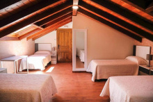
Resthy’s place in Pandorado is a small complex. It has a bar/mesón, restaurant, and tourist apartments (with washing machines!). They are very familiar with peregrinos. Ender’s guide doesn’t list it, and that may be because they have been a bit uncooperative with accommodating pilgrims. When I stayed there in 2014, there were no others spending the night in their nice tourist apartments, and the price for me was a whopping 60€. The owner told me the price was the same for 1, 2, 3, or 4, and I was free to invite in some others. He and his wife were very nice, they just were not there to help pilgrims out. At that time, they also had a kind of taxi service. If the next day you walked to Fasgar or to any place before that, they would come pick you up and bring you back to Resthy’s. Cost was in the 20s€ I believe. But of course you would have to pay another fee to get taken the next day back to your starting point. That would make for 160€ for two nights plus taxi, not to mention food. That is no longer necessary, as there are places to stay now, but back in the day they had a kind of monopoly going on.
There is also a Gran Hotel Pandorado across the street from Resthy’s, so maybe that has made him offer more competitive prices. The hotel was not open when I walked through in 2019, and it doesn’t seem to have a website. Booking says it is not taking reservations.
All in all, I think this is a very manageable and enjoyable 20 km day.
Ender actually lists Riello as the “end of stage” but I don’t see any accommodation there. The casa rural I have contacted has advised me it’s a whole house rental with a minimum of two days. But there is a nice bar there, with an outdoor café. This was another one of those places where the local residents were eager to talk to me about the camino, their pueblo, and their hopes for a better future. Carrying on from Riello to Pandorado is another 2.5 km and involves an ascent, but it isn’t dramatic.
It's perhaps worth mentioning that the tienda in Riello is the last one before Iguëña, 46km further on, and other food options are scarce. Especially if the lovely restaurant in Vegarienza (the oldest in León province) closes, and if you hit Fasgar when Aires de Fasgar is closed (which it is roughly 300 days a year).
Resthy’s place in Pandorado is a small complex. It has a bar/mesón, restaurant, and tourist apartments (with washing machines!). They are very familiar with peregrinos. Ender’s guide doesn’t list it, and that may be because they have been a bit uncooperative with accommodating pilgrims. When I stayed there in 2014, there were no others spending the night in their nice tourist apartments, and the price for me was a whopping 60€. The owner told me the price was the same for 1, 2, 3, or 4, and I was free to invite in some others. He and his wife were very nice, they just were not there to help pilgrims out. At that time, they also had a kind of taxi service. If the next day you walked to Fasgar or to any place before that, they would come pick you up and bring you back to Resthy’s. Cost was in the 20s€ I believe. But of course you would have to pay another fee to get taken the next day back to your starting point. That would make for 160€ for two nights plus taxi, not to mention food. That is no longer necessary, as there are places to stay now, but back in the day they had a kind of monopoly going on.
There is also a Gran Hotel Pandorado across the street from Resthy’s, so maybe that has made him offer more competitive prices. The hotel was not open when I walked through in 2019, and it doesn’t seem to have a website. Booking says it is not taking reservations.
Day 17. Pandorado to Fasgar (26 km)
If you have slept in Pandorado, your choices are either Vegarienza (8) or Fasgar (26). There is just nothing in between Vegarienza and Fasgar. The road up to Fasgar through the valley has lots of tiny little villages, all looking like great vacation spots, but no accommodations that I can find!
Leaving Pandorado, there is an initial descent along an untraveled road to the pretty town of Omañuela and its river. From there it is really a pretty walk, a very gradual ascent, lots of river walking. There is nothing in the spectacular range, but there are ancient bridges, a few bits of Roman Road, a couple of tiny towns. Not much in the way of places to eat or drink, unless you are walking when the pueblos have “reopened” for summer, so bring what you need. Even in summer, the bars are unlikely to open in morning or early afternoon. It is almost totally off-road, so the feet enjoy the surface and the mind enjoys the quiet.
About 8 km after Pandorado, you come to the tiny hamlet of Vegarienza. Estela is a woman who grew up in the village, worked in Madrid, then retired and came home to take care of her ailing brother. Her house is two doors down from the medical center, and she noticed that it had a top floor that was not being used. With the help of other Olvidado supporters, she was able to get the top floor converted into a very nice albergue. She has the keys, will check you in, and is a gem. Her love is directed at her village, not at the Camino, and she fervently hopes the albergue will help bring back some life.
******
If you like longer stages, La Magdalena to Vegarienza is about 30. I stayed here in 2019 and it was really very nice. The little restaurant on the road was open for lunch, so I had my main meal here. It was pretty astonishing to see an elderly woman and her daughter (and by elderly I mean over 90!) doing all the cooking, serving, and cleaning. The set-up gave you a front row seat to the action, because the kitchen is in the middle of the restaurant. The mother told me they had been trying to retire for years now, but can’t bring themselves to shut the place and leave the village and the surrounding area with nothing. Googlemaps tells me Restaurante Maxi is currently open for takeout, a good sign for post-pandemic walkers!
******
But back to the route to Fasgar. Shortly after leaving Vegarienza, you take a left turn off the LE-493. You are now on a small road that ends in Fasgar. The camino is mainly off road, but the road is never far away. It goes through several small villages, all along the river. Just so pretty. I had a cow encounter or two, and those who are leery could just stay on the road, because it is very very untraveled. The only advice I would definitely give is to make sure to take the camino path from Vegapujín into Fasgar, it is lovely and no cows!
On my first Olvidado, Rosi opened her home to me, thanks to Adolfo (from Nava de Ordunte). Rosi had recently moved back to her pueblo from Oviedo, where she was on the hamster wheel of living pay check to pay check with a young child and high child care costs. When I first met her, she was running the “social center” (municipally owned bar). But basically they were living “off the grid” — with their own garden plots, a few animals (with an annual pig slaughter), wood stove. At that time the year round population was about 8, and it was the 3rd birthday of Rosi’s daughter, which I was privileged to celebrate with them in the bar.
Fasgar, at the end of the road, is a beautiful little mountain village, which fills up in the summer. Winters are hard, no more than 10 full time residents, and Rosi told me of many weeks with no outside contact. During her first winter back, she counted the days with snow and then got discouraged and stopped counting. It must be beautiful, but almost inaccessible.
Fast forward a few years, there is now an albergue in the old school, a slightly fancy restaurant, and a Casa Rural, all run by Rosi. I would highly recommend a stop here, no matter where you stay the night before. The restaurant seemed wildly successful the last time I was there. In fact, checking today on their website, I see that the weekend is completely booked for the restaurant, and this is a Tuesday during a pandemic!<
If 26 km is too much for you, the only obvious options I see are to either take Resthy up on his taxi offer for part of the way, or break the stage up into 8 (to Vegarienza) and 18 (to Fasgar).
It is a lovely stage, ending in a really pretty little town with a river running through it. It is literally at the end of the road.
About 8 km after Pandorado, you come to the tiny hamlet of Vegarienza. Estela is a woman who grew up in the village, worked in Madrid, then retired and came home to take care of her ailing brother. Her house is two doors down from the medical center, and she noticed that it had a top floor that was not being used. With the help of other Olvidado supporters, she was able to get the top floor converted into a very nice albergue. She has the keys, will check you in, and is a gem. Her love is directed at her village, not at the Camino, and she fervently hopes the albergue will help bring back some life.
Accommodation in Vegarienza.
| Casa de Acogida |
On my first Olvidado, Rosi opened her home to me, thanks to Adolfo (from Nava de Ordunte). Rosi had recently moved back to her pueblo from Oviedo, where she was on the hamster wheel of living pay check to pay check with a young child and high child care costs. When I first met her, she was running the “social center” (municipally owned bar). But basically they were living “off the grid” — with their own garden plots, a few animals (with an annual pig slaughter), wood stove. At that time the year round population was about 8, and it was the 3rd birthday of Rosi’s daughter, which I was privileged to celebrate with them in the bar.
Fasgar, at the end of the road, is a beautiful little mountain village, which fills up in the summer. Winters are hard, no more than 10 full time residents, and Rosi told me of many weeks with no outside contact. During her first winter back, she counted the days with snow and then got discouraged and stopped counting. It must be beautiful, but almost inaccessible.
Fast forward a few years, there is now an albergue in the old school.
The Aires de Fasgar Rural House and its restaurant have closed.
Day 18. Fasgar to Igüeña (18 km)
On my first Olvidado in 2014, this stage was heralded as the “etapa reina” (jewel in the crown more or less) of the Olvidado. It is beautiful, no doubt about it, but it now has some stiff competition from the Boñar-Vegarienza-La Magdalena variant. But if the weather is good, you are in for some exhilaration.
You ascend on a dirt road from Fasgar, then go down and cross the Campo de Santiago, where Santiago appeared in 981 to help defeat the Moors. I wrote a short synopsis of the story for Ender’s guide and won’t repeat it here, but the bottom line is that thanks to Santiago’s intervention, about 70,000 Moors lost their lives on this battlefield.
From the ermita at the bottom commemorating the battle, you continue on a beautiful trail along the river. There is uneven footing in places, but the wooden bridges back and forth over the river have been rebuilt since the first time I walked on very precarious wooden structures.
The camino emerges a total of 12 kms later from Fasgar in the town of Colinas del Campo de Martín Moro Toledano (the leader of the Moors in the famous battle). This is the town with the longest name in all of Spain, and it is another beautiful mountain village, just beautiful. Only a bar or two, seasonal hours, so don’t count on much. The first time I walked through nothing was open, but the second time was a Saturday and I was able to enjoy a nice cold drink in a very lively mesón with terrace.
The fun fact is that the walk from Fasgar to Colinas del Campo is 12 km on foot. Driving a car turns it into a 79 km ordeal.
From Fasgar, the rest of the way into Igüeña is along the river, usually off road and very pleasant. All shaded! Igüeña has a modern albergue run by the bar/restaurante that is adjacent, and the owners will cook you up a plato combinado at any reasonable hour.
The mural at the entrance to town makes a big impact and reminds you that you are still in the part of Spain that is struggling to find life after mining.
If 18 km is too short for you, here are a couple of other ways to break it up.
Vegarienza to Igüeña is about 35 or 36. But you would not get a stop in Fasgar, which is surely a pity. Beyond Igüeña, Quintana de los Fuseros and Labaniego have options.
Day 19. Igüeña to Labaniego (19 km)
The mountain walking is now officially over, but I remember some nice walking tracks through logging forests and just generally pleasant terrain. Nice views, nice paths. The hills of the Bierzo are on your left and there are vineyards and other agricultural production.
About 7 kms beyond Igüeña is the small town of Quintana Fuseros. On my first Olvidado, I arrived too early from Fasgar to stop in Igüeña and decided to keep on walking. When I got to Quintana Fuseros and went into the bar, the bar owner made a phone call and the mayor came down to meet me. After welcoming me to town and buying me a drink, he proceeded to call the owner of the casa rural. She had a neighbor open the house and left me the run of the place. She asked me to leave 20€ on the table. It’s not much of a town to look at, but the people are wonderful. The home was clean, modern, hot showers and good kitchen. But bring food because there’s nothing in town.
After Quintana Fuseros, as you are ascending to a forest, you’ll see a broken crucifix. The Cruz Cercenada represents the cross that was broken by Almanzor’s sword during a 10th century battle in the area. I think the idea is to turn it into something similar the Cruz de Fierro but I didn’t see any evidence of that.
Another 12 kms and you are at Labaniego. I have never stayed here, but Ender’s guide indicates there is “acogida de peregrinos.” This term means that you will find a place to sleep but no guarantees about bed or showers or hot water. Labaniego also has several casas rurales, and a couple are offered on booking.com. It’s a small place, several nicely restored homes, but no services of any kind that I can see on google. So I would be sure to bring food.
If you can walk 5 more kms, there is a small Hostal/Bar in Losada. On my last walk through, it was a terribly rainy day. I very much enjoyed a long stop and two hot cafés con leche. Wonderful people. You can tell a lot about a person’s character by her reaction to the entrance of a dripping wet pilgrim. Total hospitality, no worries about the puddles!
On my first Olvidado, I arrived too early from Fasgar to stop in Igüeña and decided to keep on walking. When I got to Quintana Fuseros and went into the bar, the bar owner made a phone call and the mayor came down to meet me. After welcoming me to town and buying me a drink, he proceeded to call the owner of the casa rural. She had a neighbor open the house and left me the run of the place. She asked me to leave 20€ on the table. It’s not much of a town to look at, but the people are wonderful. The home was clean, modern, hot showers and good kitchen. But bring food because there’s nothing in town.
Another 12 kms and you are at Labaniego. I have never stayed here, but Ender’s guide indicates there is “acogida de peregrinos.” This term means that you will find a place to sleep but no guarantees about bed or showers or hot water. Labaniego also has several casas rurales, and a couple are offered on booking.com. It’s a small place, several nicely restored homes, but no services of any kind that I can see on google. So I would be sure to bring food.
Day 20. Labaniego to Congosto (18.5 km).
I remember this day as having lots of beautiful views over the Bierzo region to my left. At some point the terrain changes to vineyards, but before that it is green and even lush. My memory is not exactly tracked with these stages, because these are not the stages I walked. These last few days into Ponferrada are very pleasant, because you are now firmly implanted in the Bierzo, which IMO is a gorgeous part of the country.
Such a contrast between houses, some beautifully preserved, apparently on their last legs.
In Cobrana, about 13 km beyond Labaniego, I slept in La Vieja Fragua. It’s a tiny house with a loft, and the owner rents to peregrinos. The bar owners are in charge, since the owner lives out of town, but a WhatsApp is easy to set things up. Gelines in the bar prepared me a “lunch” that was too much food for lunch AND dinner. She delivered it to the house after I was showered and dry. It had been one of those almost all-day rains. I can’t remember what it was, but I do remember some excellent cheese, bread and sausage on the side. In the afternoon, the rain let up, and I enjoyed some good time with locals who are, as seems to be generally the case along the route, hoping very much that the Camino Olvidado becomes more popular.
From Cobrana to Congosto is forest with beautiful chestnut groves. Before you get to Congosto, there is an ascent to the Sanctuary of the Virgen de la Peña. As a dutiful peregrina, I walked up, but it was thick pea soup fog and there were no views to be had. But the views would be over the Bárcena Reservoir, and frankly, I have come to the conclusion that I just don’t much like reservoirs. Cañaveral, Arija, Aguilar de Campoó, and now Bárcena. All of the reservoirs I have walked by strike me as slightly depressing for some reason.
I have only slept in Congosto once, and it was on my first Olvidado when I once again was saved by the kindness of others. I called several casas rurales, and the owner of the Casa Rural Álvaro de Mendaña moved mountains to get her house opened for me. She was leaving town at noon be in Ponferrada for an appointment, but she prevailed upon her brother to open up the house when I called upon arrival. On the table were a bowl of cherries and some home made cakes. And the brother told me his sister had said to just leave whatever I thought was an appropriate amount. Highly recommended, though I would recommend giving her a heads up more than a few hours in advance like I did!
The house is right across the street from a restaurant, where I was overjoyed to find a cheap menú del día at 5€ because I had almost totally run out of cash. Pola de Gordón (day 15) was the last ATM I had seen. Hopefully others can chime in with information about ATMs I might have missed. Luckily, the next day was Ponferrada, but I was close to penniless by that time.
On my last walk through, it was a terribly rainy day. I very much enjoyed a long stop and two hot cafés con leche. Wonderful people. You can tell a lot about a person’s character by her reaction to the entrance of a dripping wet pilgrim. Total hospitality, no worries about the puddles!
In Cobrana, about 13 km beyond Labaniego, I slept in La Vieja Fragua. It’s a tiny house with a loft, and the owner rents to peregrinos. The bar owners are in charge, since the owner lives out of town, but a WhatsApp is easy to set things up. Gelines in the bar prepared me a “lunch” that was too much food for lunch AND dinner. She delivered it to the house after I was showered and dry. It had been one of those almost all-day rains. I can’t remember what it was, but I do remember some excellent cheese, bread and sausage on the side. In the afternoon, the rain let up, and I enjoyed some good time with locals who are, as seems to be generally the case along the route, hoping very much that the Camino Olvidado becomes more popular.
From Cobrana to Congosto is forest with beautiful chestnut groves. Before you get to Congosto, there is an ascent to the Sanctuary of the Virgen de la Peña. As a dutiful peregrina, I walked up, but it was thick pea soup fog and there were no views to be had. But the views would be over the Bárcena Reservoir, and frankly, I have come to the conclusion that I just don’t much like reservoirs. Cañaveral, Arija, Aguilar de Campoó, and now Bárcena. All of the reservoirs I have walked by strike me as slightly depressing for some reason.
I have only slept in Congosto once, and it was on my first Olvidado when I once again was saved by the kindness of others. I called several casas rurales, and the owner of the Casa Rural Álvaro de Mendaña moved mountains to get her house opened for me. She was leaving town at noon be in Ponferrada for an appointment, but she prevailed upon her brother to open up the house when I called upon arrival. On the table were a bowl of cherries and some home made cakes. And the brother told me his sister had said to just leave whatever I thought was an appropriate amount. Highly recommended, though I would recommend giving her a heads up more than a few hours in advance like I did!
The house is right across the street from a restaurant, where I was overjoyed to find a cheap menú del día at 5€ because I had almost totally run out of cash. Pola de Gordón (day 15) was the last ATM I had seen. Hopefully others can chime in with information about ATMs I might have missed. Luckily, the next day was Ponferrada, but I was close to penniless by that time.
Day 21. Congosto to Ponferrada (16-19 km)
I am just planning on taking us from Congosto into Ponferrada, unless anyone thinks they would be interested in the Cabanas Raras route, which joins up with the Francés in Cacabelos. I know I’ve said this a million times, but if you are going to continue from here to Santiago, I think heading to Ponferrada and then walking the Invierno to Santiago is a terrific choice! With apologies to the dilligent Olvidado organization.
The official Camino Olvidado does not go down to Ponferrada, but rather continues for two more days to Cabañas Raras (20 km) and then onto the Francés at Cacabelos, with a stage ending in Villafranca del Bierzo (16 km from Cabañas). I have gone into Ponferrada both times, in order to get on the Invierno, which is a combination of caminos made in heaven. If you are going to continue on the Francés, though, Cabañas Raras is very eager to have pilgrims, and there is an “acogida” in town.
There are at least 2 ways to get from Congosto to Ponferrada. One is along the reservoir and across the dam. The spot where you leave the Olvidado to go into Ponferrada is obvious, but someone has tried mightily to erase the arrows showing the split. I would have a GPS just to make sure get on the right path, and there are many wikiloc tracks.
In 2014 I followed the arrows and it turned out to be a slightly convoluted loop. You walk alongside the reservoir, and cross over to the other side at the dam. It keeps you on the route to Cabañas Raras for a lot of the way, and then a cut south down to Ponferrada.
In 2019 I thought I was heading to the romanesque church I describe below, but got turned around and wound up in a pine forest. Luckily I came across a European Diabetic biking group, and they helped me get back on track. (And I ran into them the next day in Las Médulas!). The pine forest is a nice option for going into Ponferrada, but I’m afraid I can’t reconstruct it since I was lost.
On both occasions I joined the Francés at Columbrianos and then walked “backwards” to Ponferrada.
A second way into Ponferrada was brought to my attention after my last Olvidado. It is based on the idea that you want to go straight from Congosto to Ponferrada, rather than walk along the Olvidado route leaving Congosto and then detour. So this route leaves the Olvidado directly in Congosto. And it is a few km shorter.
This route will not take you to Santo Tomás de las Ollas, with its 10C Mozárabe church, unless you detour off the wikiloc tracks, near where the wikiloc map says “Urbanización Patricia.”
Alansykes was able to visit and enjoyed it immensely. He forged his own route, staying part of the way on the Olvidado and then turning off. Here’s what he reported:
Assuming you're planning on taking the Invierno into Compostela, I'd recommend leaving the Olvidado near the Bárcena reservoir and going straight into Ponferrada, rather than following the official route on to Villafranca del Bierzo. As well as saving a day or so, the main advantage is that you get to pass the glorious (possibly partly pre-)Romanesque/mozárabe church of Santo Tomás de las Ollas, with its amazing horseshoe arches and breathtaking almost circular simple apse.
I was sitting sadly outside thinking I would never see the interior when Manuela, a relatively elderly lady living in one of the houses on the square in front of the church came out with the key and let me in and gave me a lot of information about this fascinating site, including that it's just possible that it's of Visigothic origin. If Manuela isn't about, she told me that the local bar will let people know where she is, or find a key somewhere else (they're clearly justly proud if this hidden gem in the area). And then only a km or so into the centre of Ponferrada. "Vaut le detour", as the Michelin guides used to say.
The official Ponferrada website says to call the tourist office to see about getting someone to open it up. 987.42.42.36 Open every day except Monday.
So there you have it, the Olvidado from Bilbao to Ponferrada!
Cacabelos is best known for the production of wine, you’ll notice a modern building at the start of town that was built to promote the region.
Take the time to wander the lateral streets and you will be rewarded with several out of the way restaurants. The municipal albergue here has a curious design; horseshoe in shape it wraps around the church and enjoys semi-private two person rooms.
Cacabelos owes its prosperity to the once Archbishop of Santiago de Compostela Diego Gelmírez who gave the instructions that it be rebuilt in 1108. Very few of the churches remain, but the Iglesia de La Quinta Angustia near the river houses a positively unique sculpture of Baby Jesus and Saint Anthony of Padua playing cards.
Although most of his men were drunkenly sacking nearby Villafranca, Sir John Moore’s retreating army scored a small victory here during the Battle of Cacabelos. One of his riflemen, the talented Thomas Plunket, managed to put a bullet in the head of the French cavalry Brigadier General Auguste Colbert from 500m, and another into the head of the officer that came to Colbert’s aid. The balance of the Peninsular War didn’t quite go to Moore’s advantage and following this victory he resumed his retreat towards A Coruña.
The camino leaves town along the road over the Río Cúa and past the church and albergue.
Accommodation in Cacabelos al final del Camino Olvidado.
| Albergue de Cacabelos 6€ 70 |
|
| Albergue La Gallega 13€ 26 Booking.com |
|
| Albergue-Pensión El Molino 15€ 16 |
|
| Saint James Way 22€ 15 Booking.com |
|

