
Note: If you are continuing to Finisterre then the bar here is the last place to stock up on food and water for some distance. There is a fountain between here and Cee but very little else.
If you are continuing to Finisterre then the bar here is the last place to stock up on water or grab a sandwich. There is a fountain between here and Cee but very little else.
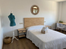
Accommodation in Hospital
| Albergue O Casteliño 14€ 18 |

|

Shortly after the roadside bar beyond Hospital, in the middle of a large roundabout, is a double mojón indicating the choice between Finsterre and Muxía.
From the roundabout with the twin markers, take the paved road to the left and alongside the massive factory. The camino follows the road for 300m before leaving it to join a trail on your right.
IF you are headed to Finisterra from this point, all the way to the first building in Cee, the camino remains well isolated from the road and any form of development beyond the two chapels mentioned below.

No fountain! Chapel, picnic area, and a nice place to take a rest.
Chapel and fountain. Shortly beyond this point, you will catch your first glimpse of the Cabo Finisterre.
After the Capela de San Pedro the camino comes to a fork, with the yellow arrows taking you left and downhill. The option to the right follows a dead-end trail 50m to the Cruceiro de Armada, a point which marks the medieval pilgrim’s first glimpse of the sea.
The camino leaves this high plateau quite dramatically via a steep descent into Cee. Very steep. It starts off rocky but quickly turns into an asphalted road for the majority of the descent. The camino follows the road into Cee but has a very confusing set of arrows through town. They have been painted and painted over by competing albergues. No matter which way you choose you will get through town, but the shortest distance follows closest to the beach.
Cee, with it's crescent beach, is the first place that the camino arrives at the Atlantic coast. It has every service you might need, including a full hospital, plenty of inexpensive accommodation, and a small shopping center. There is as well a bus terminal with service to Finisterre (don't even think about it) and Santiago.
Accommodation in Cee
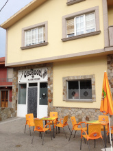
| Albergue O Bordón 15€ 24 Booking.com |
|
| Albergue A Casa da Fonte 15€ 40 |
|
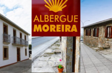
| Albergue Moreira 15€ 15 |
|
| Albergue Tequerón 15-18€ 20 Booking.com |
|
| Pension Beiramar Booking.com |
|


Be mindful of the arrows which will cause you to bear right shortly after the road begins to ascend. The camino does NOT continue along the road, but rather shortcuts its way over the hills behind Corcubión. If you lose the arrows, proceed to the Church of San Marcos. From there, and with the water to your back, leave the square in the rear left corner. You will shortly come to a narrow rocky trail with tall walls on either side. Continue upwards, and in 1km you will have passed through the intersection at Vilar, and arrived at the picnic area at San Roque.
Accommodation in Corcubión


The camino passes the hamlet of Amarela as it winds its way downhill, trying at every opportunity to avoid the main road until it arrives at Estorde.
Accommodation in San Roque
| Albergue San Roque Donativo€ 14 |
|

Accommodation in A Amarela
| Albergue San Pedro 17-22*€ Booking.com |
|
Accommodation in Estorde
| Camping Ruta Finisterre |
| Hotel Playa de Estorde | 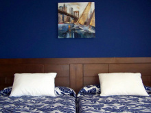
|

The camino does not pass near the beach here, but it is certainly possible to make the small detour for a rest or a soak of the feet. If you go that way, pay close attention to the arrows out of town and DO NOT follow the road.
Be mindful not to follow the main road out of town, the camino follows a trail on the upper (your right) side of town and is much more comfortable walking.
Accommodation in Sardiñeiro


Finisterre is the end of the world, and for anybody walking west, the beginning of the end. From the city center only 3km remain to the Cabo (lighthouse and restaurant). On the other hand, 31km remain for anyone wishing to turn North and continue to Muxía. The tourism office, just up the road from the Xunta albergue can provide you with the official document, the Fisterrana, declaring your completion of the walk. You are advised to have all of your stamps in order, for they are on the lookout for anybody who might have taken the bus.
This is the sort of place where salty air mixes with cheerful rendezvous and pilgrim farewells. Pilgrimage to this point, the most westerly point of continental Europe, predates that of Santiago. As unique as this might make it, Finisterre has managed to maintain a low profile. The harbor restaurants, now enjoying their recently rebuilt environs, continue to do grilled sardines and pimientos de padrón the way they always have.
Bus service returns to Santiago from in front of the municipal albergue several times daily and is easy to sort out. The schedule is posted at most albergues. Be mindful of the phrase "Enlace" which indicates a change in buses along the way and a potential delay when traffic is heavy. The drivers are serious fellows, and not very talkative. If you find yourself standing with a group of people on the side of the road, unsure of what is going on, be patient. If you are in more of a hurry, taxi service can get you back to Santiago as well.
Lastly, but perhaps most importantly, is a quick geography lesson. Contrary to perception, the walk to the lighthouse is actually Southerly. The beach approaching Finisterre, the Playa Langosteira, faces East. This puts the setting sun, and nostalgic glances towards home for North Americans, on the other side of the peninsula; a little over 1km from the municipal albergue. If you fancy a plunge into the Atlantic, naked or otherwise, the relatively private beach there will oblige... just saying. If you go, be extremely mindful of the strong currents which will quickly pull you from the beach when the waves roll in. The beach is unmonitored.
For those of you wishing to continue onward to Muxía, I have separated the notes and put those into "San Martiño de Duio." The elevation profile as well begins there.
The official certificate of completion, known as the Fisterrana, can be obtained at the tourism office. You are advised to have all of your stamps in order, for they are on the lookout for anybody who might have taken the bus.
The most famous son of Finisterre is simultaneously its most obscure. Alexandre Campos Ramírez, also known as Alejandro Finisterre, was a poet and inventor born here in 1919. He was injured in the battle for Madrid during the onset of the Spanish Civil War and was evacuated to the hospital in Montserrat. A similar fate had led Ignatius of Loyola to the same place 4 centuries earlier and although Alexandre didn’t go so far as to pen his own Spiritual Exercises he did manage to dream up the design for the first foosball table.
The biggest fiesta in Finisterre is Holy Week, when many thousands of Galicians descend on the village to take part in the celebrations and processions. If you plan to arrive during this time do book a room in advance. Nuestra Señora del Carmen is celebrated from the 8-10th of September.
TO MUXÍA: The route to Muxía has matured over the last five years, but services along the 29km stretch way remain scarce. Lires and Frixe both have bars, and Lires has a few guesthouses if you wish to split the walk into two days.
To find the way to Muxía, head back along the road you came in on. At the cruceiro that marks the end of the beach stay on the road. It curves left at the cruceiro, and then curves right. Turn left (uphill) at the second street when you get to the first signs indicating the way. Between here and Muxía you will find the new markers installed in pairs and indicating the ways to Muxía and Finisterre, and you will also find double ended yellow arrows with M and F on either end.
The walk is along paved road from Finisterre to San Salvador, but from there it joins a gravel trail for most of the way, only joining paved surfaces as it passes through the smaller villages.
Accommodation in Finisterre - Fisterra
| Albergue de Peregrinos de Fisterra 10€ 26 |
|
| Albergue O Encontro 12/15€ 5 Booking.com |

|
| Albergue Finistellae 13€ 20 |
|
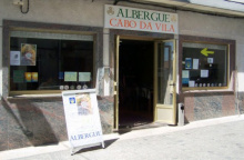
| Albergue Cabo da Vila 15€ 32 Booking.com |
|
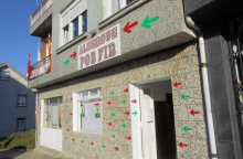
| Albergue Por Fin 17€ 11 Booking.com |
|
| Albergue Mar de Rostro 16-17€ 27 |
|
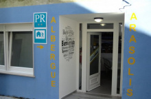
| Albergue Arasolis 15€ 16 |
|
| Albergue Mar de Fora 16€ 38 Booking.com |

|
| Albergue La Espiral 15€ 14 |
|
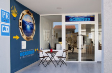
| Albergue Oceanus Finisterre 17€ 36 Booking.com |
|
| Albergue Buen Camino de Sonia 15-17€ 50 Booking.com |
|

| Hostal Mariquito Booking.com |
|


Approximately 3km from the center of Finisterre, this is the last place that you could hope to walk to without changing course. It can be a busy place, and the number of vendors there seems to grow with every passing year, but a careful climb down to a suitable lookout point will provide you with a peaceful enough place for you to contemplate your next move.