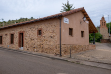
León is now a fully modernized city home to more than half of the population in the province. Like Burgos behind and Santiago ahead, it is worthy of more time than the average pilgrim spends here. To explore in full would take several days, to cover the basics at least two. If you are keen to keep your feet moving every day, consider spending an extra afternoon in León and setting out after lunch for a half day of walking.
The Cathedral of Santa María de la Regla is a magnificent example of Gothic architecture whose multicolored windows are not to be missed, particularly on a sunny day when the interior is filled with light. The Virgen Blanca on the main portico is a reproduction, the original is in a chapel behind the main altar. You'll also notice that quite a few sculptures have been removed for restoration. The Church of San Isidoro is the other not to be missed church; it houses the relics of San Isidoro and is the site of the Pantheon of Kings where 23 of the Leonese monarchy are resting.
Fans of Gaudi will not want to miss the Casa de Los Botines just a short stroll from the Cathedral, and perhaps capture a selfie with a bronze statue of the architect seated on a bench in front. Every service imaginable can be found in León. The best food and the liveliest crowds can be found in the Barrio Humedo, a twisted knot of narrow streets near the Plaza Mayor whose name implies that the drinks are overflowing. The region of León is unique in Spain as the only one that produces hops for the production of beer. A few new breweries have appeared on the scene in recent years (Four Lions is recommended) and most produce a local beer known as Zerep. As you walk around town you will notice several types of plaques embedded in the pavement. One is the impression of the left foot of a Roman soldier and marks the boundary of the original Roman settlement and wall. The other, seen closer to the Plaza Mayor, is a symbol of the peninsula and bears the Hebrew word ספרד which translates as Sefarad, the Jewish name for Spain. It was that Jewish population that was expelled from Spain under the Alhambra Decree in 1492. The marker indicates the start of what was once the Jewish barrio of León.
Leave León by way of the road behind the Parador San Marcos. While facing the Parador cross the square to your right and follow the path around the building. Arrows dedicated to the San Salvador route will appear, as well as a fairly unique mojon.
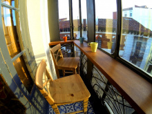
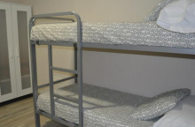
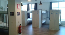
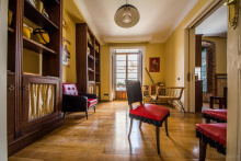
Accommodation in León - Start of San Salvador
| Albergue Unamuno 13-18€ 85 |
|
| Albergue LeonHostel 17-22€ 20 Booking.com |
|
| Albergue Muralla Leonesa 16€ 80 Booking.com |
|
| Albergue Check in León 11-13€ 40 Booking.com |
|
| Hostel Covent Garden 20-25€ 26 Booking.com |
|
| Albergue de Peregrinos de las Benedictinas - Sta. María de Carbajal 8€ 132 |
|
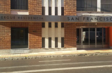
| Albergue San Francisco de Asis 14-18€ 90 Booking.com |
|
| Pensión La Torre Booking.com |

|
| Hostal Albany ★★ Booking.com |
|
| Hostal Alda Casco Antiguo ★★ Booking.com |
|
| Hostal Quevedo ★★ Booking.com |
|
| Hostal Misericordia Booking.com |

|
| Hotel NH Plaza Mayor ★★★★ Booking.com |

|
| Hotel Le Petit León ★★ Booking.com |

|
| Hotel Real Colegiata de San Isidoro ★★★ Booking.com |

|
| Parador San Marcos Booking.com |

|


Bar Central is the bar most likely to be open, so don't pass it hoping for another. There is also a small shop in town for basic food supplies. Another option for food is either in León or at the cafeteria El Palacete located on your left less than 1km outside of León. The next town with food is Cascantes.
The camino follows along the main road right up to the end where it turns to dirt. It is well marked. On the way to the next village, the camino passes the Fuente de Villabura, a fountain and rest area for pilgrims.


No services in town but 4 beds are available in the municipal albergue. If you plan to stay here you are advised to call in advance: 625 426 659.
Avoid accidentally following the road out of Cabanillas. The camino turns to the right at the edge of town and follows along a hiking trail through an oak forest and to La Seca.
Accommodation in Cabanillas
| Albergue de Cabanillas Donativo€ 4 |
|


Crossing the bridge to visit La Seca, with a bar (follow the old signs, the bar is still open) and the Ermita de San Blas, is optional.
Keep on straight (with the bridge on your left) to follow the camino.


In Cascantes the camino crosses the main road and follows a paved side road into and through the town. At the end, it rejoins the main road to La Robla. At the entrance to town is the Chapel of Celada, and beyond that a large power plant. You will pass through a tunnel and then over the railway on a elevated bridge before getting to the heart of town.
NOTE: There is an alternative route at the end of Cascantes which is signed Por Llanos de Alba. This alternative bypasses the entrance to town and with that much of the busy road walking and takes you directly to the municipal albergue in La Robla.

La Robla is the first developed city outside of León. In addition to an albergue, there are also hostals and pensions. Avoid those at the entrance to town just over the foot bridge, and continue into the center. There is also a tourist information office near the ayuntamiento if you need a stamp or a glossy brochure. The albergue is at the far end of town. Hostal Ordóñez de Celis, on your right before the ayuntamiento, is recommended.
Between La Robla and Buiza the Camino San Salvador coexists with the Camino Olvidado but they go in opposite directions. It’s not hard to keep them apart but if you get disoriented easily check your map from time to time.
The camino from La Robla, at least once you get to the end of town, is along a pleasant path adjacent to the river. It passes a restored aqueduct.
Accommodation in La Robla


Keep the main road (the N-630) to your left as you pass through Puente de Alba, and at the end of town turn right to follow the old national road which remains tree lined. Pass under the high-speed railway and enter Peredilla.

On the way out of Peredilla, BEFORE you arrive at the road sign indicating the end of town, the camino turns left along a gravel path and heads towards an underpass for the adjacent roadway. It then meets the rail track and turns to the right. It follows this path to the chapel of Buen Suceso.


The bar here appears to have closed, but is looking for a new owner. If you find a new one open, kindly leave a comment below!

The camino climbs only slightly into Nocedo de Gordon. It does not go into town, but rather take the first right just at the start of town to follow along the valley. The river will remain on your right-hand side until you cross over it and into La Pola de Gordon.

The plaza mayor of La Pola off the camino to your right after crossing the bridge over the river. Most pilgrims continue the additional 6km to the albergue in Buiza, but if you wish to stay in La Pola, you have a few options. Stock up on food here as there is none available for the next couple of days (apart from restaurants).
Several non-albergue options for accommodation, and one campsite are listed. Located on the north side of the main road, due east of the city.
When leaving town, keep to your left. The camino does not follow the main road. Instead, it turns off where the guardrail begins and passes through an industrial park. It then crosses the river and enters Beberino.
Accommodation in La Pola de Gordon
| Camping Bosque De Gordón |
| Pensión 15 De Mayo | 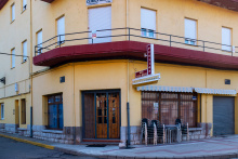
|
| Pensión Rabocan | 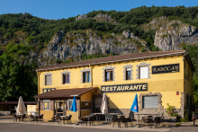
|


In Beberino the camino begins to follow a different river, this time the Casares. Pass through town along the road and keep an eye open for a turn to your right along another road which is signposted as 'Folledo' and 'Buiza'.


Buiza is your last stop before beginning the more mountainous middle section of the camino. If you plan to stay here, you are advised to bring food as the only bar in town has irregular opening hours. The albergue is in an old school building at the entrance to town and there is a fountain in front of it.
From Buiza the camino ascends to the Alto de San Antón, and before it the Forcadas de San Anton (forcadas translates to pitchfork, an aptly descriptive word for the jagged rock formations). It is about 2.5km up to the pitchfork. The descent is much more pleasant and passes through a pine forest. Before the alto there is a yellow arrow pointing along a non-existing path along the stream. A steel arrow indicating 'Mieres' is the arrow you want to follow.
NOTE: At the end of the pine forest the camino splits and the marking isn´t obvious if you have been lost in thought. On your left is a small concrete block building (for pumping water), and it is here that the official camino turns left and off of the road.
A second option, the one you might accidentally find yourself on, is to follow along the road towards (but not to) Rodiezmo. Along this path, you will arrive at the Cruz de la Salve. From the Cross, the camino turns sharply left. If you miss this turn you will end up in Rodiezmo, which means either following the busy national road or retracing your steps.
Accommodation in Búiza
| Albergue de peregrinos de Buiza 5€ 12 |

|
| Casa Rural Finca La Castañona |


This alto marks the high point of this day's climbing. On the way down it is easy to get confused and head towards Rodiezmo. Just past the third rocky outcropping, the path continues straight on to Rodiezmo. The camino itself turns Left. The last section of the camino into Poladura is a treacherous slog. San Martín is the village just before and there are several easily recognizable paths to get you there. The road between the two cities is short with little traffic.


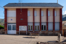
Poladura is a small town. The albergue is located in the former schoolhouse, and the only place to eat is the Posada El Embrujo.
The only meal in town is at the Posada El Embrujo. Recommended, and recommended that you call the day before to give them a bit of notice. +34 659 030 282.
A note of caution on the next section is in order.
Between Poladura and the Puerto de Pajares, the camino climbs over 350m through mountainous terrain. It is a stretch of 8km before Arbas and the first sign of civilization. Along the way, the path, and the signs indicating the path are often snow covered well into the summer months. If you are reading this via your phone be sure to charge it up before you set off. Cell phone coverage does not exist along much of the path.
Here is my best attempt to describe the trail: Leave Poladura along the road. At the first bend to the left, the camino leaves the road to cross a small field. A brown mojon is visible from the road and marks the start of the route. The first 1.3km go uphill due northwest and bring you to an opening between two rocky outcroppings. Another 300m of visible paths and the trail turns to your left, and continues around the hill, and slightly downhill, in a clockwise direction (downhill on your left, uphill on your right).
It reaches a low point and begins climbing the next hill to the West. The trail turns South at around 2.3km and shortly after takes a right turn, followed by another right turn 300m on. Another 500m on the well-worn path comes to an end, but the camino continues straight, climbing steeply. You will reach the high point of the camino 4km from Poladura, at an altitude of 1580m. Markers for the next section are often obscured by ground cover or snow, so be extra attentive. Descend from here, due north-northwest 300m. The path turns to the right and then splits. DO NOT continue straight and downhill. DO turn leftwards and begin another climb to another ridge. Follow the natural curve of the ridge for 600m and turn left towards the ridge to your West. It is that ridge that you will follow into Arbas.
Accommodation in Poladura de la Tercia
| Albergue Antiguas Escuelas Poladura de la Tercia 9€ 12 |
|
| La Posada del Embrujo ⭑⭑⭑ | 
|

The trail from Arbas to Puerto de Pajares has never been good, and in recent years has gotten worse. Nowadays it is best avoided, and the distance to the mountain pass (1.3km) covered by road. This also gives you the benefit of taking a pause at the bar at the pass.
Church in Arbás is usually open, has a lot of nice romanesque, and has REAL candles for lighting. It requires a 3-4 minute walk off camino, but it’s right there when you get down to the highway.


The Puerto de Pajares is one of the few mountain passes which for centuries has offered passage over the mountains into Asturias from the meseta. It remained the primary corridor until the construction of the A-66 to the west. It remains a difficult road for drivers and snow is not too uncommon here in June.
The old parador has opened the bar and across the road Venta Casimiro has rebuilt after a fire... it is the bar "de siempre." Parador for views, Venta for soul and a real meal.
The camino leaves the main road to follow a trail behind some farm houses at the far end of the alto; if you have gone as far as the old Parador you will have to backtrack a bit and avoid the temptation to follow the road. At the farm buildings turn right and begin a gentle ascent to the border between León and Asturias. Here you will have to pass through a gate and descend back to the National road you ought to have avoided (it really is quite dangerous). Here you have to cross over the road (CAUTION) to resume along a trail down to Pajares.
NOTE: Along the way to Pajares you will find a junction which requires you to decide between Pajares or San Miguel. The route through San Miguel will also arrive at Pajares but takes 5km longer to do so and is therefore only really recommended for cyclists or for pilgrims who intend to sleep in Bendueños (1.5km off camino).


One restaurant in town closed on Tuesdays. No grocery.
The only meal in town is at the El Mirador. Recommended, and recommended that you call the day before to give them a bit of notice. +34 636 933 069.
Leaving town, stay on the road to the city limits. The camino turns left and begins a steep descent into San Miguel del Rio in the valley below.
Accommodation in Pajares
| Albergue de Pajares 5€ 16 |
|
| Pensión El Mirador | 
|

