| Albergue Alea Private +34 987 404 133 +34 660 416 251 15 € 18 |
|
| Albergue Guiana Private +34 987 409 327 16+ € 50 Booking.com |
|
| Albergue de peregrinos San Nicolás de Flüe Parochial +34 987 413 381 Donativo € 175 |
|
| Hostal Nirvana ★★ Hostal +34 987 410 761 Booking.com |

|
| Hostal San Miguel Hostal +34 987 426 700 Booking.com |
|
| Hostal Río Selmo ★★ Hostal +34 987 402 665 Booking.com |
|
| Hotel El Castillo ★★★ Hotel +34 987 456 227 Booking.com |

|
| Hotel Los Templarios ★★ Hotel +34 987 411 484 Booking.com |

|
| Hotel Aroi Ponferrada ★★★★ Hotel +34 987 409 427 Booking.com |

|
| Miralmonte Casa Rural +34 987 419 475 +34 619 723 561 |
|
| Las Tres Negrillas Casa Rural +34 616 468 224 Booking.com |

|
| Polideportivo de Priaranza Polideportivo +34 987 420 806 |
| Casa Rural Las Barrancas Casa Rural +34 987 454 650 +34 987 428 550 +34 650 478 550 |
| Albergue municipal de Villavieja Manuel Fuentes Municipal +34 987 420 806 10 € 16 |
|
| Casa Rural Cornatel Casa Rural +34 619 868 122 |

|
| Casa Rural Cornatel Médulas ⭑⭑⭑ Casa Rural +34 987 420 568 Booking.com |

|
| Hotel Rural La Peregrina Casa Rural +34 609 062 538 Booking.com |
|
| Cabañas Rurales Lares Casa Rural +34 626 108 552 Booking.com |

|
| Casa Socorro Casa Rural +34 987 422 858 |
|
| Hotel Medulio Hotel +34 987 422 833 +34 987 422 889 Booking.com |
|
| Complejo Rural Agoga Hotel +34 987 422 844 +34 699 722 488 Booking.com |

|
| Albergue Casa Rosa Private +34 987 460 181 Donativo € 8 |
|
| Hostal Restaurante La Torre Hostal +34 987 460 081 +34 987 460 589 |

|
| Hostal La Torre II Hostal +34 987 460 081 Booking.com |
|
| Albergue de Peregrinos Xagoaza Xunta +34 639 921 679 10 € 20 |
|
| Polideportivo de O Barco Polideportivo +34 988 320 202 +34 988 320 772? |
|
| Pensión La Gran Tortuga Pension +34 988 347 044 |
|
| Pensión do Lar Pension +34 988 320 980 |
|
| Pensión Aurum Valdeorras Pension +34 988 322 098 |
|
| Hostal Mayo Hostal +34 988 322 098 Booking.com |

|
| Hotel Pazo do Castro ⭑⭑⭑⭑ Hotel +34 988 347 423 Booking.com |

|
| Hotel Calzada Hotel +34 888 040 012 Booking.com |

|
| Albergue de Vilamartín Xunta +34 680 602 423 10 € |
|
| Hostal Marbella Hostal +34 988 300 025 |
| Casa Rural Pacio do Sil Casa Rural +34 988 311 346 Booking.com |

|
| Pensión Fabio Pension +34 626 876 691 |
|
| Hostal Niza Hostal +34 626 876 691 |
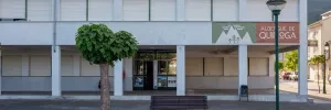
| Albergue de Quiroga Municipal +34 982 435 290 +34 669 812 659 10 € 150 |
|
| Casa do Parral Casa Rural +34 669 399 362 |
|
| Hostal Quiper Hostal +34 982 428 451 +34 676 110 961 |
| Albergue de A Pobra do Brollón Municipal 12-15 € 36 |
|
| Albergue Santiago 15 Private +34 982 195 237 17 € 50 Booking.com |
|
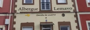
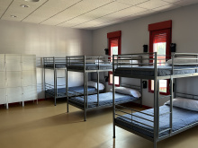
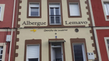
| Albergue Lemavo Private 14 € 16 Booking.com |
|
| Pensión Miño Pension +34 982 401 850 |
|
| Hostal OhLaLa Galicia Hostal +34 982 400 010 Booking.com |

|
| Hostal MON ComeySueña Hostal +34 982 401 437 Booking.com |

|
| Hostal Medievo Hostal +34 640 070 251 Booking.com |

|
| Hostal Puente Romano Hostal +34 982 403 551 |
|
| Hotel Puente Romano Hotel +34 982 403 551 +34 982 411 167 |
|
| Hotel Ribeira Sacra ⭑⭑⭑ Hotel +34 982 411 706 Booking.com |

|
| Hotel Terra Galega Hotel +34 982 405 090 |
|
| Hotel Cardenal Hotel +34 982 090 568 Booking.com |

|
| Hotel Parador de Monforte de Lemos ⭑⭑⭑⭑ Parador +34 982 418 484 Booking.com |

|
| Albergue de peregrinos de Diomondi Municipal 10 € 34 |

|
| Pensión Yoel Pension +34 982 440 294 |
|
| Hotel Mogay ⭑ Hotel +34 982 440 847 Booking.com |

|
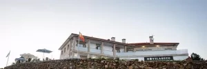
| Hotel Vilaseco Hotel +34 982 440 847 20 € 30 Booking.com |
|
| Albergue - Pensión Carpinteiras Private +34 986 790 196 12 € 28 |
|
| Pensión O Guerra Pension +34 986 790 061 |
| Albergue Lalín Centro Private +34 610 207 992 15 € 16 |
|
| Pensión Las Palmeras Pension +34 986 780 222 Booking.com |

|
| Hostal Caracas Hostal +34 680 176 205 Booking.com |

|
| Hotel Villanueva ⭑⭑ Hotel +34 986 780 344 Booking.com |
|
| Hotel Pontiñas ⭑⭑⭑ Hotel +34 986 787 147 Booking.com |

|
| Hostal Camiño Santiago Hostal +34 986 794 078 |
|
| Hotel & Spa Torre do Deza ⭑⭑⭑⭑ Hotel +34 986 787 666 Booking.com |

|
| Albergue de peregrinos de A Laxe Xunta +34 658 038 042 10 € 28 |
|
| Albergue Turístico Trasfontao Hotel Rural +34 650 261 774 Booking.com |

|
| Albergue Turístico Silleda Private +34 689 505 640 +34 986 592 001 10 € 20 Booking.com |

|
| Albergue El Gran Albergue Silleda Private +34 986 580 156 +34 615 604 393 15 € 20 |

|
| Casa Novas Hostelería Casa Rural +34 986 580 898 Booking.com |

|
| Hotel Ramos ⭑ Hotel +34 986 581 212 Booking.com |

|
| Hotel Vía Argentum ⭑⭑⭑⭑ Hotel +34 986 581 330 Booking.com |
|
| Albergue de la Xunta de Bandeira Xunta +34 670 502 356 10 € 36 |
|
| Hostal Conde Rey Hostal +34 986 585 861 Booking.com |

|
| Hotel Victorino ⭑ Hotel +34 986 585 330 Booking.com |

|
| Albergue Casa Leiras 1866 Private +34 620 483 603 +34 634 613 690 15 € 10 |
|
| Albergue-Pensión O Cruceiro da Ulla Private +34 981 512 099 12 € 18 |
|
| Albergue de peregrinos de Outeiro Xunta +34 630 941 288 10 € 32 |
|
| Pazo de Galegos Hotel +34 981 512 217 Booking.com |
|
| Hotel Rural Casa de Casal Hotel +34 981 503 227 Booking.com |
|
| Albergue Reina Lupa Private +34 981 511 803 +34 679 842 829 15 € 14 |
|
| Hotel Santa Lucía Hotel +34 981 549 283 Booking.com |

|
| Albergue Seminario Menor en Santiago de Compostela Private +34 881 031 768 17 € 199 Booking.com |
|
| Albergue O Fogar de Teodomiro Private +34 981 582 920 +34 699 631 592 15 € 20 Booking.com |
|
| Albergue Mundoalbergue Private +34 981 588 625 +34 674 415 600 19 € 30 |
|
| Albergue Santo Santiago Private +34 657 402 403 14-18 € 40 Booking.com |
|
| Albergue-Hotel LoopINN Private +34 981 585 667 22 € 84 Booking.com |
|
| Albergue The Last Stamp Private +34 981 563 525 19-25 € 62 Booking.com |
|
| Albergue Azabache Private +34 981 071 254 16-25 € 22 Booking.com |
|
| Albergue Meiga Backpackers Private +34 981 570 846 +34 615 765 509 14-20 € 30 Booking.com |

|
| Albergue La Estrella de Santiago Private +34 617 882 529 14-30 € 24 |
|
| Albergue Porta Real Private +34 633 610 114 15-25 € 22 Booking.com |
|
| Albergue La Estación Private +34 981 594 624 +34 639 228 617 17-19 € 30 Booking.com |
|
| Albergue Monterrey Private +34 655 484 299 +34 881 125 093 14-30 € 36 Booking.com |
|
| Albergue La Credencial Private +34 981 068 083 +34 639 966 704 18-22 € 36 Booking.com |
|
| Blanco Albergue Private +34 881 976 850 +34 699 591 238 15-20 € 20 Booking.com |
|
| KM. 0 Private +34 881 974 992 +34 604 029 410 18-30 € 51 Booking.com |
|
| Albergue SIXTOS no Caminho Private +34 881 024 195 +34 690 077 832 20 € 40 Booking.com |
|
| Albergue SCQ Private +34 881 024 195 +34 690 077 832 18-22 € 24 Booking.com |
|
| Albergue Fin del Camino Parochial +34 981 587 324 14 € 110 |
|
| Pensión Pazo de Argra ★ Pension +34 981 583 517 Booking.com |

|
| Alameda Rooms Hostal +34 981 588 100 +34 981 588 689 Booking.com |

|
| Mapoula PR Boutique Hostal +34 981 580 124 Booking.com |

|
| Hospedería San Martín Pinario ★ Hotel +34 981 560 282 Booking.com |

|
| Hotel Nest Style Santiago ★★★ Hotel +34 981 563 444 Booking.com |

|
| Hotel Alda Avenida Hotel +34 981 568 426 Booking.com |
|
| Hostal Reis Católicos (Parador de Santiago) ★★★★★ Parador +34 981 582 200 Booking.com |
 ⭑⭑⭑⭑⭑")
|
| Albergue Linares Private +34 981 580 443 16 € 14 Booking.com |
|
The bridge over the river which you crossed to get to Quereño marks your arrival in Galicia.This is a curious town full of people who mean well but do not likely know the land outside of town. You enter town after passing over a bridge and under the train tracks and are immediately faced with a barrage of arrows pointing left, straight, and right. The arrows are all sorts of colors, and the locals will tell you that some are from a recent construction job in the area.
As you come back close to the RR tracks (having completed the upside down U), you then will make a relatively sharp right turn to go up a hill to cross the tracks. At that spot, there is frequently a loud barking dog on a chain that takes him to the very edge of the owner’s property (reported still there but greatly chilled out in June 2019) and if you are startled, you may continue straight rather than take the required sharp right turn. As you ascend after the turn, you will see arrows. The Camino weaves a bit, until you cross over the RR tracks (thus putting you between the tracks and the river), only to cross back over them about a km later.
From here, the Camino keeps to the right bank of the río Sil, paralleling the RENFE railroad tracks. This is the Camino so favored in winter, with a riverine microclimate that offers sunny exposures and avoids freezing temperatures and ice. There are two recently installed picnic tables with nice views over the river separated by a few kms.
At this point the Camino stays on the “land side” rather than the “river side” of the tracks, although in earlier years the Camino took you on the side closer to the river. You may see arrows on the other side of the tracks if you are looking closely, but you should ignore them.

A few well cared-for and maybe dozens of cats. Natural spring fountain, tasty and cold. No services.
You walk through the abandoned houses village of Nogueira, mainly in ruins. Some signs have been placed to welcome you, and a statue of Mary is a recent addition. Several local women told me they walked to say a few prayers there every morning.
On the way from Pumares into Sobradelo, you will be walking for quite a long time on a high path that has shale cliffs and wildflowers on the right side, and a very long way down to tree tops, railroad tracks, and the río Sil on the left side. It is a wide path, though, and is not likely to cause anxiety to any but those with very extreme issues with heights. You will pass a pile of ruins, the village of Nogueiras, along the way.
The arrows may disappear coming into Sobradelo. Enter town on Camino Regueiros de Aguas.


Sobradelo is built on a fairly steep hill, with an ice cream kiosk, pharmacies, shops, train station, bars, banks, health center, and a swimming pool.
About five or ten minutes after entering town, you will come to the Centro Social Pontenova, whose bar is open to the public. Nice eating area out back, very good menu del día at 9€. On the 10th of each month, coinciding with the big market day in town, the centro serves a special 12€ meal featuring pulpo.
Bar Mar is just a couple of buildings down from the Centro Social, on the other side of the road. At this point, the road’s name changes to Estrada de Éntoma. The owner of the Bar Mar, Manuel Angel Martínez Ramos tel. 988 335 106, offers lodging for peregrinos. 8€. 12 beds in 4 rooms. Wifi available. Very mixed reports on the lodging. Also several reports of special gouged “pilgrim prices.”
At the three-way intersection in front of the Centro Social, both the road branching up and the road branching down have the name Calle de Éntoma. Taking the “upper branch” will take you past the Ayuntamiento, where you can get a sello. Taking the “lower branch” will take you past an ATM, the train station, and to the 16th century 7-arched bridge over the río Sil. Both branches come together at the top of town at the exit onto the OU-0801.
If you go down to the river, you can cross over the bridge for a meal in a notably good restaurant, the Restaurante Museo. This is a little off the route, but several pilgrims have commented that the food is excellent, and the view of the bridge is quite nice.
No matter which branch of the Calle de Éntoma you have taken, you will ascend and reach the OU-0801 road, which takes you out of Sobradelo. This road does go all the way to O Barco, but the Camino will take you off the highway onto more scenic trails through the forest.
After a few km on the side of the road, a Camino marker takes you off the road and then into Éntoma.

Wind your way through this pretty, but small, place (well-marked). There is a striking metal sculpture made out of agricultural hoes, which bids pilgrims a Buen Camino. Beautiful old bridge, great for rest stop. The bar, Bar Martillo, has a terrace (reportedly opens at noon). It is closed on Monday.
On May 21,1806, a woman of humble origin, from the town of Santa Marina del Rey (León province), gave birth in Éntoma. She was baptized in the local church and described as a pilgrim on her way home from Santiago.
As you leave the hamlet, the Camino takes you up through a forest with pine trees, a few chestnut trees, some cherry trees, some vineyards.
You soon arrive in O Barco’s outskirts and back on the OU-0801. From here, it is at least a half hour into the center, with development stretched along the highway.
As you are coming into town, keep an eye out for two blue Camino signs (one on each side of the road) as well as a mojón indicating the narrow tunnel to your left, under the train tracks. After the tunnel, enter the slate mill and turn right, where you follow a gravel track. O Barco is near enough, up a sharp climb and over the top of another train tunnel.

All the services you could want are in this town, and the local wine is remarkably good! Those who wish to stay at the albergue of Xagoaza should stop in town to stock up on provisions, as the albergue is in a village 3 km outside O Barco and 1.4 km off the trail. It has no services, but the hospitalera may provide a meal.
O Barco is a long, narrow town, strung out along the river. Hostals and pensions are plentiful (turgalicia.com lists 11 of them).
Wifi, restaurants, bakeries, and bars aplenty in the downtown area. O Barco is the center of the Valdeorras D.O. wine-producing region, and those with a taste for Spanish wine should sample the up-and-coming local Mencia and Godello vintages, proudly poured at every bar in town at bargain prices.
Recommended places to eat: Casa Galaica, Av. Eulogio Fernández, has a great menú. Casa Paradelo (Rúa Xirimil, back street near the station) has a nice garden area out back. Asador Viloira (pensión and restaurant across the first pedestrian bridge). Bar San Roque reported very pilgrim friendly by several pilgrims.
The town of O Barco has a much-loved riverside park. In the summer months, huge numbers of kids and teenagers go “tubing” through a little white water section of the river. Families and friends congregate there. The park is lined with cafés and playgrounds. In good weather, it is absolutely the best place to spend some time if you just want to chill out and enjoy the ambiente.
NOTE: The new albergue of Xagoaza is not actually in O Barco, but rather 3.5km out of town to the north. If you wish to stay, contact Gloria at 639 921 679 for her to open up.
Leave O Barco on the river walk. After you pass the cafés, parks, and playgrounds, you will come to a small wooden footbridge with two freshly painted arrows. This bridge does not take you across the river itself; it takes you over a small tributary emptying into the river. The path is wide and covered in gravel, so it is obviously a path used by townspeople. After passing the sanitary plant, a mojón takes you off the path. At the roundabout, turn left . Keep walking straight and cross the tracks. You will stay parallel to the highway, on an access road, all the way into Arcos.
Accommodation in O Barco de Valdeorras
| Albergue de Peregrinos Xagoaza 10€ 20 |
| Polideportivo de O Barco |
| Hostal Mayo Booking.com |

|


This route was the actual Camino route until a couple of years ago, before the riverside route was marked. Take it only if you plan to spend the night at the very highly recommended albergue in Xagoaza. I am not sure if the route is still marked through the town of O Barco, but it is easy to get to. Make your way to the railroad underpass at the end of Calle Eulogio Fernández, where you will see a blue Camino sign pointing your way west. At the roundabout just past the Repsol gas station turn left onto Rúa Estrada. At the modern Iglesia de San Tirso, turn right. Then keep straight, and go through a narrow tunnel. Up ahead there is a marker pointing up to the hamlet of Xagoaza. Pay attention, because a 2016 pilgrim reported that there are no arrows to indicate the turn. You will return to this spot to continue on the Camino.
Albergue Xagoaza (Hospitalera, Gloria, tel. 639 921 679). This albergue is several km outside of O Barco, and 1.4 km off the Camino. The hospitalera may provide meals if needed, but it is a good idea to bring your own food from O Barco, just in case. Reported quite nice by many pilgrims. Two rooms with 5 bunks each, large dining room with fireplace, two PCs and Wifi, completely furnished kitchen with stove, oven, fridge, and washing machine. Clean bathrooms and lots of outside space. 6€
Coming down from the Albergue you will join the camino at a point where it becomes an earthen path. This path may or may not be overgrown (pilgrims at different times of year had different reports), but you should continue straight ahead. You will arrive back on the road, having gone around a nicely renovated home.
When you come to a metal sign with the words “Asociación de Desenvolvemento Valdeorras”, you have a choice. You can either go straight on the road or turn left. If you turn, you will soon come to a faint arrow on the ground, which turns off the road onto a dirt track. This is just before a gravel pit of some kind. When you get to the top of the pit, you will come into a clearing with a lot of grape vines. Turn left and keep on into Arcos, with the grape vines on your right.
If you have decided to go straight at the earlier mentioned metal sign (recommended), it takes you to a paved street, where the arrows take you right for several hundred meters (this option was described by some pilgrims as “easy but boring”). Either way you will arrive in Arcos.
Still on the access road, you can see the big Hotel Paladium complex on the hill above you. Soon you cross the railroad tracks and arrive in the outskirts of Vilamartín.
Before Vilamartín, the Pensión Restaurante A Lastra is on the highway. Tel. 988 300 232. This place is not on the Camino but not far away on the N-120.
Keep on the camino which follows the N-120 and train tracks, following parallel to the river all the way to Vilamartin.
Accommodation in Arcos
| Hotel Calzada Booking.com |

|
Restaurants, hostals, and a municipal albergue. To reach the town turn right at the little bridge underpass at the entrance to the town. Bar el Castillo, reached by a short detour under the bridge, opens at 11 a.m.
Municipal albergue is straight ahead along the river. It may be hard to find the building, because there are no signs identifying it from the side the camino passes. It is the second to last building on the Sil waterfront, and is close to a small football field and open-air swimming pool.
Hostal-Restaurant Marbella, Calle Cervantes 32. About 500 m from Camino in town. Tel. 988 300 025. Pilgrim prices reported at 15€ for single room.
Hostal Restaurante Pancho y Pilar, tel. 988 300 073. Located on main street in town, Rúa de Cervantes.
Recently re-opened cafetería El Castillo (50m off Camino, under the road bridge and to the right, before you get to the tree lined area by the river). Reported nice with great outside covered terrace.
Vilamartín also has a documented old Camino story. According to the parish archives, in 1712, a peregrina on her way to Santiago died and was buried underneath the “Puertas del Sol” at the church of San Jorge. The note indicates that because she was poor, there was no charge for burial. Though she said her name was Isabel, the author of the document wrote that he could not understand her last name, but that she was a resident of Navarra.
From Vilamartín, the Camino continues along the riverside, past the dam and spillway of the Embalse de Santiago, with views over vineyards, bee boxes, quarries, and tree farms, and a skyful of circling birds of prey. At the dam, you cross over the railroad tracks and go left. Walk on the sparsely used N-536. At the intersection with N-120, sign points left into A Rúa.
On the long slog from the hilltop to the center of town, one pilgrim reported a fantastic and very inexpensive breakfast in Panadería/Cafetería Peyma.
Coming into A Rúa, there is an arrow to the right for the Camino if you don’t plan to stop in A Rúa. Going straight takes you into the town center, with its stores, bars, Casa de Cultura, etc. If you go into town and plan to continue walking, it is easy to get back on the Camino. Just turn right at the ayuntamiento, which is located on the main street.
It is a fair distance from the town entrance to the town center or to the albergue, about 20 minutes by most counts.
Accommodation in Vilamartín de Valdeorras
| Albergue de Vilamartín 10€ |
|
| Hostal Marbella |

All services, including a tourist office with sello, often staffed by members of the local Camino Amigos group. In A Rúa are restaurants, markets, wineries, and accommodation. Be sure to stock up for the next day’s walk.
In 2018, we learned that the Association is working to get government permits to renovate an old school for an in-town albergue to replace what had for year’s been an albergue in the home of the local association president. That albergue, Casa Asún, is no longer taking in pilgrims. No recent information on the progress of the albergue plans.
Municipal sports center (polideportivo) is currently available for pilgrims. It is located in the riverside park, which has the name Agullón. It is 1 km from the town hall. Monday through Friday, just go there directly between 3 and 10 pm. On weekends, call the local police, 696 91 75 94. Whether you sleep there or not, the riverside park is recommended as a nice spot to relax. Bar O Refuxio (next door to the polideportivo) recommended for its BBQ.
Hostal Taxi, Calle Dr. Vila, 10. Tel. 988 31 14 73; (phone may be 988 31 04 11).
Next to the church and right on the camino is the small hotel and restaurant O Pillabán. Praza Enriqueta Casanova, 11. Pilgrims have been pleased with both the accommodations and the food. It is one of the most highly rated restaurants in A Rúa. Rooms for pilgrims are 20 €. Tel. 988 311 416; or WhatsApp them at 627 89 10 04.
Casa Rural Pacio do Sil is actually outside of the main part of town, on Calle Xestal 33. Highly recommended. To get there, as you are getting close to A Rúa, watch out for the sign that points to the right for the Camino, and points straight ahead for going into the town of A Rúa. Stay on the Camino. Continue past the San Estevo church and head up Rua San Esteban O Bouzo. Where the Camino swings left down the Rua Vilela, leave the Camino and cross the N-120 on a pedestrian bridge. Walk another few minutes and you will see the Casa Rural in front of you. A little pricey, but several have reported it is well worth it.
For places to eat, Bar Taxi is also recommended, as is Restaurante A Lareira. Rúa do Progreso, 85. Bar Pepa, near the Ayuntamiento, is highly recommended but may not open till late in the day. Across the street, the “O 4” bar also gets good reviews from a 2019 pilgrim. O Retorno, reported to have excellent tapas and high Camino friendliness.
On Sundays, and on the 7th of each month, Amalia sets up her pulpo stall outside Bar Bravo, located on the same street as Hostal Niza and Bar Taxi. A huge portion of pulpo, potatoes, bread and wine (enough for 2 or 3) cost €9.20.
From A Rúa to Quiroga there are not many services. Carry extra water and food. Fountains have been reported in four spots: one just past Alberedos; one at Montefurado, and two in Bendilló (one is at the entrance to the village and the other is in front of the church).
Leave A Rúa by climbing up Calle Currelada to the church of Our Lady of Fátima (look for the slate-roofed twin towers. Contrary to local tales, the church was not designed by Gaudi!) and head for the N-120 road. Arrows take you to the right and lead beneath the highway. Upon leaving the tunnel, make an immediate left (arrows were reported faint, but seem to have been much improved).
There are now 7 km of asphalt walking (with very walkable soft shoulders) on the OU-933. The name of the road changes to LU-933 as you cross from the province of Ourense to Lugo. There is virtually no traffic. It is a walk of exceptional beauty above the río Sil, if you are lucky enough to walk on a clear day.
Accommodation in A Rúa de Valdeorras
| Casa da Solaina |
| Casa Rural Pacio do Sil Booking.com |

|
| Pensión Fabio |
| Hostal Niza |

Small town just beyond the provincial border of Ourense and Lugo. Keep a sharp lookout for the waymarks, they lead back to the LU-933. The Lugo line is where the Ribeira Sacra, or Holy River Bank, region begins. Some say the holiness came from the many monasteries along the riverbanks; Ramón Pérez cites others who believe the oak trees so abundant here were sacred to Celtic tribes, and later speakers confused roble (oak) with ribeira (river bank).
Lovers of Galician rural culture and panoramic vistas will enjoy the long, switchback ascent on a medieval cart track that commences about 2 km beyond Alvaredos and then descends to the ancient gristmill at the valley bottom. There an arroyo meets the railroad track and the río Sil. Right before entering Montefurado, in a grange called El Molino, the 92-year old Casimiro lives. He has lived here all his life, having operated the mill to grind all the area’s grain until grain production stopped in the 1960s. He is a spinner of tales and purveyor of homemade orujo – a true Camino character. In summer of 2019, he said that he very much enjoys visits with pilgrims and issued a standing invitation to knock on his door.
Follow along the river, keeping an eye out for the many bee-keeping complexes that have populated this valley for two millennia. Around a bend in the road the Camino enters Montefurado.

Twenty people live here now, but the monumental 18th century Iglesia de San Michael was built for hundreds. Montefurado is a testament to glories long past, when this town was a crossroads for carters carrying ore, honey, wine, and vines from here to all parts of Spain. Evidence of even older importance can be seen farther along the river valley, where a smaller set of exposed mountain innards and a hole blown through a riverside rock-face are remnants of more 2nd-century Roman ingenuity: the miners shifted the course of the río Sil in their search for gold. The village is built atop a maze of ancient tunnels, now used for storing wine and cheese.
Fountain next to church.
A 2018 pilgrim reports that there is a Centro Social near the church. If it is open, you can probably get a drink here.
Montefurado has a train station. One train a day, in the morning, runs between A Rúa and Quiroga. It has a stop in Montefurado. Similarly, there is a daily train between Quiroga and A Rúa, but it runs in the late afternoon.
Using the Train to Create Short Stages.
If your intention is to divide the approximately 40 km between O Barco and Quiroga, and if you also want to stop in A Rúa (a mere 14 km from O Barco), here is one way to divide the two stages more evenly:
Day 1: walk from O Barco to A Rúa (14 km). Check into your accommodation and drop your pack. Walk on to Montefurado and then catch the 18.14 train back to A Rúa (just 10 minutes). This would give you plenty of time for a visit with the delightful Casimiro. The train back to A Rúa leaves from the middle platform, but one peregrina on the wrong platform reported that the train patiently waited for her to get to the right track.
Day 2: As you walked to Montefurado the day before, now catch the 10.03 train from A Rúa, get off at Montefurado (just 9 minutes), and continue on to Quiroga.
These two stages would be roughly the same distance.
Now that the apartments in Soldón are available, it would also make sense to walk from O Barco or A Rúa to Soldón in one day, although the next day’s stage from Soldón to Quiroga would be pretty short.
A waymarked trail leads out of Montefurado along a green path upward. If bad weather makes a mess of the path, you can find the car access from Montefurado to the LU-933, which also takes you uphill to the village of Hermidón. As of 2019, a large portion of the walk to Bendilló has been taken off-road and now goes through nice forested areas.
 on the Camino de Santiago")


As you enter Bendilló, you will see a community olive-press, and the Ermita das Farrapas. At this point, you are still 1.5 km from the church in town. Turn right here and go up through Bendilló. Go through town and then down steeply on a dirt track towards the national highway N-120.
When you reach the highway, the arrows point you up a steep hill alongside the road. If you ignore that arrow, and merely cross and walk along the highway, you will enter Soldón at an earlier point. If you do follow the arrows up the short steep hill, you will avoid highway walking. When you descend to the highway near Soldón, you can either backtrack a little to your left (where you will see older arrows that will take you into Soldón) or cross the highway as the newer arrows instruct. The arrows will then take you along the road for a little longer and then into Soldón.
Descend to the edge of the river town of Soldón. Arrows will take you through and out of town and past a riverside café or chiringüito (with very seasonal hours) which is located under the elevated national highway. If you walk in high season, the café will be open into the night. Great place for a snack, cold drink, and a swim.
You may have trouble finding the arrows through town. Just remember that the Camino will cross the river under the elevated highway, which is quite easy to find.
The owner of the tourist apartments El Molino de Soldón, which are located at the river’s edge, now offers lodging to pilgrims. 40€ for two (price is the same for one) with towels, sheets, and breakfast. Fully equipped kitchen. Additional pilgrim 15 €. Tel. 679-455-126. Email address: apsoldon@gmail.com More info on their blog: http://apartamentosmolinosoldon.blogspot.com/. The owners also report that with one day’s notice, they will do grocery shopping for you and have it waiting in the apartment. Nice service! The village is essentially deserted, so it may not be everyone’s cup of tea.
Cross the bridge over the river, then turn left and keep straight on.
At the next fork, go right and up to the highway (going left will take you down to the river and the railroad tracks). This road takes you to the N-120, where you will walk on the left grassy shoulder for a short while.
A marker takes you off towards Sequeiros to the left. At the next fork, stay up and right (do not go left and down to the river unless you want to see the center of the little town, which is mainly deserted with a few fixer uppers). Soon after the first house you pass as you enter the outskirts of Sequeiros, you will turn right under the N-120 in a tunnel. (You will miss this turn if you have gone down to the river and walked through town, so backtracking may be needed). The Camino is paralleling the N-120 at this point.
In a short distance, you will go over a bridge with a metal rail on the left. At the fork, stay up and right (do not go left and down). Go up to the plaza of the castle of Torrenovas. The Military Order of St. John of Jerusalem built it and ran several pilgrim hospitals in the 14th century, probably attracted by the strategic lookout over the río Sil. In the plaza with the castle in front of you and the ermita behind you, turn right. This turn is counter-intuitive because you can see Quiroga in front of you. There is a very nice shady bench in front of a renovated house.
When you turn right, there will be old houses on your right. Before that row of houses ends, a Camino sign takes you left onto a grass path. It is a lovely walk on grass down and around a small stream, through green thickets. Turn left on a logging path, and then, when you reach the paved road, go left again.
Keep going straight through several intersections. This takes you through the hamlet of Caspedro. At the end of the hamlet, go to the right of the little church, then straight through another group of houses. Finally, you will emerge on the LU-933 and go straight into town.


In the hamlet of Caspedro, a turn off will take you to the “monumental complex” of Quiroga’s pilgrim hospital, which looks to be within a km or two from the Camino. In Caspedro, just before reaching Quiroga, the old pilgrimage path went to the important Romanesque church of San Salvador. Other monuments at the site include the House of the Knights, a sixteenth century manor house; and the Tower House Hospital, also from the sixteenth century. If you take this detour, please report back!

Quiroga is located in a beautiful valley of vineyards and orchards. All services.
Lots of cafés and restaurants. The one Quiroga eatery that receives consistently high praise is the Restaurante Aroza. It is off the main street and near the Plaza Mayor. Their menu del día at 10€ with good wine included is a bargain. Their tapas are also excellent. Closed on Sunday evenings.
For breakfast, the Panadería Marisa opposite the albergue opens at 8 am.
For the next day’s walk, your choice is to go from Quiroga to A Pobra do Brollón (23 km) or to Monforte de Lemos (35 km).
Bring water. There are two fountains before A Pobra, one in Carballo do Lor, and the other in Castroncelos, which is practically in A Pobra do Brollón. The trail from Quiroga to Monforte de Lemos is long, and services are short along the way.
Leave Quiroga following the waymarks westward along the main street. Cross under the N-120 and follow the country lane (LU-933) paralleling the river. The arrows take you across the river on a bridge (keep going straight if you don’t want to go through the little village of San Clodio with its bar that opens very early). If you cross the bridge, you go through San Clodio, where Quiroga’s train station is located, and through its small commercial area. You then go back over the river on another bridge and continue on the right side of the river.
Continue along the N-120 for several km. Cross the highway at the mojón.
The path rises over the little town of Noceda. You will be on a grassy shoulder along the LU-933.
After an ascent from Noceda, an arrow takes you off onto a dirt track, to the right. It is well marked and easy to follow. At the top, the Camino merges with the PR-G141, a local hiking trail that is marked with yellow and white signs. There is a lovely descent through an old growth forest (note, this may be undergoing loggin) and along pretty streams.
At the intersection of about five dirt roads, you see a chapel straight ahead. The Camino mojón and PR trail markers go past the Capela dos Remedios (Chapel of the Remedies). Soon after, the PR trail diverges from the Camino. PR goes to the left, while the Camino keeps going straight. There is a sign and also an arrow. Keep straight down to a small hamlet, Carballo do Lor. A sign points off-Camino to a fountain/lavadoiro (a lavadoiro is an old outdoor clothes-washing place) about 30 meters to the right before you start going down.
The Camino now coincides with another hiking trail, the GR-8, which is well marked with red and white blazes. Turn left at signs pointing to the very tiny hamlet of Trampillo, where a young farmer has remained indifferent to the pleas of many pilgrims that he remove his angry dogs. The dogs are chained to the house and leave ample room for pilgrims to pass, but it can be intimidating.
You enter the beautiful little place off Barxa do Lor with a bridge (Roman? Medieval?) over the river. Good Camino marking. This is the end of the first ascent and descent of the day.
The Bridge at Barxa do Lor is mentioned in a document from 1566, which again seems to confirm the route’s Camino bona fides. It involves a discussion by the village residents about the cost of repairing the bridge. The letter explains that the bridge’s arch had fallen and was causing harm to the pilgrims passing through. It also notes that pilgrims are exempt from the toll to cross the bridge. The document also mentions the importance of the route as an alternative to Santiago during the winter time when snow covers the mountains of O Cebreiro. Just as the Invierno defenders have always asserted!!
The second ascent of this stage now begins. After the first hamlet, the red wooden sign for another trail goes off the paved road to the right. If you plan to stay on the camino, keep climbing on the paved road (you will see an arrow on the street soon). If you stay on the Camino, ascend to a fork in the road with a cell tower in the middle. As the descent begins, a mojón takes you off to the left (while the main logging road keeps going up).
As you cross a paved road before entering Castroncelos, you will see the sigh pointing to Salcedo. After Castroncelos, stay on the main road, past the turn off for Piñeros. Arrive in Vilarmao at a farm, turn right towards Reguengo. This takes you into the town of A Pobra do Brollón. There are two cafés on the main road, which is named after the fascist leader José Antonio Primo de Rivera. The town of Pobra marks the end of the second up and down, only one more to go before Monforte de Lemos.
Accommodation in Quiroga


There is a sign posted in A Ponte, which illustrates the way to Monforte. There are various routes in these parts, and although most of them will eventually lead you to Castroncelos, only one of them is well marked.
Shortly outside of Barxo, after crossing over the bridge, a trail splits off to the right of the road. DO NOT take that trail, but rather head upwards along the wider road. It will take a few turns, and you may well get the sensation of going the wrong direction as it zigs and zags. Eventually, it will straighten out, and you will once again have the N-120 on your left at the bottom of the hill.
Ignore all signs for the ironical name GR-8.


The closure of Hostal As Viñas in Pobra was not welcome news for pilgrims. Yet for those who do not want to walk the 35 km from Quiroga to Monforte, there are several current options for lodging in or near Pobra de Brollón:
1. The polideportivo
2.There are several casas rurales and a hotel in Salcedo, about 3.5 km off camino. All under one management. http://www.turismoruralensalcedo.net/
Casas Rurales A Salanova AND Hotel O Forno, Tel. 982 430 501 OR 619 813 834. The owner is happy to provide transportation to and from the camino at no extra charge. If you prefer to walk there, you can follow a marked trail from Barxa de Lor (after crossing the river) or can take a turn-off on the road from near Castroncelos.
The town of A Pobra has made a little swimming area by constructing a simple dam along the river. Residents sing its praises, saying that it has been a hugely successful amenity. In summertime, it is the place to go in the warm afternoons. The water may be cold, but even if you don’t want to swim, it’s worth a visit to enjoy the very popular gathering spot.
Café Bar Restaurante Avenida, on the Camino, is highly recommended.
To leave A Pobra, the mojón taking you out of town is right next to the big Guardia Civil (national police) building, with its motto “Todo por la Patria” (everything for the homeland). You are soon on a beautiful green track, which comes out to the road paralleling the river – turn right and walk along the river.
You emerge at the first houses of Cereixa, go over bridge and through this little hamlet Cross the paved road, and go towards the crucifix and the church. The Camino then goes to the right towards Rairos. There is one more short ascent before Monforte.
The way is well marked and takes you through yet another pine forest. The descent is on a very wide dirt road, which in 2019 had signs that heavy earth-moving had taken place, perhaps in preparation for logging. When you cross a channel, you will be on a much more pleasant dirt road, and will descend into Reigada, which is the last hamlet before Monforte. From there into Monforte the way is well marked, on agricultural roads and tracks.
The last stretch before entering town is on a dirt path which seems to always be waterlogged, even in dry times. Reports in the press describe efforts to re-route the Camino at this spot, but as of summer 2019, nothing had changed. If the dirt path is just too muddy (some report mud and muck almost up to the knees), go back to the road, turn left and take that road into town. This will take you on the older route and past the train section, so you may see faded arrows.
When the Camino takes you over the railroad tracks, you will be on the Rúa Escultor Francisco Moure in central Monforte, where there are many bars, restaurants, and other commercial establishments. The Camino leaves Monforte on the Puente Romano, where there is a hotel and pensión. There are few if any arrows in town until you reach the Puente Romano.
The last section into the city of Monforte has been re-routed. When I first walked in 2008, the arrows took you past the RR station. That is a kind of scruffy area of town and no longer on the Camino, though you may still see arrows. Intown lodging options are likely a better choice. If you have trouble finding the arrows, just ask for how to get to the Puente Romano, Roman Bridge. That’s in central Monforte and is where the Camino crosses the river to leave town.
Accommodation in A Pobra do Brollón
| Albergue de A Pobra do Brollón 12-15€ 36 |
|

The bar is a short distance off the camino, to your left, when you are near the church.

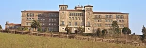
Monforte offers attractions to lovers of history, art, and architecture. Top of the list is the Colegio Nuestra Señora de la Antigua (also known locally as the Colegio de los Escolapios), an austere renaissance monastery, which currently houses a K-12 school. Tours of the rest of the monastery are 3€, at noon and 4 p.m. Tuesday to Saturday. Two El Grecos dominate the little art gallery; the dome of the church is breathtaking, a startling change after days of wide-open sky.
The railway museum is reported to be fascinating for English train enthusiasts and the public alike. http://www.muferga.es/ .
Tourist office is closed on Monday.
Monforte has a sports hall that may be available for pilgrim stays, but offers nothing but floor space and showers. Tel. 982 402 501. If you stay here, let us know!
There is no shortage of places to stay in Monforte de Lemos.
Hostal Duquesa; Duquesa de Alba, 50. 800 m from old town. Tel. 982 403 467. Recommended in summer 2015, on a street of nightclubs, but reported quiet. Room with bath 17 €, and owner did wash for free, prompting a donation.
Hotel Condes de Lemos; Praza da Estación, 2. Tel. 982 400 319 (reported good, but a ways out of the center and not directly on the Camino anymore).
Hostal Rúa; Roberto Baamonde, 30.
Hotel El Castillo; Huertas, 36. Tel. 982 402 150
Hotel Parrillada Nunez; Barrio Las Lamas, s/n (s/n is an indication in Spanish, sin número, which tells you that the site has no street number; it usually means that the place is not centrally located)
Hotel Terra Gallega; Chantada, 218. Tel. 982 405 090
Several pilgrims report having a very good meal at Al Portal. Another remembered an excellent meal in O Grelo, which is located up on the hill near the parador (not cheap, but reported as serving great food). Also recommended is Restaurante Polar in the center. Restaurante Cardenal on the main pedestrian street highly recommended. Café Chokolat on Rúa do Comercio open early and good breakfast.
A laundromat recently opened in Monfort de Lemos. Laundromats are rare in Spain, so this may be a good opportunity for you. Located on Rúa Chantada (the road going over the Puente Romano), just before the Lidl and Gadis supermarkets. It is opposite the Mapfre insurance offices at the traffic lights.
If your next stage is the 29 km to Chantada, make sure to save time to stock up on food and drink here in Monforte. It’s a long stage with little in the way of services.
Between these two towns, the only accommodation is in casas rurales. They include: the Michelin-listed La Rectoral de Castillon http://www.rectoraldecastillon.com/ Tel. 982 455 415, which is about 10 km from Monforte; Torre Vilarino http://www.torrevilarino.com/ , Tel. 982 45 22 60, which is another 4 km beyond that; and Penelope’s place in Castrotañe. Be sure to phone ahead and reserve if you plan to stay at any of these places. The owners of La Rectoral have been happy to pick up pilgrims from points on the Camino. These casas rurales provide a good and less taxing first-day option if your pilgrimage begins at Monforte.
Leaving Monforte, cross the Roman bridge, and make a quick left at the monastery of the Clarisas. Go right at the old town hall plaza – you will see a shell on the pavement. Follow Rúa Abeledos right out to the edge of town, passing by an unmarked but friendly bread bakery on the left. Where two roads come into Abeledos from the left (Rúa O Savinao and Poeta Manuel María), take the latter road. Walk between the church of San Antonio and the backside of the Gadis supermarket, and come to the roundabout with a hórreo (a Galician granary). Take a left to reach another roundabout, with a statue of a pilgrim pointing towards A Vide. Pass the 24 hour Repsol gas station on the right. This next stretch is one of the few on asphalt with no soft shoulder.
Accommodation in Monforte de Lemos
| Albergue Santiago 15 17€ 50 Booking.com |
|
| Albergue Lemavo 14€ 16 Booking.com |
|
| Pensión Miño |
| Hostal OhLaLa Galicia Booking.com |

|
| Hostal MON ComeySueña Booking.com |

|
| Hostal Medievo Booking.com |

|
| Hostal Puente Romano |


The camino is very well marked leaving A Vide, and off-road alternatives have been closed. Stay on an asphalt road that takes you to the Pazo O Reguengo, passing through Broza. This is another asphalt stretch, about 2.5 km., but with the noble old pazo (farm complex) there to provide a landmark.
This will take you to the hamlet of Castrotañe.
Shortly after the estate’s walls end, a moon indicates a left turn onto a paved road. This goes through a little hamlet of a few houses, named San Lourenzo. When the road ends, the Camino goes into the fields for an extremely short distance. You emerge in Castrotañe, where an English woman, Penelope, has a casa rural and offers rooms to pilgrims at reasonable prices. One pilgrim stayed here in 2015 and paid 20€ for room and kitchen access. Penelope also took her into town for shopping. Information on Penelope’s place: https://www.galiciaholidayrentals.com/to-find-us.html Tel. 677 120 321 OR 982 17 16 32 or via email at penelope@galiciaholidayrentals.com.
The path continues on to the small hamlet of Piñeiro, with its welcoming fountain.
IF the path from San Lourenzo is overgrown or muddy, you can remain on the paved road, the LU-P-4112 and in a few minutes you will arrive in Piñeiro, where you can pick up the Camino again at the water fountain.


At the fountain of Piñeiro, the water is sweet, delicious, and welcome. This is a great picnic spot. If you plan to stay at La Rectoral de Castillón casa rural (a splendid option at a good price) this is the place to phone Rosa, the proprietor, and ask for a ride. The inn is very nearby, but walking directions are unclear. She can return you to the fountain in the morning, or set you down at a place along the road if there is too much mud.
From Piñeiro onward to Camiño Grande, the mojones take you on a lovely walk through fields and green tunnels, with stone walls on either side.

Casa Rural Torre Vilariño. http://www.torrevilarino.com/ Very highly recommended, with Camino-friendly staff; pilgrim price for room is 20€ each. Swimming pool; menú del día 15€, pilgrim menú, 10€. Also would be a good lunch or coffee break for pilgrims doing the entire Monforte-Chantada stage. Tel. 982 45 22 60. You can also WhatsApp Susana at 640 10 46 27. Restaurant closed on Wednesdays, except in summer (mid-June through mid-September).
From the Torre Vilariño, there is a marvelous 6 km circle walk that takes you to some amazing viewing spots of bends in the Miño River. Unfortunately the view from the lookout point “Mirador do Cabodomundo” has been obscured by growing trees and bushes. But a few kms on, near the Adegas Moure, the views are open and spectacular. This loop takes you past the Igrexia Monacal de San Martiño da Coba, also perched up high with a view of the Minho.
Although plans had been announced for an albergue in an old school in O Saviñao (about 3 minutes walk from Torre Vilariño), neighbors have filed a lawsuit, which means that nothing is currently happening.
From the mojón in Camiño Grande, you enter a new concello of O Savinao. Then at a cross-roads with numerous signs, the Camino goes on the LU-P-5807 straight ahead to Fión. You will see the road marker for km 0, indicating that this is the start of that road. There is a turn for Escairón to the right (you don’t take it, unless you plan to take the alternative route described below). At this point there is also an option to take a 400 meter detour to the left to another Casa Rural, the Torre Vilariño.
The Camino stays on the side of the road (virtually no traffic) and passes through a number of small hamlets – Fontela, Vilaravides, Vilatinosa, A Madredauga, Sobrado, O Cerdeiro, A Vendanova, Outeiro, Montecelo, and finally Diomondi. You will actually enter the “parroquia” of Diomondi about 2 km before arriving at the church itself.
[ALTERNATIVE:
Splitting the Monforte to Chantada stage with a detour to Escairón. The town of Escairón is about four kilometers from the crossroads described above (where you go left to the Torre Vilariño and straight ahead to stay on the Camino). But if you know you are going to sleep in Escairón, and don’t mind getting slightly off the Camino, you can go there straight from Monforte de Lemos. Cross the Puente Romano and keep going straight on Rúa Chantada until you get to the roundabout with a hórreo (old stone Galician granary). Keep going straight, you will be on the LU-617, which is the road that goes straight into Escairón. There are a few bars on the way, and at least one restaurant. Google maps shows this as almost 14 km.
A Pobra do Brollón is about 26 km from Escairón, which is a do-able stage for most. The next day from Escairón to Chantada would be approximately 17 km.
In Escairón the 2** Hotel O Ruso is recommended. Large modern room, 37 € includes individual room, main meal, and breakfast. Tel. 982 452 134. Excellent tapas bars include O Noso Lar, El Candíl and Avenida. Stamp available in Casa de Concello and Hotel.
The next day, continue on the LU-617. Turn left by the cheese factory, onto LU-P-5806. There is a sign indicating you are 4 km from Diomondi church, and when you arrive there you will be back on the Camino, and ready to start the descent to Belesar.
END OF ALTERNATIVE.]


The long anticipated albergue of Diomondi has now opened!
The little hamlet of Diomondi has a jewel of a Romanesque church, San Pelagio de Diomondi. It is an architectural highlight of this Camino. The church is easy to find. When you come to the modern bench and shelter, the Camino begins its descent. To see the church, just stay on the road for a few meters. The thousand-year-old cow heads carved above the side doors are a sweet salute to the creatures in the fields all around. After many years of scaffolding, the episcopal palace attached to the church seems to have been repaired. We have no information about possible visiting hours, however.
At the shelter, the Camino leaves the road and turns to the left, beginning to descend the many switchbacks of the codos (elbows) of Belesar, a 2.5 km stretch of steep, broken pavement with remnants of the old Roman Road. The 17th century chronicler of his route home from Santiago on the Invierno noted that the bridge and path were named after a Roman Captain named Belisario, apparently in charge of the construction of the bridge.
The path zig-zags from the forest into the vineyards, down to the river itself. This descent can be hard on the knees; hiking poles would help a lot. The path down to the river is marked with the GR red and white blazes. Don’t worry about the lack of arrows.
Accommodation in San Paio de Diomondi
| Albergue de peregrinos de Diomondi 10€ 34 |
|

Turn right at the bottom of the descent. A hundred meters or so ahead, after the bridge, is a marina-bar restaurant, Abaceria o Batuxo. It appears open after some sporadic closings.
Boat tours stop here periodically; a ride up and down this beautiful, terraced river valley will ease your feet and show you a piece of Camino few pilgrims ever see. Information at http://www.lugotierra.com/cs/rutas_fluviasis.asp
After crossing the río Miño, begin a steep ascent, which takes you on and off the road several times. You will pass two restaurant/wineries. The first is Via Romana on the right hand side. The caretaker may invite you to look around, take a bathroom break, rest on the balcony overlooking the river, or even have a glass of wine.
Second, on the left, is the Mesón Adega do Veiga. It offers a comfortable terrace with fantastic views back down to Belesar, In low season, the mesón is only open on weekends. June through September it is open every day except Tuesday. The mesón is ALWAYS closed on the 5th and the 21st of the month. The owner is very friendly and expressed willingness to help people out in a pinch. Tel. 657 805 731. This is a very popular restaurant; people come from Ourense to eat here; highly recommended.
After passing the wineries, the camino takes you down to a small river and a mill and then up the hill Back on the road for a while, when you get to the third winery, the Camino goes off road to the right. This trail may be muddy and overgrown, but when you emerge, you will be in San Pedro de Líncora.
After crossing the río Miño, begin a steep ascent, which takes you on and off the road several times.
After passing the wineries, the camino takes you down to a small river and a mill and then up the hill back on the road for a while, when you get to the third winery, the Camino goes off road to the right. This trail may be muddy and overgrown, but when you emerge, you will be in San Pedro de Líncora.


Nice shaded rest area near the church.
From San Pedro to Chantada is mostly downhill and on the side of the road. Cross the río Asma, and the Camino continues into the old part of Chantada.
This town’s arcaded streets are lined with elegant portals and mansions from the 15th and 16th centuries.
When you cross the bridge into town, Piolindo is the first bar on the right. It has been reported as having good food, and the manager Rachel is very helpful. Highly recommended by two separate pilgrims! Rachel will help you find your way to the place you want to stay. The next establishment, Bar do Río, is on the left with a very nice terrace looking over the river.
Bar Lucus, under the arches near the tourist office, was the only restaurant in Chantada that received unanimous praise. The owners retired a couple of years ago, and reports on the new management are mixed. No crowds reported at lunchtime anymore, though the food is certainly edible. The outdoor seating near the river is lovely, even if the food may have dropped a notch.
One restaurant nearby is the Bar as Amizades on the new main drag, Juan XXIII. 9€ menu; nothing gourmet but totally edible. Pulpería Os Pendellos is reportedly fantastic, too, but be ready for crowds. Rúa de Benigno Ledo, 13. Pizzería Agocho, close to both the Hotel Mogay and Hostal Yoel, recommended. Café Amedeo also highly rated by one pilgrim. Panadería Ascención recommended for breakfast, just around the corner from Hotel Mogay.
Hotel Gamallo; Garcia Arias, 7 Tel. 982 440 833.
Laundromat in the same building as Pensión Yoel. 3 € with a credit card, 3.5 € if you pay cash.
The modern church in the center of town is pilgrim-friendly and offers a sello. The Casa de Cultura, alongside the church and with free wifi, also offers a sello and is very helpful.
The path crosses over a mountain and past the landmark Hermitage of Monte Faro. On this stretch are several beautiful petos de las ánimas, medieval crossroads shrines with striking sculpted images of the souls in purgatory. The little slot was there so the faithful could make monetary offerings on behalf of those souls.
Leave Chantada from Praza Santa Ana along Alferez Baanante, heading towards Centulle. You are actually walking on the in-town portion of the LU-1809 highway. Just past the first peto de ánimas, a mojón takes you off the road. Continue through the little hamlet of Centulle. You will eventually be back on the LU-1809. Follow the arrows to the right.
After that right turn, about a hundred meters or so down the road, go left, and walk on the service road of the main Chantada-Lalín highway. You will stay on the service road for a few km. Pass over a paved road or two, and after you go under the road bridge, turn left. Go through the hamlet of Boan.
Enter Lucenza and keep straight on. Before the end of this hamlet, take the path to the right. At the stop sign, cross a paved road, follow the mojón onto a composite road on the left. At the next stop, cross the road and keep straight on. The next hamlet you pass through is Vilaseco.
Continue to the little town of Penasillás.
Accommodation in Chantada
| Pensión Yoel |
| Hotel Mogay ⭑ Booking.com |

|


Accommodation in Lucenza
| Hotel Vilaseco 20€ 30 Booking.com |
|

There is another peto de ánimas here. Penasillás, a town of 18 people and surely as many or more dogs (none menacing, however), offers a fountain of cold spring water. The wise pilgrim will fill up here for the climb up a logging road toward the Monte Faro shrine. There is also a bar here, Cantina o Peto, which seems to be opening earlier now that pilgrim traffic has picked up. Officially, it is supposed to open around 10 am, but 2019 pilgrims have found it open as early as 9. It also has a stamp for your credential. If closed, one pilgrim urges others to knock on the door of the house on the right, where the owner lives. The family told him they would be happy to increase their pilgrim traffic.
The next five km steadily ascend to the Monte Faro. Eventually you reach an asphalt road with a monolith. Continue on this road.


One of the Amigos groups has an alternative route for those who wish to avoid the ascent, or at least some of it. From Penasillás you can take a series of secondary roads that pass through Mouricios, Ferreiros, Mundín, San Vicente.
According to one GPS calculation, this alternative has 180m of ascent, compared to the Camino’s 420m. You would then reconnect with the Camino at the intersection of the PO-533 and CG-2.1. One pilgrim was happy he took the detour, but most have enjoyed the opportunity to see Monte Faro and have stressed that the ascent is not bad at all. The long slog beneath the windmills may not be everyone’s cup of tea, however.
Atop this tall mountain is a beloved regional shrine, the Ermita de Nosa Señora do Monte do Faro. It is considered the geographical center of Galicia. Although an ascent to this place was almost certainly not part of any historical ancient Camino, we recommend a detour, if only for the views – all Galician provinces are visible from the high point (though you are unlikely to be able to distinguish which is which!). If you want to totally avoid the ascent to the Monte Faro, you can take a paved road from Penasillás. This option is described further on.
After several km walking on paths and unpaved roads after Penasillás, the Camino merges with a paved road. If you plan to go up to the Alto and its ermita, look for stone steps on the left. These steps take you off the Camino and ascend on the grass past the crosses representing the Stations of the Cross. In a few minutes, you will be at the high point, a huge field with its ermita, lookout tower, and cruceiro. One pilgrim in 2017 enjoyed going to the lookout tower for a nice conversation with the fire ranger there.
To rejoin the Camino, you have two options. One would be to backtrack down the stairs and rejoin the Camino at the exact spot that you left it. Another is to go to the cruceiro (decorated standing crucifix, located within sight of the ermita). From the cruceiro, you descend a hill and turn right at the bottom. This takes you past an overgrown picnic area, which is on the Camino.
If you do not wish to ascend to the Ermita on the Monte Faro, simply continue straight at the turnoff with the Stations of the Cross. You will pass the picnic area on your right. Shortly thereafter, you come to a T-junction, and a waymarker takes you to the right, so you are essentially hugging the picnic area on your right. If you have taken the descent from Monte Faro that leaves from the crucifix, you will rejoin the Camino at this T-junction, continuing straight to rejoin the Camino just before the picnic area.
The marked Camino leaves the tarmac to the right beyond the picnic area, and parallels windmills on a limestone access road with lovely views back to Chantada. At this point, you will see a beaten up old street marker, pointing to Rodeiro to the left. There is a clear yellow X (indicating that you should NOT go this way). Even if you are interested in the “road option” to Rodeiro, this is not the most direct route. You should wait till a later point, when the Camino crosses the PO-533, which is the direct road option to Rodeiro. Several pilgrims followed this first road sign to “Rodeiro” and learned that it is the “back road route” and weaves around, crossing with lots of unmarked roads. They got lost many times.
After a few km walking through the other-worldly windmill farm with its constant flap flap flap and motor rumblings, the path meets pavement again. At this point the Camino turns left, and crosses a bridge over the PO-533, which is the highway from Lalín to Chantada. Here you pick up yellow arrows again. Going left will take you along the highway, going right is the official camino route through farmland and hamlets. This is the spot for those who wish to save a few km and go directly to Rodeiro on the side of the road. It is not pretty, but not at all dangerous, since you can walk along an access road the whole way. I have not taken this route, but on the map it looks like a straight shot into Rodeiro.
6.0 km Crossing of the CG-2.1 and PO-533.
If you stay on the Camino, granite waymarkers will take the Camino off to your left. One is the standard mojón with the tile scallop shell. The other is larger, placed there by the “Concello de Rodeiro” and indicates that you are on the Camiño de Inverno. This pretty path passes El Pazo de Camba. That old estate is usually closed, but two 2016 pilgrims happened upon it during preparation for a baptism in the small church, the 1st in 25 years. They were treated to a visit. After walking by the estate, the Camino passes through a field and out to the LU-P-1809. Arrows then take you off the road before the contiguous hamlets of A Feira ( as a bar that serves a good menu del día, O Recanto) and Leboro, but if you remain on the road, you will come to the Mesón Lamazares. (And continuing on, the LU-P-1809 will take you into Rodeiro).


 on the Camino de Santiago")


As you come into Rodeiro, cross the river. You emerge on the square with the Casa do Concello (town hall – stamp, but only open till 2 pm). The Camino leaves to the right of the Casa do Concello, and not up the hill through town. You will find the first arrows taking you out of town near the monument to the wheel, located in a prominent roundabout.
Rodeiro’s romanesque church dates to the 12th century.
Bar Desito highly recommended for tortilla española.
No services on the camino into Lalín. Be sure to carry plenty of water and food for a picnic lunch. Some pilgrims stay on the highway, which has a few bars and is a few kms shorter than the Camino. This highway option, though not too pleasant, is safe since you will always be on an access road. The Camino, in contrast, follows beautiful back roads through the Galician heartland; there are several towns, but no services except the occasional fountain. You are likely to meet residents taking their cows in or out of the barn.
Leave Rodeiro on the PO-5330, the main road west, for about 2km. A mojón stands along the road across from a rabbit-processing factory, COGAL, directing you to the right onto a paved road towards Puente Limpio. It soon becomes a dirt path and meanders over a wide valley with stone quarries, trout-fishing streams, and sunken lanes that sometimes turn to mud or streams. Mojones direct you from Penebosa to Puza to Penela, notable for an enormous granite monument the farmer has dedicated to the former Spanish king Juan Carlos. From here travel on to Eirexe, where the Camino crosses a 12th century bridge. The little town lies just beneath a huge strip mine.
Next comes a long stretch on a dirt road, which goes through agricultural fields and some forests. At approximately 19km from Rodeiro, the Camino enters the hamlet of Palmaz and soon takes you onto the PO-933 into Lalín de Arriba. The arrows take you right in front of the church from the 10th century (the keeper of the keys lives close by and is very happy to open the church up if you can find her). The date 980 is carved into a stone window sill. Arrows then take you through the town of Lalín.
Accommodation in Rodeiro
| Albergue - Pensión Carpinteiras 12€ 28 |
| Pensión O Guerra |


BEWARE. At the end of town, where the camino meets the road, there is an official arrow which points left. IT IS WRONG. It is also commonly smeared with dirt to alert you that something is not right, and from time to time the man that lives nearby will shout the right way.... which is to follow the road downhill.


 on the Camino de Santiago")


Ethnographic museum looks interesting: http://museoetnografico.net/museo-etnografico/ Open Tuesday through Sunday, 10-2 and 4-7 pm.
Something is always happening in downtown Lalín (some pilgrims encountered a trotting competition, others have come across little specialized weekend markets of artisanal cheese, organic foods, etc). A life-size bronze hog stands in the main street, a tribute to the area’s culinary mainstay.
Lalín is famous for its cocido– a dish that serves up greens, potatoes, garbanzos, broth, and assorted stewed pork bits in a great steaming heap. Casa Mouriño, across the street from the Palacio Hotel is a great place to try it.
Other recommended places to eat include:
Restaurant Cabanas, Rua Pintor Laxeiro, 3 (very good reviews on line, confirmed by a 2016 pilgrim);
Restaurante San Martín II, Rua C, 3;
Bakery Bar Dulces Encantados (near main church).
Pizzería Casa do Gato, Rua Ramón Aller 5 (although the street has a different name, it is the continuation of Calle Matmático Rodriguez, one of the town’s main streets, and the street on which the Hotel el Palacio is located). This place is owned by the president of the local association of the Friends of the Camino. Very pilgrim-friendly; stamp.
Lalín has a lot of private accommodations, here are a few recommended by others.
Hotel Restaurante el Palacio. Very close to the Camino. From the church, walk down to the second cross street, Calle Matemático Rodriguez and turn right. The hotel is on that first block (number 10). It’s a 2**, very clean and comfortable. Pilgrim deal of 35 € for room, a main meal, and breakfast. Early breakfasts not a problem (I had mine at 6:30 and could have had it earlier; just check with hotel staff). Tel. 987 780 000.
Hostal As Vilas, Calle Arenal, 4. Tel. 986 780 140
Hostal Mourino. Tel. 986 780 073
Hostal Naval do Espinal. Tel. 986 787 604
Hotel Camino de Santiago. Tel. 986 794 078 (4 km out of town along the trail.)
The Camino leaves Lalín on the Pontiñas River walk. The path (with both a paved and unpaved option) is accessible at various points throughout the town. If you are unsure, just ask; everyone knows where it is. The name in Spanish is Paseo Fluvial.
To get to the river walk from the town church, walk down with the church behind you, on the street Rúa Colón. You will come to a plaza with a monolithic monument to Joaquín Loriga, an early 20th century aviator. Go past that square, continue behind the plaza, down hill, till you come to a big playground at the edge of the town. You will be able to join the river walk there, take it to your left. It’s a very nice walk.
When the mojón takes you off the river walk, you will start to ascend. Turn left at a little ermita (arrow on the adjacent shed/garage) and continue on that back road. You emerge onto the road that traverses the industrial park in front of the Hotel Torre do Deza. Continuing straight ahead, you will come to a gravel road that takes you to a tunnel under the super highway and enter A Laxe.
Accommodation in Lalín
| Albergue Lalín Centro 15€ 16 |
| Pensión Las Palmeras Booking.com |

|
| Hostal Caracas Booking.com |
|


The arrows through this industrial area are not well maintained, and neither is the path. As recently as May 2021 the grass was overgrown to the point of being impassable. At the Hotel Torre de Deza (see photo), keep to the left and simply follow the road. It is a paved pedestrian walk lined with streetlights and will take you to the end of the industrial part before sending you off to the right.
Accommodation in Bergazos


Meals available at a bar a bit further along the main road. Buses to Santiago from Ourense stop here.
At the albergue in A Laxe, the Camiño de Inverno joins the Camino Sanabrés. From here the Camino is well marked and well trodden to Santiago. The following towns and distances will give you all you need to plan your remaining days. The most obvious stages are from A Laxe to the albergue in Outeiro (34 km) and from there to Santiago (17 km, allowing for plenty of time to get to the pilgrims’ mass).
Shortly after leaving A Laxe, you will pass the Pazo de Bendoiro, a restored manor house with its spa treatments and swimming pool. Beautiful but pricey, single room with breakfast reported 63 € in 2019.
The camino takes you into the woods and ascends to a lovely old bridge, originally Roman but with much rebuilding. The bridge is hidden in the forest and inaccessible to cars. A bit further on, the Romanesque church at Taboada has a carving of Samson over the doorway. You have to cross the busy highway to get there, but it is worth it, just a stone’s throw from the Camino. Volunteers keep the church open for pilgrim visits; 8:30h -15;10h, closed Tuesday.
Accommodation in A Laxe
| Albergue de peregrinos de A Laxe 10€ 28 |
|


Accommodation in Transfontao
| Albergue Turístico Trasfontao Booking.com |

|
Bar Gerardo just before entering town is recommended.
On the main street of Silleda, the Bar Toxa offers an occasional pulpo (only on Tuesday) and Ribeira Sacra wine special when you see the pulpo-boiler set up outside the front door. Inexpensive rooms are available upstairs. 15€ in 2018. Mixed reviews.
The farmacia here is known to double its prices for foreign pilgrims.
The last 40km to Santiago is through pleasant Galician farmland. It is close enough now that the proximity to the roads and major highway interchanges means lots of crossings. The way from here is well marked and easy to follow.
Accommodation in Silleda
| Albergue Turístico Silleda 10€ 20 Booking.com |

|
| Albergue El Gran Albergue Silleda 15€ 20 |

|
| Casa Novas Hostelería Booking.com |
|


Good food and warm company at Bar Arume, which is located up the hill on a side street soon after you enter Bandeira. Sandwich vegetal recommended.
Bar Plazoleta, just over the road from the Hostal Conde Rey, in a small square, is also great.
Hostal Victorino, tel. 986 585 330
Cross to the right side of the road as early as is convenient, at the end of town the camino veers right and trying to cross at that point is dangerous.
Accommodation in Bandeira
| Albergue de la Xunta de Bandeira 10€ 36 |
|
| Hostal Conde Rey Booking.com |

|

In that place, a young Italian couple, Cristina and Andrea, has renovated a house and opened an albergue, called Casa Leiras 1866. It is directly on the Camino.
A 300 m detour down to the N-525 highway will take you to a bar/restaurant El Emigrante.
From Dornelas the camino descends to the Río Ulla, passing through San Miguel de Castro (5km) along the way.
Accommodation in Dornelas
| Albergue Casa Leiras 1866 15€ 10 |
|


Día grocery store on the way out of town; stock up if you are going to the albergue in Outeiro. Excellent panadería and bakery in town right on the Camino, in the block or two after you cross the river.
Bar Ríos. Immediately across the bridge on your right. Tel. 981 512 305. Restaurant and rooms available. Room prices seem to vary by season, from 10-15-20 €, based on what pilgrims have reported. Food reported to be quite good. Menú del día 12€, with additional charge for wine after the first glass.
Pensión O Cruceiro da Ulla; tel. 981 512 665; info@ocruceiro.es. Located across the street from the Día grocery store. Newly constructed, functional, good service and good prices. They also have an albergue.
Hostal Churrasco de Juanito; tel. 981 512 619. Located on the Camino, soon after crossing the river. 30€ room, 14€ menú reported as overpriced and not great. A pilgrim walking in October 2014 said he got a room for 15€ and a meal for 8€, so walking off-season appears to have its financial benefits. More negative than positive reports on this establishment, however.
For any foodies out there, the Restaurante Villa Verde is the place to go. Walk straight from the bridge into Ponte Ulla. When you get to the intersection with the AC-240 road, to the left is the Camino. Turn right, go up the hill and in a few minutes you’ll see the Restaurante on the right side of the road, located in an old stone house, very pretty. No menú del día, all a la carte. One 2016 pilgrim describes a yummy meal for 42€, which is probably beyond the typical pilgrim budget. It may be worth a splurge, though, because the pilgrim enjoyed a feast of home-smoked salmon over fresh tomatoes, roballo (my favorite Galician/Portuguese fish, maybe something like sea bass in English ??), and a walnut and banana torte. Coffee and a few glasses of albariño.
The camino follows briefly a section of the N-525 as it leaves Ponte Ulla; this section can be a bit dangerous so keep an eye open for the two times it leaves the road. The first is to your left, so you’ll need to cross the road. The second is to your right which means you will have to cross back. 500m separate the two crossings. If these crossings sound unnecessarily dangerous to you, you are not alone.
After the second crossing, the camino returns to safer side roads as it climbs to Outeiro.
Accommodation in Ponte Ulla
| Albergue-Pensión O Cruceiro da Ulla 12€ 18 |
|

A bar will deliver meals. Your best bet is probably to bring up food from the Día supermarket in Ponte Ulla.
From Outeiro the camino passes through Lestedo (3.7km), A Susana (bar, pharmacy) (3.4km), Aldrei (3.1km), and Santa Lucía (bar) (2.3km).
The camino enters Santiago from a neighborhood called Sar, named for the modest river that flows through it. It is here that you will find the Colegiata de Santa María a Real, a 12th-century construction that is well worth a short visit. It is to your left just after crossing the river. From the church, the camino continues along the same road, and eventually steeply uphill to the old town.
At the top of the hill, the arrows are a bit hard to find. There is nothing more to do than to cross the road and head into the old town via the last standing gate, the Puerta de Mazarelos. Continue through it and keep on going straight (against traffic). You will pass a statue to Alfonso II at the highest point (geographically speaking) of Santiago, and here keep on going straight where the road narrows considerably. At the next crossroads, turn left steeply downhill. At the bottom stands the Cathedral.
Accommodation in Outeiro (San Pedro de Villanova)
| Albergue de peregrinos de Outeiro 10€ 32 |
|

Good lunch specials at Restaurante Via de la Plata along the carretera.
The rest of the way is through the suburbs of Santiago, which display a mixture of modern construction and old stone houses, many of which are beautiful. The Camino crosses the railroad tracks very close to the spot where the RENFE train derailed in July 2013, killing 79 people and injuring many more. The fence has become a make-shift memorial, with many touching remembrances, photos and prayers.
Accommodation in Lestedo (Boqueixón)
Accommodation in A Susana
| Albergue Reina Lupa 15€ 14 |
|

Welcome to Santiago! There are a tremendous amount of things to see and things to do in Santiago de Compostela; you are encouraged to stay for at least one full day extra for exploring the web of streets, all of which seem to bring you back to the Cathedral.
Your pilgrim related business is likely to start in front of the cathedral, kilometer zero. A shell and plaque mark the spot in the center of Plaza Obradoiro (see below).
If you are interested in receiving your Compostela, the certificate of completion, you will need to visit the Pilgrim’s Office, which was relocated in 2016 to a bright new building. To get there from the Plaza Obradoiro, face the Parador (the hotel on your left if you are facing the Cathedral) and look for the road that goes downhill to the left. Halfway down you pass the public restroom, and at the next street turn right. The office is at the end of that road and is easy enough to find. Note that there are few arrows indicating the way.
The Cathedral is the single largest attraction to Santiago and for good reason. Both inside and out it presents countless treasures to investigate, too many to list in fact but below are the best.
The Cathedral - Plaza by plaza
1. Plaza de Inmaculada, a.k.a. Azabache: As you enter the city, the first part of the Cathedral that you pass is the Puerta de la Azabachería. This is the entrance that faces the Monastery of San Martín Piñario.
2: Obradoiro: From Azabache you pass under the Palace of the Bishop which is adjoined to the Cathedral and cannot possibly be the sort of palace that affords much peaceful sleeping; the sound of bagpipes welcoming you can be heard from dawn to dusk. The stairway leads directly to the Plaza de Obradoiro and kilometer zero for pilgrims. In the center of the plaza is the last scallop shell and you are likely to find pilgrims taking their shoes off for a photo with it, and the Obradoiro Facade behind them.
This facade is the most majestic and most photographed of the Cathedral and was part of the 18th century building projects that took place in Santiago. The baroque design will keep your eyes moving and the massive amounts of glass allow for the illumination of the Pórtico de la Gloria that lies behind it. That Pórtico was the original front to the church designed by Maestro Mateo 600 years before the new facade.
3. Plaza Platerias: If you continue around the Cathedral you arrive at the Puerta de las Platerías (named for the silver craft that still exists in the shops below it). You will notice that some of the stonework stands out as a different material. These are replacement carvings, the originals were damaged and subsequently moved to the Cathedral Museum; and unfortunately the original composition was forgotten, leaving a somewhat nonsensical layout. In front of the doors are a set of stairs and the Platerías fountain, the usual meeting point for pilgrims commonly referred to as “the horse fountain”.
4: Plaza de Quintana: Continuing up the stairs and around the Cathedral we arrive in the large Plaza de Quintana and the Puerta de Perdón. The actual Holy Door is behind this facade (which is not actually a structural part of the Cathedral, it is more like a highly decorated wall around the Holy Door itself). The carvings here are impressive and depict 24 Saints and prophets.
In medieval times it was common for pilgrims to spend the night in the Cathedral, sleeping on the stone floors and fighting (to the death on a few occasions) for the privilege of sleeping close to their chapel of choice.
The best time to visit is early in the morning before the crowds arrive, when paying a visit to the crypt and hugging the bust of Santiago can be done quietly and with a bit of contemplation.
The botafumeiro, quite possibly the largest thurible in the Catholic Church, is swung across the transept (from north to south) by a group of men called the tiraboleiros. It has only come loose from the ropes twice, and never in modern times. At the time that this book was printed, the tradition of swinging it during the Friday evening mass had been canceled. Inquire at the pilgrim’s office for more information.
The Monastery and Museum of San Martín Piñario
The enormity of this Monastery is difficult to comprehend, but if you pay close attention to this building as you walk around Santiago you will find that you are almost always standing next to it if you are on the north side of the Cathedral. There are three cloisters! The facade of the church often feels like it is somewhere else entirely and is quite curious for the fact that you must descend the staircase to get to the doors, rather than the other way around. The reason for this was a decree by the Archbishop that no building should exceed in elevation that of the Cathedral; the architects did not compromise by redesigning San Martín to be less tall, they simply dug down and started at a lower point.
San Fiz de Solovio
Compared to the two churches above, San Fiz feels like an almost minuscule affair. To find it, make your way to the Mercado de Abastos (Supply Market). San Pelayo (the hermit that rediscovered the bones of Santiago) was praying here when the lights called him. Grand and majestic it is not, but the oldest building site in Santiago it certainly is. The church that exists today is not the original, but excavations have revealed the foundations and necropolis dating to the 6th century.
The Supply Market (Mercado de Abastos)
The produce market is a great place to wander for lunch. Compared to other markets in Spain (like those in Madrid and Barcelona) the Santiago market is a fairly solemn affair. In fact, the architecture appears almost strictly utilitarian and is as Galician as it gets. The vendors make the experience, and even if your Spanish is not up to par, it is worth the visit for a glimpse into the way the locals go about their most ordinary business.
The buildings you see today date from the early 1940’s but replace ones that stood for 300 years. In fact, many of the vendors are second, third, or fifth generation market operators.
Alameda Park
Alameda Park was once the sort of place where the people of Santiago would turn out for elaborate displays of personal wealth and stature; the various paths that cut through and around the park were only to be used by members of a certain class. Nowadays it is far more democratic. The park is the site of a Ferris wheel and feria during the Summer months, an ice skating rink during the Winter holidays, and a massive eucalyptus tree overlooking the Cathedral year round.
The Hidden Pilgrim
Hiding in the shadows cast by the Cathedral, in the Plaza Quintana, is the hidden pilgrim. He is only visible at night and might take a while to discover.
And lastly, there are the many other Monasteries, and while it would be a challenge to visit all of them it is important to realize their construction shaped the city that we see today. Taking the time to walk between them will reveal countless little treasures.
One word of caution regarding accommodation is in order. If you are arriving in the high season, you are advised to make a reservation in advance. There have been several additions to the albergue roster in recent year but the numbers of pilgrims still exceed capacity in the high season.
The Feast day of Saint James is celebrated with a full week of music and dance, with a fireworks display in the Plaza Obradoiro on the evening of the 24th of July. The best views can be had from Obradoiro, or from Alameda park.
Accommodation in Santiago de Compostela at the end of the Camino Sanabrés
| Albergue O Fogar de Teodomiro 15€ 20 Booking.com |
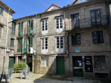
|
| Albergue SCQ 18-22€ 24 Booking.com |
|
| Albergue SIXTOS no Caminho 20€ 40 Booking.com |
|
| KM. 0 18-30€ 51 Booking.com |
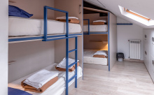
|
| Blanco Albergue 15-20€ 20 Booking.com |
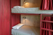
|
| Albergue La Credencial 18-22€ 36 Booking.com |
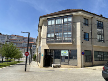
|
| Albergue Monterrey 14-30€ 36 Booking.com |
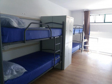
|
| Albergue La Estación 17-19€ 30 Booking.com |
|
| Albergue Porta Real 15-25€ 22 Booking.com |
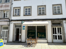
|
| Albergue Meiga Backpackers 14-20€ 30 Booking.com |
|
| Albergue Seminario Menor en Santiago de Compostela 17€ 199 Booking.com |
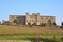
|
| Albergue Mundoalbergue 19€ 30 |
|
| Albergue Santo Santiago 14-18€ 40 Booking.com |
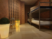
|
| Albergue-Hotel LoopINN 22€ 84 Booking.com |
|
| Albergue The Last Stamp 19-25€ 62 Booking.com |
|
| Albergue Azabache 16-25€ 22 Booking.com |
|
| Albergue La Estrella de Santiago 14-30€ 24 |
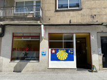
|
| Albergue Linares 16€ 14 Booking.com |
|
| Albergue Fin del Camino 14€ 110 |
|


 ⭑⭑⭑⭑⭑")
