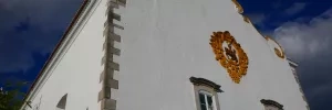
The first arrow and shell for the camino can be found at the Church of Santiago. This church was originally built in the late 13th century (no later than 1270), shortly after the reconquest of Tavira in 1242. It suffered heavy damage in the 1755 earthquake and was subsequently rebuilt. An image of Santiago the Moor-slayer adorns the façade.
Behind the Church of Santiago, the Church of Santa Maria was also rebuilt after the earthquake but retained some of its earlier elements. Look out for the Capelo do Senhor dos Passos, a 16th-century chapel with a wooden Manueline vaulted ceiling. The vault joints have symbols carved into them, including crosses for the Order of Santiago and the Order of Christ. In the apse of the church, there’s a tombstone for seven knights of the Order of Santiago who died in the reconquest of Tavira.
Leaving Tavira, there are painted yellow arrows on the ground leading from the Church of Santiago across the Roman bridge and out of town.

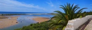
The camino passes the entrance to this village and a visit is recommended. Cacela Velha contains a 17th-century fort and a church dating to medieval times (which may both be closed), but the real highlight is the spectacular view out over the Ria Formosa estuary and the ocean. There’s a restaurant (Casa Azul) if you’re there around lunchtime.

On the way out of Manta Rota at a tiny roundabout, the arrows go in two directions: left and straight. Go straight on Rua da Lota as it’s more direct and it’s also on quieter roads.
On the way out of Altura at a busy intersection with a roundabout and an ‘Altura Boa Viagem’ sign, the arrows continue straight. If you want to head to Vila Real de Santo António, turn right onto the N125 instead. Follow it for 1.5km (there’s a dirt shoulder 2-3m wide so it’s not dangerous) and turn right at the Cabeço sign. From here you can pick up the Ecovia signs (white arrows and a bicycle pictogram on a blue background), eventually turning left onto a forest path to Monte Gordo and then to Vila Real de Santo António.
OPTION 1
OPTION 2
Not strictly on the camino, but easily reachable and with all services available. Plenty of accommodation as well.
Both Routes rejoin in Castro Marim
Castro Marim is a pleasant town boasting a 13th-century castle, a more recent military fortress and a restored windmill.
Leaving town, an alternate route that becomes a dirt path among pine trees with nice views over the countryside is preferable to the official camino. It’s shared with the GR15 hiking trail, so look for the red and white striped markings.

The store at Azinhal is the last one until Alcoutim (26km), so it’s worth stocking up on a few snacks or self-catering items if your supplies are running low.
Casa da Paz is an excellent overnight option at the entrance to Almada de Ouro. Run by English owner Anne, it’s a beautiful property with a pool overlooking the Rio Guadiana and a fully-stocked kitchen for self-catering.
On the right side of the camino, there are ruins of first-century AD Roman houses and a 6th-7th century Visigothic church. There’s not much to see except foot-high building foundations but it’s worth a quick look. Entrance is at the northern end of the complex and is free.
Alcoutim is a lovely village of whitewashed houses with orange roofs, opposite the equally picturesque village of Sanlúcar de Guadiana, across the river in Spain. Alcoutim boasts a castle that dates from the 14th century and a riverside statue of an otter made from garbage, part of Portuguese street artist Bordalo II’s Big Trash Animals series.
There are two places to stay in Alcoutim. Hotel d’Alcoutim is a resort-style hotel with a pool and tennis court and is about a kilometre north of the village. Alojamento Brisas, in the village, is a better choice, with two rooms for either €45 (with en-suite bathroom) or €40 (with a bathroom outside the room). Call or text +351 967 531 064 to make a booking.

OFFICIAL ROUTE direct to Mesquita 13.9km
ALTERNATE via Monte Vascão