The town has been called Villaviciosa, an allusion to the fertility of the land, since the 14th century. It occupies a low valley south of the estuary and the rich land here supports a cattle and dairy industry, but perhaps more importantly it grows very good apples for the production of the sidra (the famous hard cider of Asturias). If you spot a sidrería stop in for a glass but mind the curious customs of drinking it: it is poured from a great height, bottle held high and glass held low, and usually behind the back, to get some air into the small amount which is to be consumed with haste. Don’t let it sit around!
The late-Romanesque/early-Gothic Iglesia de Santa María de la Oliva does not disappoint.
Santumedero de Sietes is celebrated on the 3rd of March. San Juan on the 24th of June, and Santiago on the 25th of July.
Pay close attention to the arrows through town. The camino follows a route which takes you past most of the more notable monuments, including the Ayuntamiento building, the monument to Carlos I, and the Iglesia de Santa María de la Oliva. At the church it turns left to follow the AS-255 out of town and to La Ferrería.
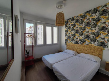
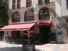
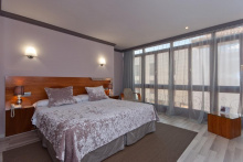
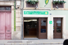
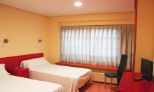
Accommodation in Villaviciosa [Primitivo]
In La Ferrería the camino leaves the road and crosses the Río de la Ria. On the other side of the small river is La Parra.
Follow the road through the small village, but turn right at the end of town to follow the VV-10 in the direction of Grases. Casquita, and an important split in the camino, are 1km away.
In Casquita the Camino del Norte splits twice. Pay extra close attention to which route you chose as not all of them rejoin later.
At the first split, just past the chapel at the start of the village and indicated by two shells on a post, you are presented with the option to leave the Camino del Norte and head towards Oviedo and the start of the Camino Primitivo. If you wish to follow that trail (not described here) turn left. Otherwise keep on straight to follow the official camino.
Shortly ahead is the second split. Here the camino simply presents an option to stay on the road instead of turning left onto a lane. Here the road option is shorter and does not pass through Niévares.
For Oviedo and the Camino Primitivo: Turn left at the fork in the road in the direction of Camoca. The camino passes through several small hamlets on before arriving in San Pedro de Ambás: El Ronzon, La Fontana, El Campu, El Pelu Riva, and La Cruz. After La Cruz, at a small intersection with a picnic table in the middle, the camino splits. The camino is to the left, and the alternate route via Valdedíos is to the right. This alternate route adds 700m hundred meters and rejoins the camino at the Alto de la Campa. If you miss this turn, and still want to go through Valdedíos, stay on the road when you get to San Pedro de Ambás and there are more arrows directing you to Valdedíos.
The early 13th century Monasterio de Santa María de Valdedíos, and the 9th century Iglesia de San Salvador de Valdediós next to it, merit a detour. The Monastery is inhabited by a dozen or so Carmelite nuns who also run the albergue here.
Accommodation in Valdedíos
| Albergue del Monasterio de Santa María de Valdediós 20**€ 12 |
In San Pedro de Ambás the camino again splits, from the main road (AS-257) you again have the option to go to Valdedíos (1.5km).
Follow the road signs towards Vega.
Picnic table just before Vega. The grocery store is 70m past the main square.
The camino passes through Barbechu, Aramante, and El Castru. From El Castru the camino can either follow the road or a trail. The trail passes through Aveno before returning briefly to the road. Between here and Vega de Poja there are many intersections of small country lanes. Keep an eye open for arrows at every junction.
Accommodation in Vega de Sariego
| Albergue de peregrinos de Vega de Sariego 5€ 16 |
The yellow arrows in Vega de Poja, which direct you to the right, are not quite the right yellow and could be dismissed as farm markings. They are not. However if you go wrong there are more arrows which will eventually bring you back to the right path.
The landmark building in La Pola is the Iglesia de San Pedro, located near the original site of a 13th century pilgrim’s hospital. The current church dates back to the first years of the 19th century.
Founded by Alfonso X in 1270, La Pola is one of the largest towns in the surrounding municipality.
Market day is every Tuesday.
The Fiesta de los Huevos Pintos is celebrated on the Tuesday after Easter Sunday, with traditional dances and the sale of painted eggs.
The camino passes the municipal albergue and at the next roundabout follows signs to the barrio of La Carrera. At the highest point along this stretch, a large black billboard of a bull stands on the opposite hillside. The camino enters El Berrón along the back roads.
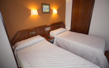
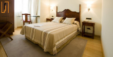
Accommodation in Pola de Siero
| Albergue de Peregrinos Casona de San Miguel 7€ 18 |
| Hostal Siero |
Most services but no accommodation.
When you get to the main road in El Berrón (a divided highway) turn left (south) to cross the intersection with care. A short distance later you will cross to your right to follow the Avenida de Oviedo through and out of town. From here the camino passes along smaller paved roads, through some residential areas with brightly colored homes.

In Mieres the camino splits into two directions. Turn right.
Just beyond Castañera the camino joins the N-634 for a short while as it enters Colloto.
The town of Colloto derives its name from “collis-altus,” a reference to the hilltop location.
Between Colloto and Oviedo it is mostly urban walking, and entirely along the trajectory of the N-634 into Oviedo.
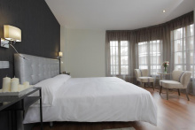
Accommodation in Colloto
| Albergue de peregrinos Güertu Donativo€ 7 |
If you are starting your camino in Oviedo be sure to leave enough time to visit the Cathedral, which is the origin of the camino itself. It is also the place to pick up your credential (pilgrim passport) which will cost you 2.5€ but will include a visit to the Camara Santa, the oldest part of the Cathedral which was originally built to secure relics.
The greater Oviedo area is home to more pre-Romanesque architecture than any other place in Asturias; including the Iglesia de San Julián de los Prados, Santa María del Naranco and San Miguel de Lillo. These last two are not in the city center, but instead require a small detour when leaving Oviedo on the way to Santiago.
On the other end of the spectrum is the ultra-modern Palacio de Congresos by Calatrava, and in between the oldest and the newest are dozens of churches and civic buildings of note. The Monasteries of San Vicente and San Pelayo are the most noteworthy.
When Oviedo was founded in 761 it was all but deserted apart from two monks; Fromestano and his uncle Máximo. These two dedicated their church to San Vicente, and 20 years later it would grow to become a monastery. In that monastery was born the future King Alfonso II, during whose reign would be discovered the remains of Santiago. It was he that first made the pilgrimage to Santiago, and in so doing the mountainous path between Oviedo and Santiago became known as the Camino Primitivo.
The road out of Oviedo is notoriously confusing. To make matters worse, there are too many shells on the ground to be helpful, especially in the center. They mark several of the caminos into, and out of, Oviedo. There is no distinction between the two directions.
This is how it is done:
1. With the main facade of the Cathedral to your back, walk to the opposite end of the plaza and take the exit on the right. This is the Calle San Francisco.
2. San Francisco ends when it meets Calle de Uría (350m from Cathedral). Turn right and follow Calle de Uría. For the first 250m, the Parque de San Francisco will be on your left. Stay on this road, regardless of arrows or shells. It is about 700m long and ends at the train station.
3. At the train station, turn left along the Calle de la Independencia. Stay on the right-hand side of the road. You will pass 7 cubist looking apartment buildings before the sidewalk turns sharply back to the right. Follow the turn and cross the road towards another cluster of 4 similar buildings with a plaza in front. From here it is safe to follow the arrows.
4. At the end of the plaza is a roundabout. Cross to the left (clockwise) twice and turn left along the Calle de la Argañosa. When it turns to the left (700m) you should turn towards the right, looking out for the pedestrian bridge which crosses the train tracks.
5. The arrows from here zigzag you through new development which ends quickly. By the time you get to an urban looking track and have left Oviedo behind, you will have covered about 3.6km.
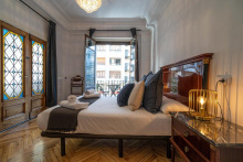
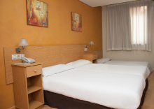
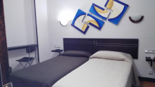
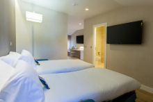
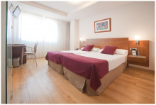
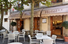
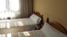
Accommodation in Oviedo and the Start of the Camino Primitivo
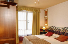
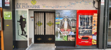
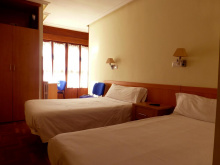
| Albergue Turístico La Peregrina 20-25€ 26 Booking.com |
|
| La Hospedería Oviedo 20-25€ 10 |
| Albergue de El Salvador de Oviedo 8€ 14 |
|
| Hostal Los Arcos | |
| Hostal Romero ⭑⭑ Booking.com |
|
| Hostal Álvarez ⭑⭑ Booking.com |
|
| Hostal Fidalgo Booking.com |
|