
Bar on road, higher prices for tourists reported so ask before you buy.
The camino passes the bar at the alto and keeps off of the road for a short distance. Between here and Fonsagrada it will follow adjacent to, or directly on, the main road. You will pass through Cabreira halfway to Fonfría.


Fonfría derives its name from the fresh spring that feeds water to the fountain here and which was the catalyst for the construction of a pilgrims hospital in the late Middle Age. From time to time one of the villagers opens up her kitchen to invite pilgrims in for a coffee.
Standing directly between Fonfría and Barbeitos is a small hill. The road goes around it to the north and the camino goes around it to the south. The two meet in Barbeitos.
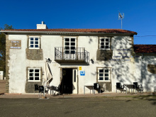
The Mesón Catro Ventos is to your right when you arrive at this road interchange.
The camino crosses over the road here only to cross back when it gets to Silvela.
Old arrows from Paradanova may tempt you to follow the road, you are better off following the trail to enter Fonsagrada from the North on a quieter road.
Just beyond Silvela, on the forest track that connects it with Paradanova, you will pass an ermita and a restored capilla dedicated to Santa Bárbara. The camino passes straight through Paradanova 155.9. Immediately at the far end of town it crosses the road and climbs up to Fonsagrada along a back road. See note below about possible conflicting arrows.
Be advised that there have been a growing number of false arrows in Paradanova. Some of them are the official looking blue and yellow plastic (most are painted arrows) signs.
These arrows are intended to detour you from Fonsagrada and towards A Proba de Burón and should be ignored.
The real camino into Fonsagrada follows South of the road (keep road on your right and dont cross it).
If you find that you have mistakenly followed the wrong arrows you will have another opportunity to get to Fonsagrada by turning left at the next large intersection.
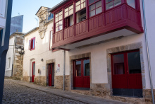
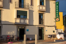
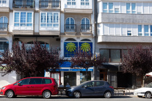
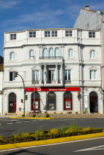
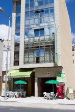
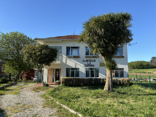
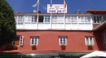
Fonsagrada is the first town of any serious size since crossing into Galicia, and while it may not be a postcard quality village it does provide for everything you might need, including a selection of restaurants to choose from. If you are dining out consider trying the pulpo (octopus), it is the market food of choice in Galicia and is served with heavy bread and a local white wine. In recent years the addition of three albergues here has caused the closure of the old Padrón albergue in the next town.
The camino between Padrón and O Cádavo is arguably the most difficult of the route, and possibly the reason for the nickname the leg wrecker. Allow for extra time, especially after a rain since many of the sections become thick with mud.
The sacred fountain (fons sacrata) that gives the town its name is located behind the Iglesia de Santa María de Fonsagrada (on the aptly named Rúa do Fonte), a chapel-sized church in the center of town. The fountain and its curative waters are part of numerous miraculous bits of lore.
The camino exits Fonsagrada along the main road, and shortly after follows a secondary road parallel to it, into Padrón. Beyond Padrón it follows through forested paths off of the road.
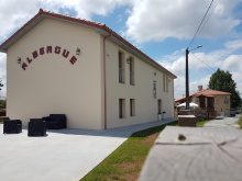
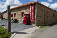
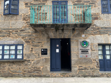
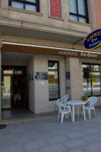
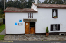
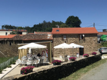
Accommodation in A Fonsagrada
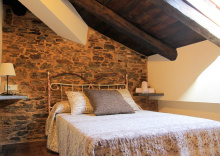
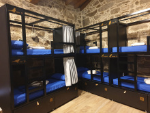
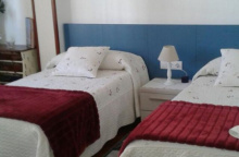
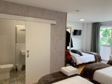
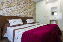
| Albergue de peregrinos Ramón Rodríguez 10€ 42 |
|
| Albergue Pensión Cantábrico 15€ 18 |
|
| Albergue-Pensión Casa Cuartel 15€ 20 Booking.com |
|
| Camping A Fonsagrada |


The camino between Padrón and O Cádavo is arguably the most difficult of the route, and quite possibly the reason for the nickname 'Rompe Piernass'. Allow for extra time, especially after a rain since many of the sections become thick with mud.
Accommodation in Padrón
| Casa da Lembranza Booking.com |
|


The ruins of the old Hospital de Montouto can be found here at the alto, though if history is any indication they may not stay for long; this refuge for pilgrims as been relocated more than once since it was built in 1357 as the camino route itself varied from century to century.
On the 25th of July the small chapel here is the destination for a romería from Fonsagrada in honor of Santiago.
From this alto it is a 300m descent to Paradavella in less than 4km. The path is entirely off of the road along a forest track.
From Paradavella the camino follows a trail to the right of the road and crosses it to descend into the village of Calzada (meaning road). The next village, also without services, is Degolada. The camino keeps to the south of the road along the path and eventually climbs up to rejoin it as it enters A Lastra.

At the far end of A Lastra keep to the left, along the oncoming exit road, and just before it returns to the main road turn left uphill towards the houses. The climb continues steeply uphill for a gain of about 150m and the last part rejoins the road as it enters Fontaneira.
Between Fontaneira and O Cadavo is a small plateau known as the Campo da Matanza. According to legend it was here that Alfonso II (the first pilgrim) and his troops defeated a Muslim invasion in the year 813.
At the far end of Fontaneira leave the LU-530 for a small road uphill (direction Pandelo). You will pass the cemetery and then return to the main road to follow it for close to 1km. The camino then leaves the road in favor of a path on the right. As you descend to O Cádavo you will cross the Campo da Matanza.
O Cádavo remains a largely agricultural town and is a checkpoint for travelers heading uphill in the opposite direction as its slightly lower altitude makes for a substantial difference in snowfall. The industry here is cows, both for dairy and for meat, and you are bound to see more than one dairy tanker cross your path. The town itself is otherwise rather unremarkable but for the vistas.
The camino between here and Castroverde manages to avoid the steep LU-530 entirely. From O Cádavo it continues uphill along a farm lane to the town of Pradeda where you can look back for a nice view of O Cádavo. Beyond Pradeda the climb continues up to the Alto de Vacariza.
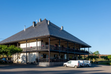
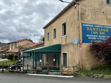
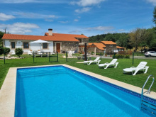
Accommodation in O Cádavo Baleira
| Albergue de Cádavo Baleira 10€ 22 |
|
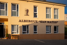
| Albergue San Mateo 12€ 40 |
|
| Albergue-Pensión Porta Santa 15€ 16 Booking.com |
|
| Hotel Moneda ⭑ 6€ 22 |

The camino beyond the alto splits and there is now a new type of marker to contend with. In 2016 the Galician government installed new stones to mark the camino. When they were installed the routes were re-examined by planners and several changes and additions were made. In this case, the old camino route was re-named the complementaria route, and a second route was added as the official route. This business of creating complementaria routes has led to much confusion because in some localities (Arzúa is the nearest example) it was applied to a route (for historical reasons) which for decades has been the only option; causing many pilgrims to waste time looking for an official route which does not exist. In this case the old camino has been renamed the complementaria. This guidebook however continues to treat it as the original and still preferred option and the distances indicated are along it. It is 5.5km from the split to Castroverde along the complementaria option, and 4.7 along the newer option.
The Gothic church here is a national monument and is known locally as the Cathedral of Castroverde (an only slight exaggeration). In summer months you are likely to find a small food truck at the edge of town.
The camino follows the road from here all the way to Castroverde, and the first building on your right when you get back to the LU-530 is the municipal albergue.
Castroverde marks the end of the descent, and although the terrain ahead is not flat by any stretch of the imagination, it could be described as gently rolling hills when compared to where you have come from. The relative flatness means that the ability to farm increases and indeed the next 80km or so, with the exception of the center of Lugo, are entirely through farmlands. The most notable landmark in town is the 20m tall Torre de Homenaje, a tower which is the only part left standing of the 14th century castle that once stood here. The local church is dedicated to Santiago. A stamp is available at the town hall opposite the church.
Apart from vending machines there are no places to get food between here and Lugo, a distance of 21km. Pack a lunch.
The camino passes through town to the south (left) of the LU-530 and after passing the town hall it joins a trail through a chestnut forest. When it returns to the LU-530 it crosses straight over it (caution!) and turns left to go through a tunnel. It passes through San Miguel do Camiño and an unnamed hamlet before entering Souto de Torres.
Accommodation in Castroverde
| Albergue de Castroverde 10€ 34 |
| Pensión Cortés ⭑ |

Capilla and cruceiro at the entrance to the village.
Turn right at the entrance to town and follow this country lane all the way to Vilar de Cas, passing through one more unnamed hamlet along the way.

At the end of town there are markers for another complementaria route, this time for a detour to the Iglesia de Soutomerille (see below). This worthwhile alternative adds 700m to the journey, through an evergreen forest.
Accommodation in Vilar de Cas
| Albergue A Pociña de Muñiz 20€ 16 |
|
The first 1.8km from Gondar are along the paved road. The camino will eventually leave it along a trail to the right. It nears the village of Bascuas 110.2 and then returns to the LU-530. Along this busy road to Lugo you will pass a sign announcing the entrance to Carballido, though you won’t ever see the town which is through the forest to your left. Instead, the camino turns to the right 400m after this sign to resume walking along a country road to the hamlet of As Casas da Viña.

Bascuas lies to the North of the camino shortly beyond the sand pit. Black and yellow arrows point to the right and will keep you on the camino, which no longer passes through this village. Instead it turns left again and parallels the main road into Lugo.
If you are a devout follower of arrows, you will enter and exit Carballido without ever seeing more than the road signs. The village didn't move, but the camino did. The village is to the South through the trees. It is a smaller than most, and is comprised mostly of one large estate and a slaughterhouse for chickens. Continue on the road, being mindful of traffic. The camino turns to the right just beyond town to follow another much safer asphalt road.

As Casas is not much more of a village than any that you passed through along this stretch. It is, however, the last one you will pass before getting to the edge of Lugo and its suburbs.
As the route approaches Lugo it passes through some rather unappealing surroundings. Lugo is the capital of the region and is surrounded by divided highways which the camino must navigate safely. When it arrives at the highway it makes a right turn and continues to a small overpass which is much safer for pedestrians. You are on a mostly disused road until the next sign of habitation appears.
The barrio known as A Chanca sits along the río Rato in the shadow of a stone railway bridge. From here it is an uphill climb up to Lugo. After passing under the railway cross the road to your right at the first marked pedestrian crossing. Take the stairs on your left to the Rúa de Fontiñas. Turn left here, following the arrows, but cross to your right at the first pedestrian crossing. This road will take you straight up to the old walled city and one of the city gates. The municipal albergue is just inside the wall and to the right down a side street.

Lugo is the capital of the province of Lugo and one of the most populated cities in Galicia. The once defensive ‘muralla’ that surrounds it was built by the Romans in the 3rd century and is as tall as 15 meters in parts. If you have not had your fill of walking, make your way to one of the many staircases or ramps (one directly in front of the Cathedral) and enjoy an elevated view of the city from the pedestrian path that encircles the old town. It is over 2km long, has 71 towers, and counts 10 gates.
There is a stretch of 10km west of Lugo without any services for pilgrims. Stock up before you leave.
As is the case with most places dating back to the Romans, the actual origin of the name Lugo is not clear. Some argue that it is named after Lugos, the God of Light. However back when the Romans were first conquering these parts (13 B.C. ), it was called Lucus Augusti, and some argue that the name comes from the Latin Lucus, or sacred grove. When gods and topology vie for the namesake, nobody wins.
The walled city is obviously well placed, perched high above the three rivers (the Minho, Rato, and Chanca) that provide for natural boundaries. Its prosperity survived for many centuries but it was abandoned by the middle of the 8th century. A slow revival began and by the middle ages, the pilgrimage to Santiago had once again brought prosperity to the region.
Fueled by agriculture it has continued to grow right up to the present day and now covers an area much larger than the Romans had envisioned.
During the last weeks of June, the city celebrates Arde Lucus or Burn Lugo. The residents dress in full Roman regalia and celebrate Lugo's origins. If you are lucky enough to pass through at this time, allow for an extra day to take in all of the activities, but be advised that the celebration draws a crowd of people nearly a half a million strong and book your room early.
The camino leaves the walled city at the gate opposite the Cathedral and proceeds downhill along the Rúa de Santiago. Halfway down the hill it bears right onto the Rúa Calzada da Ponte. It crosses a divided boulevard and descends all the way down to the río Miño.
The Ponte Romano carries you over the river and once on the other side, it turns right to follow along the river bank. After passing the Iglesia de San Lázaro it turns up to the left and follows the road to pass under the N-540. There is one more large intersection ahead and it is a simple matter of crossing straight over it. From here you will follow along the paved road, the LU-P-2901, all the way to San Román de Retorta.
Landmarks along the way include the Santuario de Santo Matías and the hamlets of Seoane de San Xoán do Alto 92.2 and Carrigueiros 90.7.
Accommodation in Lugo
| Albergue de Lugo 10€ 42 |
|
| Four Rooms Hostel 23-30€ 10 Booking.com |
|
| Shiku Hostel Booking.com |
|
| Hostel Cross Booking.com |
|
| Hostel Roots & Boots Lugo 10€ 40 Booking.com |

|
| Albergue Juvenil Lug2 9€ 75 |


Beyond As Searas, the camino leaves the road for a trail that passes through the village of Bacurin 86.3. During periods of heavy rain, it is possible to stay on the road. From Bacurin the camino returns to the road and passes through the hamlets of O Paso, Hospital, and San Pedro de Abaixo. The next hamlet, Taboeiro 81.9, may have a bar which is open. If not there is a small detour of 100m to the bar in nearby Crecente (closed Mondays).
The bar in San Román is open daily from 11am. Nice and helpful, they keep tabs on the bed availability in the two albergues up the trail; which are often listed as being in San Román.
Things tend to get a bit tricky here if you are not fully aware. San Román sits at the intersection of two country roads, and from here the camino goes off in two different directions, or at least it did until last year. This means that old arrows may still exist which would take you to Palas de Rei on the Camino Francés rather than to Melide.
From the bar in San Román head west (turn right when leaving the bar). When you emerge on the road some 70m later, cross the road and take the path opposite you. The albergues are a short distance onward.

The camino follows the country lane out of Castrelo. It passes the village of Burgo de Negral 77.6 (with picnic area) and Pacio 75.6. The next town is Ferreira and one of the albergues there (Cruz Ferreira) is actually located along the road 1km before town.
Accommodation in Castrelo
| Albergue de peregrinos de San Román da Retorta 10€ 12 |
| Albergue O Cándido 14*€ 21 |
| Casa Castrelo Booking.com |

|
The camino follows the road out of Ferreira but will depart from it onto a trail on the left to pass through the hamlet of Leboreira 70.7. It returns to the road shortly before San Xurxo.
Accommodation in Ferreira
| Albergue Ponte Ferreira 15€ 27 |
|
| Albergue A Nave de Ferreira 15€ 14 |
|
| Albergue Cruz Ferreira 12€ 18 |
| Casa da Ponte Booking.com |

|
Picnic area at start of the village.
Shortly beyond the church in San Xurxo, near the stone marked 68.3, the camino splits. It is possible, but not at all recommended, to follow the LU-P-2901 south to Palas del Rei. To avoid doing so, look for the arrows which have you leave the road in favor of a trail on your right. The trail doesn’t last long and soon you are on a different paved road and entering the hamlet of Merlán.

Picnic area past the church, up stairs on your right.
Shortly after passing through Merlán turn off the road to your left. This narrow lane will deliver you to As Seixas.
Vending machines at the albergue, which is a modern restoration of a village home. To get there turn right up the first road, following the signs. Otherwise, continue straight on through town.
Beyond As Seixas the camino leaves the road and follows a trail to Casacamiños.
Accommodation in As Seixas
| Albergue de peregrinos de As Seixas 10€ 34 |
|
| Albergue A Toqueira 15€ |
From town, the camino turns north to O Hospital das Siexas, the last hamlet in Lugo. Shortly beyond, on the ridge of the Sierra del Careón, it enters the region of La Coruña.
Accommodation in Casacamiños
| Casa Camino Turismo Rural Booking.com |
|
This high point marks the border between Lugo and La Coruña.
The camino goes up and over the ridge that divides Lugo from La Coruña. A short distance beyond it leaves the road for a trail and descends through the hamlets of Vilouriz and Vilamor before entering Irago de Arriba.
Welcoming, if somewhat curious, bar. This is the last stop on the Camino Primitivo before it joins the Camino Frances in Melide. The number of pilgrims will increase noticeably. So too will your options for accommodation and morning coffee.
Between Irago and Melide there are a number of small villages and urban sprawl. The first bars appear on the road into Melide.

Although it has been on the menu as far back as O Cebreiro, pulpo (octopus) doesn’t seem to garnish much attention until Melide. Despite its apparent disconnect with the sea, Melide’s thriving Thursday market meant that shipping pulpo was a profitable enterprise. It is served today as it was then: on a wooden plate, garnished only with a healthy drizzle of olive oil and a shake of paprika. It is eaten with a rather crude looking toothpick, alongside heavy Galician bread and a bowl of the local Ribeiro wine. One of the better places to try it is Pulpería a Garnacha, the last door on your left before you get to the main road in Melide.
Melide, long the crossroads between territories, is also the meeting point of the various camino routes which come from the north, including the part of the Camino del Norte and the Camino Primitivo. Because of this, and the proximity to Santiago, the road become a great deal more congested. The melindre is another of Melide’s favorite foods. It resembles a glazed donut and is sold from dozens of identical booths during festivals.
Melide is an ancient settlement and despite its importance as a natural crossroad since Neolithic times, it has never been protected by a wall. In Medieval times the overwhelming bulk of the town industries were tied to the camino.
The traffic through Melide can be dangerous, particularly on market days when booths line the crowded streets and the arrows through town become difficult to spot. Arrows direct you towards a small side street through the old part of town that parallels the main road. There are many other yellow arrows that direct you towards the many albergues in town, they are often attached to adverts or are painted alongside a simple ‘A’. These can be ignored.
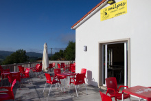
Accommodation in Melide on the Camino Primitivo
| Albergue de Melide 10€ 156 |
| Albergue O Apalpador 13-15€ 13 Booking.com |
|
| Albergue Ezequiel 15€ 18 |
|
| Albergue O Candil 21*€ 12 Booking.com |
|
| Albergue Arraigos 14€ 20 Booking.com |
|
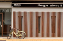
| Albergue Alfonso II 15-17€ 35 Booking.com |
|
| Albergue Pension San Antón 15€ 28 Booking.com |
|
| Albergue Melide 14€ 57 Booking.com |
|
| Albergue O Cruceiro 13€ 88 |
|
| Albergue Pereiro 13€ 40 Booking.com |
|
| B&B A Lúa do Camiño Booking.com |

|

| Hotel Pousada Chiquitín 30-70€ 16 |
|
| Hotel Carlos 96 ★ Booking.com |

|
| Hotel Sony | 
|
The first building in Boente on your left is the Bar de los Alemanes, and this is the best bar in town. Further down the hill, the camino crosses the main road (caution) where two albergues and a few bars are located.
You can get a sello in the Iglesia de Santiago de Boente, and curiously enough the entrance that most pilgrims use leads directly to the sacristy. A collection of hundreds of prayer cards from around the world adorn the walls, and if the priest is not there to stamp your credencial he leaves it out for you to take matters into your own hands.
Walking past the church the camino turns right and descends more. The hills ahead are steep in both directions, take it easy.
Accommodation in Boente
| Fuente Saleta 14€ 22 |
|
| Albergue Boente 15€ 40 Booking.com |
|
| Albergue El Alemán 16€ 40 |
|
It is said that the ovens that produced lime for the construction of the Cathedral were here in Castañeda. Pilgrims carried the raw materials here from Triacastela and swapped it for lime which they carried to Santiago.
It is uphill once more, followed by a steady descent into the valley below, steep at points.
Accommodation in Castañeda
| Albergue Santiago 14€ 6 |
|

A bar near the river with a large patio for celebrating a successful walk. The river here is quite cold and the perfect place to dip your feet.
The camino to Arzúa begins with a steady walk uphill. By the time you reach the road it levels out and the remaining kilometers are flat into town.
Accommodation in Ribadiso da Baixo
| Albergue de Ribadiso da Baixo 8€ 70 |
|
| Albergue Los Caminantes 12€ 68 Booking.com |
|
| Pensión Ribadiso ★★★ Booking.com |
|

There is now an albergue in the upper part of Ribadiso. It is located at the top of the climb and before you get to Arzua.
Accommodation in Ribadiso da Carretera
| Albergue Milpes 15€ 24 Booking.com |
|
| Miraiso 15€ 10 |
|
Arzúa is a pleasant town with almost enough beds for pilgrims. If you find everything to be full and don’t feel like splurging on one of the many hotels in the area, the Polideportivo (sports hall) is often used to house pilgrims. Between here and O Pedrouzo lie a string of very small Galician hamlets of little note. The locals in these parts enjoy telling you, without the slightest tone of irony or sarcasm, that ‘no hay vacas in Galicia’ (there are no cows in Galicia). Hold that thought in your head while you slosh through a soggy trail on an otherwise sunny day.
Tetilla Cheese: You might have seen this curiously shaped cheese in the shop windows. If you made a connection between the name and the shape you are not mistaken. It was shaped this way by cheese makers in protest to the bishop of Santiago. At the time the Portico de la Gloria (Master Mateo’s famous sculptures at the Cathedrals main entrance) was being finished and the bishop took issue with the odd smile on the prophet Daniels’ face. The clever bishop followed his gaze across the doorway and found that Queen Esther’s bosom was augmented by a cheeky sculptor. Daniel kept his smile, Esther had a reduction, and we got boob-shaped-protest-cheese.
Famous for its cheese, Arzúa hosts an annual (and three day long) Festival of Cheese in March. They have been doing so for 40 years. Apart from this and several other secular celbrations, Arzúa celebrates Corpus Christi, as well as Nuestra Señora del Carmen, who is celebrated on the 16th of July.
The camino leaves Arzúa along a footpath, NOT the road. If you arrived at the main square, walk past the church (with your back to the road) and turn right onto the side street. The terrain is pleasant, a blend of trails and paved roads through small towns and lots of forests. There are a few steep sections but none of any considerable length.
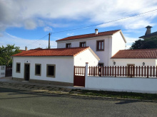
Accommodation in Arzúa
| Albergue de Arzúa 10€ 46 |
|
| Albergue Ultreia 14€ 38 Booking.com |

|
| Albergue San Francisco 15€ 26 Booking.com |
|
| Casa del Peregrino 10-12€ 14 |
|
| Cruce de Camiños 16/17€ 40 Booking.com |
|
| Albergue Los Tres Abetos 16€ 42 Booking.com |
|
| Albergue Turistico Arzúa 14€ 18 |
|
| O Albergue de Selmo 15-16€ 46 Booking.com |
|
| De Camino Albergue 15€ 46 Booking.com |
|
| Albergue Los Caminantes 12€ 26 |
|
| Albergue Santiago Apóstol (Arzúa) 13-14€ 72 |
|
| Albergue Don Quijote 12€ 50 |
|
| Albergue Via Lactea 15€ 124 Booking.com |
|
| Albergue-Pensión A Conda 15€ 8 Booking.com |
|

Accommodation in Pregontoño
| Albergue Camiño das Ocas 14€ 30 |
|

Accommodation in Calle - O Outeiro
| Albergue A Ponte de Ferreiros 15€ 30 |
|
| Casa Rural do Horreo Booking.com |
|


There is a pair of bars in Salceda, and a restaurant (La Esquipa) that is thick with pilgrims every day but Monday when it is closed.
The camino rejoins the road in Salceda, and while it does not walk on the road it does remain quite close. In fact, the camino crosses the road several times between here and Santiago. The speed of traffic, the curves in the road, and the abundance of pilgrims makes this the most dangerous stretch along the camino. Cross carefully and quickly and always under the road when possible.
The camino leaves town to the right of a wedge shaped park next to La Esquipa, not along the road.
Accommodation in Salceda
| Albergue Turistico de Salceda 15€ 8 Booking.com |
|
| Albergue Alborada 15€ 10 Booking.com |
|
| Albergue La Corona 22€ 20 |
|

Accommodation in A Brea
| Mar de Frisia Booking.com |

|

CAUTION crossing the road, dangerous intersection.
The camino crosses the main road at the highest point in the road, there is no marked crosswalk and the arrows on the other side of the road are often obscured by parked cars. You may see pilgrims continuing along the road but are advised against following them as the camino returns to the trail when you turn off the road.
Half way down the hill it splits and arrows indicate that you should either turn left to go under the road or continue straight. Unless you have reason to visit Santa Irene you can keep on straight and avoid the hassle of crossing back over the road. If you continue straight you will arrive at the important part of Santa Irene (the part with the bar).
Accommodation in Empalme
| Albergue Andaina 12€ 14 |


Accommodation in Santa Irene
| Albergue de Peregrinos Santa Irene (Municipal) 10€ 36 |
|
| Albergue de Peregrinos Santa Irene (Privado) 14€ 15 |
|
| Albergue Rural Astrar 12€ 20 |

|

Where the camino returns to the road at the start of O Pedrouzo you will find an abundance of arrows and a large map which is nearly worthless. Arrows and dozens of signs advertising various hostels and hotels point in every direction. If you have a reservation, review the map to find the best path, otherwise turn left up the road. If you are not staying the night in O Pedrouzo, cross the road here and continue along the camino.
Accommodation in A Rúa [O Pino]
| Albergue Espíritu Xacobeo 15€ 46 Booking.com |
|
| Camping Peregrino O Castiñeiro 12€ |
| Hotel Rural O Acivro Booking.com |
|
Unfortunately, there is little to say about this modernized town. When it comes to charm, or monuments, or outrageous legends, it comes up short. During the busier periods along the camino the town feels overrun with pilgrims; most of whom are excited to have finished their penultimate day of walking.
Avoid the temptation of following the main road out of Pedrouzo. There are very few arrows to get you back to the camino and following along the road puts you in very real danger and takes you away from a lovely forest walk. See note below to get back to the camino.
If you spent the night in O Pedrouzo, it is important to find your way back to the camino proper which runs through the forest to the north. To get to it, find the intersection of the main road and Calle de Condello (where the Casa do Concello is located). Continue uphill (north from here) and in a few hundred meters the camino presents itself. Turn left and continue through the forest to Amenal.
The camino between here and Santiago is a mixture of rural and urban settings, some forests and some sprawl. The up and downs that you have been experiencing continue: the elevation gain/loss is +308/-339m, a not insignificant amount.
Accommodation in O Pedrouzo [Arca do Pino]
| Albergue de Arca do Pino 10€ 120 |
|
| Albergue Porta de Santiago 12€ 54 |
|
| Albergue Mirador de Pedrouzo 16€ 62 Booking.com |
|
| Albergue O Trisquel 15€ 78 Booking.com |
|
| Albergue REM 13€ 40 Booking.com |
|
| Albergue Otero 14€ 34 |
|
| Albergue O Burgo 16€ 14 Booking.com |
|
| Albergue Edreira 13€ 40 |
|
| Albergue Cruceiro de Pedrouzo 12€ 94 |
|


| Hotel O Pino ★ | 
|

Two bars, one on either side of a dangerous crossing.
The camino crosses the very busy N-547 by passing underneath it. Do not cross over the road.
Leaving the bar behind you climb steeply uphill a short distance. The path soon levels out on a comfortable trail surrounded by eucalyptus trees. The Santiago Airport is very near, and the camino follows a path around the runway.
Accommodation in Amenal
| Pensión Kilómetro 15 Booking.com |
|

The written history of San Paio has been lost to the ages, but the church here is dedicated to San Paio (or Payo), the 14 year old saint who was kidnapped by the invading Muslim troops, taken to Sevilla, and ultimately martyred to pieces and tossed into the río Guadalquivir.
Accommodation in San Paio - San Payo


The name Lavacolla has one of the most debated origins of all the camino towns. They range from the bland “field at the bottom of the hill” to the more profane “scrub your scrotum.” What is more widely accepted is that pilgrims bathed in this river before entering the Cathedral.
If you walked down the stairs to visit either of the bars at the bottom, turn and walk up the steps towards the Iglesia de Benaval. The camino continues around to the right-hand side and down to cross the road. At the road, cross at the crosswalk and continue along the road and over the famous river (see inset below).
The last hill is ahead, and if you are a stickler for doing things according to tradition you should start running now. It is said that the first of your group to arrive in Monte de Gozo is entitled to be called King. Be advised that there is no prize.
Accommodation in Lavacolla
| Albergue Lavacolla 14€ 40 |
|
| Albergue A Fábrica 20€ 32 Booking.com |
|
| Pazo Xan Xordo Booking.com |
|
| Pensión Dorotea Booking.com |

|


Monte de Gozo, or ‘Mount Joy’, was once the first place that pilgrims could get a glimpse of the Cathedral spires. A new stand of trees blocks the view now. It is a large gathering place for pilgrims, who flock to the over-sized monument commemorating the pilgrimage that Pope John Paul II made here in 1993. The modest Capilla de San Marcos has the last stamp and a small kiosk selling cold drinks.
You do not need to enter the complex but for the sake of curiosity, carrying on down the road will take you where you are heading.
Pass the outdoor gallery of a local (and gifted) sculptor of stone and cross the bridge over the highway. It is midway over this bridge that you enter the city of Santiago de Compostela but to keep pilgrims from crossing the road half way across the bridge, the sign indicating such has been moved further into the city.
Accommodation in Monte del Gozo
| Albergue de Monte do Gozo 10€ 400 Booking.com |
|
| Albergue Benvido Monte do Gozo 23€ 500+ Booking.com |

|


This outermost barrio of Santiago was once the closest point that pilgrims affected with leprosy were permitted to go.
The walk into Santiago is through the urbanized zone that has grown up around the old town. After passing over the highway bridge the first part of Santiago you walk through is the Barrio San Lazaro; the church here is said to be the limit for pilgrims with leprosy. There is a fairly large intersection to cross where the arrows disappear and are replaced by blue and yellow signs on posts.
At last, you will enter the old town, through the Porta do Camiño, winding gently through the stone paved lanes, through the Plaza Cervantes, under the Bishops residence, and into the Plaza de Obradoiro. Congratulations, and welcome to Santiago de Compostela!
Accommodation in Barrio San Lázaro
| Albergue Dream in Santiago 25€ 60 Booking.com |
|
| Residencia de Peregrinos San Lázaro 10€ 80 |
|
