
Accommodation in Ponferrada y el inicio del Camino de Invierno.
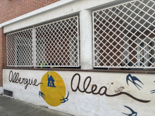
| Albergue Alea 15€ 18 |
|


Pharmacy, nice stone bridge, and a friendly Café Bar Nogal, located in the plaza. Bar opens around 9 and is reported to have weak wifi. There is also a post office, a shop just before bridge, and a bakery. Bar El Puente is just before the river. These bars, and many others on the Invierno, have irregular opening hours, particularly on the weekends.
When leaving Toral de Merayo, pass the church. The asphalt road turns to dirt fairly quickly. The camino then branches off to the right. Soon you will arrive at Villalibre de la Jurisdicción.
Accommodation in Toral de Merayo.
| Miralmonte | |
| Las Tres Negrillas Booking.com |

|

Fountain. Bar La Estrella is along the highway, but the Camino passes through the middle of town and does not pass that bar. Bar Ruta 98 is a short walk from the center of town on the way to the main road.

Soon after entering town, the Camino takes you off the highway and to the right.
Fountain, Farmacia, Bar Taberna El Sitio de mi Recreo is very close to the camino. It has a nice patio and recommended as “cozy” but does not open till late.
Leaving town, the path rejoins the highway before the Mirador de Santallo, a well-known scenic overlook. The views over the Bierzo valley and the craggy cliffs across the river, known as Las Barrancas de Santalla, make for a nice place to rest for a while.

A scenic overlook at the entrance to Santalla which offers excellent views of the Bierzo valley and the mountains beyond.

Right after the mirador, you leave the highway and go through on a village street. There is also a grocery store in town center.
There are two sets of arrows when leaving town, and a mojon which keeps you on the camino towards Villavieja. Do not follow the arrows to Las Barrancas.
The Calle Chaos takes you out of town, and it turns to a dirt path.
A couple of kms out of town, after walking through ag fields and orchards, a mojón takes you to the left, across the national highway and an ascent begins. There is a sign for the Villavieja Albergue.
You can, however, stay on the road, bypass the castle, and go directly on the road to Borrenes. There is minimal elevation gain, but walking on the shoulder of a national highway is generally a bad idea. If you take the road, you will have another option later to take a road ascent to the castle, but the Camino route through Villavieja is far preferable.
If you take the climb, you will have great views of the castle and arrive in Villavieja.

Spring-fed fountain, Church of Santiago. This pretty little hamlet was once home to the serfs who worked for the inhabitants of the castle up above. Other than the albergue, there are no services of any kind, so if you plan to stay here, you must carry your food and provisions with you.
Villavieja is the one place where pilgrims repeatedly reported having been scared by a very large mastiff, loose and barking loudly. For years, the owner had refused to do anything. It seems that the dog is now confined (but not chained) in a large yard. The dog situation in Villavieja seems to be resolved.
Halfway through Villavieja, there’s a paved road to the right. If you take that road, you will bypass the castle. On the left is a large, very nicely renovated old house, and the Camino to the castle goes by the left side of that house. It is a light gravel path through chestnut trees.
Accommodation in Villavieja.
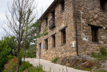
| Albergue municipal de Villavieja Manuel Fuentes 10€ 16 |
|

Visiting hours have been reduced and change frequently. It is a good idea to call ahead to get current hours. You can call the town hall of Priaranza del Bierzo at 987 420 806 or call 606 898 140.
The scholarly debate on the castle is ongoing, but here is one respected version of its history. It seems that the castle may have been the site of the Roman Castelo de Ulver, built to defend the gold operations at Las Médulas. Later 9th century traces have also been identified. It is likely that the castle was rebuilt in the 13th century by the Knights Templar after Alfonso IX of León donated it to them in 1211. When the order disappeared in 1312, the castle passed to Alfonso XI of Castilla. The castle’s name can be traced to 1378, and for the next century it was taken, retaken, nearly destroyed, and finally given by the Reyes Católicos (Ferdinand and Isabel) in 1486 to the newly created Marqués de Villafranca del Bierzo. In 1900, the heirs to the castle donated it to the hamlet of Villavieja, which used it for years to shelter flocks of sheep. Government restoration began in 2002, and the castle now contains a small museum. It is the site of an annual medieval musical festival, held the last weekend in August.
There is a nice view from a nearby bench (banco). Look for signs near the castle pointing you to el banco más bonito del Bierzo (the prettiest bench in the Bierzo region).
Once you have finished your visit, continue along the downhill road. Turn right (following the arrows) at the first intersection and a left at the one that follows. From here you will arrive shortly in Borrenes.

Quiet village with a fountain in main square. It has a pharmacy and small shop of the typical “lights off but we carry everything” variety. The shop is closed on Sunday. Bar Casa Marisol does full meals and has a wifi signal. This establishment doesn’t open till 12:30.
Polideportivo may or may not be available for pilgrims. Information would be appreciated. Possible phone number is 987 460 181.
The church of San Vicente in Borrenes has a wooden virgin from the 12th century. An abbot from Villafranca visited the church in 1701 and left instructions that the pilgrim hospital should be re-opened and a space for poor pilgrims provided. In the 18th century, records show that some ill pilgrims died here and were buried in the hospital cemetery – a pilgrim from France, a poor German pilgrim, and an injured soldier who had made the pilgrimage because of his disability.
Continue out of town, and resist the temptation to take a small, manicured fitness trail on the left. Just stay on the road and walk around the bend. A dirt track will appear up and to your left; a short climb later the trail will descend again. The first road you see takes you to Carucedo, which is not on the Camino. If you want to take a slight detour and then walk along the road up to Las Médulas.
Continue straight and turn left on the next road, which takes drivers to Las Médulas. A short distance along the road the Camino once again diverts into a more scenic landscape of chestnut groves. A short distance outside of Las Médulas, you will rejoin the road and enter town along it.

This off-road route takes you straight to the iconic Orellán lookout (Mirador de Orellán), the spot for the best views of Las Médulas. You will also pass the galleries (open for visits), the ancient tunnels that pushed the water through narrowing spaces at increasing speeds so it would blow up the hills and disgorge the gold. From the mirador, you can either go down to the village of Las Médulas, or bypass the village entirely by carrying on to Puente Domingo Flórez. The alternative is about 11 km with a total of 475 m elevation gain.
The official camino route from Borrenes up to Las Médulas has about 300 meters of elevation gain, but remember that if you want to visit the Orellán viewpoint, you will have to walk those additional meters of elevation at some point!
Saturno and Soledad (AKA Marisol) in the Centro de Turismo Rural Cornatel can give you plenty of information.
The alternative is fairly well marked, but a GPS should be used. Going this way has the big advantage that you will arrive at the best viewing point in Las Médulas before you get to town, leaving your afternoon free for other things. There is more elevation gain than on the official route, and it is 4 km longer as well.
Located off the camino to the north by about 500m, but included here because it offers accommodation. Carucedo also has several bars/restaurants
The Las Médulas cultural area has been named a World Heritage Site by UNESCO. It was at one time the most important gold mine of the Roman Empire, and a long stretch of the Camino Invierno follows a road built to transport minerals out of the region. Along the river you will still see remains of Roman mines alongside their modern counterparts. Las Médulas, an environmental holocaust two millennia ago, is now a spectacular, spooky assembly of deep-red cliffs and valleys, with wooded parkland and pathways threading in between. Essentially, the bare earth mounds and crags you see are the “innards” of what used to be hills. By channeling water through increasingly narrower tunnels, the water speed and force increased. Thus, the Romans were able to blow open the hills to extract the gold. Las Médulas is a popular summertime tourist attraction, with all the joyful merriment and price-fixing that goes with it.
A little linguistic/political debate: Contributors to the guide could not agree on whether to use the Galego “As Médulas” or the Castellano version, “Las Médulas.” Since the town and site are in Castilla y León, the “Las” may be more correct (though perhaps less “politically correct”), and that is what you see on the signs. Not wanting to wade into that debate, at the last minute I changed all of the occurrences of “As Médulas” to “Las Médulas. (Please note, this is my feeble attempt at humor, but it does serve the serious purpose of alerting you to the fact that this little debate over whether the article should be “las” or “as” serves as a proxy for a much more serious disagreement over regional identity). Pilgrims report that everyone in town uses the “As” rather than the “Las”.
Las Médulas has two tourist information centers (one at the entrance to the village on the right, and another in the village itself, close to the church), accommodation, cash machine, bars, grocery store at lavadero, and restaurants targeting weekenders hiking the many trails around the area. Its small museum is well worth a visit. One pilgrim reported that the man at the first interpretative center speaks English and gave a very good description of the history and technology of the mines. The visitors centers are open every day of the week; the galleries close on Tuesday.
You can also pick up a map describing various walks around the site. The absolute best place to go for a view is the Orellán lookout. There are several ways to get there. We unintentionally took the 6 km route, so be careful when following the map. The shortest way to Orellán is to go to the hotel complex Agoga, and take the road on the LEFT side of the complex. That will take you to the turn-off for the slightly steep but beautiful pedestrian path up through chestnut forests. When you are at the top, turn left, and you will soon come to the large lookout area. A little beyond the mirador Orellán, there is an entrance to one of the galleries and you can walk through the tunnel channels that water was pumped through. Kind of spooky fun! http://www.galeriaenlasmedulas.com/ Whether you have time or interest for the gallery tour, do not miss the view from the Orellán overlook.
Las Médulas has several accommodation options and numerous places to eat. In off-season, though, your selection is likely to be reduced. In addition, several pilgrims have noted that on Tuesdays, many places are closed.
Eateries include Bar Reigo, Taberna Romana, O Camiño Real (described by one pilgrim as “bohemian but pilgrim-friendly”), and Restaurante Marif. Some of these may be closed out of tourist season. Of those eateries, O Camiño Real gets consistently high reviews.
Leave Las Médulas on a tractor path on the western edge of town that leads to a beautiful morning walk through wooded hills. There is the possibility of a short detour to the left (perhaps 500 meters) to a ‘mirador’ with good views back over Las Médulas and the Bierzo valley. This is not the Mirador de Orellán recommended in earlier paragraphs, however, and the views are not quite as spectacular. Though a sign at the top of the ascent tells you that Puente de Domingo Flórez is only 5.7 km away, don’t believe it. It’s actually 2 km more than that! The Camino descends along a mountain lane with views across the valley to distant mines and villages. The grade, the surface, and the views are very nice all the way.
The Camino goes into Puente de Domingo Flórez on the Calle Real. It takes you across the river, then along the river, and then back over the river and into the more central parts of town. This is an unnecessary loop, but it will get you through. You can avoid the loop by ignoring the arrows and taking a straight shot across town. As you are descending on the Calle Real, look for the Calle el Toral (on your right before you get all the way down to the river). Turning right here will take you to Café Bar Los Arcos before the square. There is a churrería in the main square. Keep walking straight, and you’ll come to Bar el Cruce (very pilgrim friendly) and will be back on the Camino and on Avenida de Orense. The Camino continues on Calle Chao de Marco, a left turn off Avenida de Orense.
If you have taken the loop, the bridge into Puente de Domingo Flórez continues on the National Highway (N-536), called the Avenida de Orense in town. It swings to the left, with the Banco Pastor on your right and a pharmacy on the left.
Accommodation in Las Médulas.
| Casa Socorro |


Pharmacy, supermarkets, bars, ATM, a medical center, and one hostal. Internet is available at the town hall in the old town, set against the old bridge on the río Cabrera and in the Hostal.
In Puente de Domingo Flórez, the Camino markers take you over the bridge on the national Highway N-536. This road is called Avenida de Orense in town. At the intersection with Calle Chao de Marco, turn left. When Chao de Marco curves to the right, you should turn left at the Día supermarket (mojón will direct you) and onto Calle Acceso Quereño. You will know you have gone too far on Chao de Marco if you pass the Guardia Civil barracks and the Hostal La Torre. Calle Acceso Quereño takes you over the bridge and into Galicia. About 50m after going under the RR bridge, Bar Estanco (opposite Quereño RR station).
After crossing the bridge, the Camino makes a big looping upside down U. Pass the electricity pylons on your left, go under the railway bridge and you’ll see three roads in front of you. Take the one in the middle and loop past some houses in the town of Quereño.
