Getting into town and out again is straightforward. There is an alternative route that is signed, which takes you through town closer to the river.
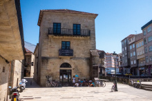
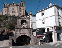
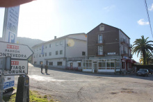
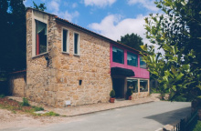
As a city, Redondela has its charms. It sits well inland of the Vigo estuary and is bisected by two massive train bridges.
When leaving town, the camino crosses the N550 at a bottleneck on the north side of town that is heavy with traffic at all hours. Cross the N550 as soon as you get to it, and almost immediately veer left gently onto a side road.
The arrows from here leave a bit to be desired. They are present, but have been spray painted with a not quite right yellow and at times, they don’t feel legit. Follow them all the same, and as you near Cesantes the stone markers return.
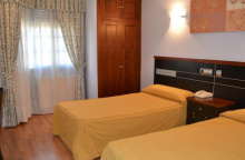
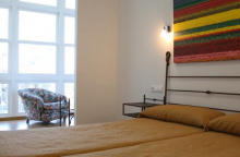
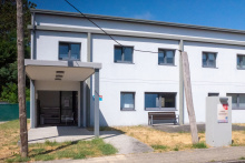
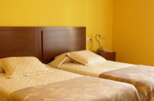
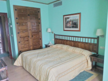
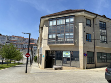
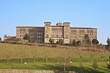
Accommodation in Redondela
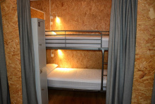
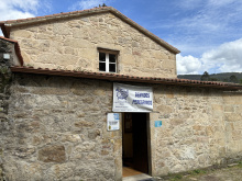
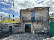
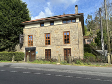
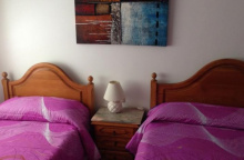
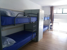
| Albergue de Peregrinos (Casa da Torre) 10€ 42 |
|
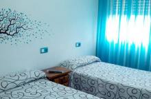
| A Casa da Herba de Redondela 16€ 24 Booking.com |
|
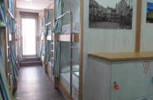
| Albergue Rosa d'Abreu 20€ 6 Booking.com |
|
| Albergue Alfonso XII 15€ 12 Booking.com |
|
| Albergue A Conserveira 14€ 38 Booking.com |
|
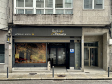
| Albergue Santiago de Vilavella 17€ 46 Booking.com |
|
| Albergue A Rotonda 17€ 9 Booking.com |
|
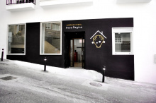
| Albergue Avoa Regina 15€ 32 Booking.com |
|
| Albergue A Dársena do Francés 20*€ 29 Booking.com |
|
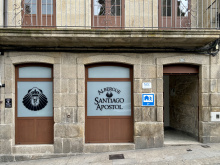
| Albergue Santiago Apóstol 12€ 30 Booking.com |
|
| Pilgrim Rooms |
| A Marisma Hostal 14€ 38 Booking.com |
|
| Apartamentos O Descansiño |

Getting past Cesantes means crossing the N550 once more, at probably the most dangerous point in a curve in the road. Head straight across and keep to your right.
You are climbing uphill now and will traverse around the O Viso peak. Along the way you pass an installation of pilgrim shells and if you have a marker on hand you can leave a message on a sun-bleached shell. From here it is downhill again to the N550.
At the entrance to Arcade, the camino turns left rather unnecessarily. It will cross back over the N550 in a few hundred meters, taking you past the albergues and shops of Arcade.
Accommodation in Cesantes
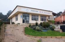
| O Refuxio De la Jerezana 18*€ 34 Booking.com |
|
| Albergue A Dársena do Francés 20*€ 29 Booking.com |
|
| Pensión Jumboli Booking.com |

|

If you fancy a dip in the sea or just a stroll along a beach, Arcade and Pontesampaio (a bridge away) will oblige. Follow the camino to the bridge over the estuary where you will find a strip of sand on both sides.
Accommodation in Arcade
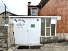
| O lar de Pepa 10€ 10 |
|
| Albergue Lameiriñas 13€ 26 |
|
| Albergue Casa Calvar 15€ 26 |
|
| Albergue A Filla do Mar 35**€ 26 Booking.com |
|


The hotels here are located along the main road, which is both noisy and a bit dangerous. Suitable as a last resort but otherwise best avoided.
After crossing the bridge, take a left turn on the first street. This turn is followed by a series of zigs and zags that take you up and through town at the highest point.
The camino takes a welcome break from the road traffic between here and O Pobo.
Accommodation in Pontesampaio
| Hostel-Albergue O Mesón 13.50€ 26 Booking.com |
|


In O Pobo / Santa Marta an alternative route into Pontevedra presents itself on the left side of the road.
Turn left to follow signs towards the Rio Tomeza. This path is 3.6 km to the Pontevedra Albergue (at the start of town near the train/bus stations), and the original road route to the same point is 2.8km.

Your entrance to the old town center of Pontevedra is punctuated with its most famous church, the Iglesia de la Virgen Peregrina, a shrine to the Pilgrim Virgen who guided pilgrims here from Baiona.
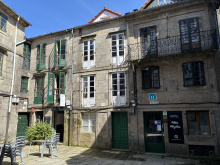
To see the rest of Pontevedra’s notable buildings will required you to stray from the arrows a bit. The old town is not large enough to get lost in, so take your time and enjoy the many plazas and parks.
The most important landmarks are the Convento de San Francisco, the Basilica de Santa María (often referred to as the Cathedral), the Iglesia de San Bartolomé, and the Convento de Santa Clara.
There are plenty of plazas to choose from, including the large Plaza de Teucro and the diminutive (and best) Plaza de Leña.
Leave by crossing the Ponte do Burgo and heading straight-ish through the next roundabout, turning left immediately after. Before long you will be alongside the railway, which you will cross just before the church of Alba.
TWO WAYS TO PONTECESURES / PADRÓN
There are two routes to Pontecesures/Padrón from Pontevedra, and the split occurs about 3km after crossing the bridge in Pontevedra.
The original camino keeps on its inland trajectory and is currently the most popular choice among pilgrims. It is also the shortest.
The second option is known as the Variante Espiritual and it turns westward to cross over the Monte Redondo as it heads towards the sea at Vilanova de Arousa. From here you have the option of a 3rd day of walking to Pontecesures or a trip by boat up the Ría to the same place. This variant was created and named by the local tourism sector and although the stories told about its origins are fantastic, they are also just that... stories. Don’t let this clever bit of marketing discourage you though, the route is recognized by the Pilgrim Office as an official variant and you will not have any difficulty obtaining your Compostela regardless of whether you take the boat or not.
This recognition, and lots of praise from pilgrims, means that this route is growing in popularity.
VIA THE VARIANTE ESPIRITUAL - 44. km on foot + 28 km on foot or ferry
The Variante Espiritual is an alternative route which connects Pontevedra with Pontecesures. It adds 8.2km of walking (and a significant climb to the top of the Monte Redondo) and another 28km by boat (from Vilanova de Arousa to Pontecesures).
Getting started is as simple as turning left at the well signposted fork in the road. The way almost immediately begins climbing upwards, though gently at first. It is making its way back to the Ría de Pontevedra, going up and around a small monte before arriving in the waterfront town of Combarro. There is one small hamlet before arriving at Cabaleiro, and it has a bar/shop with a very limited selection, but as it has odd hours it is not included here as being reliable.
THE ORIGINAL CAMINO, INLAND VIA CALDAS DE REIS - 36.3 km
This is the easiest to navigate and shortest of the options. From the split simply carry on straight.
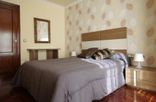
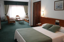
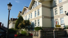
Accommodation in Pontevedra
| Albergue de Peregrinos (Virgen Peregrina) 10€ 56 |
| Aloxa Hostel 18-24€ 60 |

|
| Slow City Hostel 20-23€ 6 Booking.com |

|
| Albergue Acolá 20*€ 16 Booking.com |

|
| Hostel Nacama 18-20€ 42 |

|
| dpaso Urban Hostel 18+€ 20 Booking.com |
|
| Turoqua Hostel 21*€ Booking.com |

|
| GBC ISAPE 19+€ 40 Booking.com |

|


Exercise caution passing through San Caetano as the road is quite narrow and the traffic is quite fierce. At the end of town turn right off the road. Soon you will be along the railway once more which you will follow along for several kilometers.

San Amaro sits square above the railway that you walked along a few kilometers ago; they tunnel through this hillside on their way to Santiago.
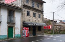
There are two bars in town; the first has the most character and the most business. Friendly service too.
Turn left at the fork in the road, past the park, and onto a country lane.
The turn off for the Portela/Barro albergue is along this stretch, and it takes you uphill to the right.


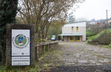
Located along a deviation of the camino, well signed. It adds a few meters to the journey but has a municipal albergue in a quiet town.
Before arriving at Briallos, the camino approaches the N550 once more. At this point, there are signs for the Natural Park of the Rio Barosa, and the waterfalls. The waterfalls are 500m down the road directly opposite this point and are a worthwhile detour. Picnic areas and a bar and bathroom are at the base of the falls.
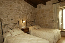
Accommodation in A Portela - Barro
| Albergue de peregrinos de Barro - A Portela 12€ 16 |
|
The albergue and the bar are located a few hundred meters from the center, turn left when you get to town, following the signs. Otherwise, keep on straight to the end of town.
Accommodation in Briallos
| Albergue de Peregrinos Briallos 10€ 27 |

|

Accommodation in Tivó
| Albergue Vintecatro 16-19€ 19 Booking.com |

|

Caldas de Reis is best known for its hot springs (caldas). They still exist, but the tradition of putting your feet into the fountain is discouraged for obvious hygienic reasons. All the same really, a hot soak after a hot day of walking isn’t the best of plans. To see the springs (and to follow the camino), turn left after crossing the first bridge in town.
The camino passes through the old quarter before arriving at another bridge, on the opposite end of which is the municipal albergue and the way out of town.
The church in town is dedicated to Saint Thomas Becket, one of very few of the sort in Spain and possibly the only one in Galicia. If you are only passing through town in the afternoon, the palm trees that surround the church make for a cooling place to relax.
On the way out of town, it is once more along the N550 (which frankly will be the case frequently between here and Santiago). Leave it to your right at the first bend in the road.
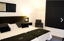
Accommodation in Caldas de Reis
| Albergue de Caldas de Reis Urraca 14€ 26 |

|
| Albergue-Hotel O Cruceiro 16-18€ 34 Booking.com |
|
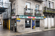
| Albergue Timonel 13€ 20 |
|
| Albergue Albor 22€ 35 Booking.com |

|
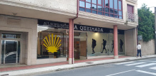
| Albergue A Queimada 14€ 74 Booking.com |
|
| Albergue GBC Caldas 25-28€ 100 Booking.com |
|
| Albergue Alecer 13€ 16 |

|
| Albergue As Pozas Termais 25€ 26 Booking.com |
|

The way to Santa Mariña is through a quiet forest away from the busy road. The bar here is quite friendly and a welcome morning stop if you have left from Caldas.
The camino crosses the N550 to the upper part of town to visit the church, and returns to cross again before Casalderrique.


The camino only touches the back side of O Pino, which has a bar and an albergue a bit off the track (200m). The albergue here is large and clean and friendly, with a shaded park in front.
Accommodation in O Pino (Valga)
| Albergue de Peregrinos Valga 10€ 78 |

|

There is not much to San Miguel apart from the modest church and the bar-grocery-everything store. The quaint countryside walking will soon give way to the sprawl of Pontecesures.

Pontecesures is the town that you wished was prettier but isn’t. It enjoys a nice riverside location but is spoiled by the belching factory across the river.
The arrows go under the road and over the bridge and across the Río Sar to Aduana. Here it runs all the way into Padrón.
Accommodation in Pontecesures
| Albergue de Peregrinos Pontecesures 10€ 54 |
|


Herbón, and the Monastery and Albergue there, could not be better placed for a peaceful day of relaxed contemplation at the end of the penultimate day of walking to Santiago.
It is a deviation from the camino’s yellow arrows, but one imagines that it has always been an important stopping point for pilgrims.
The albergue here is run by the Galician Amigos of the Camino and it is one of the few places where you can count on eating dinner with all of the other pilgrims staying there.
To get there simply follow the red arrows marked Herbón. This detour if for anyone wishing to spend the night in the Albergue at the Monastery of Herbón (recommended). From Pontecesures it is 2.7km, with an additional 3km the following morning to bring you to Padrón. In all this detour adds 3.1km to the official route.
Accommodation in Herbón
| Albergue de Herbón Donativo€ 20 |
|

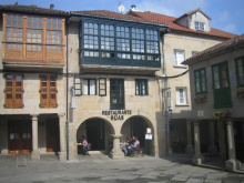
Padrón might just be the most important little town on this or indeed any other camino. It was here that the remains of Santiago arrived after being sent out to sea on a stone boat, as told in the story of the ‘translatio’.
His arrival to the specific point is attributed to the fact that it was here that he first arrived to preach while still alive, so his return was a homecoming of sorts.
Padrón is also the birthplace of Rosalia de Castro, Galicia’s most famous and beloved laureate.
Padrón (and Herbón) are home to that delicious green and possibly spicy pepper you may have had the pleasure of eating.
Take a look at the elevation profile for an idea of what these last 24km will be like, many pilgrims underestimate the elevation changes which increase as you near Santiago.
Accommodation in Padrón
| Albergue de peregrinos de Padrón 10€ 46 |
|
| Albergue Flavia 20€ 22 Booking.com |
|
| Albergue Corredoiras 15-19€ 17 Booking.com |
|
| Albergue Camiño Do Sar 15-17€ 20 Booking.com |
|
| Albergue A Barca de Pedra 18-25€ 22 Booking.com |
|
| Albergue O Pedrón 14-17€ 44 Booking.com |
|
| Albergue & Rooms Murgadán 16-20€ 32 Booking.com |
|
| Albergue d'Camiño 16-20€ 15 Booking.com |
|
| O Albergue da Meiga 15-20€ 50 Booking.com |
|

Pass through Pazos, Rueiro, Tarrio and Vilar (albergue); none with services.
Accommodation in Iria Flavia


Accommodation in Vilar
| Albergue O Lagar de Jesús 25€ 18 |
|
| A Casa da Meixida Booking.com |
|
Although there is still more that 17 kilometers separating you from the Cathedral it will feel from here onward that you are marching along a string of increasingly larger Santiago suburbs. Many of them remain quite small, but the sprawl begins to present itself.
In town, turn right off the N550 at the church, passing around its park. A country road takes you steeply uphill. You will pass through the hamlet of Cruces, Angueira de Suso, and into Areal before returning to the main road at Picaraña.
Accommodation in A Escravitude
| Albergue de Capellania 12€ 18 |
|
| Albergue Crucesinn 17€ 50 Booking.com |
|
| Casa Grande da Capellania Booking.com |
|

Accommodation in Angueira de Suso
| Albergue Camiño da Vieira 17€ 12 Booking.com |
|
NOTE: BEFORE the gas station a set of faded arrows directs you left and away from the road. Going that way takes you through a new route marked out by the local friends of the camino and is a much-preferred option to the road. After turning left keep an eye open for arrows which will turn right onto a grass (sometimes tall) path. This arrow might be a bit faded but the way is obvious, and it turns into a well-worn trail with plenty of arrows. It will bring you right up to the road at the entrance to Faramello.
Accommodation in Picaraña
Two bars in town, one at the entrance just after leaving the N550, and another at the private albergue.
Accommodation in O Faramello
| Albergue de peregrinos de Teo 10€ 28 |
|
| Albergue La Calabaza del Peregrino 18€ 36 Booking.com |
|
From Rúa, the camino passes through several small hamlets (Osebe and A Grela) as it makes its way into the large Santiago suburb of Milladoiro.
Accommodation in Rúa de Francos
| Casa Rural Parada de Francos Booking.com |
|
The camino passes between Osebe (to your left, train station) and Casalonga (to your right and on the main road, shops and atm), and not far ahead is Pedreira (albergue and food truck). It is not clear when you are passing from one to the other as they all blend together.
Accommodation in Osebe - Casalonga - Pedreira
| Albergue Casa Aldea da Pedreira 20€ 20 Booking.com |

|
O Milladoiro is Santiago’s largest suburb, and soon you will have your first glimpse of the Cathedral. The camino passes through the back side of town, avoiding the busy main road with its massive apartment blocks.
The growing network of highways around Santiago mean that you will make a few crossings and zig zags before you get to the city limits. There are even a few occasions where new camino stones stand adjacent to old camino stones, each pointing in their own direction. One offers a choice between ‘Santa Marta’ and ‘Conxo’ and here the best and most direct choice is ‘Santa Marta’, or left.
Accommodation in O Milladoiro
| Albergue Milladoiro 17€ 62 Booking.com |
|
| Hotel Payro Booking.com |
|
Welcome to Santiago! There are a tremendous amount of things to see and things to do in Santiago de Compostela; you are encouraged to stay for at least one full day extra for exploring the web of streets, all of which seem to bring you back to the Cathedral.
Your pilgrim related business is likely to start in front of the cathedral, kilometer zero. A shell and plaque mark the spot in the center of Plaza Obradoiro (see below).
If you are interested in receiving your Compostela, the certificate of completion, you will need to visit the Pilgrim’s Office, which was relocated in 2016 to a bright new building. To get there from the Plaza Obradoiro, face the Parador (the hotel on your left if you are facing the Cathedral) and look for the road that goes downhill to the left. Halfway down you pass the public restroom, and at the next street turn right. The office is at the end of that road and is easy enough to find. Note that there are few arrows indicating the way.
The Cathedral is the single largest attraction to Santiago and for good reason. Both inside and out it presents countless treasures to investigate, too many to list in fact but below are the best.
The Cathedral - Plaza by plaza
1. Plaza de Inmaculada, a.k.a. Azabache: This is the entrance that faces the Monastery of San Martín Piñario.
2: Obradoiro: From Azabache you pass under the Palace of the Bishop which is adjoined to the Cathedral and cannot possibly be the sort of palace that affords much peaceful sleeping; the sound of bagpipes welcoming you can be heard from dawn to dusk. The stairway leads directly to the Plaza de Obradoiro and kilometer zero for pilgrims. In the center of the plaza is the last scallop shell and you are likely to find pilgrims taking their shoes off for a photo with it, and the Obradoiro Facade behind them.
This facade is the most majestic and most photographed of the Cathedral and was part of the 18th century building projects that took place in Santiago. The baroque design will keep your eyes moving and the massive amounts of glass allow for the illumination of the Pórtico de la Gloria that lies behind it. That Pórtico was the original front to the church designed by Maestro Mateo 600 years before the new facade.
3. Plaza Platerias: If you continue around the Cathedral you arrive at the Puerta de las Platerías (named for the silver craft that still exists in the shops below it). You will notice that some of the stonework stands out as a different material. These are replacement carvings, the originals were damaged and subsequently moved to the Cathedral Museum; and unfortunately the original composition was forgotten, leaving a somewhat nonsensical layout. In front of the doors are a set of stairs and the Platerías fountain, the usual meeting point for pilgrims commonly referred to as “the horse fountain”.
4: Plaza de Quintana: Continuing up the stairs and around the Cathedral we arrive in the large Plaza de Quintana and the Puerta de Perdón. The actual Holy Door is behind this facade (which is not actually a structural part of the Cathedral, it is more like a highly decorated wall around the Holy Door itself). The carvings here are impressive and depict 24 Saints and prophets.
In medieval times it was common for pilgrims to spend the night in the Cathedral, sleeping on the stone floors and fighting (to the death on a few occasions) for the privilege of sleeping close to their chapel of choice.
The best time to visit is early in the morning before the crowds arrive, when paying a visit to the crypt and hugging the bust of Santiago can be done quietly and with a bit of contemplation.
The botafumeiro, quite possibly the largest thurible in the Catholic Church, is swung across the transept (from north to south) by a group of men called the tiraboleiros. It has only come loose from the ropes twice, and never in modern times. At the time that this book was printed, the tradition of swinging it during the Friday evening mass had been canceled. Inquire at the pilgrim’s office for more information.
The Monastery and Museum of San Martín Piñario
The enormity of this Monastery is difficult to comprehend, but if you pay close attention to this building as you walk around Santiago you will find that you are almost always standing next to it if you are on the north side of the Cathedral. There are three cloisters! The facade of the church often feels like it is somewhere else entirely and is quite curious for the fact that you must descend the staircase to get to the doors, rather than the other way around. The reason for this was a decree by the Archbishop that no building should exceed in elevation that of the Cathedral; the architects did not compromise by redesigning San Martín to be less tall, they simply dug down and started at a lower point.
San Fiz de Solovio
Compared to the two churches above, San Fiz feels like an almost minuscule affair. To find it, make your way to the Mercado de Abastos (Supply Market). San Pelayo (the hermit that rediscovered the bones of Santiago) was praying here when the lights called him. Grand and majestic it is not, but the oldest building site in Santiago it certainly is. The church that exists today is not the original, but excavations have revealed the foundations and necropolis dating to the 6th century.
The Supply Market (Mercado de Abastos)
The produce market is a great place to wander for lunch. Compared to other markets in Spain (like those in Madrid and Barcelona) the Santiago market is a fairly solemn affair. In fact, the architecture appears almost strictly utilitarian and is as Galician as it gets. The vendors make the experience, and even if your Spanish is not up to par, it is worth the visit for a glimpse into the way the locals go about their most ordinary business.
The buildings you see today date from the early 1940’s but replace ones that stood for 300 years. In fact, many of the vendors are second, third, or fifth generation market operators.
Alameda Park
Alameda Park was once the sort of place where the people of Santiago would turn out for elaborate displays of personal wealth and stature; the various paths that cut through and around the park were only to be used by members of a certain class. Nowadays it is far more democratic. The park is the site of a Ferris wheel and feria during the Summer months, an ice skating rink during the Winter holidays, and a massive eucalyptus tree overlooking the Cathedral year round.
The Hidden Pilgrim
Hiding in the shadows cast by the Cathedral, in the Plaza Quintana, is the hidden pilgrim. He is only visible at night and might take a while to discover.
And lastly, there are the many other Monasteries, and while it would be a challenge to visit all of them it is important to realize their construction shaped the city that we see today. Taking the time to walk between them will reveal countless little treasures.
One word of caution regarding accommodation is in order. If you are arriving in the high season, you are advised to make a reservation in advance. There have been several additions to the albergue roster in recent year but the numbers of pilgrims still exceed capacity in the high season.
The Feast day of Saint James is celebrated with a full week of music and dance, with a fireworks display in the Plaza Obradoiro on the evening of the 24th of July. The best views can be had from Obradoiro, or from Alameda park.
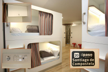
Accommodation in Santiago de Compostela at the end of the Camino Portugues
| Albergue O Fogar de Teodomiro 15€ 20 Booking.com |
|
| Albergue SCQ 18-22€ 24 Booking.com |
|
| Albergue SIXTOS no Caminho 20€ 40 Booking.com |
|
| KM. 0 18-30€ 51 Booking.com |
|
| Blanco Albergue 15-20€ 20 Booking.com |
|
| Albergue La Credencial 18-22€ 36 Booking.com |
|
| Albergue Monterrey 14-30€ 36 Booking.com |
|
| Albergue La Estación 17-19€ 30 Booking.com |
|
| Albergue Porta Real 15-25€ 22 Booking.com |
|
| Albergue Meiga Backpackers 14-20€ 30 Booking.com |
|
| Albergue Seminario Menor en Santiago de Compostela 17€ 199 Booking.com |
|
| Albergue Mundoalbergue 19€ 30 |
|
| Albergue Santo Santiago 14-18€ 40 Booking.com |
|
| Albergue-Hotel LoopINN 22€ 84 Booking.com |
|
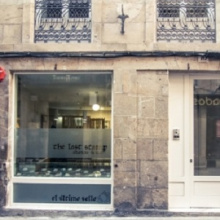
| Albergue The Last Stamp 19-25€ 62 Booking.com |
|
| Albergue Azabache 16-25€ 22 Booking.com |
|
| Albergue La Estrella de Santiago 14-30€ 24 |
|
| Albergue Linares 16€ 14 Booking.com |
|
| Albergue Fin del Camino 14€ 110 |
|


 ⭑⭑⭑⭑⭑")
