From Granja de Moreruela you can follow the Camino Sanabrés (follows from below) a total of 366km to Santiago, or you can follow the Vía de la Plata to Astorga 93.8km and from there follow the Camino Francés the remaining 256.9km. A description of the route to Astorga continues on page 98 but this guide does not include the stretch from Astorga to Santiago.
The Camino Sanabrés turns left and due west from Granja. It follows farm tracks to reach the Puente Quintos (6.7km) over the Río Esla.
Once over the bridge, the river splits into two distinct routes to get to Faramontanos de Tábara. The right route follows the road and is preferred when rains have been heavy. Follow the road to the first paved left turn to descend and rejoin the left route. The left route turns left at the end of the bridge to follow a more scenic trail along the river.
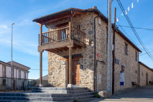
Accommodation in Granja de Moreruela to Sanabrés Route
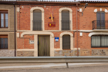
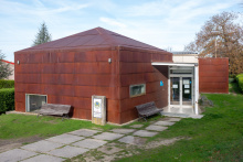
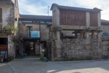
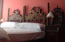
| Albergue de peregrinos de Granja de Moreruela 6€ 20 |
|
| Casa Rural La Casa del Tío Quico |

Once over the bridge, the river splits into two distinct routes to get to Faramontanos de Tábara. The right route follows the road and is preferred when rains have been heavy. Follow the road to the first paved left turn to descend and rejoin the left route. The left route turns left at the end of the bridge to follow a more scenic trail along the river.

The camino to Tábara crosses over the AVE railway development. From this point you can see Tábara in the distance, but note that the camino does not enter Tábara. If you plan on stopping here aim for the church towers.

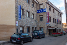
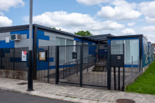
Tábara’s municipal albergue is one of the not-to-be-missed albergues on the whole of the Vía de la Plata.
If you entered Tábara you have two options to return to the camino. You can return to the camino where you left it, or if you stayed at the Municipal albergue you can follow the alternate route from there.
The camino between here and Santa Croya offers two options, both of equal length. The original and more scenic route turns right and passes through Bercianos de Valverde, however with the shuttering of the bar there this route has fallen out of favor with pilgrims. It has been replaced with the left route, which heads directly towards Villanueva de las Peras.
Accommodation in Tábara
| Albergue de peregrinos de Tábara Donativo€ 28 |
|
| Albergue El Roble 11€ 14 |
|


Keys to the albergue are available at the bar La Mona.
Small village squabbles and arrows pointing in two directions. The easiest way to Santa Croya de Tera is via the road out of town.
Accommodation in Villanueva de las Peras
| Albergue La Alameda 12€ 7 |

|


The private albergue here has been closed without any indication of reopening.

The pride of Santa Marta is the Romanesque Iglesia de Santa Marta and it is well worth a visit. Around the back of the church, beside the doorway, is the oldest known sculpture in stone of the Apostol Santiago. If you happen to be passing by on March 21st, or on September 23rd, join the crowd to observe the illumination of a carved capital as the sun aligns with an opening in the apse.
The camino ahead turns westwards and follows closely the Río Tera as it runs between a string of villages. Shortly before Calzadilla de Tera the camino leaves the road to avoid a blind curve in the road.
Accommodation in Santa Marta de Tera
| Albergue de Peregrinos de Santa Marta de Tera 5€ 16 |
|

The camino from Calzadilla follows along the canal, though a number of confusing arrows might lead you to the road which will also get you there.
Accommodation in Calzadilla de Tera
| Albergue de peregrinos de Calzadilla de Tera Donativo€ 6 |

|


From Olleros the camino follows a path to the dam on the east side of the Embalse de Agavanzal (4.3km). Once over it turns left to follow a path which follows the contours of the reservoir until it reaches Villar de Farfón.
Accommodation in Olleros de Tera
| Albergue La Trucha 7€ 6 |

|


Coffee and tea and conversation at the Albergue on the far end of town (follow the signs).
The camino returns to a rural trail until it reaches the Río Negro, just short of reaching the N-525. It crosses the river on a small pedestrian bridge and then crosses under the N-525 to enter Rionegro.
Accommodation in Villar de Farfón
| Albergue de peregrinos Rehoboth Donativo€ 4 |

The camino leaves Rionegro on the north of the N-525 and soon later it crosses over the A-52 to follow a rural track until reaching the gas station and restaurant at the start of Mombuey.
Accommodation in Rionegro del Puente
| Albergue de peregrinos Virgen de la Carballeda 10€ 32 |
|
| Habitaciones Bar Palacio |

The Iglesia de la Asunción, located near the private albergue, is just so-so. The bell tower, on the other hand, is something special indeed; it was built as a lookout by the Knights Templar in the last half of the 13th century.
As the camino gets deeper into the region of Zamora, and soon into Galicia, the villages get closer together and smaller. Few offer any services. The camino follows near the N-525 for a short distance before turning south to cross the motorway and the AVE line. After crossing it passes through the small rural hamlets of Valdemerilla (4.6km), Cernadilla (3.5km), San Salvador de Palazuelo (1.8km), and Entrepeñas (3.4km). It then turns back north to cross back over the AVE, the motorway, and the N-525 into Asturianos.
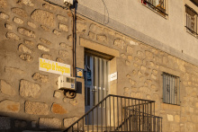
Accommodation in Mombuey
| Albergue de Mombuey Donativo€ 8 |

|
| Hotel La Ruta | 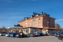
|


Accommodation in Cernadilla
| Albergue de peregrinos de Cernadilla |


Small shop near the church, and the memorable Bar-Meson El Carmen is on the main road.
When the camino leaves Asturianos if picks up the N-525 but leaves it soon after to follow a paved road that turns to the right. DO NOT miss this turn, or the one just after which removes you from the road entirely. It is a country path all the way to Palacios de Sanabria.
Accommodation in Asturianos
| Albergue de peregrinos de Nuestra Señora de la Asunción 5€ 22 |
|

Between Palacios de Sanabria and Puebla de Sanabria the camino follows more country paths and once again crosses the motorway and the AVE line. Along the way, it passes through the hamlets of Remesal (2.4km), Otero de Sanabria (2.8km), and Triufé (2.5km).
After Triufé it turns south again to cross the motorway and join the N-525. Follow the road to the first roundabout and turn left, descending gently into Puebla de Sanabria.
In Puebla, the albergue and some services are on the east side of the river.


The camino through Puebla follows a path which skips entirely the oldest and best parts. It is a short climb to the top and is recommended, especially for a visit to the Castillo de los Condes de Benavente (with museum).
If you stay at any of the accommodation options on the south side of the city be sure to retrace your steps to get back to the camino, it would be easy to confuse the southern road with the northern one.
The camino follows the road north out of town but soon picks up a trail (before you get as far as the N-525). The walk is scenic, and muddy after a rain. On several occasions, it joins the N-525 but never for very long so keep an eye open for the exit points. It reaches Terroso (9.7km) and then makes a large loop to the north before descending into Requejo de Sanabria.
Accommodation in Puebla de Sanabria


These days Requejo is the defacto heavy truck stop for the nearby AVE construction, with a number of restaurants along the road.
AVE ALERT. The camino has largely avoided any serious disruption because of the AVE construction. However, the mountains of Galicia make for a much more complicated job and the camino has been rerouted in several places. There are plenty of signs indicating the detours, which frequently have you walking on the busy road. The bulk of them occur between here and Lubián. NOTE that the town of Aciberos has been cut off from the camino by these changes.
It is uphill from here to the Portela de la Canda. From Requejo the camino follows a narrow country road adjacent to the river. This road soon ends at another and straight ahead is the OLD camino. DO NOT follow it, rather heed the detour signs telling you to turn right and up the road. It leads back to the N-525 which, unfortunately, you have to follow.
On two occasions the camino leaves the N-525 in search of a safer path, be certain to follow both. At the entrance to Padornelo you can either turn left to walk through the lower part of town or you can keep on the road (the camino returns to it).
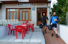
Accommodation in Requejo de Sanabria
| Albergue de Requejo 5€ 20 |
|
| Albergue Casa Cerviño 15€ 10 |
|
| Hostal Tu Casa |
| Hotel Maite | |
| Hotel Mar Rojo |

The bar in town is located in the Hotel along the road.
The camino leaves Padornelo along the N-525 to a junction. Here there are signs indicating a detour (the old way turned to the right and went through Aciberos). Now the camino keeps on the road to pass over the A-52 and then a short distance later right back under it. It then turns left to follow a rural track up to Lubián.
Accommodation in Padornelo (Zamora)
| Hotel Padornelo | 
|
 on the Camino de Santiago")
The albergue is not well marked but is one of the first buildings in town. The rest of the services are along the main road. For the forseeable future this otherwise sleepy village is kept a bit lively with the business brought by the AVE construction crew.
The camino follows the secondary road out of Lubián, downhill from the main road. It turns right after a few twists in the road to follow the signs to the Santuario de La Tuiza. It descends to pass under the A-52 and pass by the Santuario. From here it climbs to the Portela de la Canda, the gateway to Galicia.
Accommodation in Lubián
| Albergue de Lubián 3€ 16 |

|
| Casa Rural Val dos Pigarros |
The camino emerges onto a paved road at the alto and almost immediately leaves it, turning left to descend along another track. It passes through the hamlet of A Canda (1.4km) and soon begins its descent into Vilavella, passing beneath a railway line along the way.
From here the camino begins its march through Galicia and there is no shortage of ups and downs. They mellow in altitude as you travel west, but increase in frequency.


Note that both bars are off the camino, uphill from the camino. The same goes for the Hotel. This is the only option to fill up between Lubián and La Gudiña.
The camino descends to O Pereiro (3.8km) and then climbs to O Cañizo (5.3km). It then joins the N-525 as it enters La Gudiña.
Accommodation in Vilavella
| Hotel Spa Vilavella ⭑⭑⭑⭑ | 
|


There is a variant of the camino Sanabrés which turns south and passes via Verín and Xinzo de Limia. Mind the arrows to keep to the itinerary below.
From the albergue, pass back under the railway bridge and head back towards the N-525 but turn right onto the Rúa Mayor before you get there. A few hundred meters ahead the camino splits, the route below is the Laza option (straight).
The way to Campobecerros begins with a climb almost entirely along a quiet paved road with excellent views all around. It passes through Venda do Espiño (4.5km), Venda da Teresa (3.2km), Venda da Capela (2.3km), and Venda do Bolaño (3.2km) before descending steeply into Campobecerros.
Accommodation in La Gudiña
| Casa da Viúva 10€ 44 |
|
| Pensión Óscar |
| Hostal La Madrileña | |
| Hostal Suizo |
| Hotel Relojero |


The camino follows the road to Porto Camba (3.3km) and then picks up a trail to the hamlet of As Eiras.
Accommodation in Campobecerros
| Casa Núñez |

No bar per se, but a small table set up by the local Friends of the Camino which is self serve.
The road begins again in As Eiras and the camino follows along it to Laza. Take your time here and enjoy the views.


A number of restaurants in the center, La Picota is a favorite amongst locals. The albergue is a bit out of town in a new building and is run by the local Protección Civil. Their office is adjacent to the Casa do Concello as you come into town and the key is available there.
Between Laza and Soutelo Verde the camino follows the road, a mostly flat walk along the valley. It leaves the road to the left to pass through Soutelo (bar) (3.3km). It returns to the road and then turns right onto a rural track to Tamicelas (3.2km). From Tamicelas it begins the climb to Alberguería.
Accommodation in Laza
| Albergue de peregrinos de Laza 10€ 34 |
|
| Pensión Blanco Conde |
If you visit only one bar on the whole of the camino, make it the one in Alberguería and leave your name on one of the thousands of shells adorning the walls and ceilings.
Rural walking, on the road and off again in several places with a descent into Vilar do Barrio.
Accommodation in Alberguería
| Albergue El Rincón del Peregrino 10€ 15 |


Paved walking along the road through the hamlets of Bóveda (2.2km), Vilar do Gomareite (bar) (0.9km), Bobadela a Pinta (5.3km), Padroso (bar) (1.1km), Cima de Vila (1.7km), and Quintela (1.4km). As you enter Xunqueira de Ambía on a back road the albergue is one of the first buildings on your right.
Accommodation in Vilar do Barrio
| Albergue de peregrinos de Vilar de Barrio 10€ 24 |
|
| Casa Rural A Casa do Adelino |

It is said that the name of the town, and its prominence as a religious center, both date back to the 4th century. It was then that the Virgen appeared in the marsh (juncal) nearby. An Ermita was erected, and in subsequent centuries the Monastery was built and expanded. The monks there provided shelter for pilgrims.
After passing the church the camino turns right to follow the road towards Salguieros, but quickly leaves the road to follow a side road and track down to the Río Arnoia (0.9km). It then climbs up to A Pousa along another track which turns off from the road shortly after crossing the river.
Accommodation in Xunqueira de Ambía
| Albergue de peregrinos de Xunqueira de Ambía 10€ 24 |
|
| Albergue Casa Tomás 18€ 9 |
|
| Casa Rural Do Souto |


Between A Pausa and Ourense the camino is almost entirely along paved roads (see River Walk exception below). It passes through the hamlets of Salguieros (bar) (1.6km), Veirada (1.6km), Ousende (0.9km), Panelas (bar, shop) (0.9km), Venda do Río (2.1km), Pereiras (bar, shop) (0.5km), A Castellana (the urbanization begins) (bar) (2.3km), and Reboredo (bar, shop, pharmacy) (2.2km) before reaching Ourense’s nearest suburb of Seixalbo.


From Verín you can rejoin the other route in Laza (due North along the Támega Valley), or continue along this more southern route to Xinzo de Limia.
Accommodation in Verín
| Albergue de peregrinos de Verín 10€ 38 |


Accommodation in Xinzo de Limia
| Albergue de peregrinos de Xinzo 10€ 15 |
Accommodation in Allariz


From Seixalbo and the Capela Santa Ádega, the camino descends towards Ourense, either along the main road or a side road. It eventually reaches a large PEUGEOT car dealership. STOP.
The official camino from here is along the road more or less straight into the center of Ourense. To your left is an alternate route to follow the river into the city.
Though not marked with yellow arrows, this river walk is easy to follow and is used by locals out on a walk. It follows both sides of the river but since you will need to exit to the east it is best to stick to the right bank.
The route requires a road crossing (the river runs under the road) near the Ford factory but the river path resumes once on the other side.
From the Ford factory the river walk passes under 5 bridges, and after the 5th one, it becomes a boardwalk for a short distance. At the 6th crossing (all overhead) it is time to turn right and away from the river. With the river behind you walk straight towards the main road and the center of the old town on the opposite side.
What this route lacks in signage it makes up for in scenery (and lack of industry).


Ourense’s everlasting tourist attraction is its natural thermal spas. It is said that the Romans settled here because of the warm waters, though more likely is the strategic location along the Río Miño and the gold within it.
The spas are still open to the public, some are free and others are not. Surprisingly, the free ones are the best but come prepared in a proper bathing suit or expect to be turned away. The ones closest to the city center are the Termas Chavasqueira, across the river and to the west.
If all of that sounds like too much trouble (it's not, go for it) just stick to the old town. Not too big, not too small, it is easily seen in a short afternoon.
The Cathedral here, one of 5 in Galicia, retains a polychromatic portico.
Just beyond the río the camino again splits. Here again the arrows leave a bit to be desired, there is only one set of arrows to indicate the split. They are painted on the sidewalk and are fading.
Here is how to find the way:
Once over the Río Miño keep to the right side of the road and head uphill. You will pass 4 streets: Rúas Ribeira de Canedo, Mercado, Ramón y Cajal, and Vicente Risco). As you near the fifth (a much larger intersection) keep an eye to the ground for the arrows. From this junction, the camino either continues straight (the LEFT route) or it turns right (the RIGHT route). Both routes merge in Casas Novas.
RIGHT ROUTE - 18.9km
From the right-hand turn at the split, this route follows the N-525 uphill for about 1km. Follow on the right side of the road to see the arrows. At the gas station, the camino veers right and begins to climb steeply up to Cudeiro.
LEFT ROUTE - 17.6km
From the split continue straight up the hill, and keep to the right-hand side. The road passes the train station (on your right, bar) and follows the road to Quinitela.
Accommodation in Ourense
| Albergue de peregrinos de Ourense 10€ 42 |
|
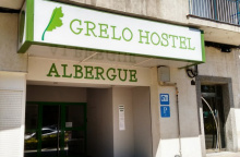
| Albergue Grelo Hostel 15*€ 32 |
|
| Albergue Augas Quentes 18€ 36 Booking.com |
|


Just beyond the río the camino again splits. Here again the arrows leave a bit to be desired, there is only one set of arrows to indicate the split. They are painted on the sidewalk and are fading.
Here is how to find the way:
Once over the Río Miño keep to the right side of the road and head uphill. You will pass 4 streets: Rúas Ribeira de Canedo, Mercado, Ramón y Cajal, and Vicente Risco). As you near the fifth (a much larger intersection) keep an eye to the ground for the arrows. From this junction, the camino either continues straight (the LEFT route) or it turns right (the RIGHT route). Both routes merge in Casas Novas.
RIGHT ROUTE - 18.9km
From the right-hand turn at the split, this route follows the N-525 uphill for about 1km. Follow on the right side of the road to see the arrows. At the gas station, the camino veers right and begins to climb steeply up to Cudeiro.
LEFT ROUTE - 17.6km
From the split continue straight up the hill, and keep to the right-hand side. The road passes the train station (on your right, bar) and follows the road to Quinitela.

After crossing over the main road through Cudeiro the camino continues to climb. It passes several hamlets along the way and eventually returns to the N-525 (which wound around the mountain). It crosses the road and shortly after turns right to enter Tamallancos via a back road.

From Tamallancos the camino follows loosely the N-525 to Casas Novas, but seldom directly on it. It passes through the hamlets of Bouzas (bar) (0.7km), Sobreira (bar) (3.7km), and Viduedo (bar, shop) (1.5km).

The old part of town is an ancient knot of confusion but somehow it is impossible to get too lost. Every other building seems to have a legacy as a bakery (a few remain) and there are a few hórreos still standing.
There are about 17 bakeries in this small village, and the locals tell of a time when there were closer to 50! They all produce the same Pan de Cea, the only bread in Galicia which is protected and monitored for quality in the same way that wines have a D.O. By definition, all of the loaves meet strict requirements for weight and production. Every aspect is strictly governed; from the stone ground flour and water source to the kneading method, and even the types of wood that can heat the oven. Every one of the over 300.000 loaves that are baked annually weighs the same, have the same shape and color, and make the same divine crunching sound when they are ‘opened’.
The camino crosses the main road and heads uphill towards a sporting facility. Around the back side of the building, the camino once again splits into two distinct routes. Here the choice is a bit more complicated than the previous option. The two options merge in Castro-Dozón.
Accommodation in Cea
| Albergue de peregrinos de Cea 10€ 40 |
|
| Casa Mañoso Booking.com |

|

The camino crosses the main road and heads uphill towards a sporting facility. Around the back side of the building, the camino once again splits into two distinct routes. Here the choice is a bit more complicated than the previous option. The two options merge in Castro-Dozón.
PIÑOR ROUTE - 14.8km
Shorter and more direct route to Castro Dozon, but without an albergue along the way. Take care along the latter half as the waymarks are difficult to find. It follows mostly rural tracks and country lanes and passes several names and un-named hamlets along the way. The identifiable ones are:
Porto De Souto 1km
Cotelas (bar) 1km
Piñor (bar, pharmacy) 1.6km
Fontelo 0.8km
Arenteiro(bar) 0.7km and
O Reino 1.4km
After O Reinothe camino rejoins the N-525 and passes through the village of Carballeda. At the far end of town, just before the exiting Carballedasign, the camino turns left and heads towards the motorway. It passes beneath it and soon after turns right off of the road to begin the climb up to Castro Dozón.
OSEIRA ROUTE - 18.4km from split
The RIGHT route is the official camino and is a bit longer than the newer Piñor variant. It passes through the village of Oseira(Monastery and Albergue) and is scenic. It is better waymarked than the variant.
Turn right at the split. The paved road comes to an end and you pick up a track through the forest. About halfway to Pielasthe camino rejoins a paved road.

A sleepy hamlet with a new bar for pilgrims.
The camino follows the road out of Pielas, downhill to Oseira.
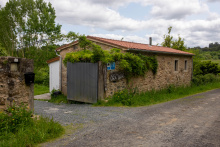
Oseira is hard to miss for the looming and massive Monasterio de Santa María de Oseira. It is well worth a visit. Built in the 12th century it was originally a Cistercian order of French monks. They stayed a surprisingly long time but like nearly every other religious order they were turned out by the Royal Order of Ecclesiastical Exclaustration of 1835. It took nearly a century to pass before the Monastery was again occupied, this time (and still) by Trappists (Cistercians of the Strict Reform).
The way out of Oseira is not along the road (though cyclists may prefer it for the more gentle grade) but rather up a steep track adjacent to the road with the restaurants.
It passes the hamlets of Vilarello (2km), O Outeiro (2.5k), Carballediña (1.5km), and A Gouxa (bar) (0.4km) before nearing the motorway and Castro-Dozón.
Accommodation in Oseira
| Albergue del Monasterio de Oseira 8€ 40 |

|

From Castro-Dozón the camino resumes its on-again-off-again dance with the N-525. It does so for about 4.5km. From there it veers left off of the N-525 and descends passing the hamlets of Puxallos (1.5km) and Pontenouf (2.3km). From there it climbs back up to the motorway, passing A Xesta (1.6km) along the way to Estacíon de Lalín.

The camino continues its course through rural Galicia, through a number of ‘places’ along the way. A Eirexe (bar) (3.6km) is the only place for a stop.
Accommodation in Estación de Lalín

Meals available at a bar a bit further along the main road. Buses to Santiago from Ourense stop here.
At the albergue in A Laxe, the Camiño de Inverno joins the Camino Sanabrés. From here the Camino is well marked and well trodden to Santiago. The following towns and distances will give you all you need to plan your remaining days. The most obvious stages are from A Laxe to the albergue in Outeiro (34 km) and from there to Santiago (17 km, allowing for plenty of time to get to the pilgrims’ mass).
Shortly after leaving A Laxe, you will pass the Pazo de Bendoiro, a restored manor house with its spa treatments and swimming pool. Beautiful but pricey, single room with breakfast reported 63 € in 2019.
The camino takes you into the woods and ascends to a lovely old bridge, originally Roman but with much rebuilding. The bridge is hidden in the forest and inaccessible to cars. A bit further on, the Romanesque church at Taboada has a carving of Samson over the doorway. You have to cross the busy highway to get there, but it is worth it, just a stone’s throw from the Camino. Volunteers keep the church open for pilgrim visits; 8:30h -15;10h, closed Tuesday.
Accommodation in A Laxe
| Albergue de peregrinos de A Laxe 10€ 28 |
|


Accommodation in Transfontao
| Albergue Turístico Trasfontao Booking.com |

|

Bar Gerardo just before entering town is recommended.
On the main street of Silleda, the Bar Toxa offers an occasional pulpo (only on Tuesday) and Ribeira Sacra wine special when you see the pulpo-boiler set up outside the front door. Inexpensive rooms are available upstairs. 15€ in 2018. Mixed reviews.
The farmacia here is known to double its prices for foreign pilgrims.
The last 40km to Santiago is through pleasant Galician farmland. It is close enough now that the proximity to the roads and major highway interchanges means lots of crossings. The way from here is well marked and easy to follow.
Accommodation in Silleda
| Albergue Turístico Silleda 10€ 20 Booking.com |

|
| Albergue El Gran Albergue Silleda 15€ 20 |

|
| Casa Novas Hostelería Booking.com |
|


Good food and warm company at Bar Arume, which is located up the hill on a side street soon after you enter Bandeira. Sandwich vegetal recommended.
Bar Plazoleta, just over the road from the Hostal Conde Rey, in a small square, is also great.
Hostal Victorino, tel. 986 585 330
Cross to the right side of the road as early as is convenient, at the end of town the camino veers right and trying to cross at that point is dangerous.
Accommodation in Bandeira
| Albergue de la Xunta de Bandeira 10€ 36 |
|
| Hostal Conde Rey Booking.com |

|

In that place, a young Italian couple, Cristina and Andrea, has renovated a house and opened an albergue, called Casa Leiras 1866. It is directly on the Camino.
A 300 m detour down to the N-525 highway will take you to a bar/restaurant El Emigrante.
From Dornelas the camino descends to the Río Ulla, passing through San Miguel de Castro (5km) along the way.
Accommodation in Dornelas
| Albergue Casa Leiras 1866 15€ 10 |
|


Día grocery store on the way out of town; stock up if you are going to the albergue in Outeiro. Excellent panadería and bakery in town right on the Camino, in the block or two after you cross the river.
Bar Ríos. Immediately across the bridge on your right. Tel. 981 512 305. Restaurant and rooms available. Room prices seem to vary by season, from 10-15-20 €, based on what pilgrims have reported. Food reported to be quite good. Menú del día 12€, with additional charge for wine after the first glass.
Pensión O Cruceiro da Ulla; tel. 981 512 665; info@ocruceiro.es. Located across the street from the Día grocery store. Newly constructed, functional, good service and good prices. They also have an albergue.
Hostal Churrasco de Juanito; tel. 981 512 619. Located on the Camino, soon after crossing the river. 30€ room, 14€ menú reported as overpriced and not great. A pilgrim walking in October 2014 said he got a room for 15€ and a meal for 8€, so walking off-season appears to have its financial benefits. More negative than positive reports on this establishment, however.
For any foodies out there, the Restaurante Villa Verde is the place to go. Walk straight from the bridge into Ponte Ulla. When you get to the intersection with the AC-240 road, to the left is the Camino. Turn right, go up the hill and in a few minutes you’ll see the Restaurante on the right side of the road, located in an old stone house, very pretty. No menú del día, all a la carte. One 2016 pilgrim describes a yummy meal for 42€, which is probably beyond the typical pilgrim budget. It may be worth a splurge, though, because the pilgrim enjoyed a feast of home-smoked salmon over fresh tomatoes, roballo (my favorite Galician/Portuguese fish, maybe something like sea bass in English ??), and a walnut and banana torte. Coffee and a few glasses of albariño.
The camino follows briefly a section of the N-525 as it leaves Ponte Ulla; this section can be a bit dangerous so keep an eye open for the two times it leaves the road. The first is to your left, so you’ll need to cross the road. The second is to your right which means you will have to cross back. 500m separate the two crossings. If these crossings sound unnecessarily dangerous to you, you are not alone.
After the second crossing, the camino returns to safer side roads as it climbs to Outeiro.
Accommodation in Ponte Ulla
| Albergue-Pensión O Cruceiro da Ulla 12€ 18 |
|

A bar will deliver meals. Your best bet is probably to bring up food from the Día supermarket in Ponte Ulla.
From Outeiro the camino passes through Lestedo (3.7km), A Susana (bar, pharmacy) (3.4km), Aldrei (3.1km), and Santa Lucía (bar) (2.3km).
The camino enters Santiago from a neighborhood called Sar, named for the modest river that flows through it. It is here that you will find the Colegiata de Santa María a Real, a 12th-century construction that is well worth a short visit. It is to your left just after crossing the river. From the church, the camino continues along the same road, and eventually steeply uphill to the old town.
At the top of the hill, the arrows are a bit hard to find. There is nothing more to do than to cross the road and head into the old town via the last standing gate, the Puerta de Mazarelos. Continue through it and keep on going straight (against traffic). You will pass a statue to Alfonso II at the highest point (geographically speaking) of Santiago, and here keep on going straight where the road narrows considerably. At the next crossroads, turn left steeply downhill. At the bottom stands the Cathedral.
Accommodation in Outeiro (San Pedro de Villanova)
| Albergue de peregrinos de Outeiro 10€ 32 |
|


Good lunch specials at Restaurante Via de la Plata along the carretera.
The rest of the way is through the suburbs of Santiago, which display a mixture of modern construction and old stone houses, many of which are beautiful. The Camino crosses the railroad tracks very close to the spot where the RENFE train derailed in July 2013, killing 79 people and injuring many more. The fence has become a make-shift memorial, with many touching remembrances, photos and prayers.
Accommodation in Lestedo (Boqueixón)
Accommodation in A Susana
| Albergue Reina Lupa 15€ 14 |
|