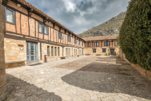
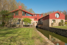
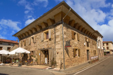
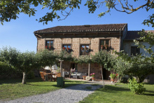
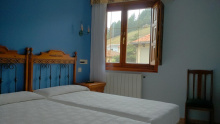
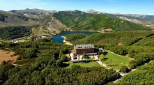
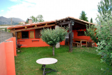
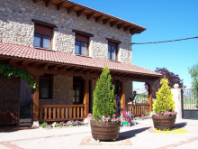
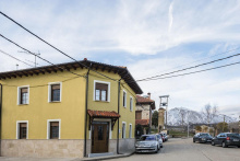
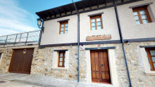
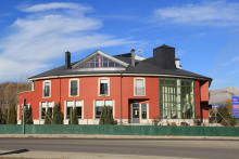
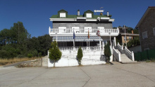
Located a short distance from the camino. Crossing a Roman bridge into the town of Nestar, the Camino leaves Cantabria and enters Palencia.
Accommodation in Nestar
| Casa Rural La Galana | |
| Casas Villa Esperanza |
| Hotel Rural Amontes Rural |
Aguilar is a big town. It was walled in medieval times, and there are a few vestiges left, along with lots of houses with those big coats of arms. The rio Pisuerga runs along one side of the center, and there is a nice paseo. The town square (very lively and friendly) and the Colegiata de San Miguel are interesting. The church has visigothic origins, but what is there now is mainly late romanesque, gothic, and even some later touches thrown in. The inside has lofty gothic arches dividing the naves, and I really liked the choir stalls and baptismal font. But I did not spent much time there, because it was only a stop on the way to my real goal — to get the keys to the Romanesque Santa Cecilia church, on the edge of town, up a hill and a short distance below the castle.
The Casa del Cura is across from the church. Ring the bell, give the priest your passport, and you will get the keys. It’s about a 10 minute walk to the Santa Cecilia church. And oh, wow. The only thing missing to add to the wonder would have been a ring of those huge old medieval keys. Today, the locks have been modernized, but the sensation of unlocking the doors of a romanesque church, which you will have all to yourself, was really something. One or two keys for the door itself, then another key gives you entrance to room with the electric box so you can illuminate the interior. The showpiece is the capital of the Slaughter of the Innocents, which is exquisite. Other capitals are nice as well. But sitting all alone is good balm for the soul, very restorative and calming. After the visit, I went up to the castle ruins and walked around a bit. No entry gates, you can walk freely.
In Aguilar, I have stayed twice at Hotel Valentín. Room price includes breakfast, which was available in the bar below at an early hour. Not cheap, and there are a number of other options. The splurge would be staying at the Posada Santa María La Real. It is located at the edge of town right on the camino, at the end of a pretty promenade. No rooms were available when I was last there, but maybe the third time’s a charm if I ever get there again! A website with nice pictures of the monastery, its cloister, and the Santa Cecilia church.
Aguilar has a big Romanesque institute, which has a museum, but it hasn’t been open when I was there. Another thing to put on my “to do” list when I return.
Day 8. Aguilar de Campoó to Cervera de Pisuerga (29 km).
Aguilar is on the edge of the Monte Palentino, the mountainous region at the top of the province of Palencia. The camino skirts the south side of it, and there are lots of nice views over the next few days. And then after Guardo you are right smack IN the mountains.
The day walking from Aguilar is really lovely. Lots of off-road, lots of river walking. Walk down the promenade in Aguilar to the convent, continue walking till you get to the reservoir, and then go up and around on the right, do not cross the dam.
The first surprise is the anthromorphic tombs right after Corvío. Probably from around the 10th C. I learned that the tombs were made so that bodies always had their feet facing east.
Lots of walking through fields, and then in Salinas de Pisuerga, you cross the rio Pisuerga and walk alongside for 12 kms, all the way into Cervera de Pisuerga. It is very pleasant. About a km or two outside of Cervera, you’ll see a sign pointing you towards the Ermita Rupestre de San Vicente (Rock hermitage of Saint Vincent). It’s about a half km off camino, and highly recommended. Another medieval construction, with more anthropomorphic tombs.
Accommodation in Aguilar de Campoo
Anthromorphic tombs right after Corvío. Probably from around the 10th C. I learned that the tombs were made so that bodies always had their feet facing east.
About a km or two outside of Cervera, you’ll see a sign pointing you towards the Ermita Rupestre de San Vicente (Rock hermitage of Saint Vincent). It’s about a half km off camino, and highly recommended. Another medieval construction, with more anthropomorphic tombs.
Cervera de Pisuerga is a nice little town, good restaurants, cafés on the square, a supermarket or two.
Day 9. Cervera de Pisuerga to Guardo (39 km)
A. Cervera de Pisuerga to Tarilonte de la Peña (20 km).
B. Tarilonte de Pisuerga to Guardo (19)
The 39 to Guardo is obviously a very long day. It starts with a short ascent to an abandoned mine.
From the mine, I was glad to have my GPS. After you descend to the first town, there is a lot of flat, off-road walking with the very pretty Monte Palentina in your sights. It is really a very nice walk, lots of wide open spaces with mountains in the distance.
I know that some have just stayed on the road, the CL-626, but that would be much less pleasant IMO and not much shorter. The camino really takes you through some little villages that time has forgotten ... if only there were a café-bar or two! I remember a very welcome rest in Santibañez de la Peña, about 12 before Guardo, cold drink, nice people. @alansykes reports that the Bar Mylo in Santibañez has rooms, so that would be a 27 km day. I think a phone call ahead would be reasonable — 979 86 02 94
When I walked by myself in 2014 I stayed in Guardo in the Real Hotel. The second time, we stayed in the albergue, which is great. Wonderful hospitalero. The albergue takes in a lot of groups, but they are used to having Olvidado pilgrims. We coincided with a group of mountain bikers and enjoyed the interaction, but I imagine it could get noisy. Both the albergue and the Real Hotel are outside of the center and up a hill, at least 1.5 km away. So bring anything you need with you unless you fancy walking back down. If you are going to take the “old” route to Puente Almuhey, these places are right on the Camino. If you want to take the Caminayo mountain alternative, you will have to go back down and through the center of town to get on that route.
As I look back on my notes, I remember one of those very wonderful camino moments on my first trip through Guardo. I arrived alone dragging my feet. It was a weekend, late afternoon, and I wasn’t sure where I was going to sleep, because a small hotel on the outskirts was full. I saw the ayuntamiento door was open, which surprised me, but I went inside. I heard some voices far in the back and scared the two cleaning people out of their skins when I came upon them and said hola. They then took it upon themselves to find me a place to stay, surely not in their job description. It occurred to me that I got much better treatment from the cleaning staff in this Ayuntamiento than I have gotten in others from the officials in charge. They were so sweet.
SHORTER STAGES
For many 40 km is too long. You can pretty precisely cut it in half with a stop in Tarilonte de la Peña, where there is a small hotel rural, El Yunque. According to the website, the hotel may let you use their kitchen. It is a very small town/village, I remember a nice rest outside the pretty church. A bar is open only May-Sept, 1-3 and 7-10 (sounds like the summer hours when all the Spaniards go home to “their pueblos.” They also own the Casa Rural El Encinar. Stopping in Tarilonte gives you two 20 km days. I am not sure which churches are pictured below, though they are definitely on this day’s walk, but one of them is surely Tarilonte!
So it seems like there are multiple good ways to break up the 40 kms. Once again, we have busted the myth of unavoidably long stages on the Olvidado.
Accommodation in Cervera de Pisuerga
| Hostal Rural El Resbalón Booking.com |

|
| Hostal Pineda Booking.com |

|
| Hotel Rural Peñalabra Booking.com |

|
| Hotel El Roble Booking.com |

|
| Parador de Cervera de Pisuerga Booking.com |

|
| Albergue Juvenil Arbejal |
| Albergue Juvenil Arbejal |
| Camping Municipal |
| Casa Las Vacas |
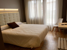
| Hotel Rural Peñalabra Booking.com |
|
| Hotel Rural Molino de Valdesgares | |
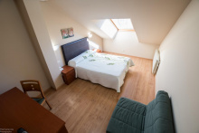
| Hotel El Roble Booking.com |
|
| Hotel Almirez |
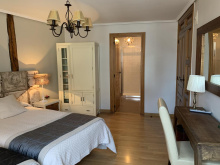
| Hostal Rural El Resbalón Booking.com |
|
Accommodation in Cantoral de la Peña
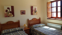
| Casas Valle de Tosande Booking.com |
|
ROUTE 1
Alternate route
Both routes rejoin in Tarilonte de la Peña
For many the 40 km between Cervera de Pisuerga and Guardo is too long. You can pretty precisely cut it in half with a stop in Tarilonte de la Peña, where there is a small hotel rural, El Yunque. According to the website, the hotel may let you use their kitchen. It is a very small town/village, I remember a nice rest outside the pretty church. A bar is open only May-Sept, 1-3 and 7-10 (sounds like the summer hours when all the Spaniards go home to “their pueblos.” They also own the Casa Rural El Encinar. Stopping in Tarilonte gives you two 20 km days. I am not sure which churches are pictured below, though they are definitely on this day’s walk, but one of them is surely Tarilonte!
So it seems like there are multiple good ways to break up the 40 kms. Once again, we have busted the myth of unavoidably long stages on the Olvidado.
Accommodation in Tarilonte de la Peña
When I walked by myself in 2014 I stayed in Guardo in the Real Hotel. The second time, we stayed in the albergue, which is great. Wonderful hospitalero. The albergue takes in a lot of groups, but they are used to having Olvidado pilgrims. We coincided with a group of mountain bikers and enjoyed the interaction, but I imagine it could get noisy. Both the albergue and the Real Hotel are outside of the center and up a hill, at least 1.5 km away. So bring anything you need with you unless you fancy walking back down. If you are going to take the “old” route to Puente Almuhey, these places are right on the Camino. If you want to take the Caminayo mountain alternative, you will have to go back down and through the center of town to get on that route.
As I look back on my notes, I remember one of those very wonderful camino moments on my first trip through Guardo. I arrived alone dragging my feet. It was a weekend, late afternoon, and I wasn’t sure where I was going to sleep, because a small hotel on the outskirts was full. I saw the ayuntamiento door was open, which surprised me, but I went inside. I heard some voices far in the back and scared the two cleaning people out of their skins when I came upon them and said hola. They then took it upon themselves to find me a place to stay, surely not in their job description. It occurred to me that I got much better treatment from the cleaning staff in this Ayuntamiento than I have gotten in others from the officials in charge. They were so sweet.
Day 10A. Guardo to Puente Almuhey 16 km
This route is flat and direct.
On my first Olvidado, the only way to Puente Almuhey was the first option, so I went about 12 km further on to a place that is no longer open. But when I went back in 2019, Ender had marked the 10B mountain alternative, which I’ll describe in my next post.
This route has been modified, much to its improvement.
Day 10B. Guardo to Puente Almuhey (32 km, 500-600m elevation gain, and considered here to be the alternate route)
As Ender’s passion is mountain walking (he lives near La Robla on the Salvador), he has taken it upon himself to provide some options to peregrinos who share that opinion. This one is beautiful.
The alternative mountain route goes down to the river in Guardo and then takes you through the abandoned mining town outside Velilla. Velilla itself has some places to stay, so if you wanted to do the alternative route, you could walk 24 from Tarilonte through Guardo and to Velilla. That would give you a 28 km day through Caminayo, which is what @omicko did. Omicko also gave some specific information. Hostal Stop. Also Casa Moura 979 861 098, 30 € with breakfast.
The rewards of this longer and harder walk are great. First in Velilla there are the ancient Támaricas Fountains. @alansykes reports that, according to Pliny the Elder, if the fountains are dry, you should be dead within a week. We had water, thankfully.<
After the town, you enter an absolutely beautiful forest, with its very hard-to-follow path. Even with my GPS we got off piste and had to take some steep downhills to get back on the path. (My old GPS only takes 500 “points” per track, so at the micro level it is often hard to follow). But it was like a fairy tale forest. Then up and around one of several abandoned mines, and it is tricky. I remember warning @MikeJS about the confusion and he reported “Laurie’s advice about keeping high and left at the coal workings was invaluable. There are so many different tracks in this uphill section until you reach the coal workings it is extremely easy to take the wrong one... After that the way becomes more obvious and on a clear day the view is wonderful.” I felt like I had done a good deed. And that our 20-minute hunt for the trail had not been in vain.
From the forest, out to the ridge, with just gorgeous views. Finally you see the little hamlet of Caminayo below you — it is nestled in the hills and about half of the way down to the level you started at. The walk down is just as pretty as the walk up. Caminayo is a tiny village, but looks to be on a path of revitalization. Some new construction, beautiful old buildings. Two women came and opened the social center to make us coffee, bringing tortilla, cheese and bread from their own homes for us.
The walk down from Caminayo is very pleasant, extremely gentle slope, lots of shade, it is gorgeous. The last kms into Guardo are along the side of the road, but on a dirt track.
This is just one of those days where the views make you gasp, and the people shower you with kindness. No need for further explanation as to why in the world would anyone take a 32 km U-loop with some significant ascent when the straight shot is flat and 16 km. But don’t feel sorry for yourself if you decide not to do it — I think the newly marked direct route looks very pretty. And of course, the earlier you get to Puente Almuhey, the more you can enjoy the great restaurant and the lovely apartments in Duende de Carricuende!
For those who would like to go via Caminayo but don’t want a 32 km day, you can cut off some kilometers on one or both ends. First, sleep in Velilla the night before (cuts off 4.4 km) or get a taxi there from Guardo. Walk through the forest and up to the ridge, down to Caminayo, and then down to Morgovejo. It’s a nice little town with lots of weekend homes that have been renovated. That’s about 20 total. From Morgovejo, call Taxi Sabino in Puente Almuhey and see the last kms along the road from the taxi window.


