The Puerto de Pajares is one of the few mountain passes which for centuries has offered passage over the mountains into Asturias from the meseta. It remained the primary corridor until the construction of the A-66 to the west. It remains a difficult road for drivers and snow is not too uncommon here in June.
The old parador has opened the bar and across the road Venta Casimiro has rebuilt after a fire... it is the bar "de siempre." Parador for views, Venta for soul and a real meal.
The camino leaves the main road to follow a trail behind some farm houses at the far end of the alto; if you have gone as far as the old Parador you will have to backtrack a bit and avoid the temptation to follow the road. At the farm buildings turn right and begin a gentle ascent to the border between León and Asturias. Here you will have to pass through a gate and descend back to the National road you ought to have avoided (it really is quite dangerous). Here you have to cross over the road (CAUTION) to resume along a trail down to Pajares.
NOTE: Along the way to Pajares you will find a junction which requires you to decide between Pajares or San Miguel. The route through San Miguel will also arrive at Pajares but takes 5km longer to do so and is therefore only really recommended for cyclists or for pilgrims who intend to sleep in Bendueños (1.5km off camino).


One restaurant in town closed on Tuesdays. No grocery.
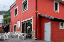
The only meal in town is at the El Mirador. Recommended, and recommended that you call the day before to give them a bit of notice. +34 636 933 069.
Leaving town, stay on the road to the city limits. The camino turns left and begins a steep descent into San Miguel del Rio in the valley below.
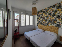
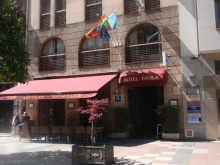
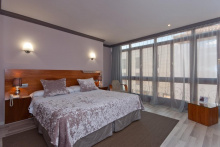
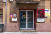
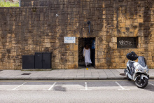
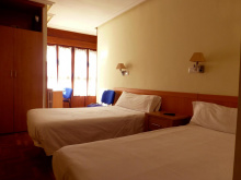
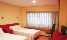
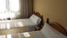
Accommodation in Pajares
| Albergue de Pajares 5€ 16 |
|
| Pensión El Mirador | 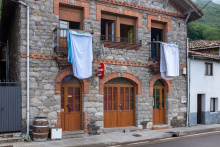
|


NOTE: From San Miguel follow the signs to Santa Marina. The village is divided, and you want the upper half, so turn Left at the first fork in the road where a shell (on your right) indicates that you should keep on the road. DO NOT follow the granite marker which tells you to continue straight.
Later, after following the road to Santa Marina, the camino comes to a chapel and again it is necessary to pay close attention. Here the camino goes through a gate which appears to lead to a private garage. On the other end of the farm are two more wooden gates and beyond them another path which covers the remaining 2km to Llanos de Somerón.


Fountain, and a place to relax in front of the church. If you do so, don't be surprised if a local comes along to unlock the church for you to visit.
From here on to Puente de los Fierros there are two options.
Stay on the road
Before entering the small town look for a path to your left marked Fresnedo. In fact, you do not actually need to enter the town of Puente de los Fierros. This route takes you through two hamlets and past one ermita (San Miguel), and a fountain.
The Munisteriu Alternative
This is a more challenging alternate route which abandons the road shortly after leaving town and which follows a 4.8km mountain trail. It is more rigorous, but most rewarding things are. This route includes an elevation gain/loss of 133 m/-387 m.
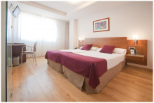
Accommodation in Llanos de Someron
| Albergue Cascoxu 20€ 16 |
|

At the very entrance to Puente de los Fierros, the camino splits into two different routes. The more common, less scenic, and completely along the roadway version is to the right and is signed La Frecha. Over the bridge, turn left and follow the N-630. Alternatively, you can return to the mountains by turning uphill to your left towards Fresnedo. This route takes you through two hamlets and past one ermita (San Miguel), and a fountain. Both routes rejoin in Campomanes. If you ask me, take the upper route via Fresnedo. The work you put into it will be worth avoiding the unforgiving asphalt.
Note that the albergue is actually in Bendueños, a 1.5km hike uphill. Ordinarily Sandra is willing to drive down to pick you up but as of May 2022 her car troubles might make that impossible. In any case, call her before you arrive... preferably the day before.
Accommodation in Herias
| Albergue de peregrinos Santuario de Bendueños Donativo€ 8 |
|

Campomanes is the return to civilization that you may be looking for. Restaurants, bars, and private accommodation are to be found here. The town sits between the old national road and the fancy new autopista. Geographically speaking it lies at the north end of the convergence of two valleys.
The camino will continue straight through the town turns right to cross the N-630 and a bit later the river. Just past the river it doubles back on itself to the left to follow a road along the river and to the Iglesia de Santa Cristina de Lena.
Accommodation in Campomanes


In Vega del Rey keep a lookout for the black pedestrian bridge on your right. Across the highway, and up a short but rigorous climb, lies one of the most important little churches in Asturias... the Iglesia de Santa Cristina de Lena.
Vega del Rey is no longer on the camino from Campomanes, but it is possible that you have arrived here by taking the road from Campomanes instead of crossing the river. If that is the case there is a pedestrian bridge which crosses the busy road to your right and which will bring you to Santa Cristina.

Palacio is not on the camino, but it is the site of Santa Cristina de Lena, the church mentioned above. It is also included in the guide because there is a hotel there, however getting there and back adds 2 km to your journey.
Accommodation in Palacio

Pola de Lena is a larger town than any other you have seen since León, spread lengthwise along the road. There is an albergue with basic services located near the train station, and plenty of bars and groceries to meet pilgrim needs.
Accommodation in Pola de Lena
| Albergue de Pola de Lena 6.75€ 36 |
|


Upon entering Ujo keep to your left if you wish to stop for a coffee or breakfast. To your right is an exercise path that you can also take but which doesn't pass any of Ujo's services.
The Church, the train station, and the breakfast bar are all in the square which is to your left when you follow the road. Both routes meet up at the end of town, and from here to Mieres, you will follow the exercise trail.

Included in the guide for the sake of measuring distances, Santullano for pilgrims is nothing more than a train station.

Another commercially oriented town, Mieres has all services.
Cross over the river and into town. If you are not interested in the town, and would rather breeze through it, continue straight after crossing the bridge, through the first major intersection. At the second one (with a large car park on your right) turn left. You will pass an urban park and at the end of the park you have two options:
1. Carry on straight, turning left at the very end of the road and rejoining the camino.
2. Reconsider your intent to breeze through town, and turn right to visit the Iglesia de San Juan. If you choose this route, just turn left again when you get to the church. The road wraps around the city and meets option 1 very quickly.
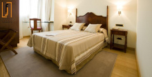
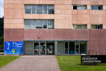
Accommodation in Mieres (Salvador)
| Residencia Universitaria del Campus de Mieres 22€ |
|
| Hostal Pachín |


From La Peña you begin the 5km climb to El Padrún. There are rest places along the way as the camino passes through a few small villages.
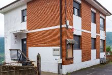
Accommodation in La Peña
| Hostal La Peña | 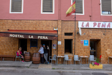
|


Fountain. Beneath you (by some 200m) runs the A-66.

Continue along the main road out of Olloniego, past El Cruce, and over the bridge to El Portazgo.

El Portazgo is more of an outpost than a village, in fact the neoclassic building on your left once you cross over the rio Nalón was originally the toll station where you would pay for the pleasure of doing so.
DO NOT stay on the road here, but look to the left for a pair of mojons which direct you up a steep path. It is about 600m uphill until you emerge on a road with a few houses, turn left and continue on the road past a multipurpose sports field. Not far beyond the sports field the camino leaves the road along a narrow path gently to your right.


All of the steepest climbs are now behind you. From here to Oviedo the camino follows along gently rolling hills.

Oviedo is now visible, weather permitting, to your north.
Arriving along Camino San Salvador: Shells and arrows will bring you right into the old quarters of Oviedo, passing a plaza and the beautiful Ayuntamiento building. There is talk of a new certificate which you can claim upon completion of the route, but details of where to find it are not yet sorted out. For now, you are advised to ask in the Cathedral or in the Albergue de Peregrinos.
Accommodation in Oviedo at the end of the San Salvador
| Albergue Turístico La Peregrina 20-25€ 26 Booking.com |
|
| La Hospedería Oviedo 20-25€ 10 |
| Albergue de El Salvador de Oviedo 8€ 14 |
|
| Hostal Los Arcos | |
| Hostal Romero ⭑⭑ Booking.com |
|
| Hostal Álvarez ⭑⭑ Booking.com |
|
| Hostal Fidalgo Booking.com |
|