The Camino Portugués
From Porto to Redondela on the Coastal Route
Lisbon to Porto
▶ Porto to Redondela on the Coastal Route
Porto to Redondela - Central Route
Redondela to Santiago
Variante Espiritual
Accommodation Directory
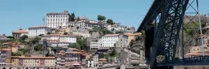
Porto is half the size of Lisbon, and twice as wonderful. It sits perched on the hillside on the north bank of the Rio Douro and has a historic center that would take two days minimum for only a casual stroll. If you plan on having a rest day, this is the town to do it in. If you had not planned on a rest day but had a long walk into Porto keep in mind that they way out of town is an arduous one too.
In Porto the buildings to see are the Igreja do São Pedro dos Clerigos and it's adjoining tower (5€, but the view from the top is unparalleled and 360°; don't bring your backpack with you as the 200 steps to the top are a tight enough squeeze as it is), the Igreja do Carmo (unassuming from the outside but spectacular inside), and of course the Sé do Porto (the Cathedral of Porto is one of the oldest surviving building in the city).
If you entered town along the upper bridge crossing you will have missed the Cais da Ribeira, the riverside boardwalk popular with tourists and locals alike. Somewhat overpriced but the atmosphere makes up for it.
Before you set off be certain to pick up a pilgrim’s credencial if you have not already done so. It can be found at the Sé Cathedral. This accordion-fold booklet is your passport to the camino and will become your most cherished souvenir of the trip. It is a required document in most pilgrim-specific accommodation, earns you pilgrim prices in many museums, and will serve as proof of your journey when presented to the Pilgrim Office in Santiago if you are planning on getting your Compostela Certificate.
As large towns go, Porto is no different when it comes to finding the camino. In fact, it is complicated somewhat by the fact that there are three different caminos between here and Santiago, be aware that you may see signs indicating the ‘Coastal Route’ or the ‘Braga Route,’ or the ‘Central Route’; amongst others.
Porto has a nice nickname among Portuguese historians, who call it The Unvanquished City for having resisted the unlawful siege by King Miguel I. He wasn’t too keen on implementing the liberal constitution that was drafted after a local rebellion but after 18 months of attacking the city he abdicated the throne and the constitution was restored. It was a victory for the Enlightenment and those who sought to distance themselves from the traditional Roman Catholic values.
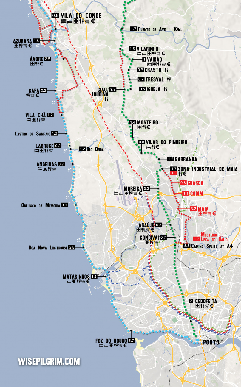
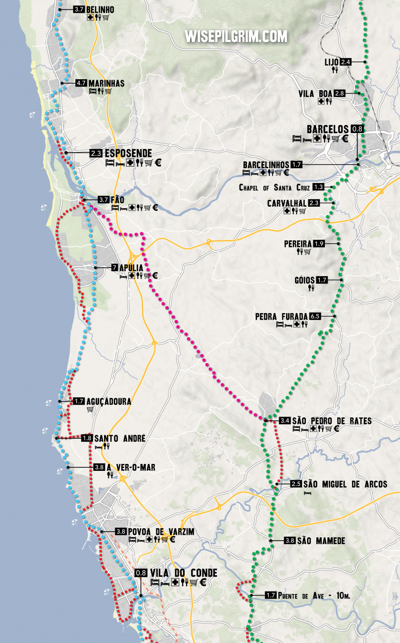
Between Porto and the border with Spain, the camino splits into three distinct routes. They are known as the Central Way, the Coastal & Litoral Ways, and the Braga Way. Additionally, there are several paths that connect each of these options, creating a network of trails that can sometimes seem confusing. The best plan is to pick one of the options and simply follow it to its natural end.
Leaving a large city is often a challenging combination of searching for arrows, heavy traffic, and durable city pavements. As an alternative, it is possible to take the Porto Metro to the city limits or beyond.
THE CENTRAL WAY
The Central Way is currently the most popular and well-developed option. As the name implies, the route continues due north from Porto up the center of Portugal. It crosses into Spain at Valença/Túi and continues from there through Redondela to Santiago.
THE COASTAL and LITORAL WAYS
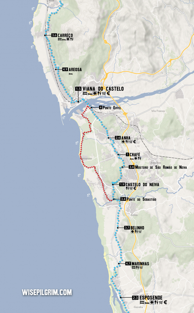
The Coastal Way is gaining in popularity as the infrastructure and signage improve. It is sometimes referred to as the Senda Litoral, although this name is technically reserved for the sections of the route that strictly follow the coast. As the primary motivation for choosing the route is the proximity to seaside views, the route set out in this book is a combination of these two routes and the blue line indicated on the map should be interpreted as such. It leaves Porto along the Litoral Route, rather than sharing the first day of walking with the Central Way before turning westward. Where options exist they are indicated on the inset maps. The route passes through Vigo and rejoins the Central Way in Redondela.
THE BRAGA WAY
Some would consider this the original way, as it passes through the city of Braga where many of the Church's earliest decisions regarding Santiago were made, and where the first Bishop ordained by Santiago (Saint Peter of Braga/Rates) officiated. It was once the capital of Galicia and remains an influential city and massive tourist attraction. These days the infrastructure along the route has not kept pace with the needs of pilgrims and it is seldom traveled. Tours to Braga can be arranged in Barcelos (on the Central Way) if you wish to visit the city. This route is not included in this guide.
THE VARIANTE ESPIRITUAL
The Variante Espiritual is a popular alternative route north of Pontevedra. It is a two day walk which ends in a 29km boat ride to the town of Pontecesures.
Accommodation in PORTO - LUNGO IL PERCORSO COSTIERO.
| Albergue de peregrinos Porto 16€ 52 |
|
| The Poets Inn Booking.com |

|
| Porto Lounge Hostel 17*€ 26 Booking.com |

|
| Albergue de Peregrinos da Senhora da Hora 12€ 20 |

|
The Metro of Porto Line A (Linha de Matosinhos) ends at Matosinhos and is a convenient way to bypass the least exciting scenery when leaving Porto. It is also possible to arrive here via the Porto Airport with only one transfer, if you do not plan to see Porto.
The camino enters town along the beach-front, and turns inland when it reaches the harbor, making a zig zag path to the bridge over the Río Leça. At the end of the bridge you will turn left at the large roundabout, to follow the Rua Hintze Ribeiro back towards the waterfront.
Accommodation in Matosinhos.
There is a bar at the group of buildings near the lighthouse, as well as the Capela de Boa Nova.
Passing the lighthouse, keep your gaze to the left, where you can enjoy a sea view far superior to the oil refinery to your right. Between here and the Obelisk you will follow off and on a walkway, passing several food options.
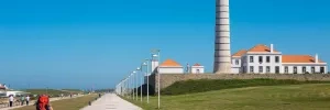
From the Obelisk, keep on the beach-side walkways straight ahead. You will pass several bar/restaurants along the way to the Angeiras Sea Houses. The camino follows a pedestrian promenade alongside the sea.

At the start of town are the Angeiras Sea Houses. If niche museums are your thing, these fisherman cottages are for you. Angeiras has a long history as a fishing village.
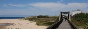
At the end of town, leave the road and rejoin the familiar wooden boardwalk, it will soon cross the Río Onda to rejoin the road into Labruge.
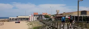
Labruge is a small seaside town, and most services (including the albergue) are located off the camino.
At the end of town is the Avenida Da Libertade, turn right here to get to the albergue or continue straight along the beach walk. Arrows are sparse, but a few point the way to the Castro of Sampaio.
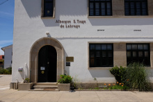
Accommodation in Labruge.
| Albergue de S. Tiago 15€ 102 |
|
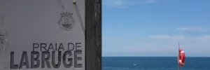
The camino leaves the familiar beach setting but follows close to the shore while it climbs to reach the chapel and castro of San Paio. From here follow the walkway along the dunes to reach Facho - Vila Chã.
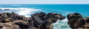
At the start of town the camino turns away from the shore and passes through the village, gone is the wooden boardwalk. It will stay some distance from the shore until Povoa de Varzim.
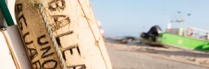
Be aware that beyond Mindelo the sands have taken over the boardwalk. The alternate route (shown in red) is recommended for anyone traveling with wheels.
There are two ways from Mindelo to Ávore, one along the waterfront and one inland. In recent years the waterfront option has become sand-swept, making it difficult for cyclists.

From Ávore the walking is entirely along paved roads.
The Metro of Porto Line B (Linha da Póvoa) passes through Azurara. To stop here, disembark at the Azurara station, but note that one more stop takes you to Vila do Conde’s Santa Clara station.
Between Azurara and Vila do Conde flows the Rio Ave. Once over the bridge, turn left and walk along the park and Plaza de la Republica. At the end of the park follow straight (along the waterfront) until the next side street (the Rua do Lidador) where you turn right and uphill. At the top of hill there is an intersection of the old-town style, which is to say many directions all difficult to describe. Keep straight here, if somewhat to the right, and head towards the Igreja Matriz.
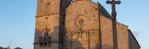
Vila do Conde is the first town along the coastal route which merits an extended visit. It is a popular destination for the Portuguese, though it is somewhat out-sized by the larger Póvoa de Varzim to the north.
Its Bronze Age discoveries aside, the more contemporary sights to see are the Aqueduct of Santa Clara (17th and 18th century), whose 999 arches carry water some 4km to reach the Convent of Santa Clara (14th century), the Igreja Matriz in the city center, and the Forte de Nossa Senhora da Assunção (a fortress which often goes by Forte de São João Baptista).
The aqueduct and the convent are a right-hand turn after crossing the bridge, the fort is a bit out of the way, but does fall along one of the waterfront alternatives.
The Metro of Porto Line B (Linha da Póvoa) passes through Vila do Conde. To stop here, disembark at the Santa Clara station.
Vila do Conde is among the oldest known settlements in Portugal, with discoveries in and near the city which date to more than 100,000 years ago. More recently it was a sea port that played a critical role in Portugal’s 16th century Age of Discovery. King Manuel I passed through on his pilgrimage to Santiago in 1502, a visit which subsequently saw the construction of the Igreja Matriz and several other notable buildings.
If you are hungry, and have 9 days to spare, the Feira de Gastronomia is held during the 3rd week of August.
A well known crafts fair, the Feira Nacional de Artesanato, is held between the last week of July and runs through the first week of August.
Friday is market day, held next to the church.
From the Igreja Matriz you have two options, the one indicated by the signs takes you through the center of this large town and carries on straight past the church. It is well marked.
The other option is to follow along the Litoral route which is unmarked but easy enough to get to. Opposite the church (on your left as you approach the church) is a small plaza, cross it and follow to the right. Turn left on the second street, the Largo de Doutor Antonío José Almeida. This will take you down to the waterfront, where you turn right and follow the walk all the way to Povoa de Varzim. Just past the harbor the beach-front picks up, and it is here where the main route rejoins.
Accommodation in Vila do Conde.
| Hi Vila Do Conde - Pousada De Juventude 24+*€ Booking.com |

|
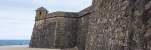
There exists an unofficial route that allows you to leave the Coastal route in Vila do Conde to join instead the Central route in Saõ Pedro de Rates. It is marked with two sets of arrows; one set is newer and brighter, and the other is faded and can be difficult to see at times. They do not always agree, but both will get you to where you want to go. There are two occasions where they need a bit of extra explanation, and the latter is drawn on the map as a red trail and is further explained below. This route is predominantly road walking, with less than 1km along woodland trails.
To begin, you should know that there are no arrows in Vila do Conde that will get you onto this route. While this may be a bit frustrating, it does ensure that nobody will accidentally follow arrows in the wrong direction. Finding the way is fairly straightforward, and once you do, the arrows will slowly emerge.
The best way to get your bearings is from the bridge over the river as you enter Vila do Conde. Visible from the bridge up high and on your right is the Monastery of Santa Clara. 300 years ago, the monastic community that lived here got started on a 999-arch, 4km long aqueduct to bring fresh water from a spring in a nearby town. It is exactly this aqueduct, and the arches that remain, which will guide you out of Vila do Conde. There are no arrows at this point, but they will gradually emerge.
Follow the aqueduct to the first immovable barrier, namely a fenced-in pasture. Here you must turn left, and then at the first opportunity turn right again. Keep your eye on the aqueduct and aim for it when you see the opportunity. It is around here that you will begin to see the yellow arrows.
The "official" arrows keep you adjacent to the aqueduct all the way to a point where you must cross the road at a point where there is no crossing. I have marked on the map a different route, which is safer but a bit longer. It requires you to turn left at the first big roundabout, and to cross over the main road, heading more or less towards the Renault dealership. This route turns right not long after passing the said Renault dealership and arcs widely to the right to head back towards the aqueduct. When it finally reaches it, turn left to follow in its shadow once again.
Keep on along the aqueduct until once again you bump into a wall. You will know you are there by the pretty plaque in front of the arches which gives you a history of the marvel you have been using as a guide. Here you need to turn left, and pay close attention to the arrows. They will bring you all the way to the main road (Grocery store!) at which point you turn right to follow the road. By now you will have learned that the aqueduct is never far away, and sure enough, this road will bring you right back to it.
By now you may have noticed that the arches are getting progressively lower. Your path to Rates takes you uphill, and the source of the water is an underground spring. If you are excited to finally get to the point where you are taller than the aqueduct, I must be the bearer of bad news: the camino abandons it before you get the chance.
Keep on with the arrows to pass underneath the highway. The aqueduct here is long gone but may appear depending on which route you take next.
This is the first of the red routes mentioned at the beginning. The official arrows turn left along a super straight, slightly industrialized road with a bar at the other end and the aqueduct newly in sight. There is nothing wrong with this route, apart from more traffic. An alternative route is mapped in red. It follows a windy path through a few small villages. To describe this route would be an exercise in futility, as there are simply too many turns. It is not hard if you have the map, but otherwise, keep to the arrows.
From here on out, the arrows are much more visible, and you are 1/3 of the way to Rates. There are no further points of confusion, keep on with the arrows. They will bring you to the entrance to Rates, but here you must take care not to go back to the Coastal route. Aim for the church, and avoid any arrow near the bike/hike/no-longer-a-train-track path... that way will bring you to Esposende on the Coastal route. From the Church, the arrows will take you deeper and higher into town towards the albergue and the safe-to-follow Central route arrows.
Povoa is one of Portugal’s most popular seaside resorts, with plenty of hotels, shopping and even casinos to show for it. All were built to support tourists who flock to the nearly 12km of beaches. A rich collection of artifacts relating to Povoa’s rich seafaring history are on display at the Ethnography and History Museum of Póvoa de Varzim.
The Metro of Porto Line B (Linha da Póvoa) terminates here.
The entirety of the walk between Póvoa and A Ver-o-Mar can be done along the coast, following the shoreline. Shortly before arriving in A Ver-o-Mar the signs are unclear. If you get to a large soccer field (no grass) you want it to be on your right, but it will likely be on your left. If it is on your right, the way is across a small bridge. If it is on your left, simply turn left at the end of the field and keep on straight, across a different bridge but one which will likewise take you across a small sandy stretch into A Ver-o-Mar.
Accommodation in Povoa de Varzim.
| Albergue São José de Ribamar Donativo€ 36 |
|
Santo André is the chapel located up the first street on your right-hand side. There is a bar at the hotel and another on the way to the chapel.
The camino splits once more at the start of Santo André. You can either follow the coast or turn right towards the chapel, and then left at the first roundabout onto the Rua Santo Andre de Cima. The latter course will take you through quiet residential areas interspersed with vegetable patches and a few services.

Follow the camino along the coast. Shortly before arriving to Apúlia the camino splits, and this time the preferred route (for being more direct) takes you away from the beach.
There is an alternate route which follows along the coast from Apulia, to get to it and the beach side bars, turn left when you get to the main road into town.
The most direct route from Apúlia to Fão is away from the beach and through a brief stretch of heavy woodlands.

Crossing the Rio Cávado from Fão to Esposende is done via bridge, take your time as the pedestrian section of the bridge is quite narrow. At the end of the bridge turn left, and at the next roundabout keep to your left into Esposende.
Accommodation in Fão.
| Hostel Do Alto - Fão 21-27€ 16 Booking.com |

|
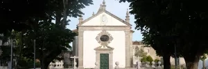
Esposende is another popular summer resort town, though one which is much more subdued than cities to the south. It has a quant small town feel and a broad seaside boardwalk that is popular among the locals.
There are multiple ways through town but the easiest is along the pedestrian path near the sea. When it comes to an end follow the natural bend in the road to the right. From there the camino turns inland towards Marinhas.
Accommodation in Esposizioni.
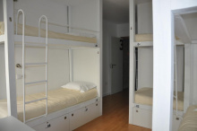
| Hostel Esposende GuestHouse Booking.com |

|
| Hostel Eleven 17+€ 9 Booking.com |
|
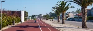

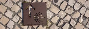
There are several bars suitable for a morning coffee, as well as a shop (before crossing the main road). Near the church are a few more bars and the municipal albergue.
The camino from Marinhas keeps away from the sea, and climbs gradually to offer an elevated view. The path is along paved back roads with little traffic. Eventually, beyond Belinho, the camino crosses descends to cross over the main road and joins a narrow forest path down to the Ponte do Sebastião.
Most services are along the main road, the N13, but there is a small supermarket along the camino.
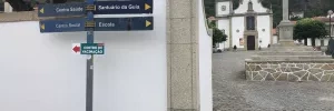
After crossing the bridge the official camino turns right and uphill. However it is possible to turn left and take the old (unmarked) road which follows the coastline. Note that while this route is very doable it is best undertaken with a sense of adventure. There are several bars along the way, and at least a bit of beach walking.
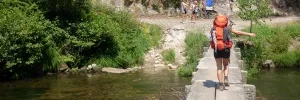
From Anha the camino makes its way to the very long dual carriage bridge that crosses the Río Limia.
Accommodation in Anha.
| Albergue Casa da Carolina 20*€ 16 |

|
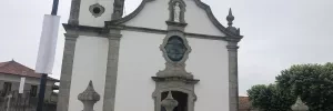
The wealth of Viana do Castelo’s rich trading history has left us with several notable buildings and defensive structures. Among them are the Sé Cathedral, the Castelo de Santiago da Barra, the Church of Santa Luzia (take the funicular up the hill for 3€ round trip, and enjoy an incredible view of the city), and lastly the hidden gem of a church that is theEMisericórdia of Viana do Castelo whose mixture of gold and azulejos tiling are not to be missed.
Viana do Castelo, until 1848 known as Viana da Foz do Lima, was an important shipping town and critical port of entry during the Age of Discovery. Later, in the age of cod, it became Portugal’s second largest center of commerce and trading.
In the end of August the citizens of Viana (and many more tourists) turn of for the Feasts of Nossa Senhora da Agonia. It is a romeria of sorts and takes place over 3 days in celebration of the Virgen of Agony, the Virgen of choice for fisherman going out to sea.
Leave the centro historico of Viana do Castelo from the main square. Head north from the fountain (keep the length of the square to your left) and follow the pedestrianized and tree lined street (the Passeio das Mordomas da Romaria) to the first intersection. Turn left there to follow in the same direction as traffic along the Rua Candido Dos Reis/Luis do Rego. The road ends at the Park and Garden of Dom Fernando, turn right and at the next intersection keep as straight as possible to what looks like a dead end road. Arrows here will direct you down steps and underneath a busy avenida.
At the top of the stairs on the other end keep going straight (you will have turned right just before climbing the stairs). DO NOT follow this road all the way to the busy avenida. Instead, turn left uphill and against traffic along the first street. It is signed as a dead end road. Follow it to the underpass.
As you exit the underpass you will be in a more residential neighborhood. Turn left at the first street which is directly in front of you, the Rua Dom Moisés Alves de Pinho. From here you continue straight for several kilometers to leave town.
The way passes through several narrow streets and cobbled lanes but is well marked. The Quinta da Boa Viagem is the next obvious landmark in Areosa.

After passing the Quinta da Boa Viagem, take the first road on your right. The next arrow is low on the curb and has you turn left and you will soon find yourself on a country road flanked by forests on both sides. Were the forest ends the road you have been following takes a sharp bend to the left, but the camino turns to the right to follow a narrow track.
When the track emerges it will turn right along the Rua do Louvado and then keep to your left to walk along the cobbled path with stone walls on either side. When the road opens up again there are several roads to choose from, and the one you want is the second from the right. It will take you uphill slowly but steadily until it reaches a fork in the road, at which point the camino takes a turn to the left and downhill, again between two walls.
A short distance on it take the first road on the right. The arrows in these parts are well defined and the camino will eventually emerge in Carreço. A bridge over the railway will appear on your left and it marks your arrival.
All services in Carreço are located along the main road. To get there you will need to turn left to cross the railway, and follow the road downhill to the roundabout. Turn left at the roundabout, heading south (with the water on your right).
If you choose to keep on the camino through Carreço, turn away from the bridge and keep to the east of the tracks. It won't be long before the camino turns back to the tracks and crosses at a level crossing. It will arrive at the church and pass behind it. Arrows are scarce to non-existent here, just keep to this same road a short distance until it merges with a larger road and turn right towards the train station.
Where this road ends turn right and back over the railway in the direction of "Paço - Carreço". A short distance on the camino turns left at the second street, there is an arrow and a marker for the PR8 hiking trail. Arrows will guide you through town, past the albergue, and at the last junction at the last house in town, keep left and into the forest. The way is anything but straight but is well indicated.
You will emerge from the forest at the edge of the town of Afife, and subsequently skirts around the town thereby avoiding all of the services available there. The way is marked and winding along cobbled roads. It will make its way over a small river and continue to climb up through the forest to a road and the stone cross cruzeiro.
Accommodation in Carreço.
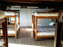
| Albergue Casa do Sardão 16€ 26 |
|
The Cruzeiro marks a high point, and it is downhill from here to Vila Praia de Âncora.

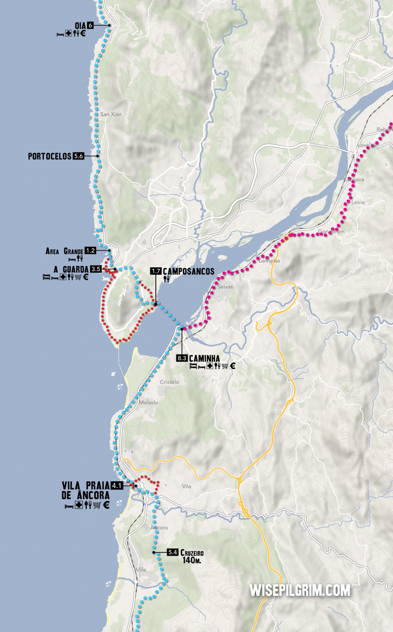
Âncora is a medium sized with all services, apart from an albergue de peregrinos.
To find your way from Âncora, make your way to the waterfront. The camino follows the road adjacent to it, and where the yellow bike lanes begin you have the option of crossing to the right-hand side of the road, but keep an eye open for where the bike path turns left as you want to follow it to where it ends. From there continue along the dirt track, with the railway to your right for a short distance.
You will pass the Capela de Santa Isodoro on your left. The path will turn to a road as it enters the first suburbs of Caminha, and where the road ends at another turn right. You are at the beach now and a short distance later turn right and pass under the railway. Once back to the main road turn left and continue towards Caminha.
Where the camino arrives at a large roundabout with the N13, take the third exit along the Rua de Pombal (NOT over the railway). The road will eventually twist to pass over the tracks and from there it proceeds directly to Caminha, arriving at the main square, the Praça Conselheiro Silva Torres.
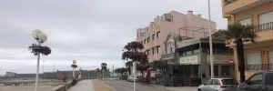
Caminha is the last town in Portugal, from here it is a 1.7 swim or a quick water-taxi across the estuary. The service is offered by xacobeotransfer.com, which is also where you can find their schedule (though it is also posted in every accommodation in Caminha).
It is here that the Atlantic meets the Río Miño, making for the ideal natural boundary. The main square (Praça Conselheiro Silva Torres) makes for the perfect place to rest the afternoon or while away the evening. At its northern edge stands the Torre do Relogio, where a euro affords you access to the best view in town. Further north, and adjacent to the old defensive walls, is the Igreja Matriz de Caminha.
At the far end of town the road meets a roundabout and crosses a smaller river by way of a bridge. DO NOT CROSS THE BRIDGE unless Valença or Tui is your destination. Arrows here still exist, and if they do they are pointing the way to Tui along the Central Way. Instead, turn back towards the harbor; signed "Ferry Boat".
Accommodation in Caminha.
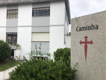
| Albergue de Peregrinos Caminha 10€ 28 |
|
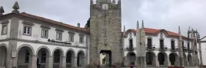
Several companies now offer to taxi you across the river, and all take around 20 minutes. The schedule varies with the tide so you will have to call ahead or just turn up to know for certain. If you are staying the night in Camino your accommodation will very likely have the timetable posted, as well as a link to make a reservation (bikes accepted).
xacobeotransfer.com
Change the time on your watch/phone/sundial/wind-up alarm clock. Spain is one hour ahead, so assuming you wake up at the same hour as the day before you will find things to be darker than usual.
From the ferry terminal in Camposancos you can choose to take an alternative route that circumnavigates the peninsula to the south, adding about 4km to the journey but adding some great views.
Otherwise turn left from the ferry terminal to follow the water a short distance to the first road, turning right and uphill on the Camino del Palomar. Note that this is not the road that is marked A Guarda 2km. That road, marked red on the map, is a possibility though not the camino.
The Camino del Palomar continues more or less straight uphill, turning only to pass around a large apartment block. At the top, it first crosses the road before turning left. A dozen meters on keep to the right along a smaller road, at which point you are heading south rather unnaturally. The camino turns itself around by turning right and then right again to follow a series of roads and trails around the Monte de Santa Trega.
It eventually returns to the Paseo de Portugal road mentioned above and turns left into town. Entering this way means that you will stay at the upper half of the town, and a few variations exist which allow you to descend and then ascend.
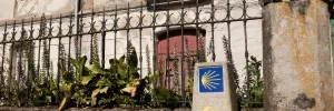
A Guarda prides itself on serving the freshest catch-of-the day seafood in Galicia.
A Guarda's single most important natural landmark is the mountain peak to the south, the Monte de Santa Trega. If you choose to make the hike to the top you will be rewarded with more than great views. On the way up is an Iron Age Celtic hill fort (castro) and museum, and at the top a small chapel.
Leave A Guarda along the Rúa Puerto Rico, passing the municipal albergue. The arrows are poor here and the best way is to keep an eye out for a sign indicating the way to Playa Area Granda, a left turn off the Rúa Puerto Rico.
Follow this road all the way to the sea and turn right. Ahead is a small beach, followed by a curve in the road, and then a slightly larger beach. This is the Area Grande.
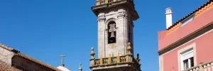
From the Area Grande beach keep to your left and through the car park. Where the car park ends the path narrows, and a smaller trail to your left presents itself. Follow it along the coast.
About 1.2km later the camino turns right at a large house, rising uphill to the main road but turning left just before reaching it. The idea here is to again keep off the busy road by means of a few side roads, twisting and turning a bit but eventually returning to the main road once more.
When it does so you can follow along a dedicated bike/hike path. It will pass a car park/lookout point before turning left off the road and then right again to parallel the road all the way into Portocelos.
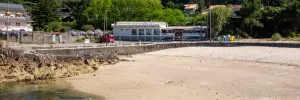
From Portocelos, continue along the same secondary road parallel to the main road. It will invariably return to the main road, once again following the dedicated bike/hike path adjacent to the road.
Where the curb barrier ends the camino veers left away from the road and into Oia.
The path through Oia takes you past all of the important stuff; first the Casa Puerta, then the restaurant, and then the Monastery of Oia.
300m beyond the Monastery the camino turns left to follow a coastal footpath and always keeping to the shoreline. You will eventually return to the road, and when you do the familiar bicycle path is there once more, follow it to the left and into Viladesuso.
Accommodation in Oia.
| La Cala Inn 25€ |
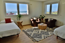
|
The Hotel Glasgow is the first building in town, and just beyond it is a Repsol station. Just beyond that the camino crosses the main road and turns right uphill.
At then end of this short road it jogs right then left again to keep on the path that is marked for bicycles. Follow this path across a river, and then take the first right uphill and away from the main road.
Where this uphill climb ends, turn left. Follow this road, eyes to your left to enjoy the view and so that you can spot the turn off to the left, marked only by a yellow and a red arrow on the road itself. It merges with another path and then reaches an intersection, where a left turn takes you back down in the direction of the main road.
Just a few meters short of the main road turn right on a narrow lane parallel to it, saving you a few meters of the road and keeping you on the marked bike path which eventually returns to the road, crosses the road, and continues along it.
Cross the bridge into Mougas and turn left towards the sea on the first road.
Accommodation in Villadesuso.
| Alojamiento Camino Portugues Oia 15-16€ 20 Booking.com |
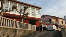
|
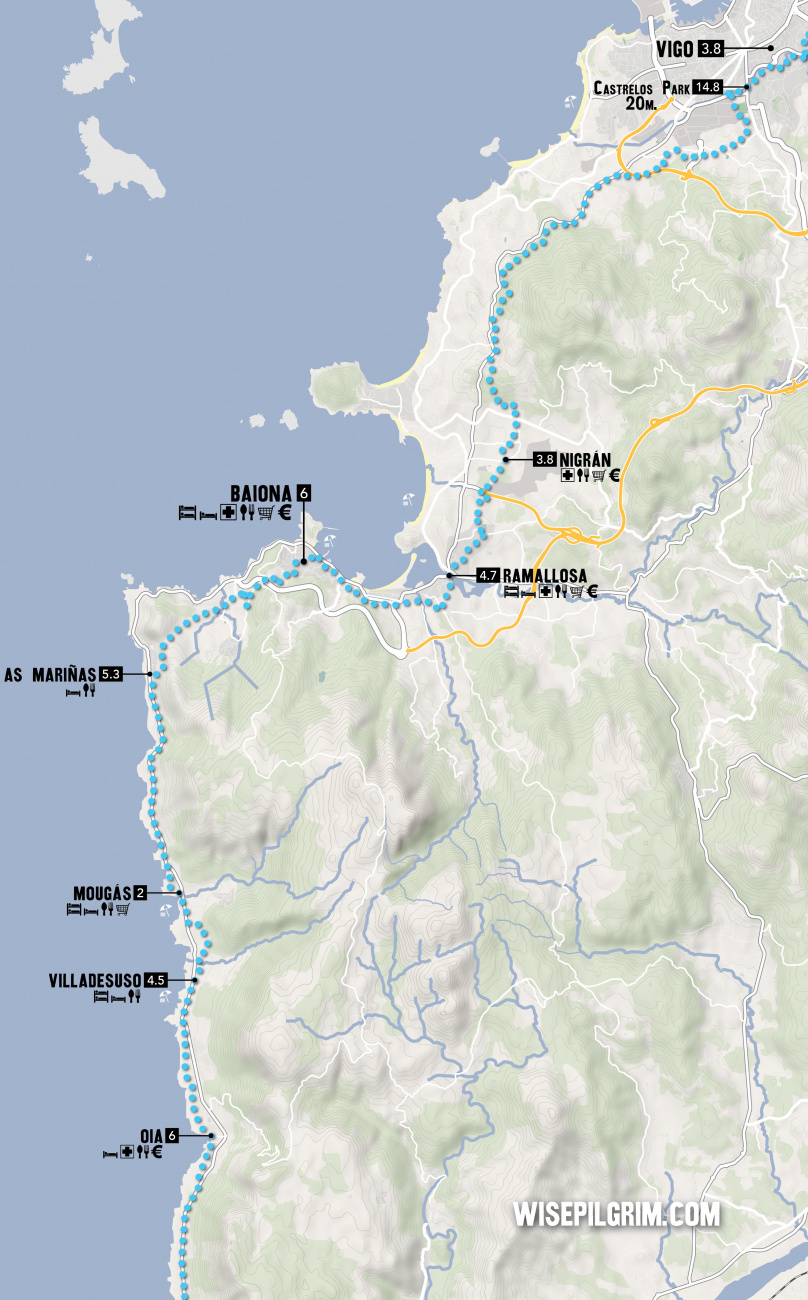
The camino from Mougas to As Mariñas follows the now familiar pattern of following the bike/hike path as it parallels the road, occasionally departing from it.
Along the way you will pass the O Muino campsite on your left, the defunct OMAR3 restaurant, and the Mougas Campsite (and Albergue Solidario) on your left.
Accommodation in Mougás.
| Camping Mougas 23+€ |
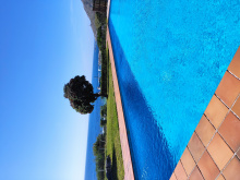
|
A short distance before arriving to As Mariñas the camino splits into two routes. The trail turns off the main road in favor of a hiking trail that bypasses the winding shoreline road. Directions for the trail are given below, and following the road along the coast is as easy as that, all the way to Baiona.
The camino takes a right turn off of the main road before arriving to As Mariñas and the Hotel Talaso. The arrows are not very generous here so keep an eye open for the turnoff; if you get to the hotel you've gone too far.
The climb ahead is both steep and beautiful but not terribly high in altitude. It is at times a bit of a scramble in parts, in part because of the rocky terrain as well as mucky from mountain streams. It will take you to the small village of Baredo.
Arrows will lead you through and out of Baredo, across a small river (the low point) and then back uphill for a short distance to the asphalt road and turn left, passing the Os da Ponte restaurant. Follow it to the first road on your right and veer uphill, you'll be sharing the camino with another hiking trail indicated by red and white bars.
This road will come to a small intersection, and here the camino turns sharply right and uphill. Where it meets the road again, turn left sharply back in the direction of Baiona.
The next big junction is with a larger road, and the camino turns left to cross a tall bridge over the AG57 highway. Once on the other side it leaves the larger road to the right (near a play park and picnic area and cruceiro), turn there and keep to the right.
Here the arrows improve and you wind your way, always downhill, to the first major roundabout in many kilometers. Turn right at the roundabout and then take the next left, passing counterclockwise around the football field which is on your left. At the far corner of the field, turn right and into the pedestrian zone. Ahead is the Plaza Santa Liberata, and two beautiful churches.
At the end of the second church, Santa Maria de Baiona (sello available), turn left down the steps and at the bottom turn right, and then immediately left again. You are in the Old Town, and are making your towards the waterfront but not quite to it, the camino proper keeps to the pedestrian area.
Baiona has a charming old town which is well preserved, and a waterfront which has a few well protected beaches. Although there is no pilgrim albergue here, it remains a favorite stopping point.
Its two most recognizable churches, the Ex-colegiata Santa Maria and the Capela de Santa Liberata (consecrated in honor of the martyred daughter of Baiona and the first women to be crucified) are at the start of town along the camino.
If you do stay here, work up the strength for an extra 2km hike around the peninsula. You will be rewarded with excellent views from the Fortaleza de Monterreal. EThe Museo de la Carabela Pinta is also located near the outcropping, and offers a terrifying glimpse of what global exploration was really like in the 15th century.
On the 1st of March, 1493, Baiona became the first Old World town to learn of the successful journey made by Christopher Columbus to the New World. It was here that La Pinta arrived, captained by Martín Alonso Pinzón, the true brain behind the voyage. The news reached Spain three days before Columbus would arrive, separated by weather, at the port of Lisbon. As the town of Baiona celebrated, the King and Queen remained unaware of either arrival.
The city celebrates the return of La Pinta during the first week of March, during the 15th century market festival known as the Fiesta de la Arribada.
The camino leaves Baiona along the Rúa Ventura Misa, the old town road that is set inland from the main road which follows the coast. It is possible to follow the main road out of town and all the way to Ramallosa.
The arrows are abundant and will take you past and over a pair of small rivers, first the Río da Baíña and then the Río da Groba. It makes the crossing to Ramallosa along an ancient stone now-pedestrian bridge adjacent to the main road. Once over it turns right then left again.
Accommodation in Baiona.
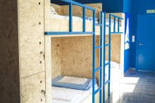
| Estela do Mar 16/17€ 20 Booking.com |
|
The arrow through Ramallosa take you uphill in the direction of Nigrán, and at the top of the short hill is the Albergue Pazo de Pias. Turn right at the albergue.
The camino here is well indicated by arrows, and follows along a bramble of winding side streets as it makes its way uphill. At the end of a paved holloway it emerges to a small roundabout and turns left along a sidewalk and towards an elevated crossing of the highway. Avoid the urge to make a surface crossing, to your right is a highway tollbooth and drivers in the area are frequently distracted in their search for spare coins.
Turn left after crossing (effectively you have done nothing more than cross straight over the intersection) and when you get to the second roundabout the camino continues straight; the road narrows here and the town of Nigrán (set off from the camino) is to your left.
Nigrán sits due west of the camino, to get there turn left on the first road after the camino path narrows near the roundabout mentioned above.
Entering Vigo: Please read carefully to understand the many options, pitfalls, tips, and why it is the way that it is.
The official camino into, through, and out of Vigo does not really exist. Due in part to party politics, and in part to uninhibited urban sprawl, the way has been erased and rewritten on many occasions. Marking the way are yellow arrows, green arrows (if you find your way to the O Freixo albergue), stone markers, and most recently several hundred blue and yellow stickers put in place by well-intentioned shop owners. With regard to these stickers, be aware that they don't really follow any path; they are all over town and their only helpful characteristic is that they mostly point North. And with regard to the stone and arrows, they are on occasion in disagreement and the path you follow might come down to what side of the road you were walking into town on… and therefore which of the two caught your eye first.
Before you go any further, do yourself a favor and open the map to familiarize yourself with the solid line that goes through Vigo, and the two alternate lines (in Red) which go around it. One of those paths goes around town to the west and the waterfront. The other goes to the east and although it does enter Vigo it avoids all of the nicer parts. Take a note of where they split.
SPLIT 1: You will have been walking along the road for some distance when you get to a roundabout. Here is where you have to choose. To your left, in front of a small home, is the stone indicating the way through/around Vigo along the coast. Fifty meters beyond the roundabout are arrows pointing to the right, that is the way around Vigo to the east as well as the way to the O Freixo albergue.
The best advice I can give is to turn left as the two options from here are the only ones which take you through the heart of Vigo. Then pay close attention to where the path splits again.
SPLIT 2: The camino splits a second time when it gets to the Rio Lagares: to your right, the arrows take you through Vigo. To the left, there are no arrows but it is a short walk to the sea and from there you simply turn right and keep the water to your left. Both of these routes rejoin at the start of a new pedestrian path that has opened in the old port, and not far beyond that is the new Xunta albergue (completely unmarked, you'll need to refer to the map again). The path through Vigo is not the official path (remember that no such thing really exists) but rather follows the easiest route down to the port where the albergue is, as well as the Basílica de Santa María de Vigo and some of its more charming barrios. Vigo is full of these barrios, they are an anomaly in a city that is the poster child for unplanned expansion. They are like small villages shoehorned into the cityscape.
From the river split, the route along the coast is the most scenic of the three options and will only cost you 1 additional kilometer of walking for the benefit of fresh are and much quieter walking. This option also passes through Bouzas (restaurants), one of the oldest and largest of the villages that make up modern Vigo.
Vigo, from the diminutive Roman word for small village, is no longer deserving of the name. It is now the largest city in Galicia which is a remarkable feat given that it didn't start to see any real growth until the end of the 19th century. When it did begin to grow, it did so with reckless abandon and is now something of a disorganized city.
Unlike many of the port cities to the south, Vigo didn't garner much attention during the Age of Discovery; such are the currents. The Vikings took a liking to it though, and so too did both Francis Drake and the French Army. The city didn't see much peace until the middle of the 17th century when Philip IV built defensive walls to protect it; though even still the British managed to occupy it for a week.
Centuries later it would be the Age of Cod that would put Vigo on the map, followed still later by heavy industry.
Departing Vigo is a simple affair. From the Xunta albergue (or the port) follow the Ruá Areal to just beyond the train station. The camino follows the road uphill to the right, but only for a short distance as it turns left almost immediately onto Rúa Garcia Barbón. 2.5km later the camino turns right and crosses the large autopista. A short distance later it turns left and follows along the highway which is high up on the hill on your right-hand side; to your left is the estuary and you are high enough up now to have a wide view of it. When you eventually turn away from the water, you pass over the highway which tunnels beneath you. From here the camino stays inland, winding its way through the suburban hillside until it joins with the Central Way just before entering Redondela.
Getting into town and out again is straightforward. There is an alternative route that is signed, which takes you through town closer to the river.
As a city, Redondela has its charms. It sits well inland of the Vigo estuary and is bisected by two massive train bridges.
When leaving town, the camino crosses the N550 at a bottleneck on the north side of town that is heavy with traffic at all hours. Cross the N550 as soon as you get to it, and almost immediately veer left gently onto a side road.
The arrows from here leave a bit to be desired. They are present, but have been spray painted with a not quite right yellow and at times, they don’t feel legit. Follow them all the same, and as you near Cesantes the stone markers return.
Accommodation in Redondela (da Vigo).
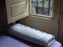
| Albergue Rosa d'Abreu 20€ 6 Booking.com |
|
| Albergue Alfonso XII 17€ 12 Booking.com |

|
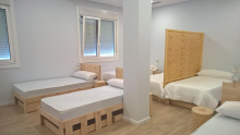
| Albergue A Rotonda 17€ 9 Booking.com |
|
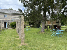
| Albergue A Dársena do Francés 20*€ 29 Booking.com |
|
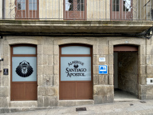
| Albergue Santiago Apóstol 12€ 30 Booking.com |
|

Getting past Cesantes means crossing the N550 once more, at probably the most dangerous point in a curve in the road. Head straight across and keep to your right.
You are climbing uphill now and will traverse around the O Viso peak. Along the way you pass an installation of pilgrim shells and if you have a marker on hand you can leave a message on a sun-bleached shell. From here it is downhill again to the N550.
At the entrance to Arcade, the camino turns left rather unnecessarily. It will cross back over the N550 in a few hundred meters, taking you past the albergues and shops of Arcade.
Accommodation in Cesantes.
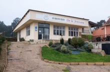
| O Refuxio De la Jerezana 18€ 34 Booking.com |
|
| Albergue A Dársena do Francés 20*€ 29 Booking.com |

|
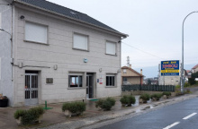
| Pensión Jumboli Booking.com |
|
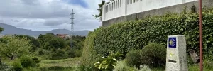
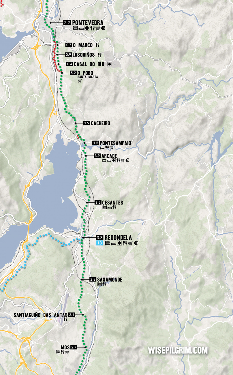
If you fancy a dip in the sea or just a stroll along a beach, Arcade and Pontesampaio (a bridge away) will oblige. Follow the camino to the bridge over the estuary where you will find a strip of sand on both sides.
Accommodation in Arcade.
| Albergue Lameiriñas 13€ 26 |

|
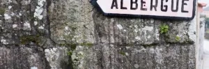
The hotels here are located along the main road, which is both noisy and a bit dangerous. Suitable as a last resort but otherwise best avoided.
After crossing the bridge, take a left turn on the first street. This turn is followed by a series of zigs and zags that take you up and through town at the highest point.
The camino takes a welcome break from the road traffic between here and O Pobo.
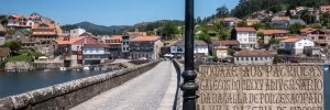
In O Pobo / Santa Marta an alternative route into Pontevedra presents itself on the left side of the road.
Turn left to follow signs towards the Rio Tomeza. This path is 3.6 km to the Pontevedra Albergue (at the start of town near the train/bus stations), and the original road route to the same point is 2.8km.

Your entrance to the old town center of Pontevedra is punctuated with its most famous church, the Iglesia de la Virgen Peregrina, a shrine to the Pilgrim Virgen who guided pilgrims here from Baiona.
To see the rest of Pontevedra’s notable buildings will required you to stray from the arrows a bit. The old town is not large enough to get lost in, so take your time and enjoy the many plazas and parks.
The most important landmarks are the Convento de San Francisco, the Basilica de Santa María (often referred to as the Cathedral), the Iglesia de San Bartolomé, and the Convento de Santa Clara.
There are plenty of plazas to choose from, including the large Plaza de Teucro and the diminutive (and best) Plaza de Leña.
Leave by crossing the Ponte do Burgo and heading straight-ish through the next roundabout, turning left immediately after. Before long you will be alongside the railway, which you will cross just before the church of Alba.
TWO WAYS TO PONTECESURES / PADRÓN
There are two routes to Pontecesures/Padrón from Pontevedra, and the split occurs about 3km after crossing the bridge in Pontevedra.
The original camino keeps on its inland trajectory and is currently the most popular choice among pilgrims. It is also the shortest.
The second option is known as the Variante Espiritual and it turns westward to cross over the Monte Redondo as it heads towards the sea at Vilanova de Arousa. From here you have the option of a 3rd day of walking to Pontecesures or a trip by boat up the Ría to the same place. This variant was created and named by the local tourism sector and although the stories told about its origins are fantastic, they are also just that... stories. Don’t let this clever bit of marketing discourage you though, the route is recognized by the Pilgrim Office as an official variant and you will not have any difficulty obtaining your Compostela regardless of whether you take the boat or not.
This recognition, and lots of praise from pilgrims, means that this route is growing in popularity.
VIA THE VARIANTE ESPIRITUAL - 44. km on foot + 28 km on foot or ferry
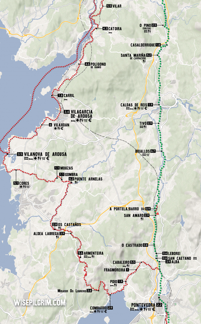
The Variante Espiritual is an alternative route which connects Pontevedra with Pontecesures. It adds 8.2km of walking (and a significant climb to the top of the Monte Redondo) and another 28km by boat (from Vilanova de Arousa to Pontecesures).
Getting started is as simple as turning left at the well signposted fork in the road. The way almost immediately begins climbing upwards, though gently at first. It is making its way back to the Ría de Pontevedra, going up and around a small monte before arriving in the waterfront town of Combarro. There is one small hamlet before arriving at Cabaleiro, and it has a bar/shop with a very limited selection, but as it has odd hours it is not included here as being reliable.
THE ORIGINAL CAMINO, INLAND VIA CALDAS DE REIS - 36.3 km
This is the easiest to navigate and shortest of the options. From the split simply carry on straight.
Accommodation in Pontevedra.
| Albergue de Peregrinos (Virgen Peregrina) 10€ 56 |
| Aloxa Hostel 19-25€ 60 |

|
| Slow City Hostel 20-23€ 6 Booking.com |

|
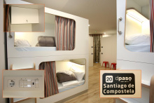
| dpaso Urban Hostel 18+€ 20 Booking.com |
|
| GBC ISAPE 19+€ 40 Booking.com |

|
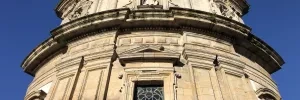
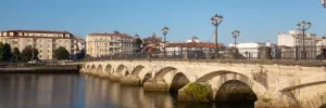
Exercise caution passing through San Caetano as the road is quite narrow and the traffic is quite fierce. At the end of town turn right off the road. Soon you will be along the railway once more which you will follow along for several kilometers.
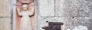
San Amaro sits square above the railway that you walked along a few kilometers ago; they tunnel through this hillside on their way to Santiago.
There are two bars in town; the first has the most character and the most business. Friendly service too.
Turn left at the fork in the road, past the park, and onto a country lane.
The turn off for the Portela/Barro albergue is along this stretch, and it takes you uphill to the right.

Located along a deviation of the camino, well signed. It adds a few meters to the journey but has a municipal albergue in a quiet town.
Before arriving at Briallos, the camino approaches the N550 once more. At this point, there are signs for the Natural Park of the Rio Barosa, and the waterfalls. The waterfalls are 500m down the road directly opposite this point and are a worthwhile detour. Picnic areas and a bar and bathroom are at the base of the falls.
The albergue and the bar are located a few hundred meters from the center, turn left when you get to town, following the signs. Otherwise, keep on straight to the end of town.

Caldas de Reis is best known for its hot springs (caldas). They still exist, but the tradition of putting your feet into the fountain is discouraged for obvious hygienic reasons. All the same really, a hot soak after a hot day of walking isn’t the best of plans. To see the springs (and to follow the camino), turn left after crossing the first bridge in town.
The camino passes through the old quarter before arriving at another bridge, on the opposite end of which is the municipal albergue and the way out of town.
The church in town is dedicated to Saint Thomas Becket, one of very few of the sort in Spain and possibly the only one in Galicia. If you are only passing through town in the afternoon, the palm trees that surround the church make for a cooling place to relax.
On the way out of town, it is once more along the N550 (which frankly will be the case frequently between here and Santiago). Leave it to your right at the first bend in the road.
Accommodation in Caldas de Reis.
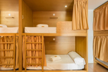
| Albergue A Queimada 14€ 74 Booking.com |

|
| Albergue GBC Caldas 25-28€ 100 Booking.com |
|
| Hotel O Cruceiro 16-18€ 34 Booking.com |

|

The way to Santa Mariña is through a quiet forest away from the busy road. The bar here is quite friendly and a welcome morning stop if you have left from Caldas.
The camino crosses the N550 to the upper part of town to visit the church, and returns to cross again before Casalderrique.

The camino only touches the back side of O Pino, which has a bar and an albergue a bit off the track (200m). The albergue here is large and clean and friendly, with a shaded park in front.
Accommodation in O Pino (Valga).
| Albergue de Peregrinos Valga 10€ 78 |

|

There is not much to San Miguel apart from the modest church and the bar-grocery-everything store. The quaint countryside walking will soon give way to the sprawl of Pontecesures.

Pontecesures is the town that you wished was prettier but isn’t. It enjoys a nice riverside location but is spoiled by the belching factory across the river.
The arrows go under the road and over the bridge and across the Río Sar to Aduana. Here it runs all the way into Padrón.
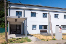
Accommodation in Pontecesures.
| Albergue de Peregrinos Pontecesures 10€ 54 |
|

Herbón, and the Monastery and Albergue there, could not be better placed for a peaceful day of relaxed contemplation at the end of the penultimate day of walking to Santiago.
It is a deviation from the camino’s yellow arrows, but one imagines that it has always been an important stopping point for pilgrims.
The albergue here is run by the Galician Amigos of the Camino and it is one of the few places where you can count on eating dinner with all of the other pilgrims staying there.
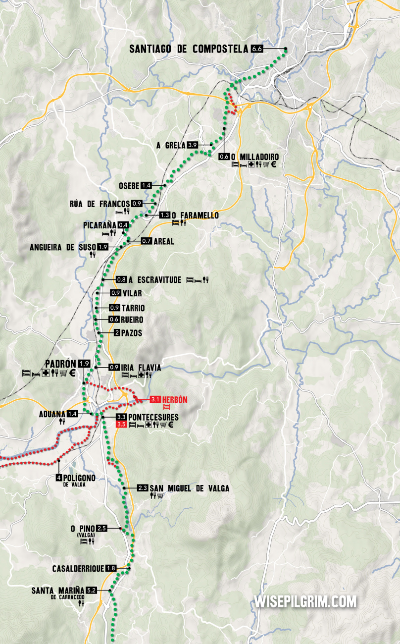
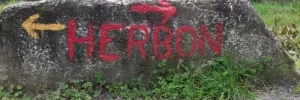
To get there simply follow the red arrows marked Herbón. This detour if for anyone wishing to spend the night in the Albergue at the Monastery of Herbón (recommended). From Pontecesures it is 2.7km, with an additional 3km the following morning to bring you to Padrón. In all this detour adds 3.1km to the official route.
Padrón might just be the most important little town on this or indeed any other camino. It was here that the remains of Santiago arrived after being sent out to sea on a stone boat, as told in the story of the ‘translatio’.
His arrival to the specific point is attributed to the fact that it was here that he first arrived to preach while still alive, so his return was a homecoming of sorts.
Padrón is also the birthplace of Rosalia de Castro, Galicia’s most famous and beloved laureate.
Padrón (and Herbón) are home to that delicious green and possibly spicy pepper you may have had the pleasure of eating.
Take a look at the elevation profile for an idea of what these last 24km will be like, many pilgrims underestimate the elevation changes which increase as you near Santiago.
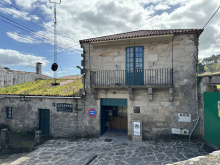
Accommodation in Padrón.
| Albergue de peregrinos de Padrón 10€ 46 |
|
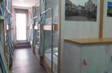
| Albergue Corredoiras 15-19€ 17 Booking.com |
|
| Albergue Camiño Do Sar 15-17€ 20 Booking.com |

|
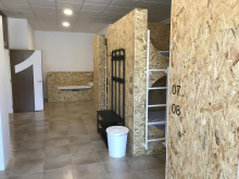
| Albergue O Pedrón 14-17€ 44 Booking.com |
|
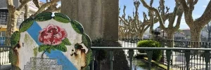
Pass through Pazos, Rueiro, Tarrio and Vilar (albergue); none with services.
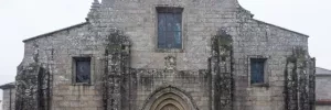

Although there is still more that 17 kilometers separating you from the Cathedral it will feel from here onward that you are marching along a string of increasingly larger Santiago suburbs. Many of them remain quite small, but the sprawl begins to present itself.
In town, turn right off the N550 at the church, passing around its park. A country road takes you steeply uphill. You will pass through the hamlet of Cruces, Angueira de Suso, and into Areal before returning to the main road at Picaraña.
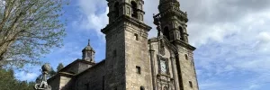
NOTE: BEFORE the gas station a set of faded arrows directs you left and away from the road. Going that way takes you through a new route marked out by the local friends of the camino and is a much-preferred option to the road. After turning left keep an eye open for arrows which will turn right onto a grass (sometimes tall) path. This arrow might be a bit faded but the way is obvious, and it turns into a well-worn trail with plenty of arrows. It will bring you right up to the road at the entrance to Faramello.
Two bars in town, one at the entrance just after leaving the N550, and another at the private albergue.
Accommodation in O Faramello.
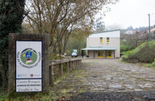
| Albergue de peregrinos de Teo 10€ 28 |
|
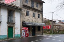
| Albergue La Calabaza del Peregrino 18€ 36 Booking.com |
|
From Rúa, the camino passes through several small hamlets (Osebe and A Grela) as it makes its way into the large Santiago suburb of Milladoiro.
The camino passes between Osebe (to your left, train station) and Casalonga (to your right and on the main road, shops and atm), and not far ahead is Pedreira (albergue and food truck). It is not clear when you are passing from one to the other as they all blend together.
Accommodation in Osebe - Casalonga - Pedreira.
| Albergue Casa Aldea da Pedreira 22-24€ 20 Booking.com |

|
O Milladoiro is Santiago’s largest suburb, and soon you will have your first glimpse of the Cathedral. The camino passes through the back side of town, avoiding the busy main road with its massive apartment blocks.
The growing network of highways around Santiago mean that you will make a few crossings and zig zags before you get to the city limits. There are even a few occasions where new camino stones stand adjacent to old camino stones, each pointing in their own direction. One offers a choice between ‘Santa Marta’ and ‘Conxo’ and here the best and most direct choice is ‘Santa Marta’, or left.
Welcome to Santiago! There are a tremendous amount of things to see and things to do in Santiago de Compostela; you are encouraged to stay for at least one full day extra for exploring the web of streets, all of which seem to bring you back to the Cathedral.
Your pilgrim related business is likely to start in front of the cathedral, kilometer zero. A shell and plaque mark the spot in the center of Plaza Obradoiro (see below).
If you are interested in receiving your Compostela, the certificate of completion, you will need to visit the Pilgrim’s Office, which was relocated in 2016 to a bright new building. To get there from the Plaza Obradoiro, face the Parador (the hotel on your left if you are facing the Cathedral) and look for the road that goes downhill to the left. Halfway down you pass the public restroom, and at the next street turn right. The office is at the end of that road and is easy enough to find. Note that there are few arrows indicating the way.
The Cathedral is the single largest attraction to Santiago and for good reason. Both inside and out it presents countless treasures to investigate, too many to list in fact but below are the best.
The Cathedral - Plaza by plaza
1. Plaza de Inmaculada, a.k.a. Azabache: This is the entrance that faces the Monastery of San Martín Piñario.
2: Obradoiro: From Azabache you pass under the Palace of the Bishop which is adjoined to the Cathedral and cannot possibly be the sort of palace that affords much peaceful sleeping; the sound of bagpipes welcoming you can be heard from dawn to dusk. The stairway leads directly to the Plaza de Obradoiro and kilometer zero for pilgrims. In the center of the plaza is the last scallop shell and you are likely to find pilgrims taking their shoes off for a photo with it, and the Obradoiro Facade behind them.
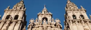
This facade is the most majestic and most photographed of the Cathedral and was part of the 18th century building projects that took place in Santiago. The baroque design will keep your eyes moving and the massive amounts of glass allow for the illumination of the Pórtico de la Gloria that lies behind it. That Pórtico was the original front to the church designed by Maestro Mateo 600 years before the new facade.
3. Plaza Platerias: If you continue around the Cathedral you arrive at the Puerta de las Platerías (named for the silver craft that still exists in the shops below it). You will notice that some of the stonework stands out as a different material. These are replacement carvings, the originals were damaged and subsequently moved to the Cathedral Museum; and unfortunately the original composition was forgotten, leaving a somewhat nonsensical layout. In front of the doors are a set of stairs and the Platerías fountain, the usual meeting point for pilgrims commonly referred to as “the horse fountain”.
4: Plaza de Quintana: Continuing up the stairs and around the Cathedral we arrive in the large Plaza de Quintana and the Puerta de Perdón. The actual Holy Door is behind this facade (which is not actually a structural part of the Cathedral, it is more like a highly decorated wall around the Holy Door itself). The carvings here are impressive and depict 24 Saints and prophets.
In medieval times it was common for pilgrims to spend the night in the Cathedral, sleeping on the stone floors and fighting (to the death on a few occasions) for the privilege of sleeping close to their chapel of choice.
The best time to visit is early in the morning before the crowds arrive, when paying a visit to the crypt and hugging the bust of Santiago can be done quietly and with a bit of contemplation.
The botafumeiro, quite possibly the largest thurible in the Catholic Church, is swung across the transept (from north to south) by a group of men called the tiraboleiros. It has only come loose from the ropes twice, and never in modern times. At the time that this book was printed, the tradition of swinging it during the Friday evening mass had been canceled. Inquire at the pilgrim’s office for more information.
The Monastery and Museum of San Martín Piñario
The enormity of this Monastery is difficult to comprehend, but if you pay close attention to this building as you walk around Santiago you will find that you are almost always standing next to it if you are on the north side of the Cathedral. There are three cloisters! The facade of the church often feels like it is somewhere else entirely and is quite curious for the fact that you must descend the staircase to get to the doors, rather than the other way around. The reason for this was a decree by the Archbishop that no building should exceed in elevation that of the Cathedral; the architects did not compromise by redesigning San Martín to be less tall, they simply dug down and started at a lower point.
San Fiz de Solovio
Compared to the two churches above, San Fiz feels like an almost minuscule affair. To find it, make your way to the Mercado de Abastos (Supply Market). San Pelayo (the hermit that rediscovered the bones of Santiago) was praying here when the lights called him. Grand and majestic it is not, but the oldest building site in Santiago it certainly is. The church that exists today is not the original, but excavations have revealed the foundations and necropolis dating to the 6th century.
The Supply Market (Mercado de Abastos)
The produce market is a great place to wander for lunch. Compared to other markets in Spain (like those in Madrid and Barcelona) the Santiago market is a fairly solemn affair. In fact, the architecture appears almost strictly utilitarian and is as Galician as it gets. The vendors make the experience, and even if your Spanish is not up to par, it is worth the visit for a glimpse into the way the locals go about their most ordinary business.
The buildings you see today date from the early 1940’s but replace ones that stood for 300 years. In fact, many of the vendors are second, third, or fifth generation market operators.
Alameda Park
Alameda Park was once the sort of place where the people of Santiago would turn out for elaborate displays of personal wealth and stature; the various paths that cut through and around the park were only to be used by members of a certain class. Nowadays it is far more democratic. The park is the site of a Ferris wheel and feria during the Summer months, an ice skating rink during the Winter holidays, and a massive eucalyptus tree overlooking the Cathedral year round.
The Hidden Pilgrim
Hiding in the shadows cast by the Cathedral, in the Plaza Quintana, is the hidden pilgrim. He is only visible at night and might take a while to discover.
And lastly, there are the many other Monasteries, and while it would be a challenge to visit all of them it is important to realize their construction shaped the city that we see today. Taking the time to walk between them will reveal countless little treasures.
One word of caution regarding accommodation is in order. If you are arriving in the high season, you are advised to make a reservation in advance. There have been several additions to the albergue roster in recent year but the numbers of pilgrims still exceed capacity in the high season.
The Feast day of Saint James is celebrated with a full week of music and dance, with a fireworks display in the Plaza Obradoiro on the evening of the 24th of July. The best views can be had from Obradoiro, or from Alameda park.
Accommodation in Santiago de Compostela alla fine del Cammino Portoghese.
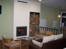
| Albergue Mundoalbergue 19€ 34 |
|
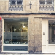
| Albergue The Last Stamp 19-25€ 62 Booking.com |
|
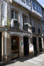
| Albergue Azabache 16-25€ 22 Booking.com |
|
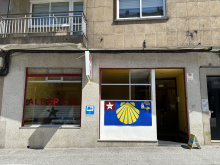
| Albergue La Estrella de Santiago 13-25€ 24 |
|
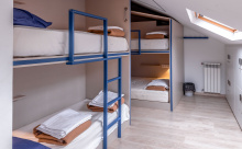
| KM. 0 20-35€ 54 Booking.com |
|
| Albergue SIXTOS no Caminho 20€ 40 Booking.com |

|
| Albergue Fin del Camino 14€ 110 |
|
