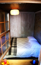
Amarelos is a small but welcoming village whose only services are a bakery and a basic albergue. To stay at the albergue, call Sebastião on +351 272 989 560. Dinner can also be arranged through Sebastião.
The last 8km into Castelo Branco is on asphalt and through the industrial and commercial zones before finally reaching the town centre.
Castelo Branco is a large town with all services. There is not much left of the castle but it’s worth a look, while the Jardim do Paço Episcopal is a hedge-maze containing statues of Portuguese monarchs and other figures that is unlike anything else you will see on the Nascente.


There is a worthwhile detour to a two-arch Roman bridge about 600m off the camino in Caféde. Turn left off the main road past the blue-and-white fountain, and the Roman bridge is just past a modern bridge.
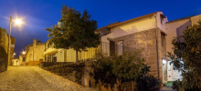
Castelo Novo is a delightful village and the first of the ‘Aldeias Históricas’ (Historic Villages) on this camino. Belmonte and Trancoso are the other two on the Nascente; there are 12 in total in this region, all on the GR22 trail. Castelo Novo is small and can be explored in half an hour or so; there are great views from the castle.
O Lagarto is the only restaurant in the village. Outside the peak months of July-September, it is only open for lunch but will open for dinner for pilgrims if notified in advance. The number is +351 275 567 406.
The camino from Castelo Novo to Alcongosta is a spectacular mountain stage. On the way down, just before the white domes of the Natura Glamping site, the arrows turn right on the road. A better trail is to go straight (with the domes to the right) and shortly after turn left onto a switchback trail down the mountain.

Alcongosta is the cherry capital of Portugal. If you pass through around the end of May, cherries will be ripe and readily available. Note the cherry mosaics as part of the calçada portuguesa pavement throughout the village.
Fundão is a large town with all services.
Leaving Fundão requires crossing a railway line. Earlier accounts suggest crossing at the station itself, while the arrows point further north. Either way, you’re likely to find yourself at a roundabout or two on a busy road before the camino becomes more rural again.
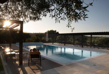
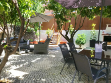
Accommodation in Fundão


Ferro is a fairly nondescript village but it has a simple albergue in the former house of the village priest. The albergue has a kitchen and there is a ‘Mais Perto’ mini-market nearby for supplies. Call +351 964 302 817 in advance to confirm.
Belmonte is another of the ‘Aldeias Históricas’ and is larger and more touristy than Castelo Novo. It has a fine castle, a church of Santiago and several sites related to the Jewish community that has lived in the village for centuries.


The camino goes past a mysterious Roman tower from the 1st century AD. Its function isn’t known but the architecture of the tower seems to suggest a military purpose.
About 1.5km after Valhelhas, the camino turns left onto a secondary asphalt road. After 250m, turn right onto the dirt road (there is no arrow) instead of continuing straight.