Soto de Luiña

Camino del Norte

To end of camino
278.5
Altitude
15

Mumayor

2.80

Soto de Luiña

19.90

Cadavedo

Services
ATM
Yes
Bar
Yes
Bus
Yes
Grocery
Yes
Pharmacy
Yes
Train
Yes

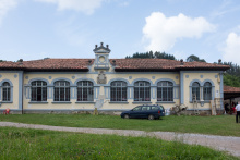
The Iglesia de Santa María was once a hospital for pilgrims. Those pilgrims, like today’s pilgrims, had to choose between two westward routes. They did not have maps or gps or Pepe who gives a description of the following days walk every night at 7pm at the municipal albergue.

Keep in mind that Pepe was part of the group that waymarked the Ballota route, so his opinions are somewhat biased. Choose the option that suits you best.

If you arrive early, consider an extra 2km to the beach, signed.

The Road

From Soto de Luiña there are two different routes to take. Both are well waymarked and the split is evident. It occurs along the road and there is a marker with two shells indicating which direction to go.

Option 1: ‌Mountain Route - 19.9

This route is entirely mountain walking and is far and away the most scenic option. As the name suggests it takes you up to and along the ridge of the mountain. If you chose this route be sure to pack enough food and water as there are no services along the way. At the point where the camino splits, the Mountain Route turns left and begins to climb.

Option 2: ‌Road / Ballota Route - 19.5

Although this route does not reach great heights, it does do a considerable amount of climbing and descending; it is essentially a long series of switchback shortcuts that parallel the road. A word of caution is in order. Because this route frequently joins the road it is necessary to keep a watch for all the arrows which take you away from it. Although you will reach your destination if you stay on the road, you will walk a great deal farther and do a lot more up and down. There are quite a few more services along this route. To follow it, simply keep to the road where the split occurs.

City Map

Comments

All Caminos App User (not verified)

Mountain route is extremely overgrown. You do have an option to go around the waist high grass. After rain the day before, the very narrow and poorly maintained path was a river. If there is any risk of rain, fog, or just clouds, there are no views. Not worth the extra time and slow going to navigate with the lack of markers and low trail visibility, only to have to walk on a highway at the end of it all.

All Caminos App User (not verified)

It’s so worth it!! Only a few steeper hills, but not very long ones. Go for it, you are not gonna regret it. Just be aware there are quite a few ticks on the second half of the path, so stay away from higher grass maybe, and check your skin.

All Caminos App User (not verified)

The coastal route is as described- MANY steep ups and downs, several sections of very dangerous road walking, and mud, rocky downhills and stream crossings. I didn’t do the mountain route, but I almost wonder if that would have been better because the coastal route was quite exhausting with the constant up and downs- longest 19km hike I’ve done so far. There are some stunning coastal views in the second half of the day, but it did feel like this section would never end, and I was glad when it did.

All Caminos App User (not verified)

Beautiful space right on the Camino! Has 2 bedrooms, one with double bed and another with a pull out bed. Full shared kitchen, washing machine, garden with line for drying clothes. 35 euro for 2 people in double bed. Fast internet, good shower/hot water. Very nice hosts. Overall highly recommend staying here!

All Caminos App User (not verified)

Beautiful views! A large number of the tiles have fallen off the way markers. However it is normally quite clear which way to go. Quite overgrown in places. Watch out for ticks - we were wearing shorts and had to remove several.

Camino de Sant… (not verified)

I choose the mountain route and didn't regret as I experienced the most stunning views on the Camino since Irun. Nice to be away from roads and houses. I managed to get a little lost at one point where there was a discrepancy between the waymarker and the route in the app. I followed the app over a steep hill.

Camino de Sant… (not verified)

We took the mountain route in June 2022 and it was fantastic. Very well marked and a relatively easy walk (whenever you look ahead and it seems as though you have a steep incline to a peak, the Camino goes around the mountain side - safely!!) Spectacular views of the sea and hills. There is a very short bit on the road during the route, during which a man in his car stopped and told us we should go down to the coastal path - nothing after this was particularly difficult, not sure why the encouragement of the road way when the mountain route is so beautiful and not too difficult!!

Camino de Sant…

Its exxeptionally well marked! All markings are NEW! Mountain route is NOT difficult, almost no Steel sections. But its very Beautiful and relaxing. I highly suggest to take it!!

Camino de Sant…

One of the best albergue to stay. Elena and her husband makes your day! Clean, very nice beds with linnen. Delicious food and wine. Nice showers. Call her in advance to check if there are places left for the night as she plans to reduce bed places. A bit of the toad, but it is worth it!

Camino de Sant…

The mountain route is not maintained and poorly marked. The shells point in weird directions, there’s tons of grass and plant overgrowth on the trail. We felt like the only people to do it in months. We made the mistake to go in the rain and had to bail part way through. Don’t do it!!!! (Unless it’s sunny and you are prepared to check the map constantly). The Ballota Route (after Ballota, the part we walked) was really pleasant with hidden beaches.