Nava de Ordunte is small, but it has a bar and restaurant, at least it did pre-Covid. More importantly it is where Adolfo lives. Adolfo has been promoting the Camino Olvidado for years, and was extremely helpful to us when we walked. I called him several times when I was in a pinch, hundreds of kms away, and he was always happy to help. Adolfo’s garage has been converted into an “informal” albergue. It is not listed in Ender’s guide because it is not officially licensed. Give a big contribution so he can get the licenses he needs to “regularize” it.
Adolfo’s option was not available when we walked, so we walked on to Villasana de Mena, which is about 7 km further, for a total of almost 30 km. These days there is actually a shorter (and marked) way to get to Villasana without going through Nava de Ordunte.
From Nava de Ordunte (aka, Adolfo’s garage), it is 33 km to Espinosa de los Monteros. From Villasana de Mena, it is 28. The two “branches” join up at the Taranco chapel right outside Ordejón de Mena. If you leave directly from Villasana de Mena, you will miss the reservoir, which is pretty and shaded, but not something to re-work your schedule around.
I give the Villasana de Mena option a 5***** rating. Not because the Hotel Foramonteros is so great, though it is fine. But because from Villasana, there is a marked off-road path, frequently alongside a pretty stream, to visit two wonderful Romanesque churches — San Lorenzo (in Vallejo) and Santa María (in Siones). The first is in a little hamlet, and the second stands alone, with a house nearby. Neighbors have the keys — best to call so they know you are coming. These are the phone numbers that worked for me in 2014!
San Lorenzo de Vallejo: Miguel Ángel: 947 126 427 OR 660 23 37 98
Santa María de Siones: Angelines, 947 126 132
Both churches have extremely beautiful apses, capitals, arches, doorways, they are really special. It would have been about a 10 km walk in total, but after visiting the second church in Siones, the skies opened and it began to pour. The “señora with the keys” called a neighbor and he drove me back into town, so I cut the kms in half. However you do it (there are local taxis), it is a real treat.
Day 3. Villasana de Mena to Espinosa de los Monteros (28 km) OR Nava de Ordunte to Espinosa (33 km).
From Nava de Ordunte (aka, Adolfo’s garage), it is 33 km to Espinosa de los Monteros. From Villasana de Mena, it is 28. The two “branches” join up at the Taranco chapel right outside Ordejón de Mena. If you leave directly from Villasana de Mena, you will miss the reservoir, which is pretty and shaded, but not something to re-work your schedule around.
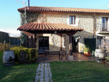
Accommodation in Villasana de Mena

Staying near Bercedo
For those who like shorter distances, about 3 km from Bercedo is a Hotel Rural Valtarranz . It is in a town called Noceco. That would give you about a 18 km day from Villasana de Mena to Bercedo, and about 23 from Nava de Ordunte. I have received a note from the owners, who say they are happy to pick peregrinos up in Bercedo or any other reasonable place. But even without that pick-up option, it would leave the day’s total from Villasana at 21.
From Bercedo to Espinosa is flat and sunny, and off road, but that’s about all I remember.
Accommodation in Loma de Montija
| Casa Rural Las Merindades Booking.com |
|

We stayed in the very nice Hostal Sancho García, which is the place recommended by Adolfo. We had a room facing onto the plaza mayor with a balcony, so we had a nice front row seat for the band playing and folkloric dancing going on that night. Also a nice spot to eat our troncos.
Day 4. Espinosa de los Monteros to Pedrosa de Valdeporres (25-26 km)
This day on the Camino is almost all off road, through a few small towns and a beautiful natural area. There is one ascent of about 200 m to a great view, with a stretch on the Via Verde made out of the now abandoned Santander-to-the-Meditrranean train line project. Begun in 1879, but never completed, the work was halted definitively in 1959. To tell the truth, the day seemed longer than 25-26, but I can’t point to any one specific difficulty. It is a very pretty walk. Ender’s guide notes that you can make the day a bit shorter by taking a forest route instead of the route on the abandoned railway. This split happes in the town of Entrambosríos and is marked.
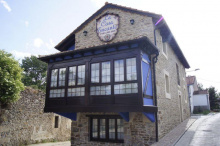
Accommodation in Espinosa de los Monteros
| Albergue de Espinosa de los Monteros 8.5€ 82 |


| El Montero de Espinosa ⭑⭑⭑ |
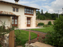
Accommodation in Quintanilla del Rebollar

Accommodation in Quisicedo
| Casa Rural Goiko |
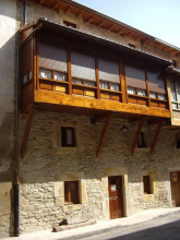
Accommodation in Villabascones de Sotoscueva
| Casa Rural Guareña ⭑⭑⭑ Booking.com |
|
Accommodation in Entrambosríos
| Casa Rural La Loma |
We spent the night in Pedrosa de Valdeporres, about .8 km before Santelices with its albergue in a train station.
We stayed in Hotel Rural La Engaña, double room was 55€. Truth be told, it was not a great price/quality ratio, but hey. A Spanish woman and her British husband operate the facility and also provide English immersion courses.
Probably the highlight of the day was walking through the natural area called Ojo Güareña. If I were to walk this way again, this is where I would mix things up a bit. It is described as a “karst complex.” Wikipedia describes an area filled with tunnels carved out of soluble rocks by underground water, 90 km of tunnels no less. Archaeological research reveals that the caves were inhabited hundreds of thousands of years ago, dating back to middle Paleolithic times. It includes the largest cave in Spain, which has rock paintings dating back at least 13,000 years. The Camino goes through a very pretty and forested area, and past some of the medieval anthropomorphic tombs.
But what it doesn’t do is take you to the Ermite de San Bernabé, which is a mere 2.1 km off the camino from the village of Quisicedo. It is a 10-12 century ermita, adjacent to a huge cave that is also open for visits. The most recent info I saw reported that it had re-opened and that guided tours take 45 minutes and cost 4€. Its setting reminded me a bit of the romanesque church in the Cañon de Río Lobos on the Camino Castellano-Aragonés. And that was just stunning. This may be more heavily touristed, which can interrupt the vibe a bit, but I think it would be a very nice visit.
So I would be tempted to take a day here, to see the ermita and to enjoy more of the natural beauty.
A video about Ojo Güareña, focusing on the natural beauty and wildlife (particuarly birds).
Day 5. Pedrosa/Santelices to Arija (27-28 km)
Another pleasant day, nice scenery (one ascent with about 200 m elevation, mostly through green tunnels) some nice open field walking. Nothing spectacular but very comfortable, and a bit of road walking thrown in.
Accommodation in Pedrosa de Valdeporres
| Casa Rural La Serna |
| Hotel Rural La Engaña ⭑⭑ |
Accommodation in Soncillo
| Albergue Juvenil Soncillo 80 |

| Molino de Luna |


Arija is probably my least favorite place on the Olvidado, but that’s just me. The original city was flooded to make the dam that created the reservoir of the Ebro. So what is there now is an “upper town,” newly created after the dam, and the “new lower town” created next to the water. A woman in the pharmacy in the upper town told me they flooded 400 houses, 8 churches, 2 chapels and a glass factory that made glass in the traditional artisanal way. Though the “upper town” is mostly newly built, I remember that the ayuntamiento seemed to be several centries old, so I am not sure whether they transported it up from below before the flooding or what the story is. The nucleus around the reservoir has the same feeling as the Embalse de Alcántara on the Vía de la Plata, though it has more commerce.
There is/was an albergue in Arija (google maps tells me it is permanently closed), but we stayed in Hotel Rural la Piedra. My notes tell me it was 46€ for both with breakfast.
There is a little grocery store down by the water. Since the hotel dining room didn’t open till 9, we went to the store to buy some food. I asked if we could get an extra plastic bag so we would have two “plates” for our meal. The little girl whispered something to her mother, then came back a few minutes later with some birthday party plates left over from her 9th birthday party.
Day 6. Arija to Olea (32.5 km)
Once you leave Arija, you have entered Cantabria and left Burgos behind. The approximately 18 kms to Villafría, which go along the reservoir, are all on the side of the road. For those who go to great lengths to avoid pavement, I was able to walk on the side on a dirt shoulder. The road is very untraveled but cars go fast between the pueblos. About 7 km along the reservoir edge, at Villanueva de las Rozas, you will see the tower of a church that was submerged to make the reservoir. There is a walkway out to the tower, and an opening that suggests you can climb the tower, but we didn’t go out. It was too forlorn looking for me.
After Villafría, I don’t think there’s any pavement at all, or very little. There were two highlights — the Roman ruins of Juliobriga, with a museum. We did not visit the museum, but enjoyed walking around and especially climbing the bell tower of the adjacent church overlooking the ruins.
From the ruins, the Camino goes up through a beech forest, about 200 m to the Peña Cutral. I remember some confusion on the top of a hill, and the GPS came to the rescue. And then there’s a descent to the spectaclar highlight of the day — the Romanesque church at Baños de Cervatos. Another Romanesque jewel, San Pedro. A good number of the capitals and corbels are erotic, though the purpose is still debated by art historians. For a sampling of the possible theories, see this article in El País. I only include G-rated pictures.
From the church to Olea is pretty straightforward, and I remember walking through some nice orchards and fields, but nothing really jumps out at me.
We stayed, as many peregrinos do, at the Casa Miguel. It’s a vacation complex of sorts, with very nicely equipped apartments. We paid 15€ each and had a very relaxing evening. The owners are generous and friendly — they and their friends insisted we sit outside with them for a few tapas and drinks. They wanted us to stay for the barbeque, but that would have kept us up way past pilgrim bedtime. They have also assured me in a recent Whatsapp exchange that they are happy to pick people up “sea donde sea” (wherever that may be).

