Accommodation in Aire-sur-l'Adour
| Accueil Communauté du Chemin Neuf 17€ 4 |
|
| Gîte La Chapelle des Ursulines 15€ 12 |
|
| Gîte d´étape La Maison des Pèlerins 17€ 15 |
|
| Gîte d´étape Au Passage de l'Adour 23*€ 4 |
|
| Gîte Au Gré de l'Adour 23*€ 5 Booking.com |

|
| Gîte-Hôtel de la Paix 15-18*€ 9 |
Accommodation in Miramont-Sensacq
| Gîte communal du pèlerin de Miramont-Sensacq 13€ 20 |
Accommodation in Bestit
| Gîte d´étape La Ferme de Marsan 14€ 10 |
Accommodation in Pimbo
| Gîte communal de Pimbo 17*€ 21 |
| Gîte Ferme de Nordland 22€ 8 |
Accommodation in Arzacq-Arraziguet
| Centre d'accueil communal d'Arzacq 12€ 90 |
Accommodation in Labalette
| Gîte d´étape A Labalette 36**€ 10 |
Accommodation in Larreule
| Gîte et chambre d'hôtes L'Escale 15€ 12 |
Accommodation in Uzan
| Gîte Chez Darribère 35**€ 4 |
Accommodation in Géus-d'Arzacq
| Gîte Ayguelongue 35**€ 4 |
Accommodation in Pomps
| Gîte d´étape communal de Pomps 13€ 18 |
Accommodation in Arthez-de-Béarn
| Gîte d´étape communal La Maison des Pèlerins 11€ 24 |
| Gîte d´étape Domi 16€ 7 |
|
| Gîte d´étape Pingouin Alternatif 15€ 5 |
|
| Gîte de la boulangerie Broussé 13€ 18 |
Accommodation in Argagnon
| Gîte d´étape du Cambarrat 15€ 8 |
Accommodation in Maslacq
| Gîte L'Estanquet 25*€ 7 |
Accommodation in Sauvelade
| Gîte d'étape Le P'tit Laa 14€ 15 |
Accommodation in Le Grand Saule
| Gîte Le Grand Saule 16€ 3 |
Accommodation in Méritein
| Accueil Chez Marinoë Donativo€ |
Accommodation in Navarrenx
| Gîte d´étape communal de Navarrenx 13€ 54 |
| Gîte et chambre d'hôtes Le Cri de la Girafe 23*€ 8 |
|
| Gîte d´étape L'Alchimiste 20*€ 12 |
Accommodation in Castetnau-Camblong
| Gîte Chez Bouju 20€ 14 Booking.com |

|
Accommodation in Lacorne
| Eco-Accueil Le Jardin des Rêves Donativo€ 18 |
Accommodation in Aroue
| Gîte d´étape communal d'Aroue 15€ 14 |
| Gîte d´étape Bellevue 12-13€ 14 |
|
| Gîte à la Ferme Bohoteguia-Chambre d'hôtes Ongi Etorri 14€ 27 |
Accommodation in Landaco
| Accueil Landaco Permaculture Donativo€ 9 |
Accommodation in Harambeltz
| Gîte d´étape Etchetoa 15€ 12 |
Accommodation in Ostabat
| Gîte Aire-Ona 20€ 12 |
|
| Gîte d´étape Ospitalia 14€ 12 |
|
| Gîte d’étape Izarrak 38-39**€ 14 |

|
Accommodation in Utxiat
| Ospital de Utxiat Donativo€ 4 |
Saint Jean Pied de Port is the nexus of several routes that spread out across mainland Europe, and it was from here (primarily but not exclusively) that pilgrims most frequently made the crossing into the Iberian peninsula.
The tradition remains and the small town is often saturated with pilgrims, and pilgrim related tourism, during most of the year. With so many newly minted pilgrims roaming the streets, it has an air of excitement mixed with apprehension and a touch of dread.
You are advised to have a reservation before arriving, and the same holds true for the very few accommodation options that exist between here and Roncesvalles. If reservations are not part of your plans, march on with the philosophy that the camino provides, as it so often does in the most unexpected of ways.
Landmarks to explore include the Citadelle at the top of town, the Porte de San Jacques, and the Notre Dame du Bout du Pont. Look to the cobbled streets for the well-trodden plaques that point the way to Santiago de Compostela.
Before you set off for the Pyrenees and the border crossing into Spain be certain to pick up a pilgrim’s credencial at the pilgrims office (Rue de la Citadelle). This accordion-fold booklet is your passport to the camino and will become your most cherished souvenir of the trip. It is a required document in most pilgrim-specific accommodation, earns you pilgrim prices in many museums, and will serve as proof of your journey when presented to the Pilgrims Office in Santiago if you are planning on getting your Compostela Certificate.
It is important to be aware of the dangers of weather between here and Roncesvalles. These mountains have claimed more than a few lives, including several in recent history. If you have any questions regarding the journey ahead, the volunteers at the pilgrim office are there to help and advise.
Saint Jean Pied de Port, or Donibane Garazi as it is known in Basque (remember that the French border aside, this town was once a part of Lower Navarre and the Basque language is as common here as it is over the pass), was founded in the late 12th century by the Kings of Navarre and served as the capital.
Market day in Saint Jean Pied de Port is Monday, which is also one of its least busy days for pilgrims.
The distance between here and Roncesvalles is the most physically difficult stretch of road you are likely to encounter on the whole of your camino. From the “Foot of the Pass,” it is a steady climb for the majority of the day, with a rather steep descent into Roncesvalles for the last hours. This steep descent can be made easier, though longer, via a path which joins the two options at the Puerta de Ibañeta.
The Valcarlos Route - 23.5 km
The Valcarlos Route follows close to the road and is the advised route during poor weather. It passes through two towns (with services) located directly on the road between here and Roncesvalles, and two villages that are not on the road and which have no services.
The Napoleon Route - 24.3 km
The Napoleon Route is the longer of the two and covers small mountain roads and trails. It was popularized as a way to bypass the banditry that was all too common in the valley below. You will soon see that up in the mountains, there are few places to hide.
During times of poor weather, this route will be closed. When the skies are clear you can see for miles, otherwise you are not likely to see past the horses and sheep that pasture here.
Accommodation in Saint Jean Pied de Port at the end of the Vía Podiensis
| Albergue de peregrinos de Saint Jean Pied de Port 12€ 34 |
|
| Gîte La Coquille Napoléon 18-20€ 10 |
|
| Albergue Beilari 43**€ 14 |
|
| Gîte La Vita è Bella 20€ 12 Booking.com |
|
| Gîte de la Porte Saint-Jacques 20€ 6 Booking.com |
|
| Gîte Bidean 18€ 12 |
|
| Gîte Zazpiak-Bat | 
|
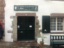
| Gîte Le Lièvre et La Tortue 23€ 14 |
|
| Albergue Zuharpeta 18€ 22 Booking.com |
|
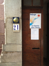
| Albergue Le Chemin vers L Etoile 21€ 50 Booking.com |
|
| Refuge Accueil Paroissial Kaserna 20*€ 14 |
| Camping Municipal Plaza Berri 10 / tent€ 50 |
| La Villa Esponda Booking.com |

|