
From Granja de Moreruela you can follow the Camino Sanabrés (follows from below) a total of 366km to Santiago, or you can follow the Vía de la Plata to Astorga 93.8km and from there follow the Camino Francés the remaining 256.9km. A description of the route to Astorga continues on page 98 but this guide does not include the stretch from Astorga to Santiago.
The Camino Sanabrés turns left and due west from Granja. It follows farm tracks to reach the Puente Quintos (6.7km) over the Río Esla.
Once over the bridge, the river splits into two distinct routes to get to Faramontanos de Tábara. The right route follows the road and is preferred when rains have been heavy. Follow the road to the first paved left turn to descend and rejoin the left route. The left route turns left at the end of the bridge to follow a more scenic trail along the river.
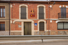
Accommodation in Granja de Moreruela to Sanabrés Route
| Albergue de peregrinos de Granja de Moreruela 6€ 20 |
|
| Casa Rural La Casa del Tío Quico |


The social center of town is the Bar Borox / albergue.
Beyond Barcial de Barco a bit of care is needed to keep to the camino. If you have any doubts, speak with the owners of the bar Borox (adjacent to the albergue), they sometimes provide a map of the way.
The confusion has to do with the recent development of a disused railway line into a pedestrian path known as the Via Verde. This is the recommended way as it delivers you directly to the albergue in Benavente (which itself is in a repurposed rail yard building).
After leaving Barcial de Barco the camino returns to the N-630 and crosses it; at this point you can see (ahead and on the left) the elevated Via Verde. The camino will eventually pass beneath it, and it is here that you can take the stairs up to the walkable level. From there it is a simple matter of following it all the way to the railway yard in Benavente.
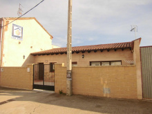
Accommodation in Barcial de Barco
| Albergue Las Eras 12*€ 14 Booking.com |
|


Note that it is technically possible to follow the Vía Verde all of the way to Villabrázaro, but that the arrows don’t really give you a good way to find where to depart from it and resume the camino.
From the albergue in Benavente, follow the Vía Verde a short distance until the road that it is parallel to it (on your right) turns away from the path. Here the camino leaves the Vía Verde and follows the road to the right. A short distance on it turns left and follows the road out of town and all the way to Villabrázaro
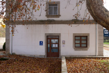
Accommodation in Benavente
| Albergue de peregrinos de Benavente 4€ 12 |
|
| Pensión La Trapería Booking.com |

|


Check with the Bar Real for keys to the albergue.
The camino follows a paved country lane to Maire de Castroponce, well marked.
Accommodation in Villabrázaro
| Albergue de peregrinos de Villabrázaro Donativo€ 14 |

|


The way to Álija del Infantado is complicated by only one turn. The camino follows a paved road most of the way and eventually arrives at a larger paved road after crossing the Puente de la Vizana over the Río Órbigo (and into the province of León). Pilgrims who have walked the Camino Francés may recognize the name, this crossing is downstream from the famous bridge at Hospital de Órbigo.
Here the camino arrows indicate a way straight ahead. However other arrows direct you to turn left along the road. If you plan to stay in the albergue, choose the latter option along the road. Both will get you there but the path ahead brings you to town well past the albergue.

Two great churches, but if you only visit one make it the Iglesia de San Esteban with its coffered Mudejar ceiling.
Follow the road to La Nora del Río (3km). Arrows at the start of town are conflicting, the smaller ones send you through town (no services) while a giant one encourages you to turn left along a trail adjacent to the river. The river choice is the best option and you will follow it for the next few hours.
Accommodation in Álija del Infantado
| Albergue de peregrinos de Alija del Infantado 8€ 12 |
|
| Hotel El Hotelito | 
|


Cross over the river (which now looks more like a canal) to get to the bar, otherwise keep on straight through town.
The camino ahead passes near the villages of Villanueva de Jamuz (bar) (3.4km) and Santa Elena de Jamuz (3.8km) but does not actually enter them. At the far edge of Santa Elena it joins the road but only for a short distance, keep an eye open for the arrows which turn right and away from the road.
The path follows farm lanes to the A-6 motorway and here the camino turns left in search of a way beneath it... which happens to be along the road you left earlier. The camino follows the road until it bends to the left, where it instead turns to the right to enter La Bañeza via the back roads.


Accommodation in La Bañeza
| Albergue de peregrinos Monte Urba 10€ 36 |

| Hostal Caminito ⭑ Booking.com |

|


Accommodation in Palacios de La Valduerna
| Hotel Rural Señorío de los Bazán Booking.com |

|


Here you will take first notice of the Maragato culture, the ancient tribe of red-headed Iberians that served as the muleteers between the coast and the interior of Spain. They maintain several curious customs by modern standards, doing most thing the exact opposite as we are accustomed. One of these is their cocido, which is served meat first and greens last. It is a hearty meal and one not to be tackled alone. Grab a group of pilgrims and head off to one of the restaurants serving “Cocido Maragato” for a taste. Be warned, this is not a vegetarian-friendly option.
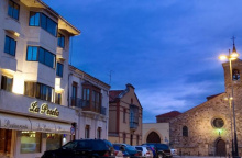
Three buildings of note: 1. The Ayuntamiento (whose animatronic sculptures ring in the hours), 2. The Palacio Episcopal, which was never occupied by the Bishop and which was designed by Gaudi, and 3. the Catedral de Astorga. The last two can be visited on a joint ticket for 5 euros but the opening hours are not always clear.
At the junction of several Roman roads, it is no wonder that Astorga is full of Roman ruins. Several dig sights are ongoing and can be toured, and nearly every structure in town has some Roman foundation. This was an important crossroad for the Romans and the gateway into El Bierzo.
Santa Marta is celebrated during the last week of August. Market day is Tuesday.
The camino here leaves the last of the plains behind and begins, slowly at first, to climb. The ascent is slow and gradual until Rabanal, where it begins a more steep ascent to the alto and an equally quick descent into Molinaseca. On the way up it passes through several small but equipped towns (no ATM’s but plenty to eat).
Accommodation in Astorga (from the Via de la Plata)
| Albergue San Javier 12€ 65 |
|
| Albergue Só Por Hoje 28€ 10 Booking.com |
|
| Albergue MyWay 14€ 14 |
| Albergue de Peregrinos Siervas de María 7€ 165 |

 on the Camino de Santiago")
 on the Camino de Santiago")