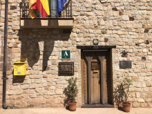
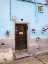
Viana is a thriving city that serves as a good stopping point. A pair of albergues, a few churches, the occasional closing of the city streets to run with the bulls, and a handful of good restaurants offer a break from walking.
There is a nice green park, small but a great place to rest, on the west end of the town near the albergue and church ruins. It also offers great views of the plains to the west and the mountains to the north.
The restaurant Armendariz has a sidreria in the basement, where you can serve your own cider. To do so is a two person job whereby you position your glass near a bucket in the center of the room, and the person seated nearest the spigot in the wall lets flow an arc of cider on a trajectory towards said bucket.
Viana, being a frontier town along the border with La Rioja, has been built with obvious fortifications. The most strategic of these is its perch high above the surrounding hillside.
Although the city walls served their purpose well, holding off several prolonged sieges, the town changed possession several times since its founding in 1219. It did so largely with the shifting possession of the surrounding land.
Viana has no shortage of celebrations, and it is entirely possible that when you arrive the main street will be closed to everyone but bulls and mad men.
The most important: San Felices is celebrated on the 1st of February, Magdalena and Santiago from the 21st to the 25th of July. And the Fiesta for the Virgen de Nieva (snow), a movable feast that is celebrated from the Saturday to Wednesday that includes the first Sunday after the 8th of September.
Not long after leaving Viana you will have left Navarra behind and entered into La Rioja. The way into Logroño, its capital, is without much heavy industry.
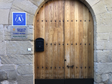
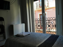
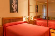
Accommodation in Viana
| Alberguería Andrés Muñoz 8€ 54 |
|
| Pensión San Pedro |
| Hostal Casa Armendáriz |

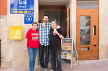
| Albergue Izar 15*€ 44 |
|


The 17th century ermita, and the river that it sits along, are often considered to be the border to La Rioja. The actual modern day border is closer to Logroño but the paper factory that marks it is much less quaint than this ermita.
You have now left Navarra behind you, and the basque ‘feeling’ which has been fading since Roncesvalles will now disappear almost entirely. The widespread use of the name La Rioja, which first appears in a charter from 1099, is fairly new; prior to that, it was referred to as the province of Logroño. From a legal perspective, the name La Rioja was not legitimized until after the 1975 death of Francisco Franco when Spain transitioned into a democratic monarchy.
La Rioja is the second smallest autonomous community in Spain and the smallest along the Camino Francés. The camino will pass through several of its larger cities, including Logroño, Santo Domingo de la Calzada (which is next to the “río Oja”), and Nájera. It will also pass through several smaller villages, whose populations seldom exceed 200.
La Rioja has made its mark on the world as one of Spain’s largest producers of wine. Enjoy it while it lasts, which is only about 60km worth of walking along the camino. If that strikes you as too little, consider a detour to the Monasteries of Yuso and Suso; just enough to prolong your stay and explore some of the finest Monasteries around.
To the south of Logroño lies the town and castle of Clavijo. It was there in 844 during a battle between Ramiro I of Asturias and Abd ar-Rahman II of Córdoba that the legend of Santiago Matamoros was born. The legend tells of the return of Santiago (centuries since deceased remember) on a white horse and dressed for battle. Such a sight energized the Christian fighters (who had been on the losing side of the Moorish invasion) who went on to defeat Abd ar-Rahman. The scene is depicted in countless places along the camino, with Santiago riding high and the moors trampled underfoot.

Once you have crossed the río Ebro, you have entered Logroño proper.
Worth visiting are the Concatedral de Santa María de La Redonda (it shares the title of Cathedral with Santo Domingo, and it has a semi-hidden painting of the crucifixion by Michelangelo), the Iglesia de San Bartolomé, and the Iglesia de Santiago del Real. Of these, only the last one is located along the camino route, though all are easy to find and centrally located.
If you have grown accustomed to the usual Menu de Peregrino for dinner, Logroño will have you adjust your thinking a bit. Here they go in for the tapas style dining and they want you to join them. So head over to Calle Laurel and do just that... hopefully your albergue keeps the door open a bit late. If you go a bit overboard, a short day to Navarrete tomorrow is not at all uncommon.
Like a few towns before, and several ahead, Logroño owes its success to the construction of the stone bridge over the río Ebro which for a long time was the only suitable crossing point of this wide river. As such it was able to command a toll, to which pilgrims were subjected. Unfortunately very few of its medieval monuments have survived, nearly all of them destroyed. Logroño in fact, given its position both along the Ebro and on the frontier, is one of the most battled for cities in the north of Spain. In 1092 it was destroyed by El Cid.
Logroño seems always to be in a state of celebration. The two big festivals are for San Bernabé on the 11th of June, and San Mateo on the 21st of September. The latter of these two, held during the fall harvest, is much to do about wine.
Leaving Logroño is not unlike departing most large cities in that it winds its way across town in a way that mixes landmarks with practicalities. There are plenty of arrows to mark the way, but most are painted low on curbs and can be difficult to see if you are a pre-dawn walker. If in doubt, make your way to the Cathedral and with it to your back head straight ahead along the Calle de Marqués de San Nicolás. You will pass straight through two roundabouts, turn left on the third.
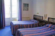
Accommodation in Logroño
| Albergue de Peregrinos Albas 15€ 22 Booking.com |

|
| Albergue Logroño 15€ 48 Booking.com |
|
| Albergue Santiago Apóstol 15-18€ 76 Booking.com |
|
| Winederful Hostel & Café 21€ 18 Booking.com |

|
| Albergue Parroquial de Santiago Donativo€ 30 |
| Albergue de Peregrinos de Logroño 10€ 68 |

|


The Alto de la Grajera is part of the park and embalse (reservoir) on the outskirts of Logroño. It is an excellent place to walk through slowly, perhaps to stop in and enjoy some nature.
The dam here, and the resulting ecosystem, was constructed in 1883 as a way to store water for irrigation. Since then the park has grown in size and importance and is one of the few wetlands that exist in La Rioja. Anyone with a keen interest in bird watching will especially appreciate the protected areas which are home to several species of birds.
Be advised that the embalse is strictly off limits, so no pilgrim bathing should be attempted.
The Big Black Bull: The history of Spain’s most iconic billboards dates back to the founding of a Cadiz brandy-sherry winery by an Englishman named Osborne. The bulls were originally built to a height of 4 meters and bore the name Osborne in red lettering. The drove grew to 500 before anti-billboard legislation jeopardized their existence. Over popular outcry they were moved back from the road, stripped of their lettering, and rebuilt to a height of 14 meters. Today 90 of the bulls remain.


Navarrete, much fought over and mostly destroyed, no longer has any of its medieval history to share. It does, however, have a few covered arcades which give you a sense of its past. Like is common on an otherwise flat land, the town was developed around a hill; you will see plenty more of this strategy before you get back into the mountains.
The Iglesia de Santa Maria de la Asuncion deserves an extra mention here in case you were thinking to skip it. Don’t. It maintains hours which can be difficult for pilgrims but do try to make a visit.
If you are staying in Navarrete for the night, you might consider a small climb up to the ‘Tedeón’ to where the castle once stood. There is a nice picnic park there and a good view of the surrounding land.
Market day is Wednesday. In mid-August, the town turns out to celebrate the Virgen and San Roque. On the 29th of September, during the grape harvest, they celebrate their patron saint, San Miguel.
On the way into Navarrete you pass the remains of 12th century San Juan de Acre. While there is not much left, the footprint remains well enough preserved to spark the imagination. The original entrance to the former pilgrim hospital has been reincarnated as the entrance to the town cemetery which is passed on your way out of Navarrete.
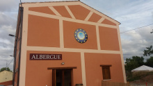
Accommodation in Navarrete
| Albergue de Peregrinos de Navarrete 10€ 48 |

|
| Albergue El Cántaro 15€ 28 |
|
| Albergue La Casa del Peregrino Ángel 15*€ 18 |

|
| Albergue Buen Camino 12€ 10 |

|
| Albergue A la Sombra del Laurel 15€ 30 Booking.com |

|
| Albergue El camino de las Estrellas 12€ 40 Booking.com |
|
| Albergue La Iglesia 15€ 15 |
|


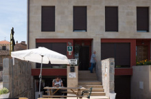
With changing times Ventosa has found itself separated from the camino by the rearrangement of yellow arrows for the sake of shaving 800m from the camino. There are two bars, an albergue, and a usually lively atmosphere as the majority of pilgrims continue to mark this path.
Accommodation in Ventosa
| Albergue San Saturnino 14€ 40 Booking.com |
|


The eastern entrance to Nájera is not easy on the eyes. This new part of the town grew up on the east bank of the río Najerilla (the cliffs prohibit expansion to the west) and much of the city’s industry is located here.
Leaving town is notably better as you transition quickly back to the rural roadways that connect many of the smaller villages.
The Monasterio de Santa María la Real is one of the finest cloistered buildings in all of La Rioja and merits a visit. It is built into the entrance of a cave where the image of the Virgin was discovered by Sancho’s son García IV.
Nájera, named for its position “between cliffs,” is a city that has been in favor since Sancho III (El Mayor) made it the capital when Pamplona was captured. At the time the camino passed further to the north, in the rugged but more protected mountains. His efforts moved the popular route to its current location.
Sancho’s preference brought the town much prosperity, including a market which was an important element in the funding of the Monasterio de Santa María la Real.
The rolling hills that you crossed to get here are the setting for a famous set of battles between Roland and the Syrian giant Ferragut. The giant had already defeated countless warriors before the Frankish leader took him to task. They both lasted through several battles, resting together between them, before Roland succeeded in finding Ferragut’s weak spot.
Tales like these, and those of Charlemagne, served to elevate towns like Nájera (and the pilgrimage route as a whole) to a near mythical status.
The Najerinos keep a busy fiesta calendar. San Antón is celebrated on the 17th of January. San Prudencio (patron of the city) on the 28th of April. San Antonio on the 13th of June. San Juan and San Pedro from the 24th to the 30th of June. San Juan Mártir and Santa María la Real from the 15th to the 18th of September. And San Miguel the weekend closest to the 29th of September.
If the celebration of Saints doesn’t move you, perhaps the celebration of the Rioja Pepper might. It is on the last Sunday of May.
On the way to Azofra, take notice of the modern aqueducts which help to irrigate the land. They are gravity fed and are a real-world example of hydraulics in action, with sections that pass beneath the road rather than passing above it.
Accommodation in Nájera
| Albergue de Najera 6€ 50 |
|
| Albergue de Peregrinos Sancho III - La Judería 13€ 15 |
|
| Albergue Puerta de Nájera 15-20€ 32 |
|
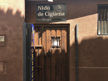
| Albergue Nido de Cigüeña 15€ 19 |
|
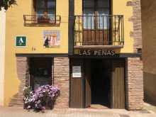
| Albergue Las Peñas 15*€ 18 |
|
| Albergue El Peregrino 10€ 28 |

|
| Pension San Lorenzo Booking.com |

|


A somewhat sleepy town, it is well maintained and a suitable place for breakfast if you set off from Nájera in the morning. The municipal albergue here is well appointed, and all rooms are double rooms.
The camino between Azofra and Cirueña passes through the Rioja Alta Golf Club where pilgrims are served alongside golfers. It no longer goes through Cirueña but passes immediately adjacent to it. Ciriñuela however has been separated from the camino by a large residential complex (there is still a bar that which serves locals, and the owner can point the way back to the camino without you having to retrace your steps).
Accommodation in Azofra
| Albergue Municipal de Peregrinos de Azofra 15€ 100 |
|
| Pensión La Plaza 12 |
|


If you are interested in a coffee or breakfast in Cirueña, turn left on the main road and walk for about 200m.
Accommodation in Cirueña
| Albergue Virgen de Guadalupe 15€ 17 |
|
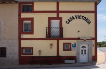
| Albergue Victoria 14€ 10 |
|
| Casa Rural Victoria Booking.com |
|

The highlight of the town is the Catedral de Santo Domingo de la Calzada and its gothic henhouse. Santo Domingo is buried there as well, fittingly, in the middle of the road. The only remaining tower (of the original three) is detached and is located across the street. This is a rarity in Spain, particularly for a building of such importance, and the location was selected as the nearest place where a suitable foundation could be built. Tours are available.
“Santo Domingo of the Road” is named after a local monk (Domingo of Viloria) who dedicated his life to the care of pilgrims. In particular, he focused on the engineered elements of the way, building roads and bridges to improve the quality of passage. It was he that built the original bridge over the río Oja on the outskirts of town.
The town is also the setting for the miracle of the “Hanged Innocent.” The same miraculous story is told in various parts of Europe (Toulouse, France and Barcelos, Portugal), and the miracle is confusingly attributed to either Santiago or Santo Domingo depending on the telling. It centers around a family of German pilgrims who stopped to rest in Santo Domingo.
When their young son refused the romantic advances of the innkeepers daughter she laid a trap. She stashed a piece of silver from the church in his bag, and made sure to notify the authorities. He was charged with theft and sentenced to hang. These being medieval times, the body was left to hang for weeks as a warning to others. His parents meanwhile, mourning their loss, finished their pilgrimage to Santiago.
Returning through Santo Domingo de la Calzada, they stopped to visit their son (a fairly morbid visit given his state) and were astonished to find him alive and well, though still hanging. His weight had been supported by one of the saints. His parents knew a miracle when they saw one (apparently, the rest of the townspeople did not) and went straight to the officials to report that he was alive. Incredulous, one of the officials replied that the boy was no more alive than the chicken he was roasting; whereupon the miracle continues with the reanimation of the chickens which took to their feet, clucking and squawking.
The town never forgot the miracle, and part of the gallows remains on display in the Cathedral transept over the Saints tomb. Descendants of the original chickens are kept (alive and well fed) in a coop in the west transept.
The Feast day of Santo Domingo is celebrated from May 1st to the 15th, but the celebration really gets going on the 10th. This is quite a celebration indeed, and the feasts themselves include a tremendous quantity of meet followed by all-night processions through town.
There is also a medieval market, held from the 4th to the 8th of December.
Leaving town you cross over the mostly dried up río Oja. The bridge is a rebuilt version of Domingo’s original.
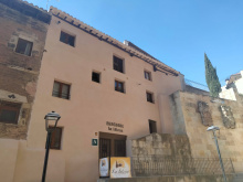
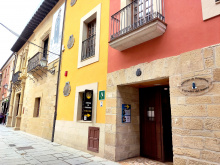
Accommodation in Santo Domingo de la Calzada
| Carpe Viam 22 Booking.com |

|
| Albergue Casa del Santo 13€ 169 |
|
| Hospedería Cisterciense ★★ | 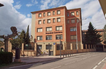
|


