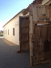
The Ermita of San Nicolás, like the ruins of San Anton before Castrojeriz, has a long history of taking care of pilgrims. Both stand on their own far from towns and as a result, they don’t necessarily get the amount of traffic they deserve. Perhaps that is for the best as pilgrims often claim them to be the most memorable albergues along the way.
Just beyond the Ermita is the Puente Fitero which takes you over the river of the same name, and into Palencia.
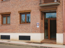
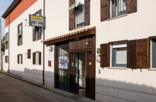
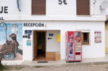
Accommodation in Ermita de San Nicolás
| Albergue de San Nicolas Donativo€ 12 |

|

Crossing the Puente Fitero brings you into the province of Palencia. The bridge here has survived the years but others to the south have long since disappeared, taking with them the pilgrims whose commerce helped to build several uncharacteristically large churches along the way.
If you are up for a detour those of Santoyo (Iglesia de San Juan, with beautiful organ) and Támara de Campos (Iglesia de San Hipolito) are among the best. To get there, follow the P-432 west from Boadilla, and turn left onto the P-431 (which comes south from Frómista). The trip there is about 12km (visiting both locations), and 7km straight back to Frómista.
Palencia also marks the start of a region known as Tierra de Campos, and the wide expanses of the meseta seem to magnify here.
The Iglesia parroquial de San Pedro Apóstol (at the entrance to town) has an image of Santiago Peregrino.
We can learn a bit about the name of the town, the name of the river, and the word for the stones that mark the camino. They all derive from hito (Fitero, Itero, and hito), which describes a stone that has been driven into the ground, and which is used to indicate a frontier or boundary.
Accommodation in Itero de la Vega
| Albergue de Peregrinos de Itero del Castillo 10€ 7 |
| Albergue Hogar del Peregrino 15€ 7 |
The fields surrounding Boadilla are dotted with adobe palomares (dovecotes). Find your way towards one and explore the interior, which holds thousand of niches.
Adjacent to the town square is the Romanesque Iglesia de la Asunción and a well preserved Rollo de Justicia, a 15th century stone column to which criminals were chained while their punishments were meted out.
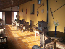
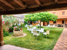
The best albergue in town (also in the square) is worth a visit even if you don’t plan to stay there. Behind the unpretentious walls is a garden oasis complete with a pool and art.
Saint Anthony of Padua is celebrated from the 13th to the 15th of June.
The camino leaving Boadilla soon joins a path that runs alongside the Canal de Castilla. You will follow along the canal until the outskirts of Frómista, where you cross at one of the locks. This canal was used for both transportation and irrigation.
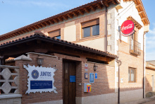
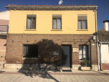
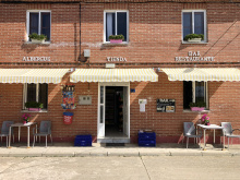
Accommodation in Boadilla del Camino
| Albergue En el Camino 14€ 48 |
|
| Juntos Albergue de Peregrinos 13€ 12 |
|


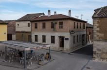
Frómista is the southernmost city along the Camino Francés and the epicenter of wheat growing in Spain. Its rises and falls over the centuries were finally steadied with the arrival of the canals in the late 18th century; they brought proper irrigation and an abundant source of power for mills.
In the center of town sits the Iglesia de San Martín, which underwent a rather unfortunate renovation in the 19th century. In the process, many of the more artistic elements were removed for reasons of decency. Quite a few decorated capitals make for an interesting, if not amusing, visit. Two other churches, San Pedro and Santa María del Castillo, are generally open to the public.
Pedro Gonzáles Telmo, patron saint of sailors and the namesake of the expression Saint Elmo’s Fire, hails from Frómista.
San Telmo is celebrated on the Monday following Easter Monday and it is a pretty big deal for Frómista. If you miss it, the smaller celebration for San Telmillo is the following Sunday. Santiago is celebrated on the 25th of July and the Virgen of Otero is celebrated on the 8th of September.
Fridays are Market days.
Leaving Frómista is accomplished by retracing a few steps to the main intersection, do not blindly make your way through town and if you plan to leave before the sun rises do yourself the favor of scouting for arrows in advance. The trail here follows a gravel path punctuated by frequent “twin hitos” that are placed to discourage off-road vehicles from taking over the path.
Accommodation in Frómista
| Albergue de Fromista 12€ 56 |
|
| Albergue Estrella del Camino 14€ 34 Booking.com |
|
| Albergue Betania Donativo€ 7 |
|
| Albergue Luz de Frómista 13€ 26 |
|
| Albergue Vicus 13€ 6 |
|
| Pension La Via Lactea Booking.com |

|


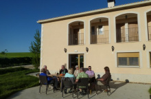
Accommodation in Población de Campos
| Casa Rural Amanecer en Campos Booking.com |
|

ALTERNATE ROUTE to Villalcázar, via Villovieco
The camino follows the road out of Población, over the bridge and along the same type of path that brought you into town. This alternative route bypasses the next two towns (Revenga and Villarmentero) and follows a quieter trail alongside the river.
To follow this detour stay on to the right through Población de Villavieco (NICE BAR) keeping on the north side of the river and passing through Villovieco. In Villovieco you cross the bridge and turn to the right and follow the river (or carry on straight and rejoin the camino in Vilarmenteros, which has been paralleling this one along the road). If you turn right, the waymarking is hard to see but you can hardly get lost as the trail stays adjacent to the river until you get to a crossroad (P-981) and a weathered ermita. Turn left on the road and into Villacázar de Sirga.

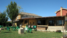
Accommodation in Villarmentero de Campos
| Albergue Amanecer 7€ 36 |
|


The Iglesia de Santa María la Blanca dominates the hillside of Villálcazar. Its appearance, that of a church/fortress, can be attributed to having belonged to the Knights Templar. King Alfonso X claimed that the White Virgin here had cured pilgrims, she is still there if you are in need of a miracle.
Accommodation in Villalcázar de Sirga
| Albergue Villalcázar de Sirga Donativo€ 20 |

|
| Albergue Don Camino 14€ 28 |
|


The Café Bar España serves as the local bus stop, should you find yourself in need of motorized transport inquire at the bar for schedules.
CAUTION - When leaving Carrión de los Condes it is extremely important to stock up on water. 17km separate it from Calzadilla de la Cueza, with little protection from the sun or wind. In recent years, a roadside kiosk has sprung up at the halfway point, but there are no guarantees that it will be open.
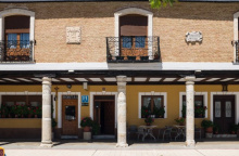
Carrión de los Condes has a rich and prosperous, to say nothing of colorful, history. Located at the intersection of the Pilgrimage road and the río Carrión it attracted merchants and a sizable population. Charlemagne is reported to have used the fields along the river as an encampment on his quest to control the pilgrimage route. Over a dozen pilgrim hospices once called Carrión home, and to this day you will find that many of the albergues are under the care of one religious order or another, the nuns of Santa María are known to sing to pilgrims.
In most parts of the Catholic world San Zoilo is celebrated on the 27th of June but not in Carrión where he is the Patron Saint. Instead it is a movable feast celebrated in August; specifically on the Monday following the second to last weekend of the month. The celebration for that day starts 5 days earlier, on Friday and it continues into Tuesday.
Nuestra Señora de Belén is celebrated on the 8th of September.
Thursdays are market days.
Accommodation in Carrión de los Condes
| Albergue Espíritu Santo 10€ 80 |

|
| Albergue de Peregrinos Parroquia de Santa Maria 8€ 52 |
|
| Monasterio de Santa Clara 10€ 30 |
|
| El Edén |
| Apartamentos Casa Tía Paula Booking.com |

|


Calzadilla’s Iglesia de San Martín, possibly the least visited church along the camino, has a generous display of crosses of Santiago.
The best, and most creative, menu in town is at Los Canarios.
The camino between here and Ledigos, a distance of 6.2km, has several detours. A large stone marker at the edge of town indicates the possible routes ahead. These variations will take you further into the hillside and away from the road. Most merge shortly before entering Ledigos, but the one that keeps farthest to the left/west (known as the Palomares Route because of the number of dovecotes along the way) bypasses both Ledigo and Teradilllos and is the shortest route to Moratinos.
Accommodation in Calzadilla de la Cueza
| Albergue Municipal de Calzadilla de la Cueza 8€ 34 |

|
| Albergue de Peregrinos Camino Real 10€ 32 |
|
| Alojamiento Los Canarios 15-19€ 9 Booking.com |
|

Santiago is celebrated on the 25th of July.
Ledigos wins the award for most confusing camino signs. Fear not, both directions will take you to Terradillos de los Templarios. However, if you are planning to stay at the Los Templarios albergue (located along the road, before the pueblo) you are advised to take the path which follows the N-120, which is the one indicated by the right arrow. The left arrow takes a more direct path to Terradillos across the fields.
Accommodation in Ledigos
| El Palomar 8€ 52 |
|
| Albergue La Morena 15€ 42 Booking.com |
|

Between here and Sahagún the camino follows along a dirt track which frequently parallels the N-120. The N-120 has numerous blind spots for motorists and you are advised to keep off it whether by bike or by foot.
Accommodation in Terradillos de los Templarios
| Albergue Los Templarios 15€ 51 |
|
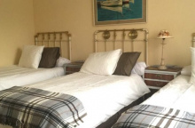
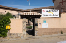
| Albergue Jacques de Molay 12/15€ 46 |
|

Moratinos has seen its share of pilgrims over the years and is currently undergoing what can be described as a slow renaissance. The hillside is chock full of hobbit holes, specially built to store large barrels of wine.
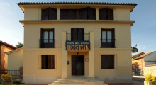
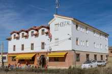
Accommodation in Moratinos
| Albergue de Peregrinos Hospital San Bruno 14€ 28 Booking.com |
|
| Hostal Moratinos ★★ 12€ 25 Booking.com |
|

