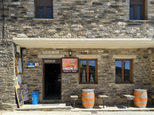
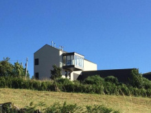
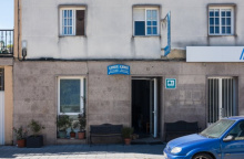
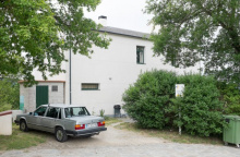
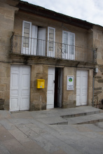
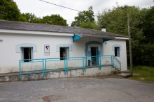
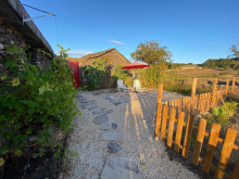
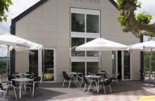
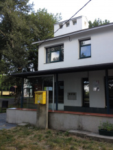
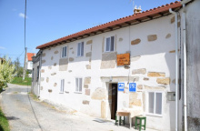
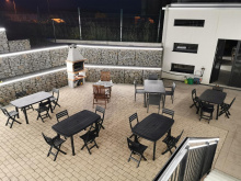
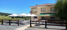
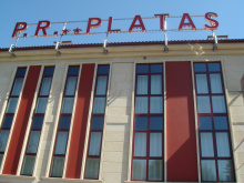
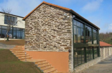
Laguna sits about 1km from the Galician border, making it a rather remote frontier town.
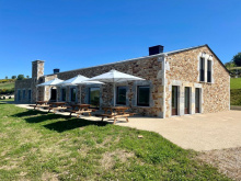
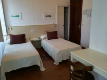
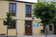
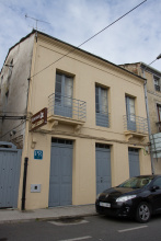
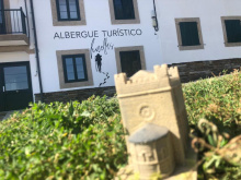
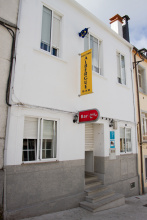
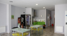
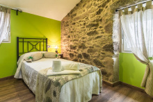
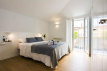
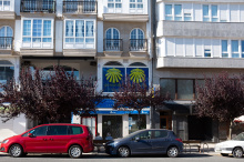
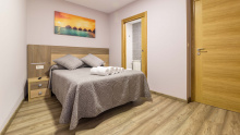
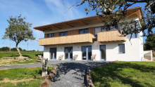
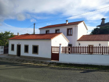
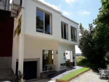
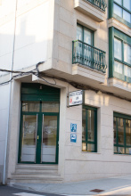
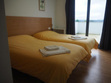
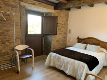
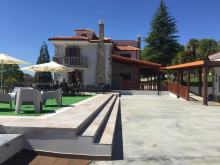
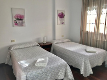
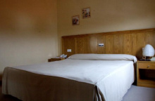
Accommodation in Laguna de Castilla
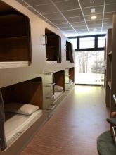
| Albergue La Escuela de La Laguna 13€ 43 |
|

Welcome to Galicia, where the legend of Santiago was born. This northwesternmost corner of the Spanish Peninsula bears little resemblance to the type of landscape that typically comes to mind when thinking about Spain. It is wet, and very green, and the mountains that surround it have for centuries kept it isolated from the rest of the country.
The language here is Gallego and although it has been distilled into one teachable form, you are more likely to get an earful of a more rustic, ancient, and totally incomprehensible version as you pass from one village to another. Village is perhaps too generous of a word, hamlet would be better suited… or perhaps just ‘place’ as so many collections of more than one building are often called here.
For centuries the land here has been fought over by invaders, but the Galicians did not defend it with quite the same gusto as their Basque counterparts and as a result they have spent most of recorded history an occupied nation. Perhaps this is the reason that Galicians have a reputation for being introverted, or guarded, or skeptical, and above all non-committal. Ask a Galician on a staircase the saying goes, and he will be unable to tell you which direction he is heading.
You are likely to find Celtic symbols carved into the stone of a home, or a church. Common also are witches, both the good kind and the bad kind. Hearty soups, a darker bread with a heavier crust, and a strong liqueur (the by-product of the local wine production) are a part of every meal.
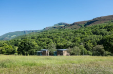
The terrain will change as you get closer to Santiago. Mountains shrink as you head west, but they become more frequent and by the time you reach the Apostle you will find precious little flat ground.
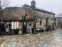
O Cebreiro has grown from a small and ancient village of dairy farmers into a small and ancient village of large scale tourism. With luck you will arrive in a shroud of fog and leave with an abundance of sunshine; both suit this village well.
It has played an important role throughout the history of the camino. It was the parish priest, Father Elías Valiña Sampedro, who is most responsible for the resurgence of the camino. It was he that first painted the yellow arrows, and the tales that surrounded him doing so are the stuff of legend. Once, in 1982, he and his white Fiat van parked along a trail in the Pyrenees. It was a time when Basque separatists were trading blows with the Guardia Civil, and when they came upon him, suspicions were aroused.
He opened the van door to reveal cans of yellow road paint and identified himself as the parish priest of O Cebreiro (a long way from home). When asked what he was doing his answer was as simple as it was prophetic: “I am preparing a great invasion!” It was he that orchestrated the installation of the granite hitos as well. His death in 1989 meant that he only got to see the trickling start of his invasion.
The parish church is also the setting for a miracle. According to legend, The Holy Grail was hidden there and in the 14th century produced a miracle that was certified by Pope Innocent VIII. A peasant from a local village braved the hike up to O Cebreiro during a dangerous snowstorm to hear mass. The priest chastised him for endangering his life for a bit of bread and wine. At that the bread and wine turned into flesh and blood, cementing the reputation of this small hamlet.
Santa María and the Holy Miracle are celebrated on the 8th and 9th of September.
From the top, it is mostly downhill, though there remain a few brief climbs, all of the way to Triacastela.
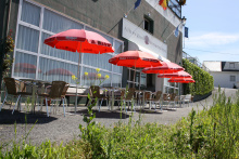
Accommodation in O Cebreiro
| Albergue de Peregrinos O Cebreiro 10€ 104 |
|
| Albergue Casa Campelo 15€ 10 |

| Pensión Casa Carolo ⭑ |
| Hotel O Cebreiro ⭑ |


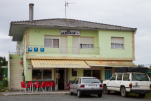
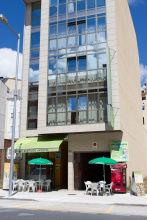
Accommodation in Linares
| Albergue Linar do Rei 14€ 20 Booking.com |
|
| Casa Rural Jaime |


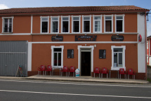
Accommodation in Hospital de la Condesa
| Albergue de Hospital da Condesa 10€ 20 |
|


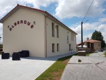
Accommodation in Alto do Poio
| Albergue Bar Puerto 6€ 16 |
|
| Hostal Santa María do Poio |

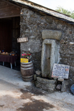
Small shop inside the albergue. The village is quite small, only 40 people. Three of the families make their living producing Queixo de Cebreiro, which can be sampled at the bar in the albergue.
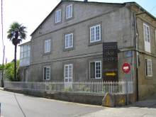
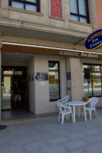
Accommodation in Fonfría
| Albergue A Reboleira - Casa Nuñez 13€ 50 Booking.com |
|
| Casa Rural Núñez Booking.com |

|
| Pensión Casa Lucas Booking.com |

|
| Casa Galego Booking.com |
|


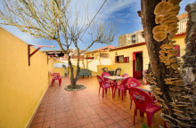
Accommodation in Filloval
| Albergue Fillobal 12€ 22 Booking.com |
|

Congratulate yourself on a job well done, the pass into Galicia has been overcome and from here on out the mountains soften in severity.
Triacastela is full of choices: where to eat, where to shop, where to sleep, and even how to leave town.
Accommodation in Triacastela
| Albergue de peregrinos de la Xunta 10€ 54 |
|
| Albergue de Peregrinos Aitzenea 10€ 38 |
|
| Albergue de Oribio 10€ 27 |
|
| Albergue Berce do Caminho 9€ 27 |
|
| Complexo Xacobeo 11€ 48 Booking.com |
|
| Albergue A Horta de Abel 11€ 14 |

|
| Albergue Lemos 12€ 12 Booking.com |

|
| Albergue Atrio 13€ 20 Booking.com |
|
| Pensión Fernández | |
| Pensión Xacobeo | |
| Casa Olga Booking.com |
|
| Pensión Casa Simón ★★ Booking.com |
|
| Pensión García Booking.com |

|
| Pensión Casa David ★★ Booking.com |
|
| Hostal Vilasante Booking.com |

|

At the end of town when leaving Triacastela you arrive at a fork in the road, presenting two distinct ways to Sarria. Distances shown are from Triacastela, through Aguiada to Sarria.
Beyond Samos, the camino once again splits, allowing you to rejoin the Calvor and San Xil route in Aguiada. This is the preferred route as it spends the least amount of time along the roadside. Alternatively, you can stay on the road from Samos all the way to Sarria. A third option is to go to Samos, and shortly after turn north to join the other route near Aguiada (distances on next page, after Samos).
via the Monastery at Samos - 25.1 km via aguiada or 21.3 km along road
At the end of town, turn left to follow the road to the Monastery at Samos (all services). The way is generally through small hamlets along country lanes.
via Calvor and San Xil - 18.2 km
At the end of town turn right. Cross the main road to follow a smaller road. The way is generally through small hamlets along country lanes.
You will notice very quickly, through both smell and sight, that dairy cows are the primary trade. The light brown color gives them their name, the Rubia Gallega; though you will also see an imported imposter, the Dutch Holstein.
Between here and San Xil you will pass a large fountain with a large scallop shell with a lot of graffiti and algae. Beyond that by two more kilometers is the Alto de Riocabo. You will also pass through San Xil de Carballo, with no services.
Accommodation in A Balsa
| Albergue El Beso 13€ 16 Booking.com |
|
You will not enter the village of Montán, but rather pass along the edge. While there is no fixed bar, there is a small picnic area with an on-again-off-again vending machine.
You will pass through Fontearcuda and Furela, no services.
The camino does not go through Calvor, but rather passes near its Iglesia de San Estevo y San Pablo. To get to the church, turn left for a short detour once you leave Pintín. The church itself is nothing spectacular, but the site has been home to one building or another since two monks from Samos founded a church here in the 8th century. Also the view towards Samos is worth the detour.
Accommodation in Calvor
| Albergue de Hospital de Calvor 10€ 22 |
|
The remainder of the camino to Sarria is along the footpath adjacent to the road.
Pass several villages with no services: Lastres, Freituxe, and San Martiño do Real.
It is difficult to separate Samos from the monastery that dominates this small village. The monastery albergue here is reminiscent of the old albergue in Roncesvalles; one long vaulted space full of hobbling pilgrims, snoring, and laughter. I cannot recommend the experience enough.
Opposite the gas station is the Rúa do Salvador. At the end of this road are a wonderful shaded park and one of the oldest surviving buildings on the camino, the 11th century Capilla del Ciprés.
Pass Foxos, and in Teiguín the camino splits again.
It is possible to stay on the road all the way to Sarria, but the connection to Aguiada is recommended. Along the road to Sarria is 8.8km, via Aguiada 12.6km
Accommodation in Samos
| Casa Forte de Lusío 10€ 60 |
| Val de Samos 15€ 54 |
|
| Albergue Tras do Convento 13€ 10 Booking.com |
|
| Albergue de Peregrinos Monasterio de Samos Donativo€ 70 |
|


Pass Foxos, and in Teiguín the camino splits again.
It is possible to stay on the road all the way to Sarria, but the connection to Aguiada is recommended. Along the road to Sarria is 8.8km, via Aguiada 12.6km
The camino follows the road for 2km past the turn off to Perros. Where this road meets the LU-641 the camino turns left onto a track. From here it proceeds through or near several small hamlets. The names and distances are listed here, but none offer any services and might even be mistaken for just a farm.

Sarria now holds the record for the most albergues in one town. Don’t be alarmed by the swell of pilgrims that appear overnight once you reach this point; the closest city to the minimum 100km point set by the church to be eligible to receive the Compostela Certificate. The effect can be dramatic during the high season and if you have been on the road for a few weeks it can be a challenge to adapt to the change.
If you have arrived early and plan to stay the night, consider the local pool as a place to pamper your feet a bit.
There are plenty of bars and restaurants along the Rúa Maior, where the bulk of the albergues are centered. To get to the grocery shopping though, you have to make your way to the main road where options abound.
The Rúa Maior evolved as a market street during the Middle Ages, due primarily to the pilgrim traffic; and this hasn’t changed. As you walk through town take a moment to admire the well-preserved coats of arms on several of the houses that line the street.
The Iglesia de Santa Maria is an unspectacular example of modern church building, but it does sit atop its 12th century predecessor. The Iglesia de San Salvador is recently restored and is located at the top of the Rúa Maior. Beyond it are the Convento de la Magdalena and the remains of the old Castle. The convent has roots in the 12th century and currently operates as a hospice and a primary school. The Castle is more recent, from the 15th century, and like most castles in Galicia, it is in poor shape. Only one tower remains, the rest was destroyed during the Irmandiña uprisings of 1467 (see below). It was rebuilt, but those efforts also fell into ruin. The remnants have been re-used to pave several of Sarria’s sidewalks.
Along the way between Sarria and Portomarin it is common to find beggars and buskers and the occasional scam artist soliciting your support and money and signature. Do your best to avoid becoming ensnared, the best method is to keep on walking. Also, you are advised to get your credential stamped at least twice a day between here and Santiago.
Archeological digs in the area around Sarria have revealed the presence of a considerable pre-Roman settlement. Documentation supporting more recent inhabitations, on the other hand, is hard to come by, and the earliest written records don’t appear until the 6th century.
Whatever existed at that time was destroyed by the Muslim invasion, and the area wasn’t repopulated until around 750. The town was favored by later Kings and it received funding for several building works from Alfonso IX of León. He was its biggest supporter and he died here in 1230 and is buried in the Cathedral in Santiago.
Irmandiña Uprisings: Also known as “The Great Brotherhood War,” The Irmandiño revolts took place in 15th century Galicia against attempts by the regional nobility to maintain their rights over the peasantry and the bourgeoisie (and by a string of bad crops).
The revolts were also part of the larger phenomenon of popular revolts in late medieval Europe caused by the general economic and demographic crises in Europe during the fourteenth and fifteenth centuries. In Galicia it meant the destruction of any type of fortified structure owned by nobility; over 130 castles were destroyed. The success of the Irmandiña revolts was mixed; the nobility fled to Castile where they rounded up reinforcements and returned to exact revenge on the leaders of the Brotherhood, but few of their former estates and strongholds were ever rebuilt.
The camino exits town along the Rúa Maior in the old town and passes the Convento de la Magdalena. Take note that the camino actually turns left BEFORE arriving at the convent. It goes steeply downhill to the road, turns right, and soon crosses the río Celeiro on the Ponte Áspera. It follows along the river, and in the shadow of a super bridge before crossing the train tracks. The first climb of the day (excluding the stairs in Sarria) is ahead and passes through an ancient forest full of gnarly oaks and chestnut trees.
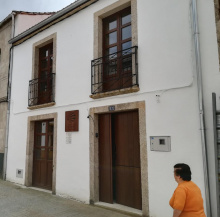
Accommodation in Sarria
| Albergue de Peregrinos de Sarria 10€ 40 |
|
| Albergue Puente Ribeira 12€ 30 Booking.com |
|
| Albergue Barullo 12€ 20 Booking.com |
|
| Albergue-Pensión El Bordón de la Casa Batallón 15€ 20 Booking.com |
|
| Hostel Andaina 13€ 26 Booking.com |
|
| Albergue La Casona de Sarria Booking.com |
|
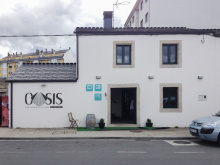
| Albergue Oasis 13€ 27 Booking.com |
|
| PENSIÓN ALBERGUE MATIAS LOCANDA 10€ 40 Booking.com |
|
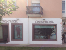
| Albergue Credencial 12€ 28 Booking.com |
|
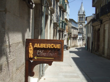
| Albergue Obradoiro 12€ 38 Booking.com |
|
| Alma do Camiño 13€ 100 Booking.com |
|
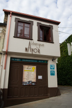
| Albergue Mayor 13€ 16 Booking.com |
|
| Albergue A Pedra 15€ 15 Booking.com |
|
| Albergue Don Álvaro 15€ 30 Booking.com |
|
| Albergue Los Blasones 10€ 42 Booking.com |
|
| Albergue O Durmiñento 10€ 41 Booking.com |

|
| Albergue Internacional Sarria 12€ 38 |
|
| Albergue San Lázaro 10€ 27 Booking.com |
|
| Albergue Casa Peltre 12€ 22 Booking.com |
|
| Albergue Monasterio de la Magdalena 12€ 110 Booking.com |
|


Vilei is often mismarked as Barbadelo on the map and in guidebooks. They are distinct hamlets, less than 1km apart. It has grown into quite a pilgrim stop from the abandoned hamlet it once was. It now counts two albergues and a trinket shop and is a pleasant place to stay if you find Sarria to be overcrowded. It is also the first coffee since Sarria.
Vilei and many of the small hamlets throughout Galicia have always been the agricultural heart of Galicia, working primarily in the dairy industry. Pilgrims come and go, and nothing for them changes much. These clusters of inhabited places are called caserios, and in many cases they number only a few houses and a small chapel.
Accommodation in Vilei
| Albergue Casa Barbadelo 12€ 40 Booking.com |
|

Barbadelo, small as it is, once housed a monastery in 874. The current church dates from the 12th century and has several quality sculptures, including the animals carved into the north portal. It is 50m off the camino to your left, signed.
Accommodation in Barbadelo
| Albergue de Barbadelo 10€ 18 |
|
| A Casa de Carmen 13€ 20 |
|
| Albergue O Pombal 12€ 8 |
|


A curious place for a medieval market, but that is exactly what this crossing of roads is known and named for.
The camino passes through the hamlets of Leimán, Peruscallo, Cortiñas, Lavandeira, Casal, and Brea. None have any services. The way is more gently rolling hills.
Between here and Morgade you may find, behind a fence on your right-hand side, a rather curious and grumpy ostrich. Ostrich meat is a growing industry in Spain, but this particular fella is the family pet.

Accommodation in Morgade
| Albergue Casa Morgade 12€ 9 Booking.com |
As the name implies, Ferreiros was once home to a notable blacksmithing trade. More recently it was another center for small dairy production, and that industry has given way to supporting pilgrims.
Beyond Ferreiros you will encounter the 100km marker. It is the single most vandalized object on the camino, changing from day to day as pilgrims leave their mark. From here on to Santiago the terrain has smoothed out, but do not be deceived. Although the height of the peaks has been reduced, the frequency with which you have to climb the smaller ones has increased.
Accommodation in Ferreiros
| Albergue de Ferreiro 10€ 22 |
|
| Albergue Casa Cruceiro 12€ 18 |
|

At the bottom of the hill from Ferreiros, there is a bar and a church/cemetery.
Beyond Mirallos you will encounter the 100km marker. It is the single most vandalized object on the camino, changing from day to day as pilgrims leave their mark. From here on to Santiago the terrain has smoothed out, but do not be deceived. Although the height of the peaks has been reduced, the frequency with which you have to climb the smaller ones has increased.

Not much in town apart from the well-kept albergue/bar Casa do Rego.
You will pass through Rozas and Moimentos, no services.
Accommodation in Pena
| Albergue Casa do Rego 15€ 6 |
|
| Casiña de Campo Booking.com |

|


Another bar-and-albergue-only kind of town, run by some fellows from Valencia and the most promising place to find paella on the menu.
Accommodation in Mercadoiro
| Albergue Mercadoiro 12€ 36 |
|
The small shop/cafe here wins the award for flair. It is run by an artist who hand paints camino shells and other souvenir items. Rock and roll sello.
You will pass through Parrocha, no services.

The camino will soon bring you within sight of Portomarín. You will also pass through the town of Vilachá before beginning the rather steep descent into the valley of the río Miño and across the modern bridge to Portomarín.
The camino into town passes over the new bridge. The old bridge spends most of its time submerged beneath the river below but by the end of summer it emerges as the water level drops. Up the stairs and through the small chapel, you are almost into town. It is a bit more uphill still.
Accommodation in Vilachá
| Albergue Casa Banderas 14€ 8 |
|
Portomarín holds the distinction of being the newest oldest town along the camino. The Portomarín we see today is a transplanted version of the original town that originally settled in the valley below. Most of the town is new construction, but the church and a few smaller buildings were relocated stone by stone. Close inspection of the Iglesia de San Juan shows that the stones were numbered to avoid head scratching later.
The río Miño was dammed in 1956, forming the Embalse de Belasar which sits beneath the bridge. The water level varies by season, and when it is at its lowest it is possible to walk among the piles of stone that were once the original town.
The Iglesia of San Juan (also known as the Iglesia of San Nicolás) is an imposing fortress in the center of town. It is the largest single-nave Romanesque church in Galicia. The Ayuntamiento building in the main square was once the Casa del Conde from the 16th century. The Iglesia de Santa María (also known as La Virgen de las Nieves) is the chapel that you passed under at the top of the stairs going into town; the local people believe that it will protect them from drowning.
Be aware of high-speed traffic as you are required to cross back and forth across the main road.
Portomarín gets its name from ‘porto’ or river crossing, and ‘marín’, a reference to the Sanctuary of St. Marina that was located here in the Middle Ages. It enjoyed its peak of prosperity in the 15th and 16th centuries when several of the Catholic Monarchs slept here. The nearby capital of Lugo, also a Roman settlement, grew at a greater pace and Portomarín was quickly forgotten. As recently as 1919 the town was still not connected by a single road that could accommodate wheeled traffic. That has changed, and the prosperity of the town can now be attributed to the reservoir and the camino.
From the square simply head downhill along the colonnaded street and stick to it until you arrive at the main road. DO NOT keep going straight. Rather turn left and head back in the direction of the bridge into town. Before you get there arrows will direct you onto a different bridge over a small river that feeds the reservoir.
At the end of the bridge are two options: TURN RIGHT.
From here it is a steadily uphill march all the way to Gonzar, passing Toxibo with its hórreo along the way. After passing through a stretch of forest the camino returns to the main road and parallels it on a gravel track. This track crosses back and forth over the main road on several occasions. Be mindful of traffic here, particularly during the morning hours when the area can be thick with fog.
Accommodation in Portomarín
| Albergue de Portomarín 12€ 110 |

|
| Albergue Ferramenteiro 13€ 130 Booking.com |
|
| Novo Porto 12€ 22 |
|
| Albergue Casona da Ponte 14€ 47 Booking.com |
|
| Albergue Pasiño a Pasiño 12€ 30 |
|
| Albergue Pons Minea 12€ 36 Booking.com |
|
| Albergue Aqua Portomarín 13€ 16 Booking.com |
|
| Albergue Casa do Marabillas 15€ 6 Booking.com |
|
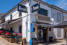
| Albergue Casa Cruz 12€ 16 |
|
| Albergue Folgueira 12€ 32 Booking.com |

|
| Albergue Villamartín 12€ 20 |
|
| Albergue Huellas 17€ 15 Booking.com |
|
| Albergue Ultreia Portomarin 13€ 14 Booking.com |
|
| Albergue Manuel 12€ 16 |
|
| Albergue PortoSantiago 15€ 14 Booking.com |
|
| Albergue El Caminante 12€ 46 |
|


Hórreo: If you pronounce this word like OREO you are pretty close. Hórreos are commonplace in northern Spain, from the smallest of hamlets to the largest of private estates. They vary in design from region to region and in Galicia they tend to stretch out lengthwise. They function as corn-cribs, with slatted walls that allow for circulation and a foundation designed to prevent rodents from climbing up. They range in length from 2m to 35m.
Gonzar is notable for the number of cows kept there, far more than the human population.
The camino leaves along the road but departs from it quite quickly. You will find that it does this often; the arrows have been placed in a manner which keeps you as far from heavy traffic as possible.
Accommodation in Gonzar
| Albergue de Gonzar 10€ 28 |
|
| Albergue Privado de Gonzar - Casa Garcia 10€ 20 |
|
| Hosteria de Gonzar 12€ 20 Booking.com |
|


Shortly beyond the village, a mere 50m off the camino to your left, are the remains of the Iron Age castro that gives the town its name. It is seldom visited (there are no signs) but is worth an exploration. It can be found before the point where you meet the main road.
Shortly beyond the village, a mere 50m off the camino to your left, are the remains of the Iron Age castro that gives the town its name. It is seldom visited (there are no signs) but is worth an exploration. It can be found before the point where you meet the main road.
Accommodation in Castromayor
| Albergue Ortiz 12€ 12 |
| Pensión Casa Maruja Booking.com |

|

When leaving Hospital de la Cruz it is important to pay close attention to the traffic. The camino crosses a large roundabout, goes over the highway, and then turns left. At this point, you are actually walking along the highway on-ramp, though only for a short distance. It turns right and continues the upward march towards Ventas de Narón.
Accommodation in Hospital de la Cruz
| Albergue de Hospital da Cruz 10€ 32 |
|

The bar O Cruceiro opens at 6 am, and there is a wonderful fountain in the picnic area. The small chapel here has a stamp, which is given by its blind caretaker with a bit of help from you.
The land in this area is poor for farming as the soil is rich with quartz and feldspar. The ridge that you are walking towards is the watershed between the río Miño (behind you, which empties into the Atlantic near Guarda) and the río Ulla (ahead of you, and which empties into the Atlantic near Padron). The area is covered thickly with broom.
The year 820 was an important one for Ventas de Naron, and for Christian Spain. For Ventas, it was the site of a battle between the Muslim and Christian forces. The Muslim forces aimed to expand their territory to the north and the Christians, led by the Asturian King Alfonso II the chaste, sent them back. For Christian Spain, it was also the year that the bones of our favorite Apostle were rediscovered. Not long after the very same Alfonso would become the first pilgrim (the primitivo), would verify the relics, would build a church to house them, and would set in motion a course of events that would see the remaining Muslim forces defeated.
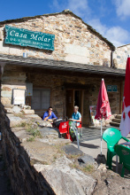
Accommodation in Ventas de Narón
| Albergue Casa Molar 10€ 18 |
|
| Albergue O Cruceiro 12€ 30 |
|


Locals say that the field on your right at the start of town is a pilgrim cemetery. There doesn’t seem to be any commemoration of that fact, or protection of the site either. Whether it is or is not a cemetery seems less important than the insight gained by remembering how dangerous a pilgrimage of this sort could be.
Accommodation in Ligonde
| Albergue de Peregrinos Escuela de Ligonde 10€ 20 |
|
| Albergue Fuente del Peregrino Donativo€ 9 |
|

Eucalyptus: The Eucalyptus tree, indigenous to Australia, was brought to Galicia in 1865 for the construction trade. It proved to be a poor choice and is now used to produce paper (most of it is shipped to the mills in Portugal). The Galicians have a love/hate relationship with this invasive species and you will find the occasional message of “Eucalyptus Non!” sprayed on buildings. There are no natural controls for the tree, which grows fast, drives out local species (oak and chestnut), and which are extremely flammable during dry seasons.
Accommodation in Eirexe [Airexe]
| Albergue de Eirexe 10€ 20 |
|
| Pension Eirexe |
You will pass through A Prebisa and Lameiros, no services.
Accommodation in Portos
| Albergue A Paso de Formiga 14€ 11 |

|

Detour to Vilar de Donas and La Iglesia de El Salvador
After passing the bar of Portos, turn right along a gravel road. There is a fork at 500m, keep left and continue strait over the N-547. To the church and back is 4.5km.
Guided tours are offered by a local, and in some cases even when the church is otherwise closed. The official hours are:
Winter (November through March): 12-17:30 closed Mondays
Summer (April through October): 11-14 & 16-20 closed Mondays
The church was given to the Order of Santiago under the pretext that Galician members of the order be buried there. The frescoes in the apse depict the parable of the 10 virgins and is in remarkable condition given that it dates from the early 15th century.
You will pass through Os Valos and Mamurria, no services.
Accommodation in Lestedo
| Casa Rectoral de Lestedo |

Accommodation in Os Valos
| Hostería Calixtino Booking.com |
|
‘Brea’ is Gallego for road, and is a very common name for a small village.
From here the camino passes through more forests and nears the road at Rosario.

Along the descent from here you will pass Os Chacotes, a recreational area with a log-cabin style hotel and sports facilities. At the entrance to Palas de Rei is the Iglesia de San Tirso, where a stamp is available. From there it is down a set of stairs into town.
Palas is bisected by a pair of large roads which twist and turn through town. After coming down the staircase, and with the municipal albergue on your left, the road to the right leads to a grocery and back to Portomarin. Straight on to bars and restaurants and albergues and the road out of town.
The origin of the name Palas de Rei, ‘Palace of the King’, is owed to the last Visigothic king to rule Spain. Witiza had a brief reign, from 700-709, and he was only 14 when he was anointed. The family ruled all of the Iberian peninsula from Toledo and it wasn’t until 701 that Witiza came to Galicia, likely to Tui; his migration was prompted by both a Byzantine invasion and the spread of the plague from Constantinople. His reign was short lived but his namesake village here on the camino remains. For the record, he was, in fact, a co-ruler alongside his father, but ‘Palace of the Half King’ lacked a certain flair.
You have now entered eucalyptus territory, and although there are patches of old oak forests to be found this non-indigenous species has taken over the landscape and has become a symbol of Galicia.
Accommodation in Palas de Rei
| Albergue de Palas de Rei 10€ 60 |
|
| Albergue Os Chacotes 10€ 112 |
|
| Albergue Buen Camino 12€ 41 |
|
| Albergue Mesón de Benito 13€ 80 |
|
| Albergue San Marcos 14€ 71 |
|
| Albergue Castro 12€ 56 |
|
| Albergue Outeiro 13€ 50 Booking.com |
|
| Albergue A Casiña di Marcello 16-20€ 17 Booking.com |
|
| Albergue Zendoira 13-16€ 50 Booking.com |
|
| Pensión Palas ★ Booking.com |

|
| Pensión Bar Plaza Booking.com |
|
| Pensión Casa Curro Booking.com |

|
| Pension Casa Camiño Booking.com |

|
| Hostel O Castelo Booking.com |

|

You have now entered eucalyptus territory, and although there are patches of old oak forests to be found this non-indigenous species has taken over the landscape and has become a symbol of Galicia.
A one horse town, the bar and albergue here are not likely to open before noon.
Saint Julian is one of the favored Saints of the camino and is the patron of hospitallers and hoteliers. The legend that surrounds his calling to the camino is a dark one: As a young noblemen fond of hunting, he receives a prophecy (by a deer no less) that he would kill his own parents. A believer, young Julian decides to put distance between himself and his parents, getting as far away as Portugal. He finds both work and favor from the King and is married to a young widow.
By a most remarkable circumstance of chance, his parents in the meanwhile had set off looking for him only to find his young wife at home alone. The wife, of course, was overjoyed to realize the family connection and immediately welcomed Julian’s parents into the home and went as far as to offer them rest in her bed while she went to church for her prayers. When Julian returns home to find two people in his marital bed, he slays them both in a rage. Of course, it doesn’t take long for him to realize his mistake, to curse that deer, and to begin his own pilgrimage to Rome seeking forgiveness.
That forgiveness would not come easily; the Pope declared that he would have to care for pilgrims along the road to Santiago. He then returned and with his wife set up a hospice to do as the Pope demanded. He got more than forgiveness for his labors and so did his wife, both were canonized. He, of course, is St. Julian and his wife St. Basilisa. All of this makes for great storytelling of course, but the church itself is undecided on the veracity of it. There are several Julians, surprisingly many Basilisa’s, and chances are good that this tale takes the best of each.
Near San Xulain the camino is undergoing a rerouting to accommodate the new highway connecting Santiago with Lugo. Most recently this meant walking across the unfinished highway. Changes are frequent and it is best to follow the detour signage.
Accommodation in San Xulian
| Albergue O Abrigadoiro 14€ 18 |
Pontecampaña is the setting for a bloody battle which was fought between Fernán Ruiz de Castro (on behalf of King Pedro I of Castile) and Pedro’s half-brother Enrique II. It was 1370 and the resulting feud left ‘rivers of blood.’ Of note today are the remains of the ancient granite bridge over the río Pambre.
Accommodation in Ponte Campaña
| Albergue Casa Domingo 14€ 21 |
Accommodation in Casanova
| Albergue de Mato 10€ 20 |
With several bars and one casa rural, Coto sits along a small stretch of the old road.
Accommodation in Coto


Leboreiro is one of the more charming hamlets along this stretch of road. It is sparsely populated but well maintained. The small Romanesque Iglesia de Santa María de las Nieves has a nice tympanum. Also of note is the first cabaceiro, a small woven structure with a thatched roof that serves the same function as an hórreo.
The church is also surrounded by legend. It is a familiar one, retold in similar churches and capillas all across Europe. It is the ‘legend of the Virgin that moves in the night’. It tells of a mysterious spring that emerged suddenly and which glowed at night. In their search for the source of the spring, the villagers unearthed the statue of the Virgin. They built a chapel nearby (the one we see today) and moved the Virgin to it. Every night she moved back, unhappy in her new home. Unhappy that is until a clever sculptor correctly interpreted her move as a desire to be outside, he carved a figure of the Virgen into the tympanum and the statue has remained at the altar ever since.
In addition to the Iglesia de San Juan, with its uncommon crucifix, Furelos has a bridge and a bar. Both are impressive, the former for dating back to the Romans, and the latter for the tortillas.
The village and its pilgrims hospice were under the ownership of the Hospitallers of San Juan in the 12th century. The Iglesia de San Juan is worth visiting for its quite interesting crucifix which depicts Jesus not with his hands outstretched to his sides, but rather with one hand reaching up to the Heavens and the other down to Earth.
Accommodation in Furelos


Although it has been on the menu as far back as O Cebreiro, Pulpo (octopus) doesn’t seem to garnish much attention until Melide. Despite its apparent disconnect with the sea, Melide’s thriving Thursday market meant that shipping pulpo was a profitable enterprise. It is served today as it was then: on a wooden plate, garnished only with a healthy drizzle of olive oil and a shake of paprika. It is eaten with a rather crude looking toothpick, alongside heavy Galician bread and a bowl of the local Ribeiro wine.
One of the better places to try it is Pulpería a Garnacha, the last door on your left before you get to the main road in Melide.
The melindre is another of Melide’s favorite foods, and if you like dry and flavorless it can be your favorite too. It resembles a glazed donut and is sold from dozens of identical booths during festivals.
Melide, long the crossroads between territories, is also the meeting point of the various camino routes which come from the north, including the part of the Camino del Norte and the Camino Primitivo. Because of this, and the proximity to Santiago, the road become a great deal more congested.
Melide is an ancient settlement and despite its importance as a natural crossroad since Neolithic times, it has never been protected by a wall. In Medieval times the overwhelming bulk of the town industries were tied to the camino. This is evident today in the way the town is shaped; stretched out lengthwise along the camino road.
The traffic through Melide can be dangerous, particularly on market days when booths line the crowded streets and the arrows through town become difficult to spot. Simply follow along with the main road to the first roundabout. If you have not yet crossed the main road do so at the roundabout, and then cross the road that runs perpendicular to it. Arrows should point you towards a small side street through the old part of town that parallels the main road. There are many other yellow arrows that direct you towards the many albergues in town, they are often attached to adverts or are painted alongside a simple ‘A’. These can be ignored.
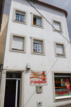
Accommodation in Melide
| Albergue de Melide 10€ 156 |
| Albergue O Apalpador 13-15€ 13 Booking.com |
|
| Albergue Ezequiel 10€ 20 |
|
| Albergue O Candil 18*€ 4 Booking.com |
|
| Albergue Montoto 14€ 53 |
|
| Albergue Arraigos 14€ 20 Booking.com |
|
| Albergue Alfonso II 12€ 35 Booking.com |

|
| Albergue Pension San Antón 14-15€ 32 Booking.com |
|
| Albergue Melide 12€ 57 Booking.com |
|
| Albergue O Cruceiro 12€ 72 |
|
| Albergue Pereiro 12€ 40 Booking.com |
|
| B&B A Lúa do Camiño Booking.com |

|

| Hotel Pousada Chiquitín 30-70€ 16 |
|
| Hotel Carlos 96 ★ Booking.com |

|
| Hotel Sony | 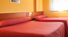
|

The first building in Boente on your left is the Bar de los Alemanes, and this is the best bar in town. Further down the hill, the camino crosses the main road (caution) where two albergues and a few bars are located.
You can get a sello in the Iglesia de Santiago de Boente, and curiously enough the entrance that most pilgrims use leads directly to the sacristy. A collection of hundreds of prayer cards from around the world adorn the walls, and if the priest is not there to stamp your credencial he leaves it out for you to take matters into your own hands.
Walking past the church the camino turns right and descends more. The hills ahead are steep in both directions, take it easy.
Accommodation in Boente
| Fuente Saleta 14€ 22 |
|
| Albergue Boente 15€ 40 Booking.com |
|
| Albergue El Alemán 16€ 40 |
|
It is said that the ovens that produced lime for the construction of the Cathedral were here in Castañeda. Pilgrims carried the raw materials here from Triacastela and swapped it for lime which they carried to Santiago.
It is uphill once more, followed by a steady descent into the valley below, steep at points.
Accommodation in Castañeda
| Albergue Santiago 13€ 6 |
|
A bar near the river with a large patio for celebrating a successful walk. The river here is quite cold and the perfect place to dip your feet.
The camino to Arzúa begins with a steady walk uphill. By the time you reach the road it levels out and the remaining kilometers are flat into town.
Accommodation in Ribadiso da Baixo
| Albergue de Ribadiso da Baixo 8€ 70 |

|
| Albergue Los Caminantes 12€ 68 Booking.com |
|
| Pensión Ribadiso ★★★ Booking.com |
|
There is now an albergue in the upper part of Ribadiso. It is located at the top of the climb and before you get to Arzua.
Accommodation in Ribadiso da Carretera
| Albergue Milpes 12€ 24 Booking.com |

|
| Albergue Mirador de Ribadiso 12€ 10 |
|
Arzúa is a pleasant town with almost enough beds for pilgrims. If you find everything to be full and don’t feel like splurging on one of the many hotels in the area, the Polideportivo (sports hall) is often used to house pilgrims. Between here and O Pedrouzo lie a string of very small Galician hamlets of little note. The locals in these parts enjoy telling you, without the slightest tone of irony or sarcasm, that ‘no hay vacas in Galicia’ (there are no cows in Galicia). Hold that thought in your head while you slosh through a soggy trail on an otherwise sunny day.
Tetilla Cheese: You might have seen this curiously shaped cheese in the shop windows. If you made a connection between the name and the shape you are not mistaken. It was shaped this way by cheese makers in protest to the bishop of Santiago. At the time the Portico de la Gloria (Master Mateo’s famous sculptures at the Cathedrals main entrance) was being finished and the bishop took issue with the odd smile on the prophet Daniels’ face. The clever bishop followed his gaze across the doorway and found that Queen Esther’s bosom was augmented by a cheeky sculptor. Daniel kept his smile, Esther had a reduction, and we got boob-shaped-protest-cheese.
Famous for its cheese, Arzúa hosts an annual (and three day long) Festival of Cheese in March. They have been doing so for 40 years. Apart from this and several other secular celbrations, Arzúa celebrates Corpus Christi, as well as Nuestra Señora del Carmen, who is celebrated on the 16th of July.
The camino leaves Arzúa along a footpath, NOT the road. If you arrived at the main square, walk past the church (with your back to the road) and turn right onto the side street. The terrain is pleasant, a blend of trails and paved roads through small towns and lots of forests. There are a few steep sections but none of any considerable length.
Accommodation in Arzúa
| Albergue de Arzúa 10€ 46 |
|
| Albergue Ultreia 12€ 38 Booking.com |

|
| Albergue San Francisco 15€ 26 Booking.com |
|
| Casa del Peregrino 10-12€ 14 |
|
| Cruce de Camiños 16/17€ 40 Booking.com |
|
| Albergue Los Tres Abetos 16€ 42 Booking.com |
|
| Albergue-Pensión Arzúa 12€ 18 |
|
| O Albergue de Selmo 13-14€ 46 Booking.com |
|
| De Camino Albergue 12-14€ 46 Booking.com |
|
| Albergue Los Caminantes 12€ 26 |
|
| Albergue Santiago Apóstol (Arzúa) 10-12€ 72 |
|
| Albergue Don Quijote 12€ 50 |
|
| Albergue Via Lactea 15€ 124 Booking.com |
|

| Albergue-Pensión A Conda 15€ 8 Booking.com |
|

Accommodation in Pregontoño
| Albergue Camiño das Ocas 12€ 30 |
Accommodation in El Lugar de Tabernavella
| Albergue Taberna Vella 17€ 8 |


Accommodation in Calle - O Outeiro
| Albergue A Ponte de Ferreiros 15€ 30 |
|
| Casa Rural do Horreo Booking.com |
|


There is a pair of bars in Salceda, and a restaurant (La Esquipa) that is thick with pilgrims every day but Monday when it is closed.
The camino rejoins the road in Salceda, and while it does not walk on the road it does remain quite close. In fact, the camino crosses the road several times between here and Santiago. The speed of traffic, the curves in the road, and the abundance of pilgrims makes this the most dangerous stretch along the camino. Cross carefully and quickly and always under the road when possible.
The camino leaves town to the right of a wedge shaped park next to La Esquipa, not along the road.
Accommodation in Salceda
| Albergue Turistico de Salceda 15€ 8 Booking.com |
|
| Albergue Alborada 15€ 10 Booking.com |
|
| Albergue La Corona 22€ 20 |
|

Accommodation in A Brea
| Mar de Frisia Booking.com |

|


CAUTION crossing the road, dangerous intersection.
The camino crosses the main road at the highest point in the road, there is no marked crosswalk and the arrows on the other side of the road are often obscured by parked cars. You may see pilgrims continuing along the road but are advised against following them as the camino returns to the trail when you turn off the road.
Half way down the hill it splits and arrows indicate that you should either turn left to go under the road or continue straight. Unless you have reason to visit Santa Irene you can keep on straight and avoid the hassle of crossing back over the road. If you continue straight you will arrive at the important part of Santa Irene (the part with the bar).
Accommodation in Empalme
| Albergue Andaina 12€ 14 |

Accommodation in Santa Irene
| Albergue de Peregrinos Santa Irene (Municipal) 10€ 36 |
|
| Albergue de Peregrinos Santa Irene (Privado) 14€ 15 |
|
| Albergue Rural Astrar 12€ 20 |

|

Where the camino returns to the road at the start of O Pedrouzo you will find an abundance of arrows and a large map which is nearly worthless. Arrows and dozens of signs advertising various hostels and hotels point in every direction. If you have a reservation, review the map to find the best path, otherwise turn left up the road. If you are not staying the night in O Pedrouzo, cross the road here and continue along the camino.
Accommodation in A Rúa [O Pino]
| Albergue Espíritu Xacobeo 13€ 46 Booking.com |
|
| Camping Peregrino O Castiñeiro 12€ |
| Hotel Rural O Acivro Booking.com |
|
Unfortunately, there is little to say about this modernized town. When it comes to charm, or monuments, or outrageous legends, it comes up short. During the busier periods along the camino the town feels overrun with pilgrims; most of whom are excited to have finished their penultimate day of walking.
Avoid the temptation of following the main road out of Pedrouzo. There are very few arrows to get you back to the camino and following along the road puts you in very real danger and takes you away from a lovely forest walk. See note below to get back to the camino.
If you spent the night in O Pedrouzo, it is important to find your way back to the camino proper which runs through the forest to the north. To get to it, find the intersection of the main road and Calle de Condello (where the Casa do Concello is located). Continue uphill (north from here) and in a few hundred meters the camino presents itself. Turn left and continue through the forest to Amenal.
The camino between here and Santiago is a mixture of rural and urban settings, some forests and some sprawl. The up and downs that you have been experiencing continue: the elevation gain/loss is +308/-339m, a not insignificant amount.
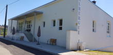
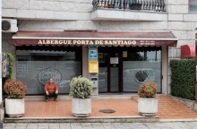
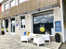
Accommodation in O Pedrouzo [Arca do Pino]
| Albergue de Arca do Pino 10€ 120 |
|
| Albergue Porta de Santiago 12€ 54 |
|
| Albergue Mirador de Pedrouzo 16€ 62 Booking.com |
|
| Albergue O Trisquel 13€ 78 Booking.com |
|
| Albergue REM 13€ 40 Booking.com |
|
| Albergue Otero 14€ 36 |
|
| Albergue O Burgo 15€ 14 Booking.com |
|
| Albergue Edreira 13€ 40 |
|
| Albergue Cruceiro de Pedrouzo 12€ 94 |
|


| Hotel O Pino ★ | 
|

Two bars, one on either side of a dangerous crossing.
The camino crosses the very busy N-547 by passing underneath it. Do not cross over the road.
Leaving the bar behind you climb steeply uphill a short distance. The path soon levels out on a comfortable trail surrounded by eucalyptus trees. The Santiago Airport is very near, and the camino follows a path around the runway.
Accommodation in Amenal
| Pensión Kilómetro 15 Booking.com |
|

The written history of San Paio has been lost to the ages, but the church here is dedicated to San Paio (or Payo), the 14 year old saint who was kidnapped by the invading Muslim troops, taken to Sevilla, and ultimately martyred to pieces and tossed into the río Guadalquivir.
Accommodation in San Paio - San Payo


The name Lavacolla has one of the most debated origins of all the camino towns. They range from the bland “field at the bottom of the hill” to the more profane “scrub your scrotum.” What is more widely accepted is that pilgrims bathed in this river before entering the Cathedral.
If you walked down the stairs to visit either of the bars at the bottom, turn and walk up the steps towards the Iglesia de Benaval. The camino continues around to the right-hand side and down to cross the road. At the road, cross at the crosswalk and continue along the road and over the famous river (see inset below).
The last hill is ahead, and if you are a stickler for doing things according to tradition you should start running now. It is said that the first of your group to arrive in Monte de Gozo is entitled to be called King. Be advised that there is no prize.
Accommodation in Lavacolla
| Albergue Lavacolla 14€ 40 |
|
| Albergue A Fábrica 20€ 32 Booking.com |
|
| Pazo Xan Xordo Booking.com |
|
| Pensión Dorotea Booking.com |

|


Monte de Gozo, or ‘Mount Joy’, was once the first place that pilgrims could get a glimpse of the Cathedral spires. A new stand of trees blocks the view now. It is a large gathering place for pilgrims, who flock to the over-sized monument commemorating the pilgrimage that Pope John Paul II made here in 1993. The modest Capilla de San Marcos has the last stamp and a small kiosk selling cold drinks.
You do not need to enter the complex but for the sake of curiosity, carrying on down the road will take you where you are heading.
Pass the outdoor gallery of a local (and gifted) sculptor of stone and cross the bridge over the highway. It is midway over this bridge that you enter the city of Santiago de Compostela but to keep pilgrims from crossing the road half way across the bridge, the sign indicating such has been moved further into the city.
Accommodation in Monte del Gozo
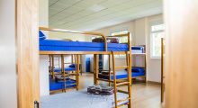
| Albergue de Monte do Gozo 10€ 400 Booking.com |
|
| Albergue Benvido Monte do Gozo 23€ 500+ Booking.com |

|

