Built on the hillside that rises up from the estuary, it is easy to feel like everywhere in Ribadeo is uphill.
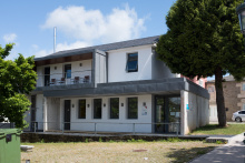
In the city center, the Convento de Santa Clara (15th century with 18th century cloister) is the cornerstone of the church, while the 1910 Casa de Indianos known as the Torre dos Moreno is a mighty monument to capitalism; a plan to rescue it is underway.
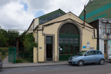
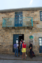
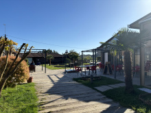
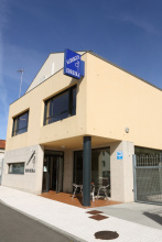
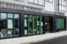
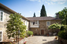
If you are staying in the municipal albergue, consider a walk (3.5km round trip) out to the Ribadeo lighthouse (Illa Pancha) along the coastal road adjacent to the albergue. Along the way is the Castillo de San Damián which sometimes holds local art exhibitions.
The number one visited place in Ribadeo (and in the top five for all of Galicia) isn’t in Ribadeo at all; the natural rock formations along the coast known as As Catedrais (the cathedrals) are 14km to the west along the coast. If you have the opportunity to share a taxi with other pilgrims it would be a pity to miss the opportunity but google ‘tide calendar’ before you go because if it is high there is little sense in going.
The scallop shells in Galicia are not installed with an orientation towards Santiago and having come from Asturias where they are it might be a bit confusing. Just remember to follow the arrow and ignore the shell.
Ribadeo has had an on-again/off-again relationships with the camino for centuries. Prior to the bridge being built the broad river hear mean a difficult river crossing. Many pilgrims made the crossing but many more turned south to follow the path of least resistance, a much shorter bridge crossing at Santiago de Abres. The bridge we see today eliminated the risk of crossing and since 1987 the southern option has fallen out of favor. However, there is a local movement to rejuvenate it and by the time you get to the Galician border you may well see alternatives to do so.
The camino through Ribadeo has been re-routed in recent years and now follows a route down to the waterfront and then back up. Of course, it is still possible to go the old way and avoid the elevation change. If that suits you, turn right at the first big intersection after you pass under the bridge into town. It is the Avenida de Leopoldo Calvo Sotelo and the official camino is across the road to the left. If you turn right you can follow old arrows through town.
At the end of town both options rejoin on the Rúa de San Lazaro and before long you are back in the countryside. Such is the case for most of the walking through Galicia; on a few occasions you will walk along the asphalt road but they are quiet country roads. The first of them is the LU-5207 which you will dance around as you enter Vilela.
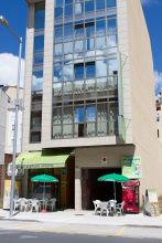
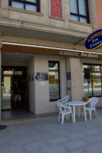
Accommodation in Ribadeo
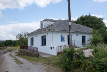
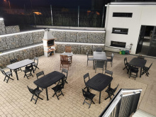
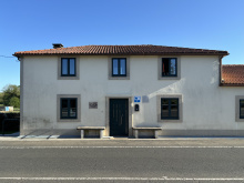
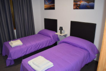
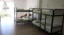
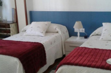
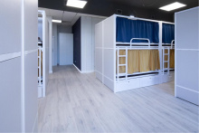
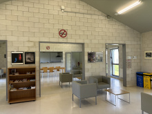
| Albergue de peregrinos de Ribadeo 10€ 12 |
|
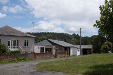
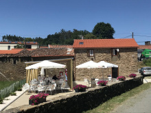
| Albergue Ribadeo A Ponte 15€ 28 Booking.com |

|
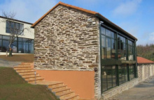
| Albergue Viruxe 12€ 20 |
|
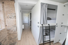
| Albergue Río Eo 15€ 32 |
|
| Albergue El Olivo 10€ 13 |
|


Has bar, but the hours are unpredictable.
If the bar in Vilela is closed, the only option for buying supplies between here and Villamartín Grande is in San Vicente, a short detour from the camino described below.
Take the turn off to the right to follow a smaller road through the forest. This road follows a broad bend and eventually turns back towards the LU-133 (which was the main road in Vilela). Before the camino gets all the way to the road, it turns to the right along a path.
NOTE: At this point you do have the option of continuing straight to the LU-133 where you can find a coffee in the town of San Vicente without adding any extra distance to your walk. When you get to the LU-133 turn right. At the far end of the sparsely populated village the camino turns from the north to cross over the LU-133 so you can simply follow it (about 2km) all the way to this junction.
When the official camino returns to the LU-133 it does not follow it; instead it crosses to the other side and descends along a path to the next road. It then zig zags a bit as it descends via paved roads to the bridge in Arante.
Accommodation in Vilela
| Albergue A Pena 12€ 17 |
The bridge here is the low point of todays walk and from here the camino begins a series of ascents and descents which are to become the de facto terrain in Galicia where level ground is seldom to be found. After the bridge the camino turns sharply right up a path and begins a climb to the top of the mountainside. It spends little time at the top before descending the other side into Villamartín Pequeno.
In Villamartín the camino rejoins the road at the lowest point in the valley, following it southwest for only a short distance. It is common to miss the turn off and continue some distance before noticing the mistake, so keep an eye open for the path on your right which marks the beginning of a steep climb into Villamartín Grande.
There is one bar in town, on your right when you get to the top. Friendly owners eager to help pilgrims.
After passing the small shop and lodging (friendly and helpful owners) the camino crosses the LU-P-6103, following the sign in the direction of Gondán; a downhill walk along a paved road.
Accommodation in Villamartín Grande
| Tentempé Peregrino Booking.com |
|
Turn right at the first 4 way junction past the albergue, and follow the back roads to San Xusto.
From San Xusto it is another climb, this time to the top of Monte Calvario before descending into the bustling town of Lourenzá.
Accommodation in San Xusto
| Albergue de peregrinos de San Xusto 5€ 14 |
|
The Benedictine Monastery of San Salvador is the most important building in town, and has been for over a thousand years. The entrance is about 3€ and is a worthwhile way to spend the afternoon. Around back is an ornate palomar (dovecote).
The founding of Lourenzá is tied to the founding of the Monastery of San Salvador in the end of the 10th century.
Last Sunday of August.
There are no services between here and Mondoñedo. From the municipal albergue, the camino leaves town along a well marked but narrow and cobbled path uphill. The path climbs to the top of this monte and joins the N-634 as it passes through the hamlet of Arroxo (just a few houses). Here it reaches the highest point along this stretch and ahead you can see the elevated A-8. Keep on the N-634 to pass underneath it and downhill to the roundabout junction where you keep to your left and abandon the N-634. A short distance ahead the camino leaves the road for a path on your right. Along it you will pass the Mondoñedo cemetery and the hamlets of San Pedro, O Reguengo, and San Paio before returning to the main road into Mondoñedo.
Accommodation in Lourenzá
| Albergue de peregrinos de Lourenzá 10€ 20 |
|
| Albergue Savior 15€ 24 |
|
| Albergue Castelos - Lourenzá 15€ 40 |
|
| Albergue - Pensión O Pedregal 18€ |
| Hostelería Rego |
| Hostal La Unión |
All roads seem to converge in the square in front of the Mondoñedo Cathedral; which is convenient because the Cathedral is on the list of must-see churches along the camino. It is also the reference point for getting out of town the following morning.
Coming into town you will pass the Igrexa Nova (the new church) and leaving town you might pass the Igrexa dos Remedios with its beautiful baroque interior.
One of the more fantastic stories to emerge from the annals of Mondoñedo’s books is the legend of the Puente de Pasatiempo (the bridge of passing time). It centers around the fate of Pedro Pardo de Cela, who was ultimately beheaded in the Cathedral square. At the moment of his death, his wife was at the bridge with letters of pardon from the King. Her passage was blocked by detractors of her husband. Pedro was ultimately buried in the Cathedral.
Os Remedios, a medieval market, is held on the first Sunday after the 8th of September.
The fiesta de San Lucas is held on the 18th of October.
The camino beyond Mondoñedo is a confusing enterprise. The albergue in Lourenzá does their best to inform pilgrims but their opinions are biased and you are encouraged to consider all options, and to not give up if you can’t find the right starting point for your desired route to Gontán and then Abadin.
Part of the confusion arises from the newly installed stone markers in Galicia. When they were installed the routes were re-examined by planners and several changes and additions were made. In this case, the old camino route was re-named the complementaria route, and a second route was added as the official route. This business of creating complementaria routes has led to much confusion because in some localities (Arzúa is the nearest example) the name was applied to a route (for historical reasons) which for decades has been the only option; causing many pilgrims to waste time looking for an official route which does not exist.
In the case of Mondoñedo to Gontán, there are two options and both begin at the Cathedral.
Option 1: The Old Camino now known as the COMPLEMENTARIA ROUTE - 15.7
This route remains the preferred one by several of the hospitaleros in these parts. It is also the longer of the two options, and follows a paved road up and over the mountain. There are minimal services along the way so pack accordingly.
With your back to the front of the Cathedral, turn left and exit the square. Just outside the square you will see the Fonte Vella (old fountain), turn right and at the next junction take the left most option up the Calle de la Rigueira. At the top of the hill the camino turns sharply left and follows the road through several hamlets, the first of which is Maariz.
Option 2: The Official Route / La ruta principal - 11.9
Though shorter, this route is both more challenging and more scenic. It can also be difficult to locate.
With your back to the front of the Cathedral, look for the pharmacy that is at the top of the stairs opposite you towards the right. The camino leave town on that road so climb up the stairs and turn left up the Rúa Lence Santar. Turn right on the first side street, and follow it as it curves to the left. When it reaches a small plaza with a fountain, keep to the right. At the next intersection, turn left onto the LU-130 (the first wide road since the Cathedral). Follow the road uphill to the park, turning right at the end of the park to pass the Iglesia dos Remedios. Turn left, again uphill, after the church. This is the N-634 and you don’t follow it for long. Turn right downhill onto the LU-P-3106 in the direction of Zoñan. This road will take you through the hamlets of Rego de Cas and Cesuras. At the end of Cesuras it turns left uphill towards Infesta. A short distance ahead, after crossing the N-634, the road turns to trail and you begin the steepest part of the climb.
Accommodation in Mondoñedo
| Albergue de peregrinos de Mondoñedo 10€ 24 |
| Albergue del Montero 18€ 38 Booking.com |
|
| Lumen Albergue 21€ 40 |

| Hostal Padornelo |

Coffee and conversation at the albergue, but little more in town.
The camino follows the road to Lousada.
Accommodation in Maariz
| O Bisonte de Maariz Donativo€ 6 |
|
| Albergue de la Naturaleza O Vilar 15€ 50 Booking.com |

|
At the end of the small village the camino leaves the road. It turns left and begins a steep descent along a path. At the bottom is the A-8 and a large roundabout. The camino keeps to the north of the A-8 and follows along a series of roads into Gontán.

The two roads from Mondoñedo converge here. Gontán has seen little growth over the centuries despite having been a major trading post and crossroads. It is overshadowed by nearby Abadín.
At the end of Gontán there is a small covered fountain opposite a sort of plaza/parking lot. Turn right to cross the parking lot and continue along the road on the opposite side, passing the Loran factory. This road ends at a junction, where you turn right and uphill to follow a pedestrian path up to the N-634 as it enters Abadín. Simply follow the curve of the road to the right.
Accommodation in Gontán
| Albergue de Gontán 10€ 26 |
|
| Pensión Claudio | |
| Pensión da Feria |
Abadín is sustained by pilgrim traffic from the camino and truck traffic from the nearby interchange. From here to Santiago your proximity to road traffic increases as the camino tries to avoid the N-634 between here and Santiago.
Santa Maria is celebrated on the 8th of September.
At the end of the very short Abadín, the camino turns right (following the sign to the Correos) and when it reaches the Correos (post office) it turns left. The road here is paved and quiet. Keep an eye open for the grassy trail that leaves the road to your right. It descends to cross the river and eventually returns to pavement, turning left when it does. It enters the area of As Paredes after passing over the A-8.
Accommodation in Abadín
| Albergue Xabarín 16*€ 26 Booking.com |
|
| Albergue Goás 15€ 46 |
The camino passes through As Paredes along the same road/trail that you entered on and will bring you back to the A-8, this time to pass underneath it into the hamlet of Castromaior. In Castromaior (not much more than a few houses) signs for the camino direct you back onto a path to Martiñan. Along the way you will again cross beneath the A-8.
Accommodation in As Paredes - Castromaior
| Albergue O Xistral 18*€ 20 Booking.com |
|
Turn left on road to get to the bar.
The camino reaches, and crosses, the N-634 in Martiñan. It winds its way along a series of back roads, all the while avoiding the N-634 traffic as best that it can. Eventually it returns to the busy road in Goiriz.
Through Goiriz you will have to walk along the N-634 for a short bit. Try to keep to the right as the turn isn’t far. Again the camino keeps away from the N-634. It will eventually return to a different road and follows the heavy traffic into Vilalba, passing around one large roundabout along all the way.
Vilalba is a major traffic hub and can be a bit of a shock to walk through compared to the calm of the Galician countryside. Despite its size and the volume of traffic that passes through it, there is little to see and even less to do. The only exception being the Iglesia de Santa Maria.
The most iconic building in Vilalba is the last remaining tower of the Castillo once owned by the Andrade family. The tower is now part of the Parador chain of hotels, the rest of the castle was destroyed during the first irmandiña uprisings.
Also known as “The Great Brotherhood War,” The Irmandiño revolts took place in 15th century Galicia against attempts by the regional nobility to maintain their rights over the peasantry and the bourgeoisie (and by a string of bad crops).
The revolts were also part of the larger phenomenon of popular revolts in late medieval Europe caused by the general economic and demographic crises in Europe during the fourteenth and fifteenth centuries. In Galicia it meant the destruction of any type of fortified structure owned by nobility; over 130 castles were destroyed. The success of the Irmandiña revolts was mixed; the nobility fled to Castile where they rounded up reinforcements and returned to exact revenge on the leaders of the Brotherhood, but few of their former estates and strongholds were ever rebuilt.
The Festa dos Pepes is held on the 19th of March on the feast of San José. Market days are on Tuesdays and Fridays.
Mind the arrows through Vilalba. The streets here are usually jam packed with cars and trucks and they can be hard to see at times. The center of town is a jumble of roads heading in every direction.
Eventually you will pick up on the natural flow of the streets and before long near the end of town. The camino winds its way around a few buildings and in the distance a Repsol gas station comes into view. Shortly before the Repsol station it leaves the road to the right. This is the end of Vilalba and it is gently rolling hills from here to San Xoan. Just before getting there you cross over the A-8 and return to the N-634.
Accommodation in Vilalba
| Albergue de peregrinos de Vilalba 10€ 42 |
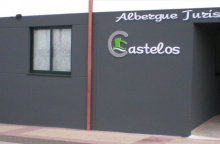
| Albergue Turístico Castelos 15€ 46 |
|
| Albergue As Pedreiras 14€ 27 Booking.com |
|


The church and adjacent cemetery, with neo-gothic spires.
The camino through San Xoan is a bit sloppy, there are no dedicated pedestrian crossings and a large junction means you have to keep alert. Although the camino reaches town from the west side of the road, and later leaves it from the west side, the arrows have you cross over the N-634 to ease the way around a junction; this route also takes you past the church and cemetery. This dancing around the N-634 is almost to an end but there are a few more crossings before Baamonde. The camino follows a few more back roads to Pedrouzos.
After Pedrouzos the camino returns to, and crosses, the N-634. A short distance later it returns to repeat the crossing in the opposite direction and proceeds to pass underneath the A-8. Past two small hamlets, it reverses course and passes back under the big highway and across the small one to reach Pígara.
Upon reaching a recreation area in Pígara the camino turns right (west) onto a road to back to the now familiar road and highway crossings. However when it reaches the N-634 for the second time if follows it a full kilometer before turning off to the left. Ahead is a large junction and the camino winds around it, avoiding the roundabouts.

The most overlooked curiosity on this or any other camino must be the Castaño de Baamonde. Just a few meters from the camino, next to the Iglesia de Santiago, stands the 500-year-old chestnut tree.
Get close to it and you’ll discover that the inside has been carved by a local artist; he took up the project in protest over the plans to chop down the damaged tree.
The sculptor was one Victor Corral, and his house and museum are just up the road from the church.
There are two routes to chose from when leaving Baamonde, but neither are related to a new alternative route that appears in San Breixo. Both routes from Baamonde are suitable and rejoin just out of town.
Beyond the two options out of town mentioned above, there will soon be another very important deviation when you get to San Breixo. There is a bit of controversy surrounding this option, based mostly on the opposition voiced by business and albergues along the old route. For now there appears to be a bit of an agreement that the old way will remain.
However the new way does exist and it is a full 10km shorter, a distance that tells you just how indirect the old way was. The best and most up to date description of the new way can be gotten from the owners of the KM111 bar in Baamonde.
Essentially this new option begins in A Fonte and bypasses both Miraz AND Sobrado, though there is an option along it to get back to Sobrado if you wish. The two options rejoin in Boimil. This new route is marked, but there are no services along the way.
La Virgen del Rosario de Baamonde is celebrated on the 11th of September.
There is one roundabout in the center of Baamonde, and from it you have two options. To the right is the official camino, and to the left is an alternative complementaria route. The complementaria route has the benefit of avoiding the road in favor of a trail.
Accommodation in Baamonde
| Albergue de peregrinos de Baamonde 10€ 64 |
|

Pay close attention to the option in this small hamlet, the arrows may have been manipulated. When you reach the road you have two choices: Left along the old camino or right to follow the newer shorter option directly to Boimil.
Along the official camino you will pass through the small hamlet of Digañe (no services) before arriving in Carballedo. Note that the albergue in Santa Leocadia is located just before town, along a marked road.
Also known as Aldar, no services for pilgrims apart from the albergue.
At the end of town the camino keeps on straight into the forest along a foot path, a shortcut to the road. When you get to the road, turn right and follow it to the two Seixóns, first the lower and then the higher.
Accommodation in Santa Leocadia / Carballedo
| Albergue Rural Witericus 14€ 9 |
|
In Seixón turn right at the junction (bar) and follow the road. The second junction is the place known as A Lagoa and the albergue is on your left.
Turn left at the albergue onto the LU-P-2107, and a few meters later veer to the right along the LU-P-2113 in the direction of Miraz.
Accommodation in A Lagoa
| Albergue A Lagoa 14€ 21 |
|
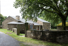
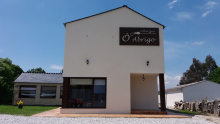
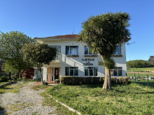
On your left as you arrive at Miraz is the last remaining tower and gate of the Pazo de Miraz, they are all that remain of the 15th century fortress. The church is dedicated to Santiago. There is a bar in the Albergue Ó Abrigo.
There are no services between Miraz and A Roxica, several hours away. Plan accordingly.
At the west end of Miraz the camino becomes a gravel road which runs 3.5km to the next paved surface and turns left and into Braña the town with no buildings. Soon it merges with another larger road (still a country lane, the LU-P-2102). If follows this road about 600m and turns right onto another. When this road bends left the camino continues straight onto a trail. When it reaches the next paved road, the LU-P-2119, it turns right and follows it 3.2km to A Roxica.
Accommodation in Miraz
| Albergue Ó Abrigo 17€ 34 |
|
| Albergue San Martin - Miraz Donativo€ 26 |
|
No services for pilgrims apart from the albergue.
Keep on the road through A Roxica and at the next junction, a fork with 3 forward options, keep on the road to the left. The village of A Cabana is ahead (no services). You will follow this road, still the LU-P-2119, past the hamlets of Travesa, and Marcela before turning right onto another road which winds up through the hamlet of Corteporcos. When it reaches the next main road, the somewhat busier AC-934, it turns right and follows the road straight. Along the way you pass into the province of A Coruña and through the hamlet of Marco das Pias to arrive at a junction. Follow the signs along the same road in the direction of Sobrado. The first town and bar along this road is in Meson.
Accommodation in A Roxica
| Albergue de peregrinos de A Cabana 10€ 28 |
| Albergue Casa Roxica 20€ 6 |
|
In Mesón the camino turns right off of the AC-934, near the start of town. It follows this quieter road in the direction of the Igrexa de Roade, following along several different roads and paths before getting back to the AC-934. Look for arrows at every junction. A short distance past the Lagoa the camino leaves the road for a smaller road on the left which brings you into Sobrado.

The Monastery of Santa María de Sobrado draws visitors from all over Galicia and has had a tumultuous life. When it was built in the year 952 it was dedicated to San Salvador. By the 12th century, it was abandoned and would be taken up by a few pious groups before the Cistercians began monastic life there. The church was added at the end of the 17th century, marking the highest point. By 1834 the monastery, along with most monasteries in Spain, was stripped of its wealth by royal decree; a process which saw a great many treasures transferred to the public domain in an effort to pay down public debt.
The camino leaves Sobrado along the AC-934. At the first small hamlet, Ponte Pedra, it leaves the road by turning left, but then turns right almost immediately to follow a smaller road. You will wind your way through the hamlets of Castro, and Madelos, before entering Corredoiras.
Accommodation in Sobrado dos Monxes
| Albergue Lecer 12€ 28 |
| Albergue de peregrinos de Sobrado dos Monxes 8€ 120 |
| Pensión Vía Sacra ⭑⭑ Booking.com |

|

Accommodation in Madelos
| Albergue Rural Abeiro da Loba 18-20€ 18 Booking.com |
|
Heavy traffic here. Cross with caution.
Cross straight through Corredoiras to keep on the AC-234. A short distance on the camino merges with the new route which left from San Breixo, and shortly beyond that the municipal albergue of Gandara is on your right along a side road.

The camino beyond Boimorto splits into three distinct routes before each joins the Camino Francés. All three re-join near the Lavacolla airport. From A Gándara you have to choose between two options, the third option is a derivation of one of the two.
When choosing between the options consider that the Camino Francés may be quite busy depending on the season; relative to the Camino del Norte there are a great deal more pilgrims on the way.
All distances shown are from A Gándara to San Paio, which is the first village after the Lavacolla airport. The number in [brackets] is the distance remaining to Santiago.
The NEW OFFICIAL ROUTE - 28.3 [40.7]
The new official route goes from A Gándara directly to Lavacolla where it joins the Camino Francés; this is the shortest route to Santiago.
There are very little services along the way (a few bars, and one Pension) and no albergues as of yet. Be prepared for a long day, and follow the AC-0603 straight out of town.
The OLD OFFICIAL ROUTE - 35.8 [48.2]
The old route to rejoin the Camino Francés in Arzúa is still marked and still walkable. It is the longer of the two options but has a lot more services to offer because it reaches the Camino Francés sooner.
To follow this route, turn left at the end of A Gándara to follow the AC-0602 in the direction of Arzua.
You will pass the hamlet of Sendelle along the way.
To Arzua is 9.7km.

Arzúa is a pleasant town with almost enough beds for pilgrims. If you find everything to be full and don’t feel like splurging on one of the many hotels in the area, the Polideportivo (sports hall) is often used to house pilgrims. Between here and O Pedrouzo lie a string of very small Galician hamlets of little note. The locals in these parts enjoy telling you, without the slightest tone of irony or sarcasm, that ‘no hay vacas in Galicia’ (there are no cows in Galicia). Hold that thought in your head while you slosh through a soggy trail on an otherwise sunny day.
Tetilla Cheese: You might have seen this curiously shaped cheese in the shop windows. If you made a connection between the name and the shape you are not mistaken. It was shaped this way by cheese makers in protest to the bishop of Santiago. At the time the Portico de la Gloria (Master Mateo’s famous sculptures at the Cathedrals main entrance) was being finished and the bishop took issue with the odd smile on the prophet Daniels’ face. The clever bishop followed his gaze across the doorway and found that Queen Esther’s bosom was augmented by a cheeky sculptor. Daniel kept his smile, Esther had a reduction, and we got boob-shaped-protest-cheese.
Famous for its cheese, Arzúa hosts an annual (and three day long) Festival of Cheese in March. They have been doing so for 40 years. Apart from this and several other secular celbrations, Arzúa celebrates Corpus Christi, as well as Nuestra Señora del Carmen, who is celebrated on the 16th of July.
The camino leaves Arzúa along a footpath, NOT the road. If you arrived at the main square, walk past the church (with your back to the road) and turn right onto the side street. The terrain is pleasant, a blend of trails and paved roads through small towns and lots of forests. There are a few steep sections but none of any considerable length.
Accommodation in Arzúa from the Camino del Norte
| Albergue de Arzúa 10€ 46 |
|
| Albergue Ultreia 12€ 38 Booking.com |

|
| Albergue San Francisco 15€ 26 Booking.com |
|
| Casa del Peregrino 10-12€ 14 |
|
| Cruce de Camiños 16/17€ 40 Booking.com |
|
| Albergue Los Tres Abetos 16€ 42 Booking.com |
|
| Albergue-Pensión Arzúa 12€ 18 |
|
| O Albergue de Selmo 13-14€ 46 Booking.com |
|
| De Camino Albergue 12-14€ 46 Booking.com |
|
| Albergue Los Caminantes 12€ 26 |
|
| Albergue Santiago Apóstol (Arzúa) 10-12€ 72 |
|
| Albergue Don Quijote 12€ 50 |
|
| Albergue Via Lactea 15€ 124 Booking.com |
|

| Albergue-Pensión A Conda 15€ 8 Booking.com |
|

Accommodation in Pregontoño
| Albergue Camiño das Ocas 12€ 30 |
Accommodation in El Lugar de Tabernavella
| Albergue Taberna Vella 17€ 8 |


Accommodation in Calle - O Outeiro
| Albergue A Ponte de Ferreiros 15€ 30 |
|
| Casa Rural do Horreo Booking.com |
|


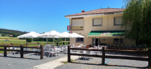
There is a pair of bars in Salceda, and a restaurant (La Esquipa) that is thick with pilgrims every day but Monday when it is closed.
The camino rejoins the road in Salceda, and while it does not walk on the road it does remain quite close. In fact, the camino crosses the road several times between here and Santiago. The speed of traffic, the curves in the road, and the abundance of pilgrims makes this the most dangerous stretch along the camino. Cross carefully and quickly and always under the road when possible.
The camino leaves town to the right of a wedge shaped park next to La Esquipa, not along the road.
Accommodation in Salceda
| Albergue Turistico de Salceda 15€ 8 Booking.com |
|
| Albergue Alborada 15€ 10 Booking.com |
|
| Albergue La Corona 22€ 20 |
|

Accommodation in A Brea
| Mar de Frisia Booking.com |

|

CAUTION crossing the road, dangerous intersection.
The camino crosses the main road at the highest point in the road, there is no marked crosswalk and the arrows on the other side of the road are often obscured by parked cars. You may see pilgrims continuing along the road but are advised against following them as the camino returns to the trail when you turn off the road.
Half way down the hill it splits and arrows indicate that you should either turn left to go under the road or continue straight. Unless you have reason to visit Santa Irene you can keep on straight and avoid the hassle of crossing back over the road. If you continue straight you will arrive at the important part of Santa Irene (the part with the bar).
Accommodation in Empalme
| Albergue Andaina 12€ 14 |

Accommodation in Santa Irene
| Albergue de Peregrinos Santa Irene (Municipal) 10€ 36 |
|
| Albergue de Peregrinos Santa Irene (Privado) 14€ 15 |
|
| Albergue Rural Astrar 12€ 20 |

|

Where the camino returns to the road at the start of O Pedrouzo you will find an abundance of arrows and a large map which is nearly worthless. Arrows and dozens of signs advertising various hostels and hotels point in every direction. If you have a reservation, review the map to find the best path, otherwise turn left up the road. If you are not staying the night in O Pedrouzo, cross the road here and continue along the camino.
Accommodation in A Rúa [O Pino]
| Albergue Espíritu Xacobeo 13€ 46 Booking.com |
|
| Camping Peregrino O Castiñeiro 12€ |
| Hotel Rural O Acivro Booking.com |
|
Unfortunately, there is little to say about this modernized town. When it comes to charm, or monuments, or outrageous legends, it comes up short. During the busier periods along the camino the town feels overrun with pilgrims; most of whom are excited to have finished their penultimate day of walking.
Avoid the temptation of following the main road out of Pedrouzo. There are very few arrows to get you back to the camino and following along the road puts you in very real danger and takes you away from a lovely forest walk. See note below to get back to the camino.
If you spent the night in O Pedrouzo, it is important to find your way back to the camino proper which runs through the forest to the north. To get to it, find the intersection of the main road and Calle de Condello (where the Casa do Concello is located). Continue uphill (north from here) and in a few hundred meters the camino presents itself. Turn left and continue through the forest to Amenal.
The camino between here and Santiago is a mixture of rural and urban settings, some forests and some sprawl. The up and downs that you have been experiencing continue: the elevation gain/loss is +308/-339m, a not insignificant amount.
Accommodation in O Pedrouzo [Arca do Pino]
| Albergue de Arca do Pino 10€ 120 |
|
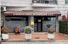
| Albergue Porta de Santiago 12€ 54 |
|
| Albergue Mirador de Pedrouzo 16€ 62 Booking.com |
|
| Albergue O Trisquel 13€ 78 Booking.com |
|
| Albergue REM 13€ 40 Booking.com |
|
| Albergue Otero 14€ 36 |
|
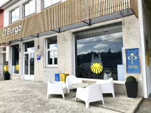
| Albergue O Burgo 15€ 14 Booking.com |
|
| Albergue Edreira 13€ 40 |
|
| Albergue Cruceiro de Pedrouzo 12€ 94 |
|


| Hotel O Pino ★ | 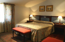
|

Two bars, one on either side of a dangerous crossing.
The camino crosses the very busy N-547 by passing underneath it. Do not cross over the road.
Leaving the bar behind you climb steeply uphill a short distance. The path soon levels out on a comfortable trail surrounded by eucalyptus trees. The Santiago Airport is very near, and the camino follows a path around the runway.
Accommodation in Amenal
| Pensión Kilómetro 15 Booking.com |
|

The written history of San Paio has been lost to the ages, but the church here is dedicated to San Paio (or Payo), the 14 year old saint who was kidnapped by the invading Muslim troops, taken to Sevilla, and ultimately martyred to pieces and tossed into the río Guadalquivir.
Accommodation in San Paio - San Payo


The name Lavacolla has one of the most debated origins of all the camino towns. They range from the bland “field at the bottom of the hill” to the more profane “scrub your scrotum.” What is more widely accepted is that pilgrims bathed in this river before entering the Cathedral.
If you walked down the stairs to visit either of the bars at the bottom, turn and walk up the steps towards the Iglesia de Benaval. The camino continues around to the right-hand side and down to cross the road. At the road, cross at the crosswalk and continue along the road and over the famous river (see inset below).
The last hill is ahead, and if you are a stickler for doing things according to tradition you should start running now. It is said that the first of your group to arrive in Monte de Gozo is entitled to be called King. Be advised that there is no prize.
Accommodation in Lavacolla
| Albergue Lavacolla 14€ 40 |
|
| Albergue A Fábrica 20€ 32 Booking.com |
|
| Pazo Xan Xordo Booking.com |
|
| Pensión Dorotea Booking.com |

|


Monte de Gozo, or ‘Mount Joy’, was once the first place that pilgrims could get a glimpse of the Cathedral spires. A new stand of trees blocks the view now. It is a large gathering place for pilgrims, who flock to the over-sized monument commemorating the pilgrimage that Pope John Paul II made here in 1993. The modest Capilla de San Marcos has the last stamp and a small kiosk selling cold drinks.
You do not need to enter the complex but for the sake of curiosity, carrying on down the road will take you where you are heading.
Pass the outdoor gallery of a local (and gifted) sculptor of stone and cross the bridge over the highway. It is midway over this bridge that you enter the city of Santiago de Compostela but to keep pilgrims from crossing the road half way across the bridge, the sign indicating such has been moved further into the city.
Accommodation in Monte del Gozo
| Albergue de Monte do Gozo 10€ 400 Booking.com |
|
| Albergue Benvido Monte do Gozo 23€ 500+ Booking.com |

|


This outermost barrio of Santiago was once the closest point that pilgrims affected with leprosy were permitted to go.
The walk into Santiago is through the urbanized zone that has grown up around the old town. After passing over the highway bridge the first part of Santiago you walk through is the Barrio San Lazaro; the church here is said to be the limit for pilgrims with leprosy. There is a fairly large intersection to cross where the arrows disappear and are replaced by blue and yellow signs on posts.
At last, you will enter the old town, through the Porta do Camiño, winding gently through the stone paved lanes, through the Plaza Cervantes, under the Bishops residence, and into the Plaza de Obradoiro. Congratulations, and welcome to Santiago de Compostela!
Accommodation in Barrio San Lázaro
| Albergue Dream in Santiago 25€ 60 Booking.com |
|
| Residencia de Peregrinos San Lázaro 10€ 80 |
|
